
 A SCHOLARLY BOOK REPOSITORY
Early in the year 1854 Frederick Law Olmsted, a young New England journalist, crossed the Louisiana border and set off on horseback into the teeth of the Texas winter. In A Journey through Texas he recounts his travels along the Old San Antonio Road through East Texas' piney woods, the dry prairies further west, the chaparral of South Texas, the coastal prairies, and the rich bottomlands around Houston and Galveston.
Olmsted does not romanticize the discomforts of his trip—the monotonous food, crude housing, wet and dry northers, rough companions—yet his book reflects a sense of limitless possibility for this new and open country. The cultured Easterner remembers in relentless detail the squalor and brutality met with in parts of East Texas, but he writes fondly of the civility and cleanliness of the German settlements around New Braunfels.
In his introductory "A Letter to a Southern Friend," omitted in earlier reprints, Olmsted sets forth his views opposing the extension of slavery into the West and promoting free-soil agriculture for frontier states.
The remarkably versatile Olmsted is best known as the founder of landscape architecture in America and for works including Central Park and Stanford University.
In his Foreword, Larry McMurtry calls A Journey through Texas an "intelligent, lively, readable book, packed with keen observation and lightened by a delicate strain of humor."
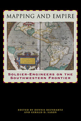
From the sixteenth through the mid-nineteenth centuries, Spain, then Mexico, and finally the United States took ownership of the land from the Gulf Coast of Texas and Mexico to the Pacific Coast of Alta and Baja California—today's American Southwest. Each country faced the challenge of holding on to territory that was poorly known and sparsely settled, and each responded by sending out military mapping expeditions to set boundaries and chart topographical features. All three countries recognized that turning terra incognita into clearly delineated political units was a key step in empire building, as vital to their national interest as the activities of the missionaries, civilian officials, settlers, and adventurers who followed in the footsteps of the soldier-engineers.
With essays by eight leading historians, this book offers the most current and comprehensive overview of the processes by which Spanish, Mexican, and U.S. soldier-engineers mapped the southwestern frontier, as well as the local and even geopolitical consequences of their mapping. Three essays focus on Spanish efforts to map the Gulf and Pacific Coasts, to chart the inland Southwest, and to define and defend its boundaries against English, French, Russian, and American incursions. Subsequent essays investigate the role that mapping played both in Mexico's attempts to maintain control of its northern territory and in the United States' push to expand its political boundary to the Pacific Ocean. The concluding essay draws connections between mapping in the Southwest and the geopolitical history of the Americas and Europe.
READERS
Browse our collection.
PUBLISHERS
See BiblioVault's publisher services.
STUDENT SERVICES
Files for college accessibility offices.
RECENTLY PUBLISHED


UChicago Accessibility Resources
home | accessibility | search | about | contact us
BiblioVault ® 2001 - 2024
The University of Chicago Press