
 A SCHOLARLY BOOK REPOSITORY
Mesoamerican archaeologists have long been interested in the collapse of political systems or civilizations but have been slow to undertake detailed abandonment analyses of specific settlements. The Archaeology of Settlement Abandonment in Middle America explores some of the old questions in Middle American archaeology in light of the newer theoretical approach provided by abandonment studies. Unlike much of the abandonment work previously done in the American Southwest, a number of contributions to this volume examine relatively large population centers.
Among the original contributions in this collection is the discovery that deposits resulting from termination rituals are more common than previously thought. Several chapters point out that structures and places can continue to serve ritual functions even after abandonment. Another finding is that the causes of abandonment—warfare, economic marginalization, or natural cataclysm—are likely to have varied effects on different social groups, which in turn sheds light on occupational histories in specific sites preceding major abandonments.
On an August evening around AD 600, residents of the Cerén village in the Zapotitán Valley of what is now El Salvador were sitting down to their nightly meal when ground tremors and loud steam emissions warned of an impending volcanic eruption. The villagers fled, leaving their town to be buried under five meters of volcanic ash and forgotten until a bulldozer uncovered evidence of the extraordinarily preserved town in 1976. The most intact Precolumbian village in Latin America, Cerén has been called the "Pompeii of the New World."
This book presents complete and detailed reports of the excavations carried out at Cerén since 1978 by a multidisciplinary team of archaeologists, ethnographers, volcanologists, geophysicists, botanists, conservators, and others. The book is divided into sections that discuss the physical environment and resources, household structures and economy, special buildings and their uses, artifact analysis, and topical and theoretical issues.
As the authors present and analyze Cerén's houses and their goods, workshops, civic and religious buildings, kitchen gardens, planted fields, and garbage dumps, a new and much clearer picture of how commoners lived during the Maya Classic Period emerges. These findings constitute landmark contributions to the anthropology and archaeology of Central America.
Identifies town site locations and clarifies entries from the earliest documents and maps of explorers in Alabama
This encyclopedic work is a listing of 398 ancient towns recorded within the present boundaries of the state of Alabama, containing basic information on each village's ethnic affiliation, time period, geographic location, descriptions, and (if any) movements. While publications dating back to 1901 have attempted to compile such a listing, none until now has so exhaustively harvested the 214 historic maps drawn between 1544, when Hernando de Soto's entourage first came through the southeastern territory, and 1846, when Indian removal to the Oklahoma Territory was complete. Wright combines the map data with a keen awareness of both previously published information and archival sources, such as colonial town lists, census information, and travel narratives.
The towns are listed alphabetically, and the text of each entry develops chronologically. While only a few of these towns have been accurately located by archaeologists, this volume provides a wealth of information for the future study of cultural geography, southeastern archaeology, and ethnohistory. It will be an enduring reference source for many years to come.
SAMPLE ENTRY,
ALIBAMA TOWN (Alibama)
The Alibama consisted of several towns—Mucclassa, Tawasa, Tomopa, Koarsati (Knight 1981, 27:48). Pickett ([1851] 1962:81) adds Ecanchati, Pawokti, and Autauga. The Alibama Town can also be added. Many maps show the Alibama as a group, but one map, 1796 Thomas and Andrews, locates the "Alabama Town"on the east bank of the Coosa just below Wetumpka.
Swanton ([1922] 1970a:209) wrote that the Tuskegee at the Alabama forks may have been known as the "Alabama Town"; however, this is unlikely, as Major W. Blue, a removal agent, wrote in July 1835 that Coosada, Alabama Town, and Tuskegee were ready to emigrate and they all lived adjoining each other in Macon County (ASP, Military Affairs 1861,6:731).
On 6 July 1838, some twenty-seven towns, including "Alibama" (NA M234 R225), attended the Creek council held in Indian Territory. Thomas Bibb, brother to Alabama territorial govenor William Wyatt Bibb, and others, including Nashville investors, founded the town of Alabama in 1817 at Ten Mile Bluff in Montgomery County (Moser 1980-94, 4:131). The town soon disappeared into history.
Maya architecture is often described as "massive" and "monumental," but experiments at Copan, Honduras, convinced Elliot Abrams that 300 people could have built one of the large palaces there in only 100 days.
In this groundbreaking work, Abrams explicates his theory of architectural energetics, which involves translating structures into volumes of raw and manufactured materials that are then multiplied by the time required for their production and assembly to determine the labor costs of past construction efforts. Applying this method to residential structures of the Late Classic period (A.D. 700-900) at Copan leads Abrams to posit a six-tiered hierarchic social structure of political decision making, ranging from a stratified elite to low-ranking commoners. By comparing the labor costs of construction and other economic activities, he also prompts a reconsideration of the effects of royal construction demands on commoners.
How the Maya Built Their World will interest a wide audience in New and Old World anthropology, archaeology, architecture, and engineering.
Masson and Peraza Lope's detailed overview provides evidence of a vibrant market economy that played a critical role in the city's political and economic success. They offer new perspectives from the homes of governing elites, secondary administrators, affluent artisans, and poorer members of the service industries. Household occupational specialists depended on regional trade for basic provisions that were essential to crafting industries, sustenance, and quality of life. Settlement patterns reveal intricate relationships of households with neighbors, garden plots, cultivable fields, thoroughfares, and resources. Urban planning endeavored to unite the cityscape and to integrate a pluralistic populace that derived from hometowns across the Yucatán peninsula.
New data from Mayapán, the pinnacle of Postclassic Maya society, contribute to a paradigm change regarding the evolution and organization of Maya society in general and make Kukulcan's Realm a must-read for students and scholars of the ancient Maya and Mesoamerica.
Archaeologists and architects draw upon theoretical perspectives from their fields to provide valuable insights into the structure, development, and meaning of prehistoric communities.
Architecture is the most visible physical manifestation of human culture. The built environment envelops our lives and projects our distinctive regional and ethnic identities to the world around us. Archaeology and architecture find common theoretical ground in their perspectives of the homes, spaces, and communities that people create for themselves. Although archaeologists and architects may ask different questions and apply different methods, the results are the same—a deeper understanding of what it means to be human.
In this volume, prominent archaeologists examine the architectural design spaces of Mississippian towns and mound centers of the eastern United States. The diverse Mississippian societies, which existed between A.D. 900 and 1700, created some of the largest and most complex Native American archaeological sites in the United States. The dominant architectural feature shared by these communities was one or more large plazas, each of which was often flanked by buildings set on platform mounds. The authors describe the major dimensions of an architectural grammar, centered on the design of the plaza and mound complex that was shared by different societies across the Mississippian world. They then explore these shared architectural features as physical representations or metaphors for Mississippian world views and culture.
In a series of data-rich chapters that address specific evidence for movement in their respective study areas, an international group of scholars assesses mobility through the isotopic and demographic analysis of human remains, stratigraphic identification of gaps in occupation, and local intensification of water capture in the Maya lowlands. Others examine migration through the integration of historic and archaeological evidence in Michoacán and Yucatán and by registering how daily life changed in response to the influx of new people in the Basin of Mexico.
Offering a range of critical insights into the vital and under-studied role that mobility and migration played in complex agrarian societies, Mobility and Migration in Ancient Mesoamerican Cities will be of value to Mesoamericanist archaeologists, ethnohistorians, and bioarchaeologists and to any scholars working on complex societies.
Contributors:
Jaime J. Awe, Meggan Bullock, Sarah C. Clayton, Andrea Cucina, Véronique Darras, Nicholas P. Dunning, Mélanie Forné, Marion Forest, Carolyn Freiwald, Elizabeth Graham, Nancy Gonlin, Julie A. Hoggarth, Linda Howie, Elsa Jadot, Kristin V. Landau, Eva Lemonnier, Dominique Michelet, David Ortegón Zapata, Prudence M. Rice, Thelma N. Sierra Sosa, Michael P. Smyth, Vera Tiesler, Eric Weaver
For two millennia, the site now known as Blue Creek in northwestern Belize was a Maya community that became an economic and political center that included some 15,000-20,000 people at its height. Fairly well protected from human destruction, the site offers the full range of city components including monumental ceremonial structures, elite and non-elite residences, ditched agricultural fields, and residential clusters just outside the core. Since 1992, a multi-disciplinary, multi-national research team has intensively investigated Blue Creek in an integrated study of the dynamic structure and functional inter-relationships among the parts of a single Maya city. Documented in coverage by National Geographic, Archaeology magazine, and a documentary film aired on the Discovery Channel, Blue Creek is recognized as a unique site offering the full range of undisturbed architectural construction to reveal the mosaic that was the ancient city. Moving beyond the debate of what constitutes a city, Guderjan’s long-term research reveals what daily Maya life was like.
The contributions gathered here provide fieldwork data to document the existence of sociopolitically distinct neighborhoods within ancient Mesoamerican settlements, building upon recent advances in multi-scale archaeological studies of these communities. Chapters illustrate the cultural variation across Mesoamerica, including data and interpretations on several different cities with a thematic focus on regional contrasts. This topic is relatively new and complex, and this book is a strong contribution for three interwoven reasons. First, the long history of research on the “Teotihuacan barrios” is scrutinized and withstands the test of new evidence and comparison with other Mesoamerican cities. Second, Maya studies of dense settlement patterns are now mature enough to provide substantial case studies. Third, theoretical investigation of ancient urbanization all over the world is now more complex and open than it was before, giving relevance to Mesoamerican perspectives on ancient and modern societies in time and space.
This volume will be of interest not only to scholars and student specialists of the Mesoamerican past but also to social scientists and urbanists looking to contrast ancient cultures worldwide.
Pampa Grande, the largest and most powerful city of the Mochica (Moche) culture on the north coast of Peru, was built, inhabited, and abandoned during the period A.D. 550-700. It is extremely important archaeologically as one of the few pre-Hispanic cities in South America for which there are enough reliable data to reconstruct a model of pre-Hispanic urbanism.
This book presents a "biography" of Pampa Grande that offers a reconstruction not only of the site itself but also of the sociocultural and economic environment in which it was built and abandoned. Izumi Shimada argues that Pampa Grande was established rapidly and without outside influence at a strategic position at the neck of the Lambayeque Valley that gave it control over intervalley canals and their agricultural potential and allowed it to gain political dominance over local populations. Study of the site itself leads him to posit a large resident population made up of transplanted Mochica and local non-Mochica groups with a social hierarchy of at least three tiers.
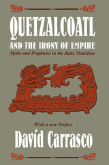
"This book, rich in ideas, constituting a novel approach . . . represents a stimulating and provocative contribution to Mesoamerican studies. . . . Recommended to all serious students of the New World's most advanced indigenous civilization."—H. B. Nicholson, Man
- American Anthropologist
"A must for both professional and serious non-professional students in Mesoamerica. Those who are interested in complex society and urbanism in general, as well as students of comparative religion, will find it stimulating. Most importantly, for anyone interested in the history of ideas, the book illuminates the tremendously powerful impact and role of a complex deity/mythico-historical figure in shaping one of the world's great pristine civilizations."
- Queen's Quarterly
This book examines the legacy of the racial imaginary in Mexico with a focus on the Wixarika (Huichol) Indigenous peoples of the western Sierra Madre from the colonial period to the present. Through an examination of the politics of identity, space, and activism among Wixarika university students living and working in the western Mexican cities of Tepic and Guadalajara, geographer Diana Negrín analyzes the production of racialized urban geographies and reveals how Wixarika youth are making claims to a more heterogeneous citizenship that challenges these deep-seated discourses and practices. Through the weaving together of historical material, critical interdisciplinary scholarship, and rich ethnography, this book sheds light on the racialized history, urban transformation, and contemporary Indigenous activism of a region of Mexico that has remained at the margins of scholarship.
Global identity politics rest heavily on notions of ethnicity and authenticity, especially in contexts where indigenous identity becomes a basis for claims of social and economic justice. In contemporary Latin America there is a resurgence of indigenous claims for cultural and political autonomy and for the benefits of economic development. Yet these identities have often been taken for granted.
In this historical ethnography, Baron Pineda traces the history of the port town of Bilwi, now known officially as Puerto Cabezas, on the Atlantic coast of Nicaragua to explore the development, transformation, and function of racial categories in this region. From the English colonial period, through the Sandinista conflict of the 1980s, to the aftermath of the Contra War, Pineda shows how powerful outsiders, as well as Nicaraguans, have made efforts to influence notions about African and Black identity among the Miskito Indians, Afro-Nicaraguan Creoles, and Mestizos in the region. In the process, he provides insight into the causes and meaning of social movements and political turmoil. Shipwrecked Identities also includes important critical analysis of the role of anthropologists and other North American scholars in the Contra-Sandinista conflict, as well as the ways these scholars have defined ethnic identities in Latin America.
As the indigenous people of the Mosquito Coast continue to negotiate the effects of a long history of contested ethnic and racial identity, this book takes an important step in questioning the origins, legitimacy, and consequences of such claims.

While a graduate student, Andrea Riley Mukavetz was invited into Geri’s home to listen to her stories and assist in compiling and publishing a memoir. Geri wanted her stories to serve as a resource, form of support, and affirmation that Indigenous people can be proud of who they are and overcome trauma. Geri hoped to be a model to current and future generations, and she believed strongly that more Indigenous people should become substance abuse counselors and work with their communities in tribally specific ways.
Geri died in 2019, but Riley Mukavetz carried on the work. This book presents Geri’s stories, lightly edited and organized for clarity, with an introduction by Riley Mukavetz that centers Geri’s life and the process of oral history in historical and theoretical context.
READERS
Browse our collection.
PUBLISHERS
See BiblioVault's publisher services.
STUDENT SERVICES
Files for college accessibility offices.
RECENTLY PUBLISHED


UChicago Accessibility Resources
home | accessibility | search | about | contact us
BiblioVault ® 2001 - 2024
The University of Chicago Press