
 A SCHOLARLY BOOK REPOSITORY
Northern Utah’s Wasatch Mountains are popular destinations for outdoor enthusiasts in every season. These mountains rise spectacularly from the relatively flat valley floor to thirteen peaks over 11,000 feet in elevation. An additional nineteen peaks rise more than 10,000 feet in elevation. Although many hiking guides exist for the Wasatch Mountains, there has been no guide book that focuses on the geologic features visible from the trails—until now.
Written by a recognized authority on the geology of the Wasatch Mountains, this guide is meant to enrich the experience of outdoor enthusiasts who want to understand the geological history and development of the Wasatch range. The first section of the book introduces the major geological time periods—the record of mountain building events from oldest to youngest, the effects of glaciation, and the development of the present topography. It then follows with a descriptive trail guide for each major trail system, including Mill Creek and Neffs Canyons, Mount Olympus, Little and Big Cottonwood Canyons, and Bells Canyon. Trail length, elevation gain, relative difficulty, and major geological features are outlined for each trail. Now you can hike these trails with the answers to all your geologic questions right at your fingertips.
Trail descriptions range from nearly level walks requiring less than an hour to ascents that challenge experienced mountaineers. To assist in selecting an appropriate trail, hikes are listed according to best season, time required, objective, and desired level of difficulty. The easy trails have the most detailed descriptions to aid beginners, while expert trails have sparse descriptions to preserve the adventure. Maps, photos, and line drawings are included and detailed driving directions to the trailheads are consolidated to save repetition. The area’s geology, flora and fauna, and human history are also discussed to further appreciation of this mountain environment.
Since the first publication of Hiking the Wasatch, there have been numerous changes to these trails, especially along the foothill-urban interface. This revised third edition contains full updates based on the author’s field checking, comments from members of the Wasatch Mountain Club, and information from land-management agencies. Hiking the Wasatch is an essential resource for exploring these mountain trails.
These place names, as well as the physcial traces and artifacts that persist in three Wasatch canyons—Mill Creek, Big Cottonwood, and Little Cottonwood—tantalize with what they suggest, but do not tell, about the history of settlement and development in the canyons. Charles Keller has extracted a wealth of information to create The Lady in the Ore Bucket, a faxcinating history of the lumber, mining, and hydropower industries built from the rich natural resources of the canyons. With more than six dozen photographs and maps, the book is alive with details concerning the personalities, politics, pacts, and peregrinations of local leaders from white settlement in 1847 through the early 1900s. It will delight any reader with an interest in the magnificent canyones that open onto the modern Wasatch Front.
In the high country of the northern Wasatch Mountains, lies what is left of one of the West’s largest ranches. Deseret Live Stock Company was reputed at various times to be the largest private landholder in Utah and the single biggest producer of wool in the world. The ranch began as a sheep operation, but as it found success, it also ran cattle. Incorporated in the 1890s by a number of northern Utah ranchers who pooled their resources, the company was at the height of successful operations in the mid-twentieth century when a young Dean Frischknecht, bearing a recent degree in animal science, landed the job of sheep foreman. In his memoir he recounts in detail how Deseret managed huge herds of livestock, vast lands, and rich wildlife and recalls through lively anecdotes how stockmen and their families lived and worked in the Wasatch Mountains and Skull Valley’s desert wintering grounds.
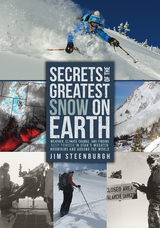
Chapters explore mountain weather, avalanches and snow safety, historical accounts of weather events and snow conditions, and the basics of climate and weather forecasting. Steenburgh explains what creates the best snow for skiing and snowboarding in accurate and accessible language and illustrates his points with 150 color photographs, making Secrets of the Greatest Snow on Earth a helpful tool for planning vacations and staying safe during mountain adventures. Snowriders, weather enthusiasts, meteorologists, students of snow science, and anyone who dreams of deep powder and bluebird skies will want to get their gloves on Secrets of the Greatest Snow on Earth.
Watch Book Trailer!(Special thanks to Ski Utah)
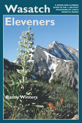
This guide provides information on trailhead access, approaches, and routes for every 11,000-foot peak. It includes overview maps of major roads, topographical overview maps, and detailed route maps for each peak. There are also total roundtrip mileages, elevation-gain (or loss) figures, and alternate routes to help hikers plan their adventures.
Featured peaks include North Mount Nebo, South Mount Nebo, Middle Mount Nebo, Mount Timpanogos, 'South' Timpanogos, West American Fork Twin Peak, 'North' Timpanogos, 'South' American Fork Twin Peak, Unnamed 11,383, Unnamed 11,347, East Broads Fork Twin Peak, West Broads Fork Twin Peak, Pfeifferhorn, White Baldy, Sunrise Peak, Unnamed 11,288, Lone Peak, North Peak, Red Baldy, Red Top Mountain, South Thunder, North Thunder, Unnamed 11,137, Monte Cristo Peak, Dromedary Peak, Box Elder Peak, Mount Baldy, Provo Peak, Sugarloaf Mountain, 'East' Provo Peak, Mount Superior, and 'East' American Fork Twin Peak.
READERS
Browse our collection.
PUBLISHERS
See BiblioVault's publisher services.
STUDENT SERVICES
Files for college accessibility offices.
RECENTLY PUBLISHED


UChicago Accessibility Resources
home | accessibility | search | about | contact us
BiblioVault ® 2001 - 2024
The University of Chicago Press