
 A SCHOLARLY BOOK REPOSITORY
In the US, the 25 largest metropolitan areas and many smaller cities have fixed guideway transit—rail or bus rapid transit. Nearly all of them are talking about expanding. Yet discussions about transit are still remarkably unsophisticated. To build good transit, the discussion needs to focus on what matters—quality of service (not the technology that delivers it), all kinds of transit riders, the role of buildings, streets and sidewalks, and, above all, getting transit in the right places.
Christof Spieler has spent over a decade advocating for transit as a writer, community leader, urban planner, transit board member, and enthusiast. He strongly believes that just about anyone—regardless of training or experience—can identify what makes good transit with the right information. In the fun and accessible Trains, Buses, People: An Opinionated Atlas of US Transit, Spieler shows how cities can build successful transit. He profiles the 47 metropolitan areas in the US that have rail transit or BRT, using data, photos, and maps for easy comparison. The best and worst systems are ranked and Spieler offers analysis of how geography, politics, and history complicate transit planning. He shows how the unique circumstances of every city have resulted in very different transit systems.
Using appealing visuals, Trains, Buses, People is intended for non-experts—it will help any citizen, professional, or policymaker with a vested interest evaluate a transit proposal and understand what makes transit effective. While the book is built on data, it has a strong point of view. Spieler takes an honest look at what makes good and bad transit and is not afraid to look at what went wrong. He explains broad concepts, but recognizes all of the technical, geographical, and political difficulties of building transit in the real world. In the end,Trains, Buses, People shows that it is possible with the right tools to build good transit.
This handbook is an essential guide to the LAMSAS project, laying out its history and describing its scope and methodology. In addition, the handbook reveals biographical information about the informants and social histories of the communities in which they lived, including primary settlement areas of the original colonies. Dialectologists will rely on it for understanding the LAMSAS, and historians will find it valuable for its original historical research.
Since much of the LAMSAS questionnaire concerns rural terms, the data collected from the interviews can pinpoint such language differences as those between areas of plantation and small-farm agriculture. For example, LAMSAS reveals that two waves of settlement through the Appalachians created two distinct speech types. Settlers coming into Georgia and other parts of the Upper South through the Shenandoah Valley and on to the western side of the mountain range had a Pennsylvania-influenced dialect, and were typically small farmers. Those who settled the Deep South in the rich lowlands and plateaus tended to be plantation farmers from Virginia and the Carolinas who retained the vocabulary and speech patterns of coastal areas.
With these revealing findings, the LAMSAS represents a benchmark study of the English language, and this handbook is an indispensable guide to its riches.
Tracing the changes in environment, land use patterns, demography, transportation, economy, and politics over the course of many centuries, Mapping New Jerseyilluminates the state's transformation from a simple agricultural society to a post-industrial and culturally diverse place inhabited by more people per acre than anywhere else in the country.
An innovator in transportation, from railroads to traffic circles to aviation, New Jersey from its beginnings was a "corridor" state, with a dense Native American trail system once crisscrossed on foot, country roads traveled by armies of the American Revolution, and, lately, the rolling wheels of many sedans, SUVs, hybrids, public and commercial vehicles, and freight. Early to industrialize, it also served as the headquarters for Thomas Edison and the development of the modern American economy. Small in territory and crowded with people, the state works to recycle garbage and, at the same time, best utilize and preserve its land.
New Jersey has been depicted in useful and quite stunning historical maps, many of the best included in Mapping New Jerseyùcrude maps drawn by sixteenth-century navigators; complex and beautifully decorated pieces created by early Dutch cartographers; land maps plotted by seventeenth-century English settlement surveyors; examples of the nineteenth century's scientific revolution in map making that helped locate topography and important mineral resources; detailed insurance maps that correct London map maker William Faden's 1777-78 classic rendering of the state; and aerial photos, remote sensing, and global positioning system maps generated through twenty-first-century technology breakthroughs in cartography.
Integrating new maps, graphs, and diagrams unavailable through ordinary research or Internet searches, Mapping New Jersey is divided into six topical chapters, each accompanied by an introduction and overview telling the story of the state's past and detailing its diversity. Mapping New Jersey, dramatically bold and in full color, travels where New Jersey has gone and the rest of the nation is likely to follow.
Few reference works are as valuable to both scholars and non-scholars as a historical atlas. Therefore, The Historical Atlas of West Virginia will be an important title for libraries, schools, and every West Virginian who wants to understand how historical forces are mapped onto the state’s terrain. This atlas also shows how the distribution of natural resources intersects with various means of distribution. Frank Riddel’s The Historical Atlas of West Virginia is copiously illustrated with maps, tables, and charts depicting everything from geological deposits and strata that have fed the state’s industries to the settlement patterns of the immigrants who settled in West Virginia. Using federal and state statistics, it also includes revelations from the national census figures since 1790.
There are 251 pages of distribution maps included in this book. The plants are arranged alphabetically by genus, and under each genus alphabetically by species. The nomenclature follows Mohlenbrock, Guide to the Vascular Flora of Illinois (1975).
In addition, a list of synonyms applied to Illinois taxa by Fernald (1950), Gleason (1952), and Jones (1963) follows the distribution maps.
Finally, in order to gain an understanding of relationships of the plants in the Illinois flora, all 3,001 taxa are arranged in a phylogenetic sequence at the end of the book.

Mapping Wonderlands fills part of this gap in existing regional studies by looking at early popular pictorial maps of Arizona. These cartographic representations of the state utilize formal mapmaking conventions to create a place-based state history. They introduce illustrations, unique naming conventions, and written narratives to create carefully visualized landscapes that emphasize the touristic aspects of Arizona.
Analyzing the visual culture of tourism in illuminating detail, this book documents how Arizona came to be identified as an appealing tourism destination. Providing a historically situated analysis, Dori Griffin draws on samples from a comprehensive collection of materials generated to promote tourism during Arizona’s first half-century of statehood. She investigates the relationship between natural and constructed landscapes, visual culture, and narratives of place. Featuring sixty-six examples of these aesthetically appealing maps, the book details how such maps offered tourists and other users a cohesive and storied image of the state. Using historical documentation and rhetorical analysis, this book combines visual design and historical narrative to reveal how early-twentieth-century mapmakers and map users collaborated to imagine Arizona as a tourist’s paradise.
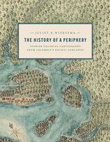
An exploration of Colombian maps in New Granada.
During the late Spanish colonial period, the Pacific Lowlands, also called the Greater Chocó, was famed for its rich placer deposits. Gold mined here was central to New Granada’s economy yet this Pacific frontier in today’s Colombia was considered the “periphery of the periphery.” Infamous for its fierce, unconquered Indigenous inhabitants and its brutal tropical climate, it was rarely visited by Spanish administrators, engineers, or topographers and seldom appeared in detail on printed maps of the period.
In this lavishly illustrated and meticulously researched volume, Juliet Wiersema uncovers little-known manuscript cartography and makes visible an unexamined corner of the Spanish empire. In concert with thousands of archival documents from Colombia, Spain, and the United States, she reveals how a "periphery" was imagined and projected, largely for political or economic reasons. Along the way, she unearths untold narratives about ephemeral settlements, African adaptation and autonomy, Indigenous strategies of resistance, and tenuous colonialisms on the margins of a beleaguered viceroyalty.
Among the great civilizations of the world, Islam remains an enigma to Western readers. Now, in a beautifully illustrated historical atlas, noted scholar of religion Malise Ruthven recounts the fascinating and important history of the Islamic world.
From the birth of the prophet Muhammed to the independence of post-Soviet Muslim states in Central Asia, this accessible and informative atlas explains the historical evolution of Islamic societies. Short essays cover a wide variety of themes, including the central roles played by sharia (divine law) and fiqh (jurisprudence); philosophy; arts and architecture; the Muslim city; trade, commerce, and manufacturing; marriage and family life; tribal distributions; kinship and dynastic power; ritual and devotional practices; Sufism; modernist and reformist trends; the European domination of the Islamic world; the rise of the modern national state; oil exports and arms imports; and Muslim populations in non-Muslim countries, including the United States.
Lucid and inviting full-color maps chronicle the changing internal and external boundaries of the Islamic world, showing the principal trade routes through which goods, ideas, and customs spread. Ruthven traces the impact of various Islamic dynasties in art and architecture and shows the distribution of sects and religious minorities, the structure of Islamic cities, and the distribution of resources. Among the book's valuable contributions is the incorporation of the often neglected geographical and environmental factors, from the Fertile Crescent to the North African desert, that have helped shape Islamic history.
Rich in narrative and visual detail that illuminates the story of Islamic civilization, this timely atlas is an indispensable resource to anyone interested in world history and religion.
In Maps in Tudor England, P. D. A. Harvey traces this revolution of production, understanding, and use of maps in England from 1485 to 1603. By the mid-sixteenth century, mapmapers had begun to draw maps to a consistent scale, reproducing the results of measured survey. By the end of the century, maps drawn to scale and showing features by conventional signs were commonly used throughout England.
In this survey Harvey focuses on maps of small areas, up to the size of a county, exploring their impact on the political and social life of England in the spheres of the military, government, towns, landed estates, buildings, and the law. Richly illustrated with thirty color and fifty black and white reproductions of rare maps, his account is an informative and accessible introduction to this revolutionary period in the history of cartography, as well as a unique visual history of Tudor England.
From the first Slavic migrations to the Romanovs’ rise to the Putin era, Russia has endured for centuries as a nation whose sheer size and diversity have challenged its rulers and shaped its identity. Restless Empire illuminates the epic sweep of Russian history in a beautifully illustrated full-color atlas depicting the essential cultural, political, economic, and military developments of Russia’s past.
Like the double-headed eagle that is its state emblem, Russia has always looked abroad to both the East and West, searching for secure trade routes, trustworthy allies, and defensible frontiers. Expansion beyond Muscovy’s forested confines began in the fifteenth century, when Ivan III rejected Mongol rule and moved into the Russian steppe. The waterways linking the Baltic to the Black and Caspian seas were crucial to Russia’s development from the Middle Ages onward. The age-old quest to acquire warm-water ports culminated in the construction of St. Petersburg in the eighteenth century, when imperial Russia began to rival Europe’s Great Powers.
From Ivan the Terrible to Catherine the Great, Lenin and Stalin to Yeltsin and Putin, Russia’s rulers have carved their nation’s destiny into world history, sometimes bending Russia toward despotism or democracy, internationalism or brusque independence. Russia’s titanic conflicts—against the Tatars and Turks, Napoleon, Nazi Germany, and the United States—and its political upheavals from the Time of Troubles to the Soviet Union’s downfall, as well as ongoing strife in Chechnya and Crimea, are presented chronologically in accessible text accompanied by detailed maps and illustrations.
Hewsen has divided the maps into five sections, each of which begins with a chronology of important dates and a historical introduction to the period. Specialized maps include Ptolemy's second-century map of Armenia, as well as maps of Roman, Cilician, Ottoman, tsarist, and Soviet Armenia. Other maps show the Persian khanate of Erevan, the Caucasian campaigns of World War I, the Armenian Genocide, the Armenian monuments in Turkey and Transcaucasia, the worldwide diaspora, ground plans of selected cities, and plans of the great monastery of Echmiadzin in 1660, 1890, and 1990. The atlas concludes with maps portraying the Karabagh war and the new Armenian Republic, and an extensive bibliography compiles references to the vast historical, ethnological, and travel literature on the region.
The first comprehensive and authoritative atlas of any of the former Soviet republics, this book does not treat Armenia in isolation, but instead sets it within the context of Caucasia as a whole, providing detailed information on neighboring regions such as Georgia and Azerbaijan. Armenia: A Historical Atlas will be an essential reference and an important teaching tool for generations to come.
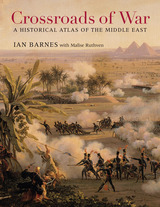
From the Bronze Age to the twenty-first century, vying armies have clashed over the territory stretching from the Upper Nile to modern-day Iraq and Iran. Crossroads of War captures five millennia of conflict and conquest in detailed full-color maps, accompanied by incisive, accessible commentary.
The lands of the Middle East were home to a succession of empires—Egyptian, Babylonian, Assyrian, and Persian—that rose and declined with the fortunes of battle. Kings and generals renowned in history bestrode the region: Nebuchadnezzar, David, Alexander the Great, Saladin, Napoleon. The religions of Zoroastrianism, Judaism, Christianity, and Islam were born here and from the beginning became embroiled in conflicts ranging from the Maccabean Revolt to Muhammad’s Arabian conquests to the Christian Crusades. In the twentieth century, the Middle East witnessed the collapse of the Ottoman Empire and played a role in the grim dramas of two world wars, as T. E. Lawrence helped spark the Arab Revolt and General Bernard Montgomery defeated Hitler’s Desert Fox, General Erwin Rommel, at El Alamein.
From the Yom Kippur War and Operation Desert Storm to a Global War on Terror that still looms over the twenty-first century, the Middle East continues to be shaped by the vagaries and vicissitudes of military conflict. Ian Barnes’s Crossroads of War offers valuable insights into the part of the world that first cradled civilization and then imagined its demise in a final clash of armies at Armageddon.
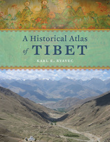
Cradled among the world’s highest mountains—and sheltering one of its most devout religious communities—Tibet is, for many of us, an ultimate destination, a place that touches the heavens, a place only barely in our world, at its very end. In recent decades Western fascination with Tibet has soared, from the rise of Tibetan studies in academia to the rock concerts aimed at supporting its independence to the simple fact that most of us—far from any base camp—know exactly what a sherpa is. And yet any sustained look into Tibet as a place, any attempt to find one’s way around its high plateaus and through its deep history, will yield this surprising fact: we have barely mapped it. With this atlas, Karl E. Ryavec rights that wrong, sweeping aside the image of Tibet as Shangri-La and putting in its place a comprehensive vision of the region as it really is, a civilization in its own right. And the results are absolutely stunning.
The product of twelve years of research and eight more of mapmaking, A Historical Atlas of Tibet documents cultural and religious sites across the Tibetan Plateau and its bordering regions from the Paleolithic and Neolithic times all the way up to today. It ranges through the five main periods in Tibetan history, offering introductory maps of each followed by details of western, central, and eastern regions. It beautifully visualizes the history of Tibetan Buddhism, tracing its spread throughout Asia, with thousands of temples mapped, both within Tibet and across North China and Mongolia, all the way to Beijing. There are maps of major polities and their territorial administrations, as well as of the kingdoms of Guge and Purang in western Tibet, and of Derge and Nangchen in Kham. There are town plans of Lhasa and maps that focus on history and language, on population, natural resources, and contemporary politics.
Extraordinarily comprehensive and absolutely gorgeous, this overdue volume will be a cornerstone in cartography, Asian studies, Buddhist studies, and in the libraries or on the coffee tables of anyone who has ever felt the draw of the landscapes, people, and cultures of the highest place on Earth.

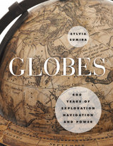
Showcasing the impressive collection of globes held by the British Library, Sumira traces the inception and progression of globes during the period in which they were most widely used—from the late fifteenth century to the late nineteenth century—shedding light on their purpose, function, influence, and manufacture, as well as the cartographers, printers, and instrument makers who created them. She takes readers on a chronological journey around the world to examine a wide variety of globes, from those of the Renaissance that demonstrated a renewed interest in classical thinkers; to those of James Wilson, the first successful commercial globe maker in America; to those mass-produced in Boston and New York beginning in the 1800s. Along the way, Sumira not only details the historical significance of each globe, but also pays special attention to their materials and methods of manufacture and how these evolved over the centuries.
A stunning and accessible guide to one of the great tools of human exploration, Globes will appeal to historians, collectors, and anyone who has ever examined this classroom accessory and wondered when, why, and how they came to be made.
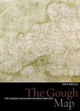
Recent digitization of the Gough Map has made it more legible than at any other time since its arrival at the Bodleian Library in 1809. This work utilizes new georectification technology to project a modern map of Britain over the Gough Map, revealing the incredible accuracy of the 700-year-old manuscript. In stunningly detailed reproduction, The Gough Map charts a vast array of cities, routes, and landmarks, including the principal medieval settlements of Bristol, Oxford and Norwich; the Severn, Thames, and Humber rivers; the loop of the Wear at Durham; and routes between towns with distances marked in Roman numerals.
The volume also features a color fold-out print of the Gough map, as well as numerous close-up images of each area. The Gough Map offers an unparalleled opportunity to examine this fascinating example of medieval mapmaking.
Maps may have been the stuff of his dreams, but they sometimes drew him away from places where he should have remained firmly rooted. In the Memory of the Map explores the complex relationship among maps, memory, and experience—what might be called a “cartographical psychology” or “cartographical history.” Interweaving a personal narrative structured around a variety of maps, with stories about maps as told by scholars, poets, and fiction writers, this book provides a dazzlingly rich personal and intellectual account of what many of us take for granted.
A dialog between desire and the maps of his life, an exploration of the pleasures, utilitarian purposes, benefits, and character of maps, this rich and powerful personal narrative is the matrix in which Norment embeds an exploration of how maps function in all our lives. Page by page, readers will confront the aesthetics, mystery, function, power, and shortcomings of maps, causing them to reconsider the role that maps play in their lives.
In After the Map, William Rankin argues that although this shift did not render traditional maps obsolete, it did radically change our experience of geographic knowledge, from the God’s-eye view of the map to the embedded subjectivity of GPS. Likewise, older concerns with geographic truth and objectivity have been upstaged by a new emphasis on simplicity, reliability, and convenience. After the Map shows how this change in geographic perspective is ultimately a transformation of the nature of territory, both social and political.
This book is about the promises and perils of map thinking. Maps are purpose-driven abstractions, discarding detail to highlight only particular features of a territory. By preserving certain features at the expense of others, they can be used to reinforce a privileged position.
When Maps Become the World shows us how the scientific theories, models, and concepts we use to intervene in the world function as maps, and explores the consequences of this, both good and bad. We increasingly understand the world around us in terms of models, to the extent that we often take the models for reality. Winther explains how in time, our historical representations in science, in cartography, and in our stories about ourselves replace individual memories and become dominant social narratives—they become reality, and they can remake the world.
The Great Basin was the last region of continental North America to be explored and mapped, and it remained largely a mystery to Euro-Americans until well into the nineteenth century. In Mapping and Imagination in the Great Basin, geographer-historian Richard Francaviglia shows how the Great Basin gradually emerged from its “cartographic silence” as terra incognita and how this fascinating process both paralleled the development of the sciences of surveying, geology, hydrology, and cartography and reflected the changing geopolitical aspirations of the European colonial powers and the United States. Francaviglia’s interdisciplinary account of the mapping of the Great Basin combines a chronicle of the exploration of the region with a history of the art and science of cartography and of the political, economic, and cultural contexts in which maps are created. It also offers a compelling, wide-ranging discussion that combines a description of the daunting physical realities of the Great Basin with a cogent examination of the ways humans, from early Native Americans to nineteenth-century surveyors to twentieth-century highway and air travelers, have understood, defined, and organized this space, psychologically and through the medium of maps. Mapping and Imagination in the Great Basin continues Francaviglia’s insightful, richly nuanced meditation on the Great Basin landscape that began in Believing in Place.
Finding one’s way with a map is a relatively recent phenomenon. In premodern times, maps were used, if at all, mainly for planning journeys in advance, not for guiding travelers on the road. With the exception of navigational sea charts, the use of maps by travelers only became common in the modern era; indeed, in the last two hundred years, maps have become the most ubiquitous and familiar genre of modern cartography.
Examining the historical relationship between travelers, navigation, and maps, Cartographies of Travel and Navigation considers the cartographic response to the new modalities of modern travel brought about by technological and institutional developments in the twentieth century. Highlighting the ways in which the travelers, operators, and planners of modern transportation systems value maps as both navigation tools and as representatives of a radical new mobility, this collection brings the cartography of travel—by road, sea, rail, and air—to the forefront, placing maps at the center of the history of travel and movement.
Richly and colorfully illustrated, Cartographies of Travel and Navigation ably fills the void in historical literature on transportation mapping.
Over the centuries, maps have served many varied purposes; far from mere guides for reaching a destination, they are unique artistic forms, aides in planning commercial routes, literary devices for illuminating a story. Accuracy—or inaccuracy—of maps has been the make-or-break factor in countless military battles throughout history. They have graced the walls of homes, bringing prestige and elegance to their owners. They track the mountains, oceans, and stars of our existence. Maps help us make sense of our worlds both real and imaginary—they bring order to the seeming chaos of our surroundings.
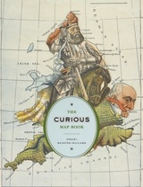
With The Curious Map Book, Ashley Baynton-Williams gathers an amazing, chronologically ordered variety of cartographic gems, mainly from the vast collection of the British Library. He has unearthed a wide array of the whimsical and fantastic, from maps of board games to political ones, maps of the Holy Land to maps of the human soul. In his illuminating introduction, Baynton-Williams also identifies and expounds upon key themes of map production, peculiar styles, and the commerce and collection of unique maps. This incredible volume offers a wealth of gorgeous illustrations for anyone who is cartographically curious.
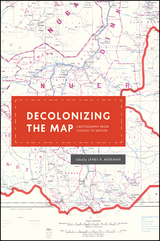
These essays, originally delivered as the 2010 Kenneth Nebenzahl, Jr., Lectures in the History of Cartography at the Newberry Library, encompass more than two centuries and three continents—Latin America, Africa, and Asia. Ranging from the late eighteenth century through the mid-twentieth, contributors study topics from mapping and national identity in late colonial Mexico to the enduring complications created by the partition of British India and the racialized organization of space in apartheid and post-apartheid South Africa. A vital contribution to studies of both colonization and cartography, Decolonizing the Map is the first book to systematically and comprehensively examine the engagement of mapping in the long—and clearly unfinished—parallel processes of decolonization and nation building in the modern world.
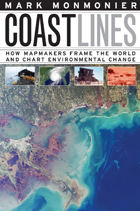
Whether for sailing charts or property maps, Monmonier shows, coastlines challenge mapmakers to capture on paper a highly irregular land-water boundary perturbed by tides and storms and complicated by rocks, wrecks, and shoals. Coast Lines is peppered with captivating anecdotes about the frustrating effort to expunge fictitious islands from nautical charts, the tricky measurement of a coastline’s length, and the contentious notions of beachfront property and public access.
Combing maritime history and the history of technology, Coast Lines charts the historical progression from offshore sketches to satellite images and explores the societal impact of coastal cartography on everything from global warming to homeland security. Returning to the form of his celebrated Air Apparent, Monmonier ably renders the topic of coastal cartography accessible to both general readers and historians of science, technology, and maritime studies. In the post-Katrina era, when the map of entire regions can be redrawn by a single natural event, the issues he raises are more important than ever.
In his acclaimed How to Lie with Maps, Mark Monmonier showed how maps can distort facts. In Mapping it Out: Expository Cartography for the Humanities and Social Sciences, he shows authors and scholars how they can use expository cartography—the visual, two-dimensional organization of information—to heighten the impact of their books and articles.
This concise, practical book is an introduction to the fundamental principles of graphic logic and design, from the basics of scale to the complex mapping of movement or change. Monmonier helps writers and researchers decide when maps are most useful and what formats work best in a wide range of subject areas, from literary criticism to sociology. He demonstrates, for example, various techniques for representing changes and patterns; different typefaces and how they can either clarify or confuse information; and the effectiveness of less traditional map forms, such as visibility base maps, frame-rectangle symbols, and complementary scatterplot designs for conveying complex spatial relationships.
There is also a wealth of practical information on map compilation, cartobibliographies, copyright and permissions, facsimile reproduction, and the evaluation of source materials. Appendixes discuss the benefits and limitations of electronic graphics and pen-and-ink drafting, and how to work with a cartographic illustrator.
Clearly written, and filled with real-world examples, Mapping it Out demystifies mapmaking for anyone writing in the humanities and social sciences.
"A useful guide to a subject most people probably take too much for granted. It shows how map makers translate abstract data into eye-catching cartograms, as they are called. It combats cartographic illiteracy. It fights cartophobia. It may even teach you to find your way."—Christopher Lehmann-Haupt, The New York Times
Some maps help us find our way; others restrict where we go and what we do. These maps control behavior, regulating activities from flying to fishing, prohibiting students from one part of town from being schooled on the other, and banishing certain individuals and industries to the periphery. This restrictive cartography has boomed in recent decades as governments seek regulate activities as diverse as hiking, building a residence, opening a store, locating a chemical plant, or painting your house anything but regulation colors. It is this aspect of mapping—its power to prohibit—that celebrated geographer Mark Monmonier tackles in No Dig, No Fly, No Go.
Rooted in ancient Egypt’s need to reestablish property boundaries following the annual retreat of the Nile’s floodwaters, restrictive mapping has been indispensable in settling the American West, claiming slices of Antarctica, protecting fragile ocean fisheries, and keeping sex offenders away from playgrounds. But it has also been used for opprobrium: during one of the darkest moments in American history, cartographic exclusion orders helped send thousands of Japanese Americans to remote detention camps. Tracing the power of prohibitive mapping at multiple levels—from regional to international—and multiple dimensions—from property to cyberspace—Monmonier demonstrates how much boundaries influence our experience—from homeownership and voting to taxation and airline travel. A worthy successor to his critically acclaimed How to Lie with Maps, the book is replete with all of the hallmarks of a Monmonier classic, including the wry observations and witty humor.
In the end, Monmonier looks far beyond the lines on the page to observe that mapped boundaries, however persuasive their appearance, are not always as permanent and impermeable as their cartographic lines might suggest. Written for anyone who votes, owns a home, or aspires to be an informed citizen, No Dig, No Fly. No Go will change the way we look at maps forever.
Maps are stories as much about us as about the landscape. They reveal changing perceptions of the natural world, as well as conflicts over the acquisition of territories. Cartographic Fictions looks at maps in relation to journals, correspondence, advertisements, and novels by authors such as Joseph Conrad and Michael Ondaatje. In her innovative study, Karen Piper follows the history of cartography through three stages: the establishment of the prime meridian, the development of aerial photography, and the emergence of satellite and computer mapping.
Piper follows the cartographer’s impulse to “leave the ground” as the desire to escape the racialized or gendered subject. With the distance that the aerial view provided, maps could then be produced “objectively,” that is, devoid of “problematic” native interference. Piper attempts to bring back the dialogue of the “native informant,” demonstrating how maps have historically constructed or betrayed anxieties about race. The book also attempts to bring back key areas of contact to the map between explorer/native and masculine/feminine definitions of space.
Focusing on maps created in Spanish America, Europe, the United States, and Asia, these essays take us from the Aztecs documenting the founding of Tenochtitlan, to early modern Japanese reconstructing nostalgic landscapes before Western encroachments, to nineteenth-century Americans grappling with the new concept of deep time. The book also features a defense of traditional paper maps by digital mapmaker William Rankin. With more than one hundred color maps and illustrations, Time in Maps will draw the attention of anyone interested in cartographic history.
The Cadastral Map in the Service of the State, illustrated with 126 maps, traces the development and application of rural property mapping in Europe from the Renaissance through the nineteenth century. Beginning with a review of the roots of cadastral mapping in the Roman Empire, the authors concentrate on the use of cadastral maps in the Netherlands, France, England, the Nordic countries, the German lands, the territories of the Austrian Habsburgs, and the European colonies. During the sixteenth century government institutions began to use maps to secure economic and political bases; by the nineteenth century these maps had become tools for aggressive governmental control of land as tax bases, natural resources, and national territories. This work demonstrates how the seemingly neutral science of cartography became a political instrument for national
interests.
In this unprecedented study, Edward T. Price covers most areas of the United States in which the initial division of land was controlled by colonial governments—the original thirteen colonies, and Maine, Vermont, Kentucky, West Virginia, Tennessee, Louisiana, and Texas. By examining different land policies and the irregular pattern of property that resulted from them, Price chronicles the many ways colonies managed land to promote settlement, develop agriculture, defend frontiers, and attract investment. His analysis reveals as much about land planning techiniques carried to America from Europe as innovations spurred by the unique circumstances of the new world.
Price’s analysis draws on his thorough survey of property records from the first land plans in Virginia in 1607 to empresario grants in Texas in the 1820s. This breadth of data allows him to identify regional differences in allocating land, assess the impact of land planning by historical figures like William Penn of Pennsylvania and Lord Baltimore of Maryland, and trace changes in patterns of land division and ownership through transfers of power among Britain, the Netherlands, France, Spain, Mexico, and the Republic of Texas.
Generously illustrated with reproductions of rare manuscripts, including 8 color plates, these accounts reveal how estate maps performed vital economic and cultural functions for property owners until the end of the nineteenth century. From plans of plantations in Jamaica and South Carolina to a map of Queens College, Cambridge, handsome examples show that estate maps formed an important part of the historical record of property ownership for both individuals and corporations, and helped owners manage their land and appraise its value. Exhibited in public places for pleasure and as symbols of wealth, they often displayed elaborate cartouches and elegant coats-of-arms.
Flattening the Earth is the first detailed history of map projections since 1863. John P. Snyder discusses and illustrates the hundreds of known projections created from 500 B.C. to the present, emphasizing developments since the Renaissance and closing with a look at the variety of projections made possible by computers.
The book contains 170 illustrations, including outline maps from original sources and modern computerized reconstructions. Though the text is not mathematically based, a few equations are included to permit the more technical reader to plot some projections. Tables summarize the features of nearly two hundred different projections and list those used in nineteenth-and twentieth-century atlases.
"This book is unique and significant: a thorough, well-organized, and insightful history of map projections. Snyder is the world's foremost authority on the subject and a significant innovator in his own right."—Mark Monmonier, author of How to Lie with Maps and Mapping It Out: Expository Cartography for the Humanities and Social Sciences.
Because it distorts the proportionate size of countries, the Mercator map was criticized for inflating Europe and North America in a promotion of colonialism. In 1974, German historian Arno Peters proffered his own map, on which countries were ostensibly drawn in true proportion to one another. In the ensuing "map wars" of the 1970s and 1980s, these dueling projections vied for public support—with varying degrees of success.
Widely acclaimed for his accessible, intelligent books on maps and mapping, Monmonier here examines the uses and limitations of one of cartography's most significant innovations. With informed skepticism, he offers insightful interpretations of why well-intentioned clerics and development advocates rallied around the Peters projection, which flagrantly distorted the shape of Third World nations; why journalists covering the controversy ignored alternative world maps and other key issues; and how a few postmodern writers defended the Peters worldview with a self-serving overstatement of the power of maps. Rhumb Lines and Map Wars is vintage Monmonier: historically rich, beautifully written, and fully engaged with the issues of our time.
READERS
Browse our collection.
PUBLISHERS
See BiblioVault's publisher services.
STUDENT SERVICES
Files for college accessibility offices.
RECENTLY PUBLISHED
")
")
")
")
")


UChicago Accessibility Resources
home | accessibility | search | about | contact us
BiblioVault ® 2001 - 2024
The University of Chicago Press