
 A SCHOLARLY BOOK REPOSITORY
"Its contribution to its specific field is both significant and original. . . . It is a pure pleasure to read." —Sabine MacCormack, Isis
"Mundy has done a fine job of balancing the artistic interpretation of the maps with the larger historical context within which they were drawn. . . . This is an important work." —John F. Schwaller, Sixteenth Century Journal
"This beautiful book opens a Pandora's box in the most positive sense, for it provokes the reconsideration of several long-held opinions about Spanish colonialism and its effects on Native American culture." —Susan Schroeder, American Historical Review
From the sixteenth century until the early nineteenth, Europeans had envisioned New Spain (colonial Mexico) in texts, maps, and other images. In the first decades of the 1800s, ideas about Mexican, rather than Spanish, national character and identity began to cohere in written and illustrated narratives produced by foreign travelers. During the nineteenth century, technologies and processes of visual reproduction expanded to include lithography, daguerreotype, and photography. New methods of display—such as albums, museums, exhibitions, and world fairs—signaled new ideas about spectatorship. García Cubas participated in this emerging visual culture as he reconfigured geographic and cultural imagery culled from previous mapping practices and travel writing. In works such as the Atlas geográfico (1858) and the Atlas pintoresco é historico (1885), he presented independent Mexico to Mexican citizens and the world.
For many, a map is nothing more than a tool used to determine the location or distribution of something—a country, a city, or a natural resource. But maps reveal much more: to really read a map means to examine what it shows and what it doesn’t, and to ask who made it, why, and for whom. The contributors to this new volume ask these sorts of questions about maps of Latin America, and in doing so illuminate the ways cartography has helped to shape this region from the Rio Grande to Patagonia.
In Mapping Latin America,Jordana Dym and Karl Offen bring together scholars from a wide range of disciplines to examine and interpret more than five centuries of Latin American maps.Individual chapters take on maps of every size and scale and from a wide variety of mapmakers—from the hand-drawn maps of Native Americans, to those by famed explorers such as Alexander von Humboldt, to those produced in today’s newspapers and magazines for the general public. The maps collected here, and the interpretations that accompany them, provide an excellent source to help readers better understand how Latin American countries, regions, provinces, and municipalities came to be defined, measured, organized, occupied, settled, disputed, and understood—that is, how they came to have specific meanings to specific people at specific moments in time.
The first book to deal with the broad sweep of mapping activities across Latin America, this lavishly illustrated volume will be required reading for students and scholars of geography and Latin American history, and anyone interested in understanding the significance of maps in human cultures and societies.
In answering these questions, D. Graham Burnett brings to light the work of several such explorers, particularly Sir Robert H. Schomburgk, the man who claimed to be the first to reach the site of Ralegh's El Dorado. Commissioned by the Royal Geographical Society and later by the British Crown, Schomburgk explored and mapped regions in modern Brazil, Venezuela, and Guyana, always in close contact with Amerindian communities. Drawing heavily on the maps, reports, and letters that Schomburgk sent back to England, and especially on the luxuriant images of survey landmarks in his Twelve Views in the Interior of Guiana (reproduced in color in this book), Burnett shows how a vast network of traverse surveys, illustrations, and travel narratives not only laid out the official boundaries of British Guiana but also marked out a symbolic landscape that fired the British imperial imagination.
Engagingly written and beautifully illustrated, Masters of All They Surveyed will interest anyone who wants to understand the histories of colonialism and science.
consolidate their power realized that better knowledge of
their lands would strengthen their control over them. By
1550, the cartographer's art had already become an important
instrument for bringing territories under the control of
centralized government; increasing governmental reliance on
maps stimulated the refinement of cartographic techniques
throughout the following century.
This volume, a detailed survey of the political uses of
cartography between 1400 and 1700 in Italy, France, England,
Poland, Austria, and Spain, answers these questions: When
did monarchs and ministers begin to perceive that maps could
be useful in government? For what purposes were maps
commissioned? How accurate and useful were they? How did
cartographic knowledge strengthen the hand of government?
The chapters offer new insights into the development of
cartography and its role in European history.
Contributors to the volume are John Marino, Peter
Barber, David Buisseret, Geoffrey Parker, James Vann, and
Michael J. Mikòs.
As Bryars and Harper reveal, maps make ideal narrators, and the maps in this book tell the story of the 1900s—which saw two world wars, the Great Depression, the Swinging Sixties, the Cold War, feminism, leisure, and the Internet. Several of the maps have already gained recognition for their historical significance—for example, Harry Beck’s iconic London Underground map—but the majority of maps on these pages have rarely, if ever, been seen in print since they first appeared. There are maps that were printed on handkerchiefs and on the endpapers of books; maps that were used in advertising or propaganda; maps that were strictly official and those that were entirely commercial; maps that were printed by the thousand, and highly specialist maps issued in editions of just a few dozen; maps that were envisaged as permanent keepsakes of major events, and maps that were relevant for a matter of hours or days.
As much a pleasure to view as it is to read, A History of the Twentieth Century in 100 Maps celebrates the visual variety of twentieth century maps and the hilarious, shocking, or poignant narratives of the individuals and institutions caught up in their production and use.
Concentrating on how and why new concepts and techniques of making and using maps were introduced, Josef Konvitz skillfully traces the modernization of cartography during the French Enlightenment. The story he unfolds is not merely a narrative of who did what, but an analysis of how the map itself influenced attitudes toward the land and the consequent effects on planning and the development of resources. Throughout, Konvitz demonstrates the significant relationship between cartography and political, economic, and military life. He emphasizes efforts to enlarge the practical applications of maps in government and the impact of government policy on the evolution of cartography.
Conley traces the explosion of interest in mapmaking that occurred with the discovery of the New World, and discusses the commensurate rise of what he defines as cartographic writing-writing that "holds, penetrates, delineates, and explores space." Considering the works of such writers as Rabelais, Montaigne, and Descartes, Conley provides a "navigation" through the printed page, revealing the emerging values of Renaissance France. In his examination of the placing of words, letters, and graphic elements in books, he exposes the playful and sometimes enigmatic relation between spatial organization and text.
Conley also exposes the ideological exercise inherent in mapmaking, arguing that Renaissance cartography is inseparably bound up with the politics of the era. He undertakes close readings of maps and illustrations, discussing the necessity of viewing Renaissance maps in the context of their typographic layout, graphic reproduction, and literary and ideological import.
Richly illustrated throughout, The Self-Made Map combines studies of art, geography, history, literature, and printing to show a clear historical transformation, along the way linking geographical discoveries, printing processes, and political awareness. Conley's provocative analysis discloses how early modern printed literature and cartography worked together to crystallize broader issues engaging the then emergent status of cultural identity, nation, and individuality.
Turning to a previously undiscovered archive of popular maps, Cartophilia reveals Alsace-Lorraine’s lively world of citizen mapmakers that included linguists, ethnographers, schoolteachers, hikers, and priests. Together, this fresh group of mapmakers invented new genres of maps that framed French and German territory in original ways through experimental surveying techniques, orientations, scales, colors, and iconography. In focusing on the power of “bottom-up” maps to transform modern European identities, Cartophilia argues that the history of cartography must expand beyond the study of elite maps and shift its emphasis to the democratization of cartography in the modern world.
Fifteen years in the making, this catalogue will be an essential reference for bibliographers and archivists dealing with rare books and maps of the period, for map collectors, map librarians, and scholars and librarians working with early printed items and manuscripts.
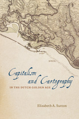
Building her exploration around the central figure of Claes Jansz Vischer, an Amsterdam-based publisher closely tied to the Dutch West India Company, Sutton shows how printed maps of Dutch Atlantic territories helped rationalize the Dutch Republic’s global expansion. Maps of land reclamation projects in the Netherlands, as well as the Dutch territories of New Netherland (now New York) and New Holland (Dutch Brazil), reveal how print media were used both to increase investment and to project a common narrative of national unity. Maps of this era showed those boundaries, commodities, and topographical details that publishers and the Dutch West India Company merchants and governing Dutch elite deemed significant to their agenda. In the process, Sutton argues, they perpetuated and promoted modern state capitalism.
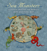
Nearly two meters wide in total, the map’s nine wood-block panels comprise the largest and first realistic portrayal of Northern Europe. But in addition to these important geographic elements, Magnus’s map goes beyond cartography to scenes both domestic and mystic. Close to shore, Magnus shows humans interacting with common sea life—boats struggling to stay afloat, merchants trading, children swimming, and fisherman pulling lines. But from the offshore deeps rise some of the most magical and terrifying sea creatures imaginable at the time or thereafter—like sea swine, whales as large as islands, and the Kraken. In this book, Nigg provides a thorough tour of the map’s cartographic details, as well as a colorful look at its unusual pictorial and imaginative elements. He draws on Magnus’s own text to further describe and illuminate the inventive scenes and to flesh out the stories of the monsters.
Sea Monsters is a stunning tour of a world that still holds many secrets for us land dwellers, who will forever be fascinated by reports of giant squid and the real-life creatures of the deep that have proven to be as bizarre and otherworldly as we have imagined for centuries. It is a gorgeous guide for enthusiasts of maps, monsters, and the mythic.
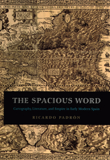
Padrón contends too that maps and geographic writings heavily influenced the Spanish imperial imagination. During the early modern period, the idea of "America" was still something being invented in the minds of Europeans. Maps of the New World, letters from explorers of indigenous civilizations, and poems dramatizing the conquest of distant lands, then, helped Spain to redefine itself both geographically and imaginatively as an Atlantic and even global empire. In turn, such literature had a profound influence on Spanish ideas of nationhood, most significantly its own.
Elegantly conceived and meticulously researched, The Spacious Word will be of enormous interest to historians of Spain, early modern literature, and cartography.
From the Renaissance to the Enlightenment, the geopolitical placement of Ukraine drew the attention of some of Europe’s most influential cartographers. Many of these maps, including ones of exceptional rarity, were collected by the Ukrainian scholar and journalist Bohdan Krawciw.
Krawciw traced the physical and aesthetic depiction of Ukraine across its changing borders as a means of self-recognition and as a cultural and political history of the contested nation and its peoples. Of special interest are his maps of Ukraine from the nineteenth and twentieth centuries, at the crossroads of four empires: Habsburg, Ottoman, Russian, and Soviet.
As part of his personal archive, Krawciw’s maps were bequeathed to Harvard University upon his death in 1975. This book serves as both a catalog of his collection and a description of how the maps he collected serve as an invaluable source for Ukraine’s history and a symbol of Ukrainian national identity. The book contains nearly 100 examples from the collection, many in full color, as well as indices listing maps by cartographer and by place name.
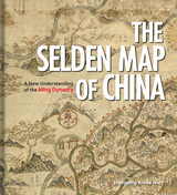
Exploring the commercial aims of the Ming Dynasty, the port city of Quanzhou and its connections with the voyages of the early traveler Zheng He, this book describes the historical background of the era in which the map was used. It also includes an analysis of the skills and techniques involved in Chinese map-making and the significance of the compass bearings, scale, and ratios found on the map, all of which combine to represent a breakthrough in cartographic techniques.
The enthralling story revealed by this extraordinary artifact sheds light on the long history of China’s relationship with the sea and with the wider world.
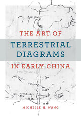
This is the first English-language monograph on the early history of maps in China, centering on those found in three tombs that date from the fourth to the second century BCE and constitute the entire known corpus of early Chinese maps (ditu). More than a millennium separates them from the next available map in the early twelfth century CE. Unlike extant studies that draw heavily from the history of cartography, this book offers an alternative perspective by mobilizing methods from art history, archaeology, material culture, religion, and philosophy. It examines the diversity of forms and functions in early Chinese ditu to argue that these pictures did not simply represent natural topography and built environments, but rather made and remade worlds for the living and the dead. Wang explores the multifaceted and multifunctional diagrammatic tradition of rendering space in early China.
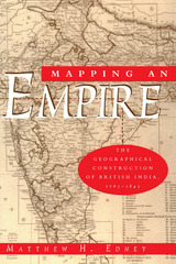
"There is much to be praised in this book. It is an excellent history of how India came to be painted red in the nineteenth century. But more importantly, Mapping an Empire sets a new standard for books that examine a fundamental problem in the history of European imperialism."—D. Graham Burnett, Times Literary Supplement
"Mapping an Empire is undoubtedly a major contribution to the rapidly growing literature on science and empire, and a work which deserves to stimulate a great deal of fresh thinking and informed research."—David Arnold, Journal of Imperial and Commonwealth History
"This case study offers broadly applicable insights into the relationship between ideology, technology and politics. . . . Carefully read, this is a tale of irony about wishful thinking and the limits of knowledge."—Publishers Weekly
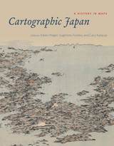
But this was not always the case: a thousand years ago, maps were solely a privilege of the ruling elite in Japan. Only in the past four hundred years has Japanese cartography truly taken off, and between the dawn of Japan’s cartographic explosion and today, the nation’s society and landscape have undergone major transformations. At every point, maps have documented those monumental changes. Cartographic Japan offers a rich introduction to the resulting treasure trove, with close analysis of one hundred maps from the late 1500s to the present day, each one treated as a distinctive window onto Japan’s tumultuous history.
Forty-seven distinguished contributors—hailing from Japan, North America, Europe, and Australia—uncover the meanings behind a key selection of these maps, situating them in historical context and explaining how they were made, read, and used at the time. With more than one hundred gorgeous full-color illustrations, Cartographic Japan offers an enlightening tour of Japan’s magnificent cartographic archive.
One of the world's oldest crossroads, the Sinai joins the great continental land masses of Africa and Eurasia. Its physical geography of rugged mountain peaks, desert plains, and sea coasts was formed by the collision of the two continental plates, while the human tides that have swept across the region over millennia have left an intricate web of cultures and ethnicities.
In this book, Ned Greenwood offers a complete, up-to-date physical geography of Sinai. After an introductory chapter that situates Sinai within world history and geography, he focuses in detail on the following areas: plate tectonics and geology, geomorphology and drainage, weather and climate, soils, and biogeography.
In the concluding chapter, Greenwood considers the human geography of Sinai, including the pressures currently posed by population growth, political extremism, and environmental constrictions on development. He offers a fully rounded picture of the physical environment of Sinai that will be vital reading for everyone concerned about the future of this strategic yet fragile land.
In this book, paleobotanist Alan Graham traces the formation and disruption of key New World land bridges and describes the biotic, climatic, and biogeographic ramifications of these land masses’ changing formations over time. Looking at five land bridges, he explores their present geographic setting and climate, modern vegetation, indigenous peoples (with special attention to their impact on past and present vegetation), and geologic history. From the great Panamanian isthmus to the boreal connections across the North Atlantic and North Pacific Oceans that allowed exchange of organisms between North America, Europe, and Asia, Graham’s sweeping, one-hundred-million-year history offers new insight into the forces that shaped the life and land of the New World.
Earth and Mars is a fusion of art and science, a blend of images and essays celebrating the successful creation of our life-sustaining planet and the beauty and mystery of Mars. Through images of terrestrial landscapes and photographs selected from recent NASA and European Space Agency missions to Mars, Earth and Mars reveals the profound beauty resulting from the action of volcanism, wind, and water. The accompanying text provides a context for appreciating the role of these elemental forces in shaping the surfaces of each planet, as well as the divergent evolutionary paths that led to an Earth that is teeming with life, and Mars that is seemingly lifeless.
Earth and Mars inspires reflection on the extraordinarily delicate balance of forces that has resulted in our good fortune: to be alive and sentient on a bountiful blue world.
This volume explores the technical and geographic scope of this important technique, focusing particularly on the intertwined influences of climatic variation and land-use practices in sculpting landscapes. Contributors offer a broad-perspective review of the state-of-the-art of repeat photography, with twenty-three chapters written by researchers around the globe who have made use of repeat photography in their work. Topics addressed include
the history of repeat photography
techniques for creating and analyzing repeat photographs
applications in the geosciences
applications in population ecology
applications in ecosystem change
cultural applications
Repeat Photography demonstrates the wide range of potential applications, examines new techniques for acquiring data from repeat photography, and clearly shows that repeat photography remains a valuable and efficient means of monitoring change in both developed and developing regions. Over one hundred sets of photographs, including thirty-two pages of color photos, serve as examples.
Recent concerns about climate change and its effects on natural landscapes, combined with ongoing concerns about land-use practices, make this state-of-the-art review a timely contribution to the literature.
Since before recorded history, people have congregated near water. But as growing populations around the globe continue to flow toward the coasts on an unprecedented scale and climate change raises water levels, our relationship to the sea has begun to take on new and potentially catastrophic dimensions. The latest generation of coastal dwellers lives largely in ignorance of the history of those who came before them, the natural environment, and the need to live sustainably on the world’s shores. Humanity has forgotten how to live with the oceans.
Nearly 60% of the world's population lives and works within 100 miles of a coast, and even those who don't are connected to the world's oceans through an intricate drainage of rivers and streams. Ultimately the whole of humankind is coastal.
Coastal Waters of the World is a comprehensive reference source on the state of the world's coastal areas. It focuses on the tremendous pressures facing coastal areas and the management systems and strategies needed to cope with them. Don Hinrichsen explores the origins and implications of three related issues: the overwhelming threats to our coastal resources and seas from population and pollution; the destruction of critical resources through unsustainable economic activity; and the inability of governments to craft and implement rational coastal management plans.
Introductory chapters present a concise summary of our coastal problems, including coastal habitat degradation and the fisheries crisis, along with a discussion of better management options. Three case studies of successful coastal governance focus on some of the problems and bring to life potential solutions. Following that are regional profiles that provide detailed information on the main population, resource, and management challenges facing each of the world's thirteen major coastal waters and seas. The profiles are presented in a standard format to allow for ease of comparison between regions, and accessibility of information. The book ends with a realistic and practical agenda for action that can be implemented immediately.
Safeguarding these complex, interlinked ecosystems is humanity's most challenging management job. Coastal Waters of the World will help raise our awareness of coastal area concerns and provide a constructive contribution to the ongoing debate over how to manage these ever-changing areas, both for ourselves and for future generations. It will serve as a valuable reference tool and an up-to-date resource for policymakers, management specialists, and students interested in sustainable coastal governance.
After explaining beaches as dynamic ecosystems, Pilkey and Cooper assess the harm done by dense oceanfront development accompanied by the construction of massive seawalls to protect new buildings from a shoreline that encroaches as sea levels rise. They discuss the toll taken by sand mining, trash that washes up on beaches, and pollution, which has contaminated not only the water but also, surprisingly, the sand. Acknowledging the challenge of reconciling our actions with our love of beaches, the geologists offer suggestions for reversing course, insisting that given the space, beaches can take care of themselves and provide us with multiple benefits.
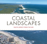
Based on numerous aerial images from helicopter and drone flights between 2015 and 2021, this book provides extensive photographs and maps of the New Jersey coast, from the Pine Barrens to the ocean beaches. The text associated with each exceptional image describes it in detail, including its location, ecological setting, and relative position within the larger landscape. Author Kenneth Able, director of the Rutgers University Marine Field Station for over thirty years, has thoroughly ground-truthed each image by observations made through kayaks, boats, and wading through marshes. Calling upon his decades of expertise, Able paints a compelling portrait of coastal New Jersey’s stunning natural features, resources, history, and possible futures in an era of rising sea levels.
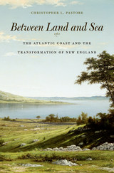
One of the largest estuaries on the North Atlantic coast, Narragansett Bay served as a gateway for colonial expansion in the seventeenth century and the birthplace of American industrialization in the late eighteenth. Christopher Pastore presents an environmental history of this watery corner of the Atlantic world, beginning with the first European settlement in 1636 and ending with the dissolution of the Blackstone Canal Company in 1849. Between Land and Sea traces how the Bay’s complex ecology shaped the contours of European habitation, trade, and resource use, and how littoral settlers in turn reconfigured the physical and cultural boundaries between humans and nature.
Narragansett Bay emerges in Pastore’s account as much more than a geological formation. Rather, he reimagines the nexus of land and sea as a brackish borderland shaped by the tension between what English settlers saw as improvable land and the perpetual forces of the North Atlantic Ocean. By draining swamps, damming rivers, and digging canals, settlers transformed a marshy coastal margin into a clearly defined edge. The resultant “coastline” proved less resilient, less able to absorb the blows of human initiative and natural variation than the soggy fractal of water and earth it replaced.
Today, as sea levels rise and superstorms batter coasts with increasing ferocity, Between Land and Sea calls on the environmentally-minded to make a space in their notions of progress for impermanence and uncertainty in the natural world.
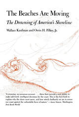
Our beaches are eroding, sinking, washing out right under our houses, hotels, bridges; vacation dreamlands become nightmare scenes of futile revetments, fills, groins, what have you—all thrown up in a frantic defense against the natural system. The romantic desire to live on the seashore is in doomed conflict with an age-old pattern of beach migration. Yet it need not be so. Conservationist Wallace Kaufman teams up with marine geologist Orrin H. Pilkey Jr., in an evaluation of America's beaches from coast to coast, giving sound advice on how to judge a safe beach development from a dangerous one and how to live at the shore sensibly and safely.
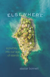
There are millions of islands on our planet. New islands are being built at an unprecedented rate, for tourism and territorial ambition. Many are also disappearing, besieged by rising sea levels. The story of our world’s islands is one of the great dramas of our time, and it is playing out around the planet—islands are sprouting or being submerged everywhere from the South China Sea to the Atlantic. Elsewhere is the story of this strange and mesmerizing planetary spectacle.
In this book, explorer and geographer Alastair Bonnett takes us on a thought-provoking tour of the world’s most fascinating islands. He traveled the globe to provide a firsthand look at numerous islands, sketching a vivid likeness of each one he visited. From a “crannog,” an ancient artificial island in a Scottish loch, to the militarized artificial islands China is building; from the disappearing islands that remain the home of native Central Americans to the ritzy new islands of Dubai; from Hong Kong to the Isles of Scilly—all have compelling stories to tell. As we journey around the world with Bonnett, he addresses urgent contemporary issues such as climate change, economic inequality, and the changing balance of world power as reflected in the fates of islands. Along the way, we also learn about the many ways islands rise and fall, the long and little-known history of human island-building and the prospect that the inland hills and valleys will one day be archipelagos.
Featuring Bonnett’s charming hand-drawn maps and 33 full-color photos, Elsewhere is a captivating travel book for any armchair adventurer.
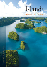
Royle shows that despite the view of some islands as earthly paradises, they are often beset by severe limitations in both resources and opportunities. Detailing the population loss many islands have faced in recent years, he considers how islanders have developed their homes into tourist destinations in order to combat economic instability. He also explores their exotic, otherworldly beauty and the ways they have provided both refuge and inspiration for artists, such as Paul Gauguin in Tahiti and George Orwell on the Scottish island of Jura. Filled with illustrations, Islands is a compelling and comprehensive survey of the geographical and cultural aspects of island life.
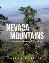
Divided into three parts, the book presents a simple system recognizing the primary landscape features of Nevada. Part I describes the methods used to define the boundaries of the ranges and divides the state into meaningful landforms. Part II describes the ecological life zones and their vegetation types. Part III describes the individual mountain ranges. Each mountain range entry contains a descriptive narrative and a data summary that includes the county or counties in which the range occurs, whether the author has visited and collected plants there, the highest point, the base elevation, a brief discussion of the geology, any historic settlements or post offices located in the range, the distribution of life zones, and a list of all conifers and flowering trees.
The result of over thirty years of exploration and study throughout the state, this is a long-overdue compendium of Nevada’s mountains and associated flora. This book is a required reference for anyone venturing out into the Nevada wilds.
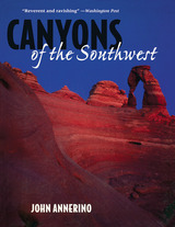
The canyons of the southwestern United States and northern Mexico contain some of the most dramatic landscapes in the world. John Annerino's pictorial celebration of this visually rich region is a handsome memento for those who have heard the wind whistling in these haunting canyons, and a beckoning invitation for those who have not yet made the journey.
Annerino has spent much of his adult life exploring this territory—as wilderness runner, adventurer, and photojournalist—and combines his firsthand knowledge with his expertise as a nature photographer and author to create an intimate portrait of these timeless places. Accompanying the photographs are informative essays describing the region's geological and human history.
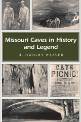
Missouri has been likened to a “cave factory” because its limestone bedrock can be slowly dissolved by groundwater to form caverns, and the state boasts more than six thousand caves in an unbelievable variety of sizes, lengths, and shapes. Dwight Weaver has been fascinated by Missouri’s caves since boyhood and now distills a lifetime of exploration and research in a book that will equally fascinate readers of all ages.
Missouri Caves in History and Legend records a cultural heritage stretching from the end of the ice age to the twenty-first century. In a grand tour of the state’s darkest places, Weaver takes readers deep underground to shed light on the historical significance of caves, correct misinformation about them, and describe the ways in which people have used and abused these resources.
Weaver tells how these underground places have enriched our knowledge of extinct animals and early Native Americans. He explores the early uses of caves: for the mining of saltpeter, onyx, and guano; as sources of water; for cold storage; and as livestock shelters. And he tells how caves were used for burial sites and moonshine stills, as hideouts for Civil War soldiers and outlaws—revealing how Jesse James became associated with Missouri caves—and even as venues for underground dance parties in the late nineteenth century.
Bringing caves into the modern era, Weaver relates the history of Missouri’s “show caves” over a hundred years—from the opening of Mark Twain Cave in 1886 to that of Onyx Mountain Caverns in 1990—and tells of the men and women who played a major role in expanding the state’s tourism industry. He also tracks the hunt for the buried treasure and uranium ore that have captivated cave explorers, documents the emergence of organized caving, and explains how caves now play a role in wildlife management by providing a sanctuary for endangered bats and other creatures.
Included in the book is an overview of cave resources in twelve regions, covering all the counties that currently have recorded caves, as well as a superb selection of photos from the author’s extensive collection, depicting the history and natural features of these underground wonders. Missouri Caves in History and Legend is a riveting account that marks an important contribution to the state’s heritage and brings this world of darkness into the light of day.
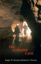
In 1925 the geological connection between Flint Ridge and Mammoth Cave was proved when dye placed in a Flint Ridge spring showed up in Echo River at Mammoth Cave.
That tantalizing swirl of dye confirmed speculations that wereto tempt more than 650cavers over half a century with the thrill of being the first to make human passage of the cave connection. Roger Brucker and Richard Watson tell not only of their own twenty-year effort to complete the link but the stories of many others who worked their way through mud-choked crawlways less than a foot high only to find impenetrable blockages.
Floyd Collins died a grisly death in nearby Sand Cave in1925, after being trapped there for 15 days. The wide press coverage of the rescue efforts stirred the imagination of the public and his body was on macabre display in a glass-topped coffin in Crystal Cave into the 1940s. Agents of a rival cave owner once even stole his corpse, which was recovered and still is in a coffin in the cave. Modern cavers still have a word with Floyd as they start their downward treks.
Brucker and Watson joined the parade of cavers who propelled themselves by wiggling kneecaps, elbows, and toes through quarter-mile long crawlways, clinging by fingertips and boot toes across mud-slick walls, over bottomless pits, into gurgling streams beneath stone ceilings that descend to water level, down crumbling crevices and up mountainous rockfalls, into wondrous domed halls, and straight ahead into a blackness intensified rather than dispelled by the carbide lamps on their helmets.
Over two decades they explored the passages with others who sought the final connection as vigorously as themselves. Pat Crowther, a young mother of two, joined them and because of her thinness became the member of the crew to go first into places no human had ever gone before. In that role, in July 1972, she wiggled her way through the Tight Spot and found the route that would link the Flint Ridge and Mammoth Cave systems into one cave extending 144.4 miles through the Kentucky limestone.
In a new afterword to this edition the authors summarize the subsequent explorations that have more than doubled the established length of the cave system. Based upon geological evidence, the authors predict that new discoveries will add another 200 miles to the length of the world’s longest cave, making it over 500 miles long.
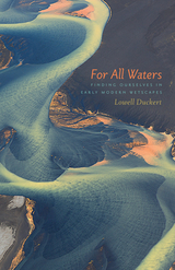
Recent years have witnessed a surge in early modern ecostudies, many devoted to Shakespearean drama. Yet in this burgeoning discipline, travel writing appears moored in historicization, inorganic subjects are far less prevalent than organic ones, and freshwater sites are hardly visited. For All Waters explores these uncharted wetscapes.
Lowell Duckert shows that when playwrights and travel writers such as Sir Walter Raleigh physically interacted with rivers, glaciers, monsoons, and swamps, they composed “hydrographies,” or bodily and textual assemblages of human and nonhuman things that dissolved notions of human autonomy and its singular narrativity. With a playful, punning touch woven deftly into its theoretical rigor, For All Waters disputes fantasies of ecological solitude that would keep our selves high and dry and that would try to sustain a political ecology excluding water and the poor. The lives of both humans and waterscapes can be improved simultaneously through direct engagement with wetness.
For All Waters concludes by investigating waterscapes in peril today—West Virginia’s chemical rivers and Iceland’s vanishing glaciers—and outlining what we can learn from early moderns’ eco-ontological lessons. By taking their soggy and storied matters to heart, and arriving at a greater realization of our shared wetness, we can conceive new directions to take within the hydropolitical crises afflicting us today.
READERS
Browse our collection.
PUBLISHERS
See BiblioVault's publisher services.
STUDENT SERVICES
Files for college accessibility offices.
RECENTLY PUBLISHED

")


UChicago Accessibility Resources
home | accessibility | search | about | contact us
BiblioVault ® 2001 - 2024
The University of Chicago Press