
 A SCHOLARLY BOOK REPOSITORY
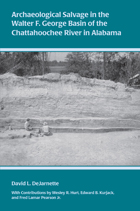
David L. DeJarnette, the founder of scientific archaeology in the state of Alabama, reports on archaeological surveys and excavations undertaken in the Chattahoochee River Valley between 1947 and 1962. The three contributors, Wesley R. Hurt, Edward B. Kurjack, and Fred Lamar Pearson Jr., each made signal contributions to the archaeology of the southeastern states. With their mentor, David L. DeJarnette, they worked out a viable cultural chronology of the region from the earliest Paleoindian and Archaic foragers to the period of early European-Indian contact. They excavated key sites, including the Woodland period Shorter Mound, the protohistoric Abercrombie village, and Spanish Fort Apalachicola, in addition to a number of important Creek Indian town sites of the eighteenth century. All are here, illustrated abundantly by site photographs, maps, and of course, the artifacts recovered from these remarkable investigations.
Copublication with the Historic Chattahoochee Commission
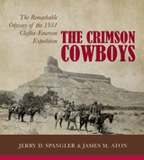
In 1931 a group from Harvard University’s Peabody Museum accomplished something that had never been attempted in the history of American archaeology: a six-week, four-hundred-mile horseback survey of Fremont prehistoric sites through some of the West’s most rugged terrain. The expedition was successful, but a report on the findings was never completed. What should have been one of the great archaeological stories in American history was relegated to boxes and files in the basement of the Peabody Museum at Harvard.
Now, based on over a thousand pages of documents (field journals, correspondence, and receipts) and over four hundred photographs, this book recounts the remarkable day-to-day adventures of this crew of one professor, five students, and three Utah guides who braved heat, fatigue, and the dangerous canyon wilderness to reveal vestiges of the Fremont culture in the Tavaputs Plateau and Uinta Basin areas. To better tell this story, authors Spangler and Aton undertook extensive fieldwork to confirm the sites; their recent photographs and those of the original expedition are shared on these pages. This engaging narrative situates the 1931 survey and its discoveries within the history of American archaeology.
Click here for a podcast with the APEX hour and Jim Aton about The Crimson Cowboys.
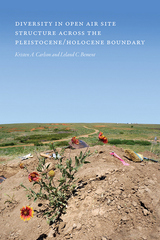
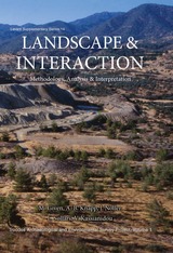
Open-air sites are difficult for researchers to locate and, because of depositional processes, often more difficult to interpret; they contain many superimposed events but often show evidence of only the most recent. Working to overcome the limitations of data and poor preservation, using decades of prior research and new analytical tools, and diverging from a one-size-fits-all mode of interpretation, the contributors to this volume offer fresh insight into the formation and taphonomy of open-air sites.
Contributors: Douglas B. Bamforth, Ian Buvit, Brian J. Carter, Robin Cordero, Robert Dello-Russo, George C. Frison, Kelly E. Graf, Bruce B. Huckell, Michael A. Jochim, Joshua D. Kapp, Robert L. Kelly, Aleksander V. Konstantinov, Banks Leonard, Madeline E. Mackie, Christopher W. Merriman, Matthew J. O’Brien, Spencer Pelton, Neil N. Puckett, Beth Shapiro, Todd A. Surovell, Karisa Terry, Steve Teteak, Robert Yohe
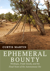
The Colorado Wickiup Project is documenting ephemeral wooden features such as wickiups, tree-platforms, and brush horse corrals that remain scattered throughout the mesas, canyons, and mountains of the state. They date from when European newcomers first arrived with a bounty of new things—horses, metal knives and axes, guns, and brightly colored glass beads—which were readily adopted by the Utes.
The Project is unique in using the techniques of metal detection, historic trade ware analysis, and tree-ring dating of metal ax–cut wickiup poles to distinguish the Ute sites from historic Euro–American ones. Through this analysis, researchers have demonstrated that not all Utes left Colorado for the reservations in Utah during the “final removal” in 1881, as has been generally believed. A significant number remained on their homelands well into the early decades of the twentieth century, building brush shelters and living much as they had for generations, but with new tools and weapons.
Appendix B Form: Aboriginal Wooden Feature Component Form
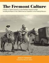
Early expedition surveys and excavations conducted by Noel Morss would lead to a definition of the Fremont culture; later research would augment existing data on the Fremont by adding entirely new traits, disclosing new variations in architecture and basketry, and providing new information on the distribution of previously known traits.
In The Fremont Culture: A Study in Culture Dynamics on the Northern Anasazi Frontier, archaeologist James H. Gunnerson provides the results of his 1950s survey and excavation in the Utah area. He presents a functional synthesis of the Fremont culture and discusses the dynamics of its growth and decline.
Gunnerson’s report also uses the original field notes, maps, plans, photographs, sketches, and unpublished preliminary reports of the Claflin-Emerson expedition. Together, the reports of Morss and Gunnerson offer the most important and complete overview of the expedition available. They are fitting tributes to the men of that expedition, scientists who recognized the importance of an ancient people who once wrested a meager living from the rugged canyon country of the Green and Colorado Rivers.
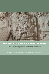
In this volume, contributors address the challenges faced by smaller polities on the peripheries of powerful kingdoms and ask how subordination was experienced and independent policy asserted. Leading experts provide cutting-edge analysis in varied topics and detailed discussion of the development of this major site and the region more broadly. The first half of the volume contains a historical narrative of the cultural sequence of El Zotz, tracing the changes in occupation and landscape use across time; the second half provides deep technical analyses of material evidence, including soils, ceramics, stone tools, and bone.
The ever-changing, inconstant landscapes of peripheral kingdoms like El Zotz reveal much about their more dominant—and better known—neighbors. An Inconstant Landscape offers a comprehensive, multidisciplinary view of this important but under-studied site, an essential context for the study of the Classic Maya in Guatemala, and a premier reference on the subject of peripheral kingdoms at the height of Maya civilization.
Contributors: Timothy Beach, Nicholas Carter, Ewa Czapiewska-Halliday, Alyce de Carteret, William Delgado, Colin Doyle, James Doyle, Laura Gámez, Jose Luis Garrido López, Yeny Myshell Gutiérrez Castillo, Zachary Hruby, Melanie Kingsley, Sheryl Luzzadder-Beach, Cassandra Mesick Braun, Sarah Newman, Rony Piedrasanta, Edwin Román, and Andrew K. Scherer
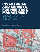
A critical first step in the conservation of cultural heritage is to identify and understand the places we want to protect. Inventories and surveys are essential tools in this effort, and their use in managing national, regional, and local heritage is mandated in heritage-related legislation across the globe. Despite the widespread understanding of the importance of inventories and surveys, however, practical, up-to-date guidance on how they should be created, implemented, and maintained has been substantially lacking—until now.
This publication draws from the Getty Conservation Institute’s ongoing work with heritage inventories and on the Los Angeles Office of Historic Resources’ experience with SurveyLA. It provides technical advice, guidance, and lessons learned for employing inventories and surveys as tools for heritage conservation and management.
The free online edition of this open-access publication will be available at www.getty.edu/publications/inventories-and-surveys. Also available are free PDF and EPUB downloads of the book.
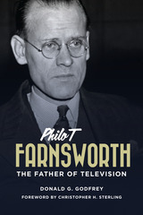
Philo T. Farnsworth (1906–1971) has been called the "forgotten father of television." He grew up in Utah and southern Idaho, and was described as a genius by those who knew and worked with him. With only a high school education, Farnsworth drew his first television schematic for his high school teacher in Rigby, Idaho. Subsequent claims and litigation notwithstanding, he was the first to transmit a television image.
Farnsworth filed ten patents between 1927 and 1929 for camera tubes (transmitting), circuitry, and the cathode ray tube (viewing). After his early years as an inventor in San Francisco, he worked as an engineer, doing battle with RCA in the 1930s over patent rights, formed the Farnsworth Television Company in the 1940s, and worked for IT&T after their purchase of the Farnsworth enterprises. Every television set sold utilized at least six of his basic patents.
Because of endless legal wrangling with RCA over patent rights, he received very little financial reward for his television patents. Donald Godfrey examines the genius and the failures in the life of Philo Farnsworth as he struggled to be both inventor and entrepreneur.
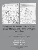
The Cuzco region of highland Peru was the heartland of the Inca empire, the largest native state to develop in the Americas. Archaeologists have studied Inca monumental architecture for more than a century, but it is only in recent decades that regional survey work has systematically sought to reconstruct patterns of settlement, subsistence, and social organization in the region. This monograph presents the results of regional surveys conducted (from 2000 to 2008) to the north and west of the city of Cuzco, a region of approximately 1200 square kilometers that was investigated using the same field methodology as other systematic surveys in the Cuzco region. The study region, referred to as Hanan Cuzco in this volume, encompasses considerable environmental variations, ranging from warm valley-bottom lands to snow-capped mountains. The chapters in this volume present settlement pattern data from all periods of pre-Columbian occupation—from the arrival of the first hunter-gatherers to the transformation of valley-bottom fields by the last Inca emperors. A chapter on the colonial period discusses how Spanish colonial practices transformed an imperial landscape into a peripheral one. Together, the chapters in this volume contribute to the archaeological understanding of several central issues in Andean prehistory.
READERS
Browse our collection.
PUBLISHERS
See BiblioVault's publisher services.
STUDENT SERVICES
Files for college accessibility offices.
RECENTLY PUBLISHED
: One Hundred Years Later, The 2014 - 2017 Excavations")


UChicago Accessibility Resources
home | accessibility | search | about | contact us
BiblioVault ® 2001 - 2024
The University of Chicago Press