
 A SCHOLARLY BOOK REPOSITORY
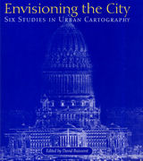
Whether a Chinese vertical city plan from the first millennium B.C. or a bird's-eye view appended to a fifteenth-century edition of Ptolemy's Geography, the type of plan chosen and its focus reflected the aspects of a city that the map's creators wished to highlight. For instance, maps of seventeenth-century cities emphasized impregnable fortifications as a deterrent to potential attackers. And Daniel Burnham's famous 1909 Plan of Chicago used a distinct representational style to "sell" his version of the new Chicago.
Although city plans are among the oldest maps known, few books have been devoted to them. Historians of cartography and geography, architects, and urban planners will all enjoy this profusely illustrated volume.
"An extraordinarily wide range of maps is depicted, which makes for good browsing, pondering and close study. . . . This is a very good, highly attractive, and worthwhile book; it will have great impact on the use of old (and new!) maps in teaching. As well, this is a tantalizing survey of mapping the United States and will whet the appetites of students and encourage them to learn more about maps and their origins."—John Warketin, Cartographica
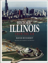
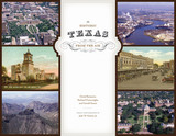
The extremely varied geography of Texas, ranging from lush piney woods to arid, mountainous deserts, has played a major role in the settlement and development of the state. To gain full perspective on the influence of the land on the people of Texas, you really have to take to the air—and the authors of Historic Texas from the Air have done just that. In this beautiful book, dramatic aerial photography provides a complete panorama of seventy-three historic sites from around the state, showing them in extensive geographic context and revealing details unavailable to a ground-based observer.
Each site in Historic Texas from the Air appears in a full-page color photograph, accompanied by a concise description of the site's history and importance. Contemporary and historical photographs, vintage postcard images, and maps offer further visual information about the sites. The book opens with images of significant natural landforms, such as the Chisos Mountains and the Big Thicket, then shows the development of Texas history through Indian spiritual sites (including Caddo Mounds and Enchanted Rock), relics from the French and Spanish occupation (such as the wreck of the Belle and the Alamo), Anglo forts and methods of communication (including Fort Davis and Salado's Stagecoach Inn), nineteenth-century settlements and industries (such as Granbury's courthouse square and Kreische Brewery in La Grange), and significant twentieth-century locales, (including Spindletop, the LBJ Ranch, and the Dallas–Fort Worth International Airport).
For anyone seeking a visual, vital overview of Texas history, Historic Texas from the Air is the perfect place to begin.
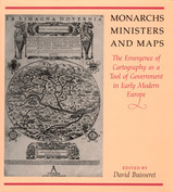
consolidate their power realized that better knowledge of
their lands would strengthen their control over them. By
1550, the cartographer's art had already become an important
instrument for bringing territories under the control of
centralized government; increasing governmental reliance on
maps stimulated the refinement of cartographic techniques
throughout the following century.
This volume, a detailed survey of the political uses of
cartography between 1400 and 1700 in Italy, France, England,
Poland, Austria, and Spain, answers these questions: When
did monarchs and ministers begin to perceive that maps could
be useful in government? For what purposes were maps
commissioned? How accurate and useful were they? How did
cartographic knowledge strengthen the hand of government?
The chapters offer new insights into the development of
cartography and its role in European history.
Contributors to the volume are John Marino, Peter
Barber, David Buisseret, Geoffrey Parker, James Vann, and
Michael J. Mikòs.
Generously illustrated with reproductions of rare manuscripts, including 8 color plates, these accounts reveal how estate maps performed vital economic and cultural functions for property owners until the end of the nineteenth century. From plans of plantations in Jamaica and South Carolina to a map of Queens College, Cambridge, handsome examples show that estate maps formed an important part of the historical record of property ownership for both individuals and corporations, and helped owners manage their land and appraise its value. Exhibited in public places for pleasure and as symbols of wealth, they often displayed elaborate cartouches and elegant coats-of-arms.
READERS
Browse our collection.
PUBLISHERS
See BiblioVault's publisher services.
STUDENT SERVICES
Files for college accessibility offices.
RECENTLY PUBLISHED
")


UChicago Accessibility Resources
home | accessibility | search | about | contact us
BiblioVault ® 2001 - 2024
The University of Chicago Press