6 start with I start with I
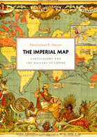
Critically reflecting on elements of mapping and imperialism from the late seventeenth century to the early twentieth century, the essays discuss the nature of the imperial map through a series of case studies of empires, from the Qing dynasty of China, to the Portuguese empire in South America, to American imperial pretensions in the Pacific Ocean, among others. Collectively, the essays reveal that the relationship between mapping and imperialism, as well as the practice of political and economic domination of weak polities by stronger ones, is a rich and complex historical theme that continues to resonate in our modern day.
Here is both a model for thinking about history within physical space and a stimulating history of thought about space, as Schlögel reads historical periods and events within the context of their geographical location. Discussions range from the history of geography in France to what a town directory from 1930s Berlin can say about professional trades that have since disappeared. He takes a special interest in maps, which can serve many purposes—one poignant example being the German Jewish community’s 1938 atlas of emigration, which showed the few remaining possibilities for escape. Other topics include Thomas Jefferson’s map of the United States; the British survey of India; and the multiple cartographers with Woodrow Wilson at the Paris Peace Conference, where the aim was to redraw Europe’s boundaries on the basis of ethnicity. Moving deftly from the Austro-Hungarian Empire to 9/11 and from Vermeer’s paintings to the fall of the Berlin Wall, this intriguing book presents history from a completely new perspective.
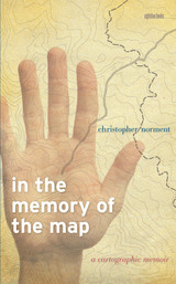
Maps may have been the stuff of his dreams, but they sometimes drew him away from places where he should have remained firmly rooted. In the Memory of the Map explores the complex relationship among maps, memory, and experience—what might be called a “cartographical psychology” or “cartographical history.” Interweaving a personal narrative structured around a variety of maps, with stories about maps as told by scholars, poets, and fiction writers, this book provides a dazzlingly rich personal and intellectual account of what many of us take for granted.
A dialog between desire and the maps of his life, an exploration of the pleasures, utilitarian purposes, benefits, and character of maps, this rich and powerful personal narrative is the matrix in which Norment embeds an exploration of how maps function in all our lives. Page by page, readers will confront the aesthetics, mystery, function, power, and shortcomings of maps, causing them to reconsider the role that maps play in their lives.
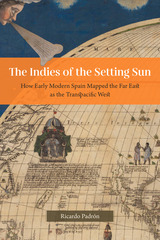
Narratives of Europe’s westward expansion often tell of how the Americas came to be known as a distinct landmass, separate from Asia and uniquely positioned as new ground ripe for transatlantic colonialism. But this geographic vision of the Americas was not shared by all Europeans. While some imperialists imagined North and Central America as undiscovered land, the Spanish pushed to define the New World as part of a larger and eminently flexible geography that they called las Indias, and that by right, belonged to the Crown of Castile and León. Las Indias included all of the New World as well as East and Southeast Asia, although Spain’s understanding of the relationship between the two areas changed as the realities of the Pacific Rim came into sharper focus. At first, the Spanish insisted that North and Central America were an extension of the continent of Asia. Eventually, they came to understand East and Southeast Asia as a transpacific extension of their empire in America called las Indias del poniente, or the Indies of the Setting Sun.
The Indies of the Setting Sun charts the Spanish vision of a transpacific imperial expanse, beginning with Balboa’s discovery of the South Sea and ending almost a hundred years later with Spain’s final push for control of the Pacific. Padrón traces a series of attempts—both cartographic and discursive—to map the space from Mexico to Malacca, revealing the geopolitical imaginations at play in the quest for control of the New World and Asia.
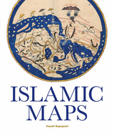
Islamic Maps examines Islamic visual interpretations of the world in their historical context through the map-makers themselves. What was the purpose of their maps, what choices did they make, and what arguments about the world were they trying to convey? Lavishly illustrated with stunning manuscripts, beautiful instruments, and Qibla charts, this book shows how maps constructed by Muslim map-makers capture the many dimensions of Islamic civilization across the centuries.
READERS
Browse our collection.
PUBLISHERS
See BiblioVault's publisher services.
STUDENT SERVICES
Files for college accessibility offices.
UChicago Accessibility Resources
home | accessibility | search | about | contact us
BiblioVault ® 2001 - 2024
The University of Chicago Press


