
 A SCHOLARLY BOOK REPOSITORY
6 start with L start with L
The Treaty of Guadalupe Hildalgo, which officially ended the U.S.-Mexican War in 1848, cost Mexico half its territory, while the United States gained land that became California, Nevada, Utah, Texas, and parts of Colorado, Arizona, and New Mexico. Because the new United States-Mexico border ran through territory that was still incompletely mapped, the treaty also called for government commissions from both nations to locate and mark the boundary on the ground. This book documents the accomplishments of both the U.S. and the Mexican Boundary Commissions that mapped the boundary between 1849 and 1857, as well as the fifty-four pairs of maps produced by their efforts and the ongoing importance of these historical maps in current boundary administration. Paula Rebert explores how, despite the efforts of both commissions to draw neutral, scientific maps, the actual maps that resulted from their efforts reflected the differing goals and outlooks of the two countries. She also traces how the differences between the U.S. and Mexican maps have had important consequences for the history of the boundary.
Seen from an airplane, much of the United States appears to be a gridded land of startling uniformity. Perpendicular streets and rectangular fields, all precisely measured and perfectly aligned, turn both urban and rural America into a checkerboard landscape that stretches from horizon to horizon. In evidence throughout the country, but especially the West, the pattern is a hallmark of American life. One might consider it an administrative convenience—an easy way to divide land and lay down streets—but it is not. The colossal grid carved into the North American continent, argues historian and writer Amir Alexander, is a plan redolent with philosophical and political meaning.
In 1784 Thomas Jefferson presented Congress with an audacious scheme to reshape the territory of the young United States. All western lands, he proposed, would be inscribed with a single rectilinear grid, transforming the natural landscape into a mathematical one. Following Isaac Newton and John Locke, he viewed mathematical space as a blank slate on which anything is possible and where new Americans, acting freely, could find liberty. And if the real America, with its diverse landscapes and rich human history, did not match his vision, then it must be made to match it.
From the halls of Congress to the open prairies, and from the fight against George III to the Trail of Tears, Liberty’s Grid tells the story of the battle between grid makers and their opponents. When Congress endorsed Jefferson’s plan, it set off a struggle over American space that has not subsided. Transcendentalists, urban reformers, and conservationists saw the grid not as a place of possibility but as an artificial imposition that crushed the human spirit. Today, the ideas Jefferson associated with the grid still echo through political rhetoric about the country’s founding, and competing visions for the nation are visible from Manhattan avenues and Kansan pastures to Yosemite’s cliffs and suburbia’s cul-de-sacs. An engrossing read, Liberty’s Grid offers a powerful look at the ideological conflict written on the landscape.
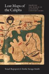
Lost Maps of the Caliphs provides the first general overview of The Book of Curiosities and the unique insight it offers into medieval Islamic thought. Opening with an account of the remarkable discovery of the manuscript and its purchase by the Bodleian Library, the authors use The Book of Curiosities to re-evaluate the development of astrology, geography, and cartography in the first four centuries of Islam. Their account assesses the transmission of Late Antique geography to the Islamic world, unearths the logic behind abstract maritime diagrams, and considers the palaces and walls that dominate medieval Islamic plans of towns and ports. Early astronomical maps and drawings demonstrate the medieval understanding of the structure of the cosmos and illustrate the pervasive assumption that almost any visible celestial event had an effect upon life on Earth. Lost Maps of the Caliphs also reconsiders the history of global communication networks at the turn of the previous millennium. It shows the Fatimid Empire, and its capital Cairo, as a global maritime power, with tentacles spanning from the eastern Mediterranean to the Indus Valley and the East African coast.
As Lost Maps of the Caliphs makes clear, not only is The Book of Curiosities one of the greatest achievements of medieval mapmaking, it is also a remarkable contribution to the story of Islamic civilization that opens an unexpected window to the medieval Islamic view of the world.
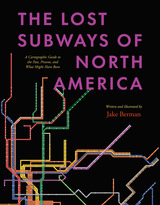
A visual exploration of the transit histories of twenty-three US and Canadian cities.
Every driver in North America shares one miserable, soul-sucking universal experience—being stuck in traffic. But things weren’t always like this. Why is it that the mass transit systems of most cities in the United States and Canada are now utterly inadequate?
The Lost Subways of North America offers a new way to consider this eternal question, with a strikingly visual—and fun—journey through past, present, and unbuilt urban transit. Using meticulous archival research, cartographer and artist Jake Berman has successfully plotted maps of old train networks covering twenty-three North American metropolises, ranging from New York City’s Civil War–era plan for a steam-powered subway under Fifth Avenue to the ultramodern automated Vancouver SkyTrain and the thousand-mile electric railway system of pre–World War II Los Angeles. He takes us through colorful maps of old, often forgotten streetcar lines, lost ideas for never-built transit, and modern rail systems—drawing us into the captivating transit histories of US and Canadian cities.
Berman combines vintage styling with modern printing technology to create a sweeping visual history of North American public transit and urban development. With more than one hundred original maps, accompanied by essays on each city’s urban development, this book presents a fascinating look at North American rapid transit systems.
READERS
Browse our collection.
PUBLISHERS
See BiblioVault's publisher services.
STUDENT SERVICES
Files for college accessibility offices.
RECENTLY PUBLISHED


UChicago Accessibility Resources
home | accessibility | search | about | contact us
BiblioVault ® 2001 - 2024
The University of Chicago Press