5 start with N start with N
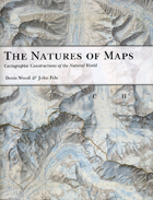
To answer that question, the authors turn to a category of maps with a particularly strong reputation for objectivity: maps of nature. From depictions of species habitats and bird migrations to portrayals of the wilds of the Grand Canyon and the reaches of the Milky Way, such maps are usually presumed—even by users who should know better—to be strictly scientific. Yet by drawing our attention to every aspect of these maps’ self-presentation, from place names to titles and legends, the authors reveal the way that each piece of information collaborates in a disguised effort to mount an argument about reality. Without our realizing it, those arguments can then come to define our very relationship to the natural world—determining whether we see ourselves as humble hikers or rampaging despoilers, participants or observers, consumers or stewards.
Richly illustrated, and crafted in vivid and witty prose, The Natures of Maps will enlighten and entertain map aficionados, scholars, and armchair navigators alike. You’ll never be able to look at Google Maps quite the same way again.
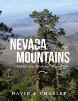
Divided into three parts, the book presents a simple system recognizing the primary landscape features of Nevada. Part I describes the methods used to define the boundaries of the ranges and divides the state into meaningful landforms. Part II describes the ecological life zones and their vegetation types. Part III describes the individual mountain ranges. Each mountain range entry contains a descriptive narrative and a data summary that includes the county or counties in which the range occurs, whether the author has visited and collected plants there, the highest point, the base elevation, a brief discussion of the geology, any historic settlements or post offices located in the range, the distribution of life zones, and a list of all conifers and flowering trees.
The result of over thirty years of exploration and study throughout the state, this is a long-overdue compendium of Nevada’s mountains and associated flora. This book is a required reference for anyone venturing out into the Nevada wilds.
New Lines takes the pulse of a society increasingly drawn to the power of the digital map, examining the conceptual and technical developments of the field of geographic information science as this work is refracted through a pervasive digital culture. Matthew W. Wilson draws together archival research on the birth of the digital map with a reconsideration of the critical turn in mapping and cartographic thought.
Seeking to bridge a foundational divide within the discipline of geography—between cultural and human geographers and practitioners of Geographic Information Systems (GIS)—Wilson suggests that GIS practitioners may operate within a critical vacuum and may not fully contend with their placement within broader networks, the politics of mapping, the rise of the digital humanities, the activist possibilities of appropriating GIS technologies, and more.
Employing the concept of the drawn and traced line, Wilson treads the theoretical terrain of Deleuze, Guattari, and Gunnar Olsson while grounding their thoughts with the hybrid impulse of the more-than-human thought of Donna Haraway. What results is a series of interventions—fractures in the lines directing everyday life—that provide the reader with an opportunity to consider the renewed urgency of forceful geographic representation. These five fractures are criticality, digitality, movement, attention, and quantification. New Lines examines their traces to find their potential and their necessity in the face of our frenetic digital life.
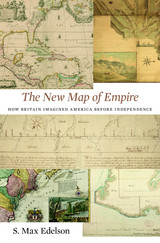
After the Treaty of Paris ended the Seven Years’ War in 1763, British America stretched from Hudson Bay to the Florida Keys, from the Atlantic coast to the Mississippi River, and across new islands in the West Indies. To better rule these vast dominions, Britain set out to map its new territories with unprecedented rigor and precision. Max Edelson’s The New Map of Empire pictures the contested geography of the British Atlantic world and offers new explanations of the causes and consequences of Britain’s imperial ambitions in the generation before the American Revolution.
Under orders from King George III to reform the colonies, the Board of Trade dispatched surveyors to map far-flung frontiers, chart coastlines in the Gulf of St. Lawrence, sound Florida’s rivers, parcel tropical islands into plantation tracts, and mark boundaries with indigenous nations across the continental interior. Scaled to military standards of resolution, the maps they produced sought to capture the essential attributes of colonial spaces—their natural capacities for agriculture, navigation, and commerce—and give British officials the knowledge they needed to take command over colonization from across the Atlantic.
Britain’s vision of imperial control threatened to displace colonists as meaningful agents of empire and diminished what they viewed as their greatest historical accomplishment: settling the New World. As London’s mapmakers published these images of order in breathtaking American atlases, Continental and British forces were already engaged in a violent contest over who would control the real spaces they represented.
Accompanying Edelson’s innovative spatial history of British America are online visualizations of more than 250 original maps, plans, and charts.
Some maps help us find our way; others restrict where we go and what we do. These maps control behavior, regulating activities from flying to fishing, prohibiting students from one part of town from being schooled on the other, and banishing certain individuals and industries to the periphery. This restrictive cartography has boomed in recent decades as governments seek regulate activities as diverse as hiking, building a residence, opening a store, locating a chemical plant, or painting your house anything but regulation colors. It is this aspect of mapping—its power to prohibit—that celebrated geographer Mark Monmonier tackles in No Dig, No Fly, No Go.
Rooted in ancient Egypt’s need to reestablish property boundaries following the annual retreat of the Nile’s floodwaters, restrictive mapping has been indispensable in settling the American West, claiming slices of Antarctica, protecting fragile ocean fisheries, and keeping sex offenders away from playgrounds. But it has also been used for opprobrium: during one of the darkest moments in American history, cartographic exclusion orders helped send thousands of Japanese Americans to remote detention camps. Tracing the power of prohibitive mapping at multiple levels—from regional to international—and multiple dimensions—from property to cyberspace—Monmonier demonstrates how much boundaries influence our experience—from homeownership and voting to taxation and airline travel. A worthy successor to his critically acclaimed How to Lie with Maps, the book is replete with all of the hallmarks of a Monmonier classic, including the wry observations and witty humor.
In the end, Monmonier looks far beyond the lines on the page to observe that mapped boundaries, however persuasive their appearance, are not always as permanent and impermeable as their cartographic lines might suggest. Written for anyone who votes, owns a home, or aspires to be an informed citizen, No Dig, No Fly. No Go will change the way we look at maps forever.
READERS
Browse our collection.
PUBLISHERS
See BiblioVault's publisher services.
STUDENT SERVICES
Files for college accessibility offices.
UChicago Accessibility Resources
home | accessibility | search | about | contact us
BiblioVault ® 2001 - 2024
The University of Chicago Press


