
 A SCHOLARLY BOOK REPOSITORY
5 start with R start with R
Cartography has a troubled history as a technology of power. The production and distribution of maps, often understood to be ideological representations that support the interests of their developers, have served as tools of colonization, imperialism, and global development, advancing Western notions of space and place at the expense of Indigenous peoples and other marginalized communities. But over the past two decades, these marginalized populations have increasingly turned to participatory mapping practices to develop new, innovative maps that reassert local concepts of place and space, thus harnessing the power of cartography in their struggles for justice.
In twelve essays written by community leaders, activists, and scholars, Radical Cartographies critically explores the ways in which participatory mapping is being used by Indigenous, Afro-descendant, and other traditional groups in Latin America to preserve their territories and cultural identities. Through this pioneering volume, the authors fundamentally rethink the role of maps, with significant lessons for marginalized communities across the globe, and launch a unique dialogue about the radical edge of a new social cartography.
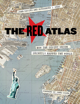
From 1950 to 1990, the Soviet Army conducted a global topographic mapping program, creating large-scale maps for much of the world that included a diversity of detail that would have supported a full range of military planning. For big cities like New York, DC, and London to towns like Pontiac, MI and Galveston, TX, the Soviets gathered enough information to create street-level maps. What they chose to include on these maps can seem obvious like locations of factories and ports, or more surprising, such as building heights, road widths, and bridge capacities. Some of the detail suggests early satellite technology, while other specifics, like detailed depictions of depths and channels around rivers and harbors, could only have been gained by actual Soviet feet on the ground. The Red Atlas includes over 350 extracts from these incredible Cold War maps, exploring their provenance and cartographic techniques as well as what they can tell us about their makers and the Soviet initiatives that were going on all around us.
A fantastic historical document of an era that sometimes seems less distant, The Red Atlas offers an uncanny view of the world through the eyes of Soviet strategists and spies.
Because it distorts the proportionate size of countries, the Mercator map was criticized for inflating Europe and North America in a promotion of colonialism. In 1974, German historian Arno Peters proffered his own map, on which countries were ostensibly drawn in true proportion to one another. In the ensuing "map wars" of the 1970s and 1980s, these dueling projections vied for public support—with varying degrees of success.
Widely acclaimed for his accessible, intelligent books on maps and mapping, Monmonier here examines the uses and limitations of one of cartography's most significant innovations. With informed skepticism, he offers insightful interpretations of why well-intentioned clerics and development advocates rallied around the Peters projection, which flagrantly distorted the shape of Third World nations; why journalists covering the controversy ignored alternative world maps and other key issues; and how a few postmodern writers defended the Peters worldview with a self-serving overstatement of the power of maps. Rhumb Lines and Map Wars is vintage Monmonier: historically rich, beautifully written, and fully engaged with the issues of our time.
In Rome Measured and Imagined, Jessica Maier explores the history of this genre—which merged the accuracy of scientific endeavor with the imaginative aspects of art—during the rise of Renaissance print culture. Through an exploration of works dating from the fifteenth to the eighteenth centuries, her book interweaves the story of the city portrait with that of Rome itself.
Highly interdisciplinary and beautifully illustrated with nearly one hundred city portraits, Rome Measured and Imagined advances the scholarship on Renaissance Rome and print culture in fascinating ways.
Generously illustrated with reproductions of rare manuscripts, including 8 color plates, these accounts reveal how estate maps performed vital economic and cultural functions for property owners until the end of the nineteenth century. From plans of plantations in Jamaica and South Carolina to a map of Queens College, Cambridge, handsome examples show that estate maps formed an important part of the historical record of property ownership for both individuals and corporations, and helped owners manage their land and appraise its value. Exhibited in public places for pleasure and as symbols of wealth, they often displayed elaborate cartouches and elegant coats-of-arms.
READERS
Browse our collection.
PUBLISHERS
See BiblioVault's publisher services.
STUDENT SERVICES
Files for college accessibility offices.
RECENTLY PUBLISHED


UChicago Accessibility Resources
home | accessibility | search | about | contact us
BiblioVault ® 2001 - 2024
The University of Chicago Press