logo for Georgetown University Press
Geospatial Intelligence
Origins and Evolution
Robert M. Clark
Georgetown University Press

A riveting introduction to the complex and evolving field of geospatial intelligence.

Although geospatial intelligence is a term of recent origin, its underpinnings have a long and interesting history. Geospatial Intelligence: Origins and Evolution shows how the current age of geospatial knowledge evolved from its ancient origins to become ubiquitous in daily life across the globe. Within that framework, the book weaves a tapestry of stories about the people, events, ideas, and technologies that affected the trajectory of what has become known as GEOINT.

Author Robert M. Clark explores the historical background and subsequent influence of fields such as geography, cartography, remote sensing, photogrammetry, geopolitics, geophysics, and geographic information systems on GEOINT. Although its modern use began in national security communities, Clark shows how GEOINT has rapidly extended its reach to other government agencies, NGOs, and corporations. This global explosion in the use of geospatial intelligence has far-reaching implications not only for the scientific, academic, and commercial communities but for a society increasingly reliant upon emerging technologies. Drones, the Internet of things, and cellular devices transform how we gather information and how others can collect that information, to our benefit or detriment.
[more]

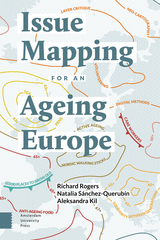
front cover of Issue Mapping for an Ageing Europe
Issue Mapping for an Ageing Europe
Edited by Richard Rogers, Natalia Sánchez-Querubín, and Aleksandra Kil
Amsterdam University Press, 2015
Issue Mapping for an Ageing Europe is a seminal guide to mapping social and political issues with digital methods. The issue at stake concerns the imminent crisis of an ageing Europe and its impact on the contemporary welfare state. The book brings together three leading approaches to issue mapping: Bruno Latour's social cartography, Ulrich Beck's risk cartography and Jeremy Crampton's critical neo-cartography. These modes of inquiry are put into practice with digital methods for mapping the ageing agenda, including debates surrounding so-called 'old age', cultural philosophies of ageing, itinerant care workers, not to mention European anti-ageing cuisine. Issue Mapping for an Ageing Europe addresses an urgent social issue with new media research tools.
[more]

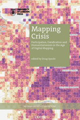
front cover of Mapping Crisis
Mapping Crisis
Participation, Datafication and Humanitarianism in the Age of Digital Mapping
Edited by Doug Specht
University of London Press, 2020
The digital age throws questions of representation, participation, and humanitarianism back to the fore, as machine learning, algorithms, and big data centers take over the process of mapping the subjugated and subaltern. Mapping Crisis questions whether it is the map itself that is in crisis. This book brings together critical perspectives on the role that mapping people, knowledges, and data now plays in humanitarian work, both in cartographic terms and through data visualizations. Since the rise of Google Earth in 2005, there has been an explosion in the use of mapping tools to quantify and assess the needs of the poor, including those affected by climate change and the wider neo-liberal agenda. Yet, while there has been a huge upsurge in the data produced around these issues, the representation of people remains questionable. Some have argued that representation has diminished as people are increasingly reduced to data points. In turn, this data has become ever more difficult to analyze without vast computing power, leading to a dependency on the old colonial powers to refine the data of the poor, before selling it back to them.
[more]

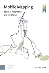
front cover of Mobile Mapping
Mobile Mapping
Space, Cartography and the Digital
Clancy Wilmott
Amsterdam University Press, 2018
This book argues for a theory of mobile mapping, a situated and spatial approach towards researching how everyday digital mobile media practices are bound up in global systems of knowledge and power. Drawing from literature in media studies and geography - and the work of Michel Foucault and Doreen Massey - it examines how geographical and historical material, social, and cultural conditions are embedded in the way in which contemporary (digital) cartographies are read, deployed, and engaged. This is explored through seventeen walking interviews in Hong Kong and Sydney, as potent discourses like cartographic reason continue to transform and weave through the world in ways that haunt mobile mapping and bring old conflicts into new media. In doing so, Mobile Mapping offers an interdisciplinary rethinking about how multiple translations of spatial knowledges between rational digital epistemologies and tacit ways of understanding space and experience might be conceptualized and researched.
[more]

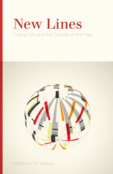
front cover of New Lines
New Lines
Critical GIS and the Trouble of the Map
Matthew W. Wilson
University of Minnesota Press, 2017

New Lines takes the pulse of a society increasingly drawn to the power of the digital map, examining the conceptual and technical developments of the field of geographic information science as this work is refracted through a pervasive digital culture. Matthew W. Wilson draws together archival research on the birth of the digital map with a reconsideration of the critical turn in mapping and cartographic thought. 

Seeking to bridge a foundational divide within the discipline of geography—between cultural and human geographers and practitioners of Geographic Information Systems (GIS)—Wilson suggests that GIS practitioners may operate within a critical vacuum and may not fully contend with their placement within broader networks, the politics of mapping, the rise of the digital humanities, the activist possibilities of appropriating GIS technologies, and more.

Employing the concept of the drawn and traced line, Wilson treads the theoretical terrain of Deleuze, Guattari, and Gunnar Olsson while grounding their thoughts with the hybrid impulse of the more-than-human thought of Donna Haraway. What results is a series of interventions—fractures in the lines directing everyday life—that provide the reader with an opportunity to consider the renewed urgency of forceful geographic representation. These five fractures are criticality, digitality, movement, attention, and quantification. New Lines examines their traces to find their potential and their necessity in the face of our frenetic digital life.

[more]


Send via email Share on Facebook Share on Twitter