
 A SCHOLARLY BOOK REPOSITORY
32 start with A start with A
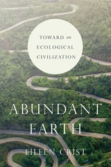
Crist argues that to do so would require a two-pronged approach. Scaling down calls upon us to lower the global human population while working within a human-rights framework, to deindustrialize food production, and to localize economies and contract global trade. Pulling back calls upon us to free, restore, reconnect, and rewild vast terrestrial and marine ecosystems. However, the pervasive worldview of human supremacy—the conviction that humans are superior to all other life-forms and entitled to use these life-forms and their habitats—normalizes and promotes humanity’s ongoing expansion, undermining our ability to enact these linked strategies and preempt the mounting suffering and dislocation of both humans and nonhumans.
Abundant Earth urges us to confront the reality that humanity will not advance by entrenching its domination over the biosphere. On the contrary, we will stagnate in the identity of nature-colonizer and decline into conflict as we vie for natural resources. Instead, we must chart another course, choosing to live in fellowship within the vibrant ecologies of our wild and domestic cohorts, and enfolding human inhabitation within the rich expanse of a biodiverse, living planet.
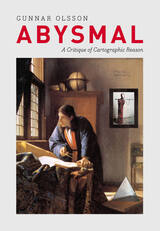
People rely on reason to think about and navigate the abstract world of human relations in much the same way they rely on maps to study and traverse the physical world. Starting from that simple observation, renowned geographer Gunnar Olsson offers in Abysmal an astonishingly erudite critique of the way human thought and action have become deeply immersed in the rhetoric of cartography and how this cartographic reasoning allows the powerful to map out other people’s lives.
A spectacular reading of Western philosophy, religion, and mythology that draws on early maps and atlases, Plato, Kant, and Wittgenstein, Thomas Pynchon, Gilgamesh, and Marcel Duchamp, Abysmal is itself a minimalist guide to the terrain of Western culture. Olsson roams widely but always returns to the problems inherent in reason, to question the outdated assumptions and fixed ideas that thinking cartographically entails. A work of ambition, scope, and sharp wit, Abysmal will appeal to an eclectic audience—to geographers and cartographers, but also to anyone interested in the history of ideas, culture, and art.
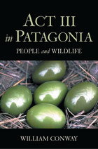
Patagonia. The name connotes the exotic and a distance that seems nearly mythical. Tucked toward the toe of South America, this largely unsettled landscape is among the most varied and breathtaking in the world-aching in its beauty as it sweeps from the Andes through broad, arid steppes to pristine beaches and down to a famously violent sea. It is also home to a vast array of rare wildlife as diverse and fascinating as the region itself.
Act III in Patagonia is the first book to take an in-depth look at wildlife and human interaction in this spectacular area of the world. Written by William Conway, former president of the Wildlife Conservation Society, the book is unique in its concentration on the long Patagonian shoreline--populated by colorful cormorants, penguins, elephant seals, dolphins, sea lions, and numerous species of whale--and an increasing number of human beings.
Threatened by overfishing, invasive species, artificially abundant predators, and overgrazing, the Southern Cone of Patagonia is now the scene of a little-known conservation drama distinguished by the efforts of a dedicated group of local and foreign scientists determined to save one of the Earth's least-inhabited places. From tracking elephant seals in the Atlantic to following flamingos in the Andes, Act III in Patagonia takes readers to the sites where real-life field science is taking place. It further illuminates the ecology of the region through a history that reaches from the time of the Tehuelche Indians known by Magellan, Drake, and Darwin to the present.
Conway has helped to establish more than a dozen wildlife reserves in South America and is thus able not only to tell Patagonia's history, but to address its future. He brings a wealth of knowledge about Patagonia and its wildlife and responds to the difficult questions of how the interests of humans and wildlife are best balanced. He tells of the exciting collaborations among the Wildlife Conservation Society and its national and provincial partners to develop region-wide programs to save wildlife in steppes, coast, and sea, demonstrating that, with public support, there is hope for this stunning corner of the world. Though singular in their details, the conservation efforts Conway spotlights are a microcosm of what is happening in dozens of sites around the world.
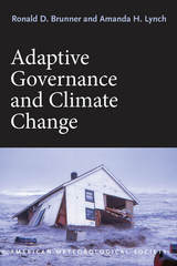
While recent years have seen undeniable progress in international acknowledgement both of the dangers of climate change and the importance of working to mitigate it, little has actually been done. Emissions continue to rise, and even the ambitious targets set by international accords would fall far short of the drastic cuts that are needed to prevent catastrophe.
With Adaptive Governance and Climate Change, Ronald D. Brunner and Amanda H. Lynch argue that we need to take a new tack, moving away from reliance on centralized, top-down approaches—the treaties and accords that have proved disappointingly ineffective thus far—and towards a more flexible, multi-level approach. Based in the principles of adaptive governance—which are designed to produce programs that adapt quickly and easily to new information and experimental results—such an approach would encourage diversity and innovation in the search for solutions, while at the same time pointedly recasting the problem as one in which every culture and community around the world has an inherent interest.
In After the Map, William Rankin argues that although this shift did not render traditional maps obsolete, it did radically change our experience of geographic knowledge, from the God’s-eye view of the map to the embedded subjectivity of GPS. Likewise, older concerns with geographic truth and objectivity have been upstaged by a new emphasis on simplicity, reliability, and convenience. After the Map shows how this change in geographic perspective is ultimately a transformation of the nature of territory, both social and political.
Hedman details, for example, how interdisciplinary studies of the Great Pyramids of Egypt can determine exactly when and how these incredible structures were built. He shows how the remains of humble trees can illuminate how the surface of the sun has changed over the past ten millennia. And he also explores how the origins of the earth, solar system, and universe are being discerned with help from rocks that fall from the sky, the light from distant stars, and even the static seen on television sets.
Covering a wide range of time scales, from the Big Bang to human history, The Age of Everything is a provocative and far-ranging look at how science has determined the age of everything from modern mammals to the oldest stars, and will be indispensable for all armchair time travelers.
“We are used to being told confidently of an enormous, measurable past: that some collection of dusty bones is tens of thousands of years old, or that astronomical bodies have an age of some billions. But how exactly do scientists come to know these things? That is the subject of this quite fascinating book. . . . As told by Hedman, an astronomer, each story is a marvel of compressed exegesis that takes into account some of the most modern and intriguing hypotheses.”—Steven Poole, Guardian
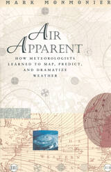
"Clever title, rewarding book. Monmonier . . . offers here a basic course in meteorology, which he presents gracefully by means of a history of weather maps." —Scientific American
"Mark Monmonier is onto a winner with Air Apparent. . . . It is good, accessible science and excellent history. . . . Read it." —Fred Pearce, New Scientist
"[Air Apparent] is a superb first reading for any backyard novice of weather . . . but even the veteran forecaster or researcher will find it engaging and, in some cases, enlightening." —Joe Venuti, Bulletin of the American Meteorological Society
"Monmonier is solid enough in his discussion of geographic and meteorological information to satisfy the experienced weather watcher. But even if this information were not presented in such a lively and engaging manner, it would still hook most any reader who checks the weather map every morning or who sits happily entranced through a full cycle of forecasts on the Weather Channel."—Michael Kennedy, Boston Globe
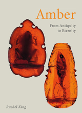
Amber: From Antiquity to Eternity is a history of human engagement with amber across three millennia. The book vividly describes our conceptions, stories, and political and scholarly disputes about amber, as well as issues of national and personal identity, religion, art, literature, music, and science. Rachel King rewrites amber’s history for the twenty-first century, tackling thorny ethical and moral questions regarding humanity’s relationship with amber in the past, as well our connection with it today. With the Earth facing unprecedented challenges, amber—the natural time capsule, and preserver of key information about the planet’s evolutional history—promises to offer invaluable insights into what comes next.
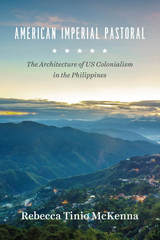
In American Imperial Pastoral, Rebecca Tinio McKenna examines the design, construction, and use of Baguio, making visible the physical shape, labor, and sustaining practices of the US’s new empire—especially the dispossessions that underwrote market expansion. In the process, she demonstrates how colonialists conducted market-making through state-building and vice-versa. Where much has been made of the racial dynamics of US colonialism in the region, McKenna emphasizes capitalist practices and design ideals—giving us a fresh and nuanced understanding of the American occupation of the Philippines.
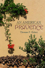
-From An American Provence
In this poetic personal narrative, Thomas P. Huber reflects on two seemingly unrelated places-the North Fork Valley in western Colorado and the Coulon River Valley in Provence, France-and finds a shared landscape and sense of place. What began as a simple comparison of two like places in distant locations turned into a more complex, interesting, and personal task. Much is similar-the light, the valleys, the climate, the agriculture. And much is less so-the history, the geology, the physical makeup of villages. Using a geographer's eye and passion for the land and people, Huber examines the regions' similarities and differences to explore the common emotional impact of each region. Part intimate travelogue and part case study of geography in the real world, An American Provence illuminates the importance sense of place plays in who we are.
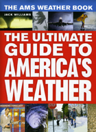
America has some of the most varied and dynamic weather in the world. Every year, the Gulf Coast is battered by hurricanes, the Great Plains are ravaged by tornados, the Midwest is pummeled by blizzards, and the temperature in the Southwest reaches a sweltering 120 degrees. Extreme weather can be a matter of life and death, but even when it is pleasant—72 degrees and sunny—weather is still central to the lives of all Americans. Indeed, it’s hard to imagine a topic of greater collective interest. Whether we want to know if we should close the storm shutters or just carry an umbrella to work, we turn to forecasts. But few of us really understand the science behind them.
All that changes with The AMS Weather Book. The most comprehensive and up-to-date guide to our weather and our atmosphere, it is the ultimate resource for anyone who wants to understand how hurricanes form, why tornados twirl, or even why the sky is cerulean blue. Written by esteemed science journalist and former USA Today weather editor Jack Williams, The AMS Weather Book, copublished with the American Meteorological Society, covers everything from daily weather patterns, air pollution, and global warming to the stories of people coping with severe weather and those who devote their lives to understanding the atmosphere, oceans, and climate. Words alone, of course, are not adequate to explain many meteorological concepts, so The AMS Weather Book is filled with engaging full-color graphics that explain such concepts as why winds blow in a particular direction, how Doppler weather radar works, what happens inside hurricanes, how clouds create wind and snow, and what’s really affecting the earth’s climate.
For Weather Channel junkies, amateur meteorologists, and storm chasers alike, The AMS Weather Book is an invaluable tool for anyone who wants to better understand how weather works and how it affects our lives.
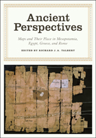
Ancient Perspectives encompasses a vast arc of space and time—Western Asia to North Africa and Europe from the third millennium BCE to the fifth century CE—to explore mapmaking and worldviews in the ancient civilizations of Mesopotamia, Egypt, Greece, and Rome. In each society, maps served as critical economic, political, and personal tools, but there was little consistency in how and why they were made. Much like today, maps in antiquity meant very different things to different people.
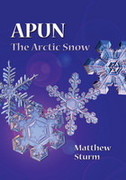
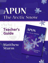
There are some twenty-five words for “snow” in the Inupiaq language. Each word denotes a different kind of snow—fresh powder snow, hard pack, soft snow, very wet snow, or just snow. Such fine distinction is reasonable, for over the centuries, Natives of the Arctic have had to rely on their knowledge of the snow to survive. Now Matthew Sturm has prepared an educational children’s book designed to teach a new generation of Arctic residents the importance of Arctic snow cover. Fully illustrated to demonstrate the cycle of the snow cover, Apun covers each phase of the “snow year.” Geared towards grades 3–4, this is a must read for elementary science classes.
There are some twenty-five words for “snow” in the Inupiaq language. Each word denotes a different kind of snow—fresh powder snow, hard pack, soft snow, very wet snow, or just snow. Such fine distinction is reasonable, for over the centuries, Natives of the Arctic have had to rely on their knowledge of the snow to survive. Now Matthew Sturm has prepared an educational children’s book designed to teach a new generation of Arctic residents the importance of Arctic snow cover. Fully illustrated to demonstrate the cycle of the snow cover, Apun covers each phase of the “snow year.” Geared towards grades 3–4, this is a must read for elementary science classes.
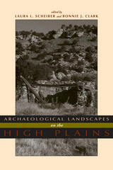
Focusing on long-term change, this book considers ethnographic literature, archaeological evidence, and environmental data spanning thousands of years of human presence to understand human perception and construction of landscape. The contributors offer cohesive and synthetic studies emphasizing hunter-gatherers and subsistence farmers.
Using landscape as both reality and metaphor, Archaeological Landscapes on the High Plains explores the different and changing ways that people interacted with place in this transitional zone between the Rocky Mountains and the eastern prairies.
The contemporary archaeologists working in this small area have chosen diverse approaches to understand the past and its relationship to the present. Through these ten case studies, this variety is highlighted but leads to a common theme - that the High Plains contains important locales to which people, over generations or millennia, return. Providing both data and theory on a region that has not previously received much attention from archaeologists, especially compared with other regions in North America, this volume is a welcome addition to the literature. Contributors:
o Paul Burnett
o Oskar Burger
o Minette C. Church
o Philip Duke
o Kevin Gilmore
o Eileen Johnson
o Mark D. Mitchell
o Michael R. Peterson
o Lawrence Todd
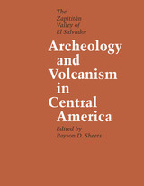
Scientists have long speculated on the impact of extreme natural catastrophes on human societies. Archeology and Volcanism in Central America provides dramatic evidence of the effects of several volcanic disasters on a major civilization of the Western Hemisphere, that of the Maya.
During the past 2,000 years, four volcanic eruptions have taken place in the Zapotitán Valley of southern El Salvador. One, the devastating eruption of Ilopango around A.D. 300, forced a major migration, pushing the Mayan people north to the Yucatán Peninsula. Although later eruptions did not have long-range implications for cultural change, one of the subsequent eruptions preserved the Cerén site—a Mesoamerican Pompeii where the bodies of the villagers, the palm-thatched roofs of their houses, the pots of food in their pantries, even the corn plants in their fields were preserved with remarkable fidelity.
Throughout 1978, a multidisciplinary team of anthropologists, archeologists, geologists, biologists, and others sponsored by the University of Colorado's Protoclassic Project researched and excavated the results of volcanism in the Zapotitan Valley—a key Mesoamerican site that contemporary political strife has since rendered inaccessible.
The result is an outstanding contribution to our understanding of the impact of volcanic eruptions on early Mayan civilization. These investigations clearly demonstrate that the Maya inhabited this volcanically hazardous valley in order to reap the short-term benefits that the volcanic ash produced—fertile soil, fine clays, and obsidian deposits.
A veteran of thirty years of field research throughout the Granite State, Starbuck revisits some of his own sites, including excavations at the New England Glassworks in Temple, two prehistoric sites on the Merrimack River, the Joseph Hazeltine pottery workshop outside Concord, the Governor Wentworth Estate in Wolfeboro, and his own long-term survey and excavation project at Canterbury Shaker Village. At the same time, though, Starbuck includes the work of other contemporary New Hampshire archeologists, representative sites of "old-timers" whose digs preceded his arrival, and the investigations of avocational diggers.
Starbuck's introduction offers an anecdotal history of archeological research in New Hampshire through the people who shaped it. Part I discusses discoveries that predate white settlement: the Paleo-Indian Period; the Archaic Period; and the Woodland Period. Part II moves from the seventeenth century to the present. Chapters include historical archeology (forts, farms, potters, Shakers); industrial archeology (mills, factories, railroads, dams, and bridges); and nautical archeology (discoveries in the state's lakes and on the seacoast).
In addition to summarizing some of the more interesting finds, Starbuck includes stories about archeologists and the techniques they have used to glean information from the past. Overall, he provides a lively account of what it is like to practice archeology in a small but dynamic New England state.
Hewsen has divided the maps into five sections, each of which begins with a chronology of important dates and a historical introduction to the period. Specialized maps include Ptolemy's second-century map of Armenia, as well as maps of Roman, Cilician, Ottoman, tsarist, and Soviet Armenia. Other maps show the Persian khanate of Erevan, the Caucasian campaigns of World War I, the Armenian Genocide, the Armenian monuments in Turkey and Transcaucasia, the worldwide diaspora, ground plans of selected cities, and plans of the great monastery of Echmiadzin in 1660, 1890, and 1990. The atlas concludes with maps portraying the Karabagh war and the new Armenian Republic, and an extensive bibliography compiles references to the vast historical, ethnological, and travel literature on the region.
The first comprehensive and authoritative atlas of any of the former Soviet republics, this book does not treat Armenia in isolation, but instead sets it within the context of Caucasia as a whole, providing detailed information on neighboring regions such as Georgia and Azerbaijan. Armenia: A Historical Atlas will be an essential reference and an important teaching tool for generations to come.
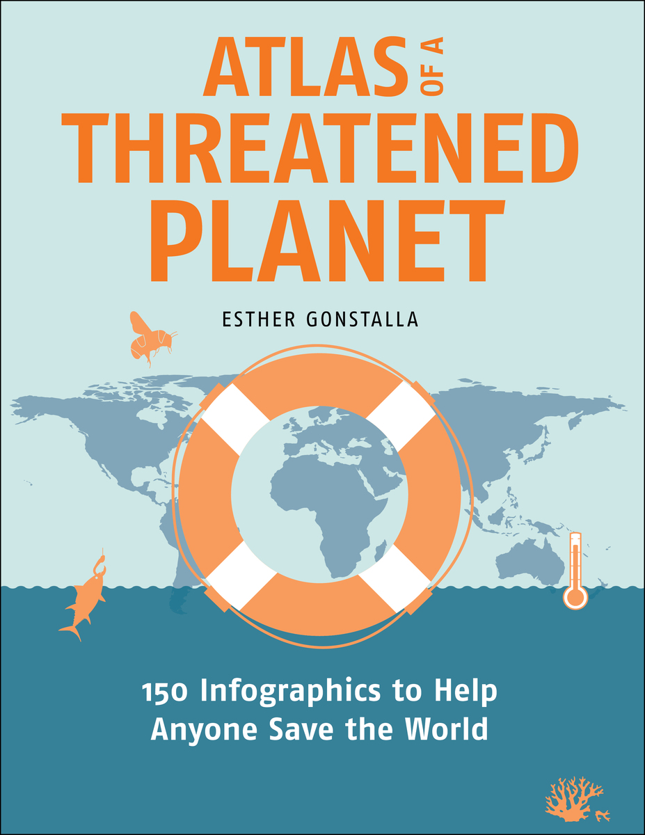
In Atlas of a Threatened Planet, award-winning book and graphic designer Esther Gonstalla digs into these questions and many more through her attractive and easy-to-understand infographics. Gonstalla is known for breaking complex topics into digestible and memorable pieces in her popular “Our World in 50 Graphics” book series. In this book, she turns her designer’s eye to the most critical threats to our environment, from shrinking glaciers and declining biodiversity to shifting ocean currents. These accessible and fun illustrations will show readers that, although the threats are grave, not all is lost. Changes in technology, infrastructure, and our outlook can still help us protect the places we love.
Atlas of a Threatened Planet will spark your curiosity and invite you to see the Earth in a new way. It is written for all who want to understand the interlocking pieces of our home—and fight for the best ideas and strategies to save it.
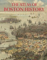
Edited by historian Nancy S. Seasholes, this landmark volume captures all aspects of Boston’s past in a series of fifty-seven stunning full-color spreads. Each section features newly created thematic maps that focus on moments and topics in that history. These maps are accompanied by hundreds of historical and contemporary illustrations and explanatory text from historians and other expert contributors. They illuminate a wide range of topics including Boston’s physical and economic development, changing demography, and social and cultural life. In lavishly produced detail, The Atlas of Boston History offers a vivid, refreshing perspective on the development of this iconic American city.
Contributors
Robert J. Allison, Robert Charles Anderson, John Avault, Joseph Bagley, Charles Bahne, Laurie Baise, J. L. Bell, Rebekah Bryer, Aubrey Butts, Benjamin L. Carp, Amy D. Finstein, Gerald Gamm, Richard Garver, Katherine Grandjean, Michelle Granshaw, James Green, Dean Grodzins, Karl Haglund, Ruth-Ann M. Harris, Arthur Krim, Stephanie Kruel, Kerima M. Lewis, Noam Maggor, Dane A. Morrison, James C. O’Connell, Mark Peterson, Marshall Pontrelli, Gayle Sawtelle, Nancy S. Seasholes, Reed Ueda, Lawrence J. Vale, Jim Vrabel, Sam Bass Warner, Jay Wickersham, and Susan Wilson
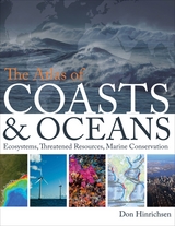
Oceans drive the world’s climate, nurture marine ecosystems full of aquatic life, and provide shipping lanes that have defined the global economy for centuries. And few realize that half of the world’s population lives in a coastal region within easy reach of one. Yet human activities such as commercial fishing, coastal real estate development, and industrial pollution have taken their toll on the seas. The first book of its kind, The Atlas of Coasts and Oceans documents the fraught relationship between humans and the earth’s largest bodies of water—and outlines the conservation steps needed to protect the marine environment for generations to come.
The Atlas offers a fascinating and often sobering account of how urbanization, climate change, offshore oil drilling, shipping routes, global tourism, and maritime conflict have had a profound impact on the world’s oceans and coasts. Combining text and images in visually engaging, thematically organized map spreads, this volume addresses the ecological, environmental, and economic importance of marine phenomena such as coral reefs, eroding shorelines, hurricanes, and fish populations—and how development threatens to destroy the ultimate source of all life on the “blue planet.” Lavishly illustrated with global and regional maps, from the Arabian Gulf to the Great Barrier Reef, from the Black Sea to the Mediterranean, and all the other major global waterways, The Atlas of Coasts and Oceans will be the definitive companion to any study of its subject for years to come.
Earlier this year, President Obama declared one of his top priorities to be “making sure that people are able to get enough to eat.” The United States spends about five billion dollars on food aid and related programs each year, but still, both domestically and internationally, millions of people are hungry. In 2006, the Food and Agricultural Organization of the United Nations counted 850 million hungry people worldwide, but as food prices soared, an additional 100 million or more who were vulnerable succumbed to food insecurity.
If hunger were simply a matter of food production, no one would go without. There is more than enough food produced annually to provide every living person with a healthy diet, yet so many suffer from food shortages, unsafe water, and malnutrition every year. That’s because hunger is a complex political, economic, and ecological phenomenon. The interplay of these forces produces a geography of hunger that Thomas J. Bassett and Alex Winter-Nelson illuminate in this empowering book. The Atlas of World Hunger uses a conceptual framework informed by geography and agricultural economics to present a hunger index that combines food availability, household access, and nutritional outcomes into a single tool—one that delivers a fuller understanding of the scope of global hunger, its underlying mechanisms, and the ways in which the goals for ending hunger can be achieved. The first depiction of the geography of hunger worldwide, the Atlas will be an important resource for teachers, students, and anyone else interested in understanding the geography and causes of hunger. This knowledge, the authors argue, is a critical first step toward eliminating unnecessary suffering in a world of plenty.
Whether it is used as an icebreaker in conversation or as the subject of serious inquiry, “the weather” is one of the few subjects that everyone talks about. And though we recognize the faces that bring us the weather on television, how government meteorologists and forecasters go about their jobs is rarely scrutinized. Given recent weather-related disasters, it’s time we find out more. In Authors of the Storm, Gary Alan Fine offers an inside look at how meteorologists and forecasters predict the weather.
Based on field observation and interviews at the Storm Prediction Center in Oklahoma, the National Weather Service in Washington, D.C., and a handful of midwestern outlets, Fine finds a supremely hard-working, insular clique of professionals who often refer to themselves as a “band of brothers.” In Fine’s skilled hands, we learn their lingo, how they “read” weather conditions, how forecasts are written, and, of course, how those messages are conveyed to the public. Weather forecasts, he shows, are often shaped as much by social and cultural factors inside local offices as they are by approaching cumulus clouds. By opening up this unique world to us, Authors of the Storm offers a valuable and fascinating glimpse of a crucial profession.
READERS
Browse our collection.
PUBLISHERS
See BiblioVault's publisher services.
STUDENT SERVICES
Files for college accessibility offices.
RECENTLY PUBLISHED
")
")
")
")
")


UChicago Accessibility Resources
home | accessibility | search | about | contact us
BiblioVault ® 2001 - 2024
The University of Chicago Press