front cover of The Lake Huron Ecosystem
The Lake Huron Ecosystem
Ecology, Fisheries and Management
M. Munawar
Michigan State University Press, 1995
Lake Huron is the second largest of the Great Lakes and the fifth largest lake in the world (surface area: 59,000 km2). It is also one of the least known lakes in the Great Lakes system in terms of limnology and food web dynamics. To rectify this, the Aquatic Ecosystem Health and Management Society organized an international symposium in September 1993, which they followed with the publication of this peer-reviewed book. In total, forty-five papers were presented during the conference on topics ranging from microbial ecology, the role of exotic species, and sediment toxicology, to fisheries and wildlife of Lake Huron and its basin. With few existing comprehensive reports on the limnology and fisheries of Lake Huron, this detailed book helps bridge the information gap by introducing a multidisciplinary and ecosystematic approach to Great Lake (particularly Lake Huron) research.
[more]

front cover of Lake Michigan in Motion
Lake Michigan in Motion
Responses of an Inland Sea to Weather, Earth-Spin, and Human Activities
Clifford H. Mortimer
University of Wisconsin Press, 2004
Written in a clear, readable style by an acknowledged expert in limnology and biology, Lake Michigan in Motion is certain to become a classic reference book on the subject of the Great Lakes. Its blend of history, science, and public policy will give it broad appeal to limnologists, graduate students, researchers, public officials, elementary and high school teachers, those who live near the Lake, and those who use it for their livelihood and recreation.
[more]

front cover of Lakeshore Living
Lakeshore Living
Designing Lake Places and Communities in the Footprints of Environmental Writers
Paul J. Radomski
Michigan State University Press, 2014
In this remarkable and remarkably accessible synthesis of ecology, landscape design, and social sciences, the authors present an approach to lakeshore living that addresses the need to create rich, sustainable places and communities on the water, where both the loon and the family find a place, and where the cabin can be handed down with integrity to the grandchildren. Fragile shorelands require care, and that caring comes from knowledge, experience, and an environmental ethic. Radomski and Van Assche argue that an environmentally sensitive lakeshore place and community design is the way forward. While many factors affect the quality of lakes and lakeshore living, property owners and local communities do not have to wait until policies are perfect: the design approach advocated here can be applied in any place people living lakeside can get together and collaborate. The approach presented here is proactive and context sensitive: new designs have to fit the existing ecological, cultural, and policy landscapes. Development is always re-development in this sense. The authors introduce the reader step-by-step to this approach and carefully discuss leverage points that can be helpful in implementation and system change.
[more]

front cover of A Lakeside Companion
A Lakeside Companion
Ted J. Rulseh
University of Wisconsin Press, 2018
Why do fish jump? Why don't lakes freeze all the way down to the bottom? Which lake plants are invasive? What are those water bugs? Is that lake healthy? Whether you fish, paddle, swim, snowshoe, ski, or just gaze upon your favorite lake, A Lakeside Companion will deepen your appreciation for the forces that shape lakes and the teeming life in and around them.

You'll discover the interconnected worlds of a lake: the water; the sand, gravel, rocks, and muck of the bottom; the surface of the lake; the air above; and the shoreline, a belt of land incredibly rich in flora and fauna. Explained, too, are the physical, biological, and chemical processes that determine how many and what kinds of fish live in the lake, which plants grow there, the color and clarity of the water, how ice forms in winter and melts in spring, and much more. Useful advice will help you look out for your lake and advocate for its protection.
[more]

front cover of Land and Wine
Land and Wine
The French Terroir
Charles Frankel
University of Chicago Press, 2014
A tour of the French winemaking regions to illustrate how the soil, underlying bedrock, relief, and microclimate shape the personality of a wine.

For centuries, France has long been the world’s greatest wine-producing country. Its wines are the global gold standard, prized by collectors, and its winemaking regions each offer unique tasting experiences, from the spice of Bordeaux to the berry notes of the Loire Valley. Although grape variety, climate, and the skill of the winemaker are essential in making good wine, the foundation of a wine’s character is the soil in which its grapes are grown. Who could better guide us through the relationship between the French land and the wine than a geologist, someone who deeply understands the science behind the soil? Enter scientist Charles Frankel.

In Land and Wine, Frankel takes readers on a tour of the French winemaking regions to illustrate how the soil, underlying bedrock, relief, and microclimate shape the personality of a wine. The book’s twelve chapters each focus in-depth on a different region, including the Loire Valley, Alsace, Burgundy, Champagne, Provence, the Rhône valley, and Bordeaux, to explore the full meaning of terroir.  In this approachable guide, Frankel describes how Cabernet Franc takes on a completely different character depending on whether it is grown on gravel or limestone; how Sauvignon yields three different products in the hills of Sancerre when rooted in limestone, marl, or flint; how Pinot Noir will give radically different wines on a single hill in Burgundy as the vines progress upslope; and how the soil of each château in Bordeaux has a say in the blend ratios of Merlot and Cabernet-Sauvignon. Land and Wine provides a detailed understanding of the variety of French wine as well as a look at the geological history of France, complete with volcanic eruptions, a parade of dinosaurs, and a menagerie of evolution that has left its fossils flavoring the vineyards.

Both the uninitiated wine drinker and the confirmed oenophile will find much to savor in this fun guide that Frankel has spiked with anecdotes about winemakers and historic wine enthusiasts—revealing which kings, poets, and philosophers liked which wines best—while offering travel tips and itineraries for visiting the wineries today.
[more]

front cover of Land Bridges
Land Bridges
Ancient Environments, Plant Migrations, and New World Connections
Alan Graham
University of Chicago Press, 2018
Land bridges are the causeways of biodiversity. When they form, organisms are introduced into a new patchwork of species and habitats, forever altering the ecosystems into which they flow; and when land bridges disappear or fracture, organisms are separated into reproductively isolated populations that can evolve independently. More than this, land bridges play a role in determining global climates through changes to moisture and heat transport and are also essential factors in the development of biogeographic patterns across geographically remote regions.

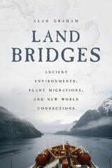
In this book, paleobotanist Alan Graham traces the formation and disruption of key New World land bridges and describes the biotic, climatic, and biogeographic ramifications of these land masses’ changing formations over time. Looking at five land bridges, he explores their present geographic setting and climate, modern vegetation, indigenous peoples (with special attention to their impact on past and present vegetation), and geologic history. From the great Panamanian isthmus to the boreal connections across the North Atlantic and North Pacific Oceans that allowed exchange of organisms between North America, Europe, and Asia, Graham’s sweeping, one-hundred-million-year history offers new insight into the forces that shaped the life and land of the New World.
[more]

logo for University of Iowa Press
Landforms of Iowa
Jean C. Prior
University of Iowa Press, 1991
Here is a captivating, authoritative guide to the Hawkeye State's landscape features and their geologic ingredients. The clearly presented text and superb full-color photographs and maps will inspire all visitors to read and enjoy the story of Iowa's landscape.
[more]

front cover of Landscapes of Power and Identity
Landscapes of Power and Identity
Comparative Histories in the Sonoran Desert and the Forests of Amazonia from Colony to Republic
Cynthia Radding
Duke University Press, 2005
Landscapes of Power and Identity is a groundbreaking comparative history of two colonies on the frontiers of the Spanish empire—the Sonora region of northwestern Mexico and the Chiquitos region of eastern Bolivia’s lowlands—from the late colonial period through the middle of the nineteenth century. An innovative combination of environmental and cultural history, this book reflects Cynthia Radding’s more than two decades of research on Mexico and Bolivia and her consideration of the relationships between human societies and the geographic landscapes they inhabit and create. At first glance, Sonora and Chiquitos are quite different: one a scrub-covered desert, the other a tropical rainforest of the greater Amazonian and Paraguayan river basins. Yet the regions are similar in many ways. Both were located far from the centers of colonial authority, organized into Jesuit missions and linked to the principal mining centers of New Spain and the Andes, and then absorbed into nation-states in the nineteenth century. In each area, the indigenous communities encountered European governors, missionaries, slave hunters, merchants, miners, and ranchers.

Radding’s comparative approach illuminates what happened when similar institutions of imperial governance, commerce, and religion were planted in different physical and cultural environments. She draws on archival documents, published reports by missionaries and travelers, and previous histories as well as ecological studies and ethnographies. She also considers cultural artifacts, including archaeological remains, architecture, liturgical music, and religious dances. Radding demonstrates how colonial encounters were conditioned by both the local landscape and cultural expectations; how the colonizers and colonized understood notions of territory and property; how religion formed the cultural practices and historical memories of the Sonoran and Chiquitano peoples; and how the conflict between the indigenous communities and the surrounding creole societies developed in new directions well into the nineteenth century.

[more]

front cover of Landscapes of the Secular
Landscapes of the Secular
Law, Religion, and American Sacred Space
Nicolas Howe
University of Chicago Press, 2016
“What does it mean to see the American landscape in a secular way?” asks Nicolas Howe at the outset of this innovative, ambitious, and wide-ranging book. It’s a surprising question because of what it implies: we usually aren’t seeing American landscapes through a non-religious lens, but rather as inflected by complicated, little-examined concepts of the sacred.
            Fusing geography, legal scholarship, and religion in a potent analysis, Howe shows how seemingly routine questions about how to look at a sunrise or a plateau or how to assess what a mountain is both physically and ideologically, lead to complex arguments about the nature of religious experience and its implications for our lives as citizens. In American society—nominally secular but committed to permitting a diversity of religious beliefs and expressions—such questions become all the more fraught and can lead to difficult, often unsatisfying compromises regarding how to interpret and inhabit our public lands and spaces. A serious commitment to secularism, Howe shows, forces us to confront the profound challenges of true religious diversity in ways that often will have their ultimate expression in our built environment. This provocative exploration of some of the fundamental aspects of American life will help us see the land, law, and society anew.
[more]

front cover of The Last Beach
The Last Beach
Orrin H. Pilkey and J. Andrew G. Cooper
Duke University Press, 2014
The Last Beach is an urgent call to save the world's beaches while there is still time. The geologists Orrin H. Pilkey and J. Andrew G. Cooper sound the alarm in this frank assessment of our current relationship with beaches and their grim future if we do not change the way we understand and treat our irreplaceable shores. Combining case studies and anecdotes from around the world, they argue that many of the world's developed beaches, including some in Florida and in Spain, are virtually doomed and that we must act immediately to save imperiled beaches.

After explaining beaches as dynamic ecosystems, Pilkey and Cooper assess the harm done by dense oceanfront development accompanied by the construction of massive seawalls to protect new buildings from a shoreline that encroaches as sea levels rise. They discuss the toll taken by sand mining, trash that washes up on beaches, and pollution, which has contaminated not only the water but also, surprisingly, the sand. Acknowledging the challenge of reconciling our actions with our love of beaches, the geologists offer suggestions for reversing course, insisting that given the space, beaches can take care of themselves and provide us with multiple benefits.
[more]

front cover of The Last Billion Years
The Last Billion Years
A Geologic History of Tennessee
Don W. Byerly
University of Tennessee Press, 2013
Tennessee’s geologic history has evolved in myriad ways since its initial formation more than a billion years ago, settling into its current place on the North American supercontinent between 300 and 250 million years ago. Throughout that long span of “deep time,” Tennessee’s landscape morphed into its present form.
The Last Billion Years: A Geologic History of Tennessee is the first general overview in more than thirty years to interpret the state’s geological record. With minimal jargon, numerous illustrations and photographs, and a glossary of scientific terms, this volume provides the tools necessary for readers with little or no background in the subject to learn about the geologic formation of Tennessee, making it an excellent resource for high school students, college students, and interested general readers. Yet, because of the depth of its scholarship, the book is also an invaluable reference for professional geologists.
Recognizing that every reader is familiar with the roles of wind, water, gravity, and organisms in their everyday environment, author Don Byerly employs the Earth Systems Science approach, showing how the five interacting parts of the Earth—the geosphere, hydrosphere, atmosphere, biosphere, and cryosphere—have worked together for eons to generate the rock compositions that make up Tennessee’s geologic past.
All regions of the state are covered. Featuring a unique time chart that illustrates the state’s geologic history from east to west, The Last Billion Years shows that while the geologic aspects of the state’s three grand divisions are related in many ways, each division has a distinctly different background. The organization of the book further enhances its usability, allowing the reader to see and compare what was happening contemporaneously across the state during the key sequences of its geologic history. Written in a clear and engaging style, The Last Billion Years will have broad appeal to students, lay readers, and professionals.
[more]

front cover of The Last Imaginary Place
The Last Imaginary Place
A Human History of the Arctic World
Robert McGhee
University of Chicago Press, 2007

The Arctic of towering icebergs and midnight sun, of flaming auroras and endless winter nights, has long provoked flights of the imagination. Now, in The Last Imaginary Place, renowned archeologist Robert McGhee lifts the veil to reveal the true Arctic world. Based on thirty years of work with native peoples of the Arctic and travel in the region, McGhee’s account dispels notions of the frozen land as an exotic, remote world that exists apart from civilization.

Between the frigid reality and lurid fantasy lies McGhee’s true interest, the people who throughout human history have called the Arctic home. He paints a vivid portrait of Viking farmers, entrepreneurial Inuit, and Western explorers who have been seduced by the natural wealth and haunting beauty of this land. From lively accounts of fur trading, ivory hunting, and whaling to white-knuckle tales of the first, doomed expeditions, McGhee takes the reader on a whirlwind journey across this disorienting, dreamlike terrain that has fascinated mankind for centuries.

“In prose infused by his position as curator of Arctic archaeology at the Canadian Museum of Civilization—which has taken him to sites in several countries—McGhee demolishes some persistent illusions about the white North . . . evocative.”—Times Literary Supplement

“[A] compelling account . . . [McGhee] believes that the Arctic is not so much a region as a dream—what he sees as a dream of a unique, attractive world . . . An archaeologist who has spent thirty years there, the author lets his love for the region shine through on every page.—Booklist

“McGhee displays the powerful attractions of the top of the world . . . [his] prose . . . sparkles like frost in the midnight sun.”—Financial Times

“McGhee has written a sensitive, fascinating and extremely important book.”—Canadian Geographic

[more]

logo for University of Minnesota Press
Late Quaternary Environments of the United States
Volume 2
H.E. Wright Jr., Editor
University of Minnesota Press, 1983

Late Quaternary Environments of the United States was first published in 1983. Minnesota Archive Editions uses digital technology to make long-unavailable books once again accessible, and are published unaltered from the original University of Minnesota Press editions.

In the late 1970s American and Russian scientists met twice in conferences on Quaternary paleoclimates sponsored by the U.S.-U.S.S.R. Bilateral Agreement on the Environment. The conferees agreed to prepare volumes summarizing the current status of research in the two countries. Late-Quaternary Environments of the United States provides a two-volume overview of new and significant information on research of the last fifteen years, since the 1965 publication of Quaternary of the United States,edited by H E. Wright, Jr., and D. G. Frey. The volume on the late Quaternary in the Soviet Union will also be published by the University of Minnesota Press.

Volume 1 of Late-Quaternary Environments of the United States covers the Late Pleistocene, the interval between 25,000 and 10,000 years ago—a time of extreme environmental stress as the world passed from full-glacial conditions of the last ice age into the present interglacial age. The interval of geologic time since the last glacial period—termed the Holocene—is the subject of Volume 2. The complexity of the natural changes occurring in the late Quaternary, and their interrelationships, make it impossible for a single scientific discipline to encompass them. Thus the papers in both volumes come from authors in many research fields—geology, ecology, physical geography, archaeology, geochemistry, geophysics, limnology, soil science, paleontology, and climatology. Many of the hypotheses presented—especially on the dynamic Late Pleistocene environments—are still hotly debated and will require additional testing as scientists strive to reconstruct the changing world of the glacial and postglacial ages.

[more]

front cover of Learning from Shenzhen
Learning from Shenzhen
China’s Post-Mao Experiment from Special Zone to Model City
Edited by Mary Ann O'Donnell, Winnie Wong, and Jonathan Bach
University of Chicago Press, 2017
This multidisciplinary volume, the first of its kind, presents an account of China’s contemporary transformation via one of its most important yet overlooked cities: Shenzhen, located just north of Hong Kong. In recent decades, Shenzhen has transformed from an experimental site for economic reform into a dominant city at the crossroads of the global economy. The first of China’s special economic zones, Shenzhen is today a UNESCO City of Design and the hub of China’s emerging technology industries.

Bringing China studies into dialogue with urban studies, the contributors explore how the post-Mao Chinese appropriation of capitalist logic led to a dramatic remodeling of the Chinese city and collective life in China today. These essays show how urban villages and informal institutions enabled social transformation through cases of public health, labor, architecture, gender, politics, education, and more. Offering scholars and general readers alike an unprecedented look at one of the world’s most dynamic metropolises, this collective history uses the urban case study to explore critical problems and possibilities relevant for modern-day China and beyond.
[more]

front cover of Learning from the Land
Learning from the Land
Wisconsin Land Use
Bobbie Malone
Wisconsin Historical Society Press, 1998
Fourth-grade students and other young readers will learn about interactions of people with natural geographical features of Wisconsin. Emphasizing both historic and new maps, Learning from the Land explores land use from early Indians to the Black Hawk War, looking at mining, logging, farming, and environmental issues.
[more]

front cover of Learning from the Land
Learning from the Land
Wisconsin Land Use, TG
Bobbie Malone
Wisconsin Historical Society Press, 1999
Fourth-grade students and other young readers will learn about interactions of people with natural geographical features of Wisconsin. Emphasizing both historic and new maps, Learning from the Land explores land use from early Indians to the Black Hawk War, looking at mining, logging, farming, and environmental issues.
[more]

front cover of Lewis and Clark in Missouri
Lewis and Clark in Missouri
Ann Rogers
University of Missouri Press, 2002
In May 1804 Meriwether Lewis, William Clark, and the Corps of Discovery embarked on a seven-thousand-mile journey with instructions from President Thomas Jefferson to ascend the Missouri River to its source and continue on to the Pacific. They had spent five months in the St. Louis area preparing for the expedition that began with a six-hundred-mile, ten-week crossing of the future state of Missouri. Prior to this, the explorers had already seen about two hundred miles of Missouri landscape as they traveled up the Mississippi River to St. Louis in the autumn of 1803.
Lewis and Clark in Missouri focuses on the Missouri chapter of their epic journey, a portion of the story that has been slighted in other accounts. Ann Rogers uses the journals kept by members of the Corps along with many other primary source materials, providing a firsthand perspective on the people, plants, wildlife, rivers, and landscapes the explorers encountered. Beautiful color photographs and illustrations complement the text and support the passages Rogers quotes from the journals.
Brief biographies of Lewis, Clark, Sacagawea, John Colter, York, and other members of the expedition tell of their years in Missouri after the journey ended. Today’s followers of the Lewis and Clark Trail can find descriptions of sites to visit in Missouri, Kansas, and Illinois.
Carefully researched, yet highly readable, Lewis and Clark in Missouri will be of great interest not only to Missourians, but also to anyone wishing to learn more about the Corps of Discovery’s historic journey.
[more]

front cover of Lie Of The Land
Lie Of The Land
Migrant Workers and the California Landscape
Don Mitchell
University of Minnesota Press, 1996
A hard-hitting look at the story behind California's famous scenery. The beauty of the California landscape is integral to its place in the imagination of generations of people around the world. In The Lie of the Land, geographer Don Mitchell looks at the human costs associated with this famous scenery. Through an account of the labor history of the state, Mitchell examines the material and ideological struggles over living and working conditions that played a large part in the construction of the contemporary California landscape. The Lie of the Land examines the way the California landscape was built on the backs of migrant workers, focusing on migratory labor and agribusiness before World War II. The book relates the historical geography of California to the processes of labor that made it, discussing not only significant strikes but also on the everyday existence of migrant workers in the labor camps, fields, and "Hoovervilles" where they lived. Mitchell places class struggle at the heart of social development, demonstrating concretely how farm workers affected their social and material environment, as well as exploring how farm owners responded to their workers' efforts to improve their living and working conditions. Mitchell also places "reformers" in context, revealing the actual nature of their role in relation to migrant workers' efforts-that of undermining the struggle for genuine social change. In addition, this volume captures the significance of the changing composition of the agricultural workforce, particularly in racial terms, as the class struggle evolved over a period of decades. Mitchell has written a narrative history that describes the intimate connection between landscape representations and the material form of geography. The Lie of the Land places people squarely in the middle of the landscapes they inhabit, shedding light on the complex and seemingly contradictory interactions between progressive state agents, radical workers, and California growers as they seek to remake the land in their own image. "It is important that the story of the migrant workers is told and Mitchell tells it well." Transactions/Area "The Lie of the Land opens up new and rich possibilities to help prod our thinking about the processes involved in understanding the changing morphology of landscape. This is an important book. Mitchell's lucid examination of the role of migrant workers in shaping and reshaping California's agricultural landscapes brings new meaning to the creation of the sometimes sublime, yet always complex, rural landscapes in places like the Salinas Valley, the Central Valley, and the Imperial Valley. For many historical geographers and others fortunate enough to read this book, the vision and study of landscape evolution will never be the same." Historical Geography "For anyone wishing to go beyond such movies and novels that do address Californian labour history before the Second World War, this is an excellent integration of all too often disparate approaches and materials. It should be required reading far beyond the confines of labour history." Labour History Review "The Lie of the Land is an important contribution to the study of landscape, to cultural geography, and more generally to critical geography. The book should be held up as a model for students and researchers in the field." Environment & Planning A "In The Lie of the Land, Don Mitchell represents a new, interdisciplinary, cultural geography, using such disparate fields as art history and labor history. He looks at migrant workers in California from the Wheatland riot of 1913 to the Bracero Program of 1942." Western Historical Quarterly "What he discovers is that the image of California as an agricultural Eden, as initially witnessed by John Steinbeck's Joad family in The Grapes of Wrath, never matches the reality of a land that is tightly controlled by corporate growers, a land that exploits the labor of waves of migratory workers from the late 19th century on. Mitchell looks behind the pastoral charm of fertile fields and neatly tended farmhouses to reveal the brutal working conditions and squalid living conditions of the migratory camps. Along the way, he acquaints the reader with a century of labor history and the fact that Anglos, Filipinos, Japanese and Chicanos have all taken their turn at working--and fighting against--the California agricultural landscape." Journal of the West "Mitchell, who teaches geography at the University of Colorado at Boulder, describes the labor struggles of the migrants with clarity and grace. The Lie of the Land is, in many ways, a valuable contribution to the study of California labor relations." Los Angeles Reader "Amidst the array of studies about California agriculture, geographer Don Mitchell offers a singular analysis. His study is a carefully researched and closely reasoned interpretation of the interaction between the place, the people, and the agricultural plenitude which together, he contends, have contributed to the evolving morphology of the California landscape." Agricultural History Don Mitchell is assistant professor of geography at the University of Colorado at Boulder.
[more]

front cover of Life in the Soil
Life in the Soil
A Guide for Naturalists and Gardeners
James B. Nardi
University of Chicago Press, 2007

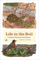
Leonardo da Vinci once mused that “we know more about the movement of celestial bodies than about the soil underfoot,” an observation that is as apt today as it was five hundred years ago. The biological world under our toes is often unexplored and unappreciated, yet it teems with life. In one square meter of earth, there lives trillions of bacteria, millions of nematodes, hundreds of thousands of mites, thousands of insects and worms, and hundreds of snails and slugs. But because of their location and size, many of these creatures are as unfamiliar and bizarre to us as anything found at the bottom of the ocean.

Lavishly illustrated with nearly three hundred color illustrations and masterfully-rendered black and white drawings throughout, Life in the Soil invites naturalists and gardeners alike to dig in and discover the diverse community of creatures living in the dirt below us.  Biologist and acclaimed natural history artist James B. Nardibegins with an introduction to soil ecosystems, revealing the unseen labors of underground organisms maintaining the rich fertility of the earth as they recycle nutrients between the living and mineral worlds. He then introduces readers to a dazzling array of creatures: wolf spiders with glowing red eyes, snails with 120 rows of teeth, and 10,000-year-old fungi, among others. Organized by taxon, Life in the Soil covers everything from slime molds and roundworms to woodlice and dung beetles, as well as vertebrates from salamanders to shrews. The book ultimately explores the crucial role of soil ecosystems in conserving the worlds above and below ground.

A unique and illustrative introduction to the many unheralded creatures that inhabit our soils and shape our environment aboveground, Life in the Soil will inform and enrich the naturalist in all of us.

[more]

front cover of Lightning Electromagnetics
Lightning Electromagnetics
Vernon Cooray
The Institution of Engineering and Technology, 2012
Lightning research is an interdisciplinary subject where several branches of engineering and physics converge. Lightning Electromagnetics is a book that caters for the needs of both physicists and engineers. It provides: The physicist with information on how to simulate: the charge generation in thunderclouds, different discharge processes in air that ultimately lead to a lightning flash, and the mechanism through which energetic radiation in the form of X-rays and Gamma rays are produced by lightning flashes; The power engineer with several numerical tools to study the interaction of lightning flashes with power transmission and distribution systems; The telecommunication engineer with numerical procedures with which to calculate the electromagnetic fields generated by lightning flashes and their interactions with overhead and underground telecommunication systems; The electromagnetic specialist with the basic theory necessary to simulate the propagation of lightning electromagnetic fields over the surface of the Earth; The atmospheric scientist with numerical procedures to quantify interactions between lightning flashes and the Earth's atmosphere, including the production of NOx by lightning flashes occurring in the atmosphere. This book also contains a chapter on the stimulation of visual phenomena in humans by electromagnetic fields of lightning flashes, which is essential reading for those who are interested in ball lightning.
[more]

front cover of Lightning
Lightning
Nature and Culture
Derek M. Elsom
Reaktion Books, 2015
Few phenomena inspire more awe than lightning. Streaking across the sky, it daunts us with its power and amazes us with its beauty. In Lightning, Derek M. Elsom explores this natural phenomenon and traces the long history of our study of it. From early civilizations’ assumptions that it was the work of gods, through eighteenth-century scientific analyses (and, yes, Ben Franklin’s kite), Elsom tells about our efforts to understand and explain lightning. He explores the many surprising folklore beliefs about lightning protection and contrasts these with today's scientific approaches. Alongside scientific explorations, he also tracks the path of lightning through our culture, from myths and legends to art and design. In addition, Elsom offers handy tips for avoiding getting struck by lightning.
           
Beautifully illustrated with stunning photographs and artistic renderings, this striking book will appeal equally to weather buffs and folklorists, scientists and artists. 
[more]

front cover of The Limits of Matter
The Limits of Matter
Chemistry, Mining, and Enlightenment
Hjalmar Fors
University of Chicago Press, 2014
During the seventeenth and eighteenth centuries, Europeans raised a number of questions about the nature of reality and found their answers to be different from those that had satisfied their forebears. They discounted tales of witches, trolls, magic, and miraculous transformations and instead began looking elsewhere to explain the world around them. In The Limits of Matter, Hjalmar Fors investigates how conceptions of matter changed during the Enlightenment and pins this important change in European culture to the formation of the modern discipline of chemistry.
           
Fors reveals how, early in the eighteenth century, chemists began to view metals no longer as the ingredients for “chrysopoeia”—or gold making—but as elemental substances, or the basic building blocks of matter. At the center of this emerging idea, argues Fors, was the Bureau of Mines of the Swedish State, which saw the practical and profitable potential of these materials in the economies of mining and smelting.

By studying the chemists at the Swedish Bureau of Mines and their networks, and integrating their practices into the wider European context, Fors illustrates how they and their successors played a significant role in the development of our modern notion of matter and made a significant contribution to the modern European view of reality.
[more]

logo for Duke University Press
Living by the Rules of the Sea
David M. Bush, Orrin H. Pilkey and William J. Neal
Duke University Press, 1996

Living by the Rules of the Sea is a primer for people living along the nation's coastlines, those considering moving to the coast, or those who want a greater understanding of the risks and dangers posed by living at the seacoast. Published as part of Duke University Press's Living with the Shore series, but without a direct focus on the coastline of one particular state, this book is intended as an overall guide to coastal physical processes, risk assessment of potential property damage from coastal natural hazards, and property damage mitigation.

Over the past twenty years, the authors have mapped and studied most of the barrier islands in the United States and have experienced coastal processes such as storms and shoreline retreat at close range. They represent a coastal geology/oceanographic perspective that is decidedly in favor of preserving the natural protective capabilities of the native coastal environment. While strongly anti-engineering in outlook, Living by the Rules of the Sea does provide a review of coastal engineering techniques. It also examines methods of repairing damage to the natural environment that lessen the prospect of further property damage. Finally, it employs a more inclusive "coastal zone" approach rather than simply concentrating on a more narrowly defined shoreline. Barrier islands are viewed as part of a larger system in which changes in one part of the system—for example, the mining of sand dunes or dredging offshore for beach replenishment sand—can have profound effects on another part of the system, predictable effects even though they may not be visible for years or decades.

A comprehensive handbook with references to recent storms including hurricanes Andrew, Gilbert, Hugo, Emily, and Opal, Living by the Rules of the Sea is designed to help people make better and more informed choices about where or if to live at the coast.

[more]

logo for Island Press
The Living Ocean
Understanding and Protecting Marine Biodiversity
Boyce Thorne-Miller; Foreword by Sylvia Earle
Island Press, 1999
The first edition of The Living Ocean, published in 1991 by Island Press in association with Friends of the Earth, was widely praised by scientists, policymakers, instructors, and general readers as a useful and accessible introduction to the science and policy of biological diversity in marine environments. Since that time, much new research has been conducted and numerous national and international policy initiatives have been undertaken.With 1998 designated by the United Nations as the International Year of the Ocean, this new, revised and expanded, edition is a welcome and much-needed addition to the literature.This edition brings the volume up-to-date, and re-establishes it as an essential primer for anyone wishing to gain an understanding of marine biodiversity and how it can be protected. It provides an overview of basic concepts and principles and a review of relevant policy issues and existing instruments. The author:defines biological diversity and discusses the importance of threats to marine biodiversity reviews the current status of scientific knowledge describes the major coastal and oceanic ecosystem types and addresses the major threats in each presents a general discussion of the ways in which government and the public can protect marine biological diversity provides specific examples of national and international policies, legal instruments, programs, and institutions addresses how social, economic, political, and ethical considerations affect decisions to conserve marine biological diversity considers the involvement of citizens in developing ocean policy The book also includes a useful glossary that provides information about basic biological concepts, and a comprehensive bibliography. Throughout, the author emphasizes the relationship of human societies and governments to the living ocean, and the need to implement programs that will protect ecosystems and species.
[more]

front cover of Living on the Real World
Living on the Real World
How Thinking and Acting like Meteorologists Will Help Save the Planet
William H. Hooke
American Meteorological Society, 2014
Every day meteorologists sift through a deluge of information to make predictions that help us navigate our daily lives. Instead of being overwhelmed by the data and possibilities, they focus on small bits of information while using frequent collaboration to make decisions. With climate change a reality, William H. Hooke suggests we look to meteorologists as a model for how we can solve the twenty-first century’s most urgent environmental problems.

Living on the Real World explains why we should be approaching environmental issues collaboratively, each taking on a challenging aspect and finding solutions to small parts of the larger problem. It outlines current crises brought about by climate change and extreme weather, including effects on food, water, and energy, and then explores the ways we can tackle these problems together. Blending science with a philosophical approach, Hooke offers a clear-eyed analysis as well as an inspiring call to action. Everyone from scientists to politicians, educators to journalists, and businesses large and small, can—and must—participate in order to save the planet for generations to come.
[more]

logo for Oregon State University Press
Living with Earthquakes in the Pacific Northwest
Robert S. Yeats
Oregon State University Press, 1998

logo for Duke University Press
Living with the South Carolina Coast
Gered Lennon, William J. Neal, David Bush, Orrin H. Pilkey, Matthew Stutz and Jane Bullock
Duke University Press, 1996
Living with the South Carolina Coast is the latest volume in the Living with the Shore series that comprehensively investigates the status of a specific state's coastal region. Completely revising a previously published work in the series that dealt with South Carolina, this book not only brings up-to-date a wealth of information on migrating shorelines, selection of building sites, and pertinent regulations, but also reflects an expanded concept of the coast to include a broad range of coastal hazards.
Powerful storms have always played a major role in coastal processes in South Carolina, and the effects of Hurricane Hugo, the storm that ravaged the area in 1989, are thoroughly discussed. A series of Coastal Risk Maps are also included. These maps, graphically depicting areas of predictable erosion and storm damage potential, have been provided for every developed beach or barrier island in the state. Beyond the threat of hurricanes and coastal erosion, South Carolina, home of the Charleston Seismic Region, is also at risk for earthquakes. An entire chapter is devoted to earthquake-resistant construction, and the great Charleston earthquake of 1886 is examined in detail. Fires and floods are discussed. The Beachfront Management Act of 1990—the first state legislation of its kind that provides a system for dealing with migrating shorelines while preserving beaches for future generations—is also explained.
Covering everything from a history of the development of South Carolina's coast to recommendations on how to select an island homesite, this book will be a resource to professional coastal planners and managers, residents, prospective homeowners, and naturalists.
[more]

front cover of London
London
The Selden Map and the Making of a Global City, 1549-1689
Robert K. Batchelor
University of Chicago Press, 2013
If one had looked for a potential global city in Europe in the 1540s, the most likely candidate would have been Antwerp, which had emerged as the center of the German and Spanish silver exchange as well as the Portuguese spice and Spanish sugar trades. It almost certainly would not have been London, an unassuming hub of the wool and cloth trade with a population of around 75,000, still trying to recover from the onslaught of the Black Plague. But by 1700 London’s population had reached a staggering 575,000—and it had developed its first global corporations, as well as relationships with non-European societies outside the Mediterranean. What happened in the span of a century and half? And how exactly did London transform itself into a global city?
           
London’s success, Robert K. Batchelor argues, lies not just with the well-documented rise of Atlantic settlements, markets, and economies. Using his discovery of a network of Chinese merchant shipping routes on John Selden’s map of China as his jumping-off point, Batchelor reveals how London also flourished because of its many encounters, engagements, and exchanges with East Asian trading cities. Translation plays a key role in Batchelor’s study—translation not just of books, manuscripts, and maps, but also of meaning and knowledge across cultures—and Batchelor demonstrates how translation helped London understand and adapt to global economic conditions. Looking outward at London’s global negotiations, Batchelor traces the development of its knowledge networks back to a number of foreign sources and credits particular interactions with England’s eventual political and economic autonomy from church and King. 
           
London offers a much-needed non-Eurocentric history of London, first by bringing to light and then by synthesizing the many external factors and pieces of evidence that contributed to its rise as a global city. It will appeal to students and scholars interested in the cultural politics of translation, the relationship between merchants and sovereigns, and the cultural and historical geography of Britain and Asia.

[more]

front cover of The Longest Cave
The Longest Cave
Roger W. Brucker and Richard A. Watson
Southern Illinois University Press, 1987

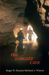
In 1925 the geological connection between Flint Ridge and Mammoth Cave was proved when dye placed in a Flint Ridge spring showed up in Echo River at Mammoth Cave.

That tantalizing swirl of dye confirmed specula­tions that wereto tempt more than 650cavers over half a century with the thrill of being the first to make human passage of the cave connection. Roger Brucker and Richard Watson tell not only of their own twenty-year effort to complete the link but the stories of many others who worked their way through mud-choked crawlways less than a foot high only to find impenetrable blockages.

Floyd Collins died a grisly death in nearby Sand Cave in1925, after being trapped there for 15 days. The wide press coverage of the rescue efforts stirred the imagination of the public and his body was on macabre display in a glass-topped coffin in Crystal Cave into the 1940s. Agents of a rival cave owner once even stole his corpse, which was re­covered and still is in a coffin in the cave. Modern cavers still have a word with Floyd as they start their downward treks.

Brucker and Watson joined the parade of cavers who propelled themselves by wiggling kneecaps, elbows, and toes through quarter-mile long crawlways, clinging by fingertips and boot toes across mud-slick walls, over bottomless pits, into gur­gling streams beneath stone ceilings that descend to water level, down crumbling crevices and up mountainous rockfalls, into wondrous domed halls, and straight ahead into a blackness inten­sified rather than dispelled by the carbide lamps on their helmets.

Over two decades they explored the passages with others who sought the final connection as vigorously as themselves. Pat Crowther, a young mother of two, joined them and because of her thinness became the member of the crew to go first into places no human had ever gone before. In that role, in July 1972, she wiggled her way through the Tight Spot and found the route that would link the Flint Ridge and Mammoth Cave systems into one cave extending 144.4 miles through the Kentucky limestone.

In a new afterword to this edition the authors summarize the subsequent explorations that have more than doubled the established length of the cave system. Based upon geological evidence, the authors predict that new discoveries will add an­other 200 miles to the length of the world’s longest cave, making it over 500 miles long.

[more]

front cover of Lord Kelvin and the Age of the Earth
Lord Kelvin and the Age of the Earth
Joe D. Burchfield
University of Chicago Press, 1990
Burchfield charts the enormous impact made by Lord Kelvin's application of thermodynamic laws to the question of the earth's age and the heated debate his ideas sparked among British Victorian physicists, astronomers, geologists, and biologists.

"Anyone interested in geologic time, and that should include all geologists and a fair smattering of biologists, physicists and chemists, should make Burchfield's commendable and time-tested volume part of their personal library"—Brent Darymple, Quartely Review of Biology
[more]

front cover of The Lost Art of Finding Our Way
The Lost Art of Finding Our Way
John Edward Huth
Harvard University Press, 2013

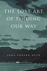
Long before GPS, Google Earth, and global transit, humans traveled vast distances using only environmental clues and simple instruments. John Huth asks what is lost when modern technology substitutes for our innate capacity to find our way. Encyclopedic in breadth, weaving together astronomy, meteorology, oceanography, and ethnography, The Lost Art of Finding Our Way puts us in the shoes, ships, and sleds of early navigators for whom paying close attention to the environment around them was, quite literally, a matter of life and death.

Haunted by the fate of two young kayakers lost in a fog bank off Nantucket, Huth shows us how to navigate using natural phenomena—the way the Vikings used the sunstone to detect polarization of sunlight, and Arab traders learned to sail into the wind, and Pacific Islanders used underwater lightning and “read” waves to guide their explorations. Huth reminds us that we are all navigators capable of learning techniques ranging from the simplest to the most sophisticated skills of direction-finding. Even today, careful observation of the sun and moon, tides and ocean currents, weather and atmospheric effects can be all we need to find our way.

Lavishly illustrated with nearly 200 specially prepared drawings, Huth’s compelling account of the cultures of navigation will engross readers in a narrative that is part scientific treatise, part personal travelogue, and part vivid re-creation of navigational history. Seeing through the eyes of past voyagers, we bring our own world into sharper view.

[more]

front cover of The Lost History of the New Madrid Earthquakes
The Lost History of the New Madrid Earthquakes
Conevery Bolton Valencius
University of Chicago Press, 2013
From December 1811 to February 1812, massive earthquakes shook the middle Mississippi Valley, collapsing homes, snapping large trees midtrunk, and briefly but dramatically reversing the flow of the continent’s mightiest river. For decades, people puzzled over the causes of the quakes, but by the time the nation began to recover from the Civil War, the New Madrid earthquakes had been essentially forgotten.
           
In The Lost History of the New Madrid Earthquakes, Conevery Bolton Valencius remembers this major environmental disaster, demonstrating how events that have been long forgotten, even denied and ridiculed as tall tales, were in fact enormously important at the time of their occurrence, and continue to affect us today. Valencius weaves together scientific and historical evidence to demonstrate the vast role the New Madrid earthquakes played in the United States in the early nineteenth century, shaping the settlement patterns of early western Cherokees and other Indians, heightening the credibility of Tecumseh and Tenskwatawa for their Indian League in the War of 1812, giving force to frontier religious revival, and spreading scientific inquiry. Moving into the present, Valencius explores the intertwined reasons—environmental, scientific, social, and economic—why something as consequential as major earthquakes can be lost from public knowledge, offering a cautionary tale in a world struggling to respond to global climate change amid widespread willful denial.     
           
Engagingly written and ambitiously researched—both in the scientific literature and the writings of the time—The Lost History of the New Madrid Earthquakes will be an important resource in environmental history, geology, and seismology, as well as history of science and medicine and early American and Native American history.

[more]

front cover of Lost Maps of the Caliphs
Lost Maps of the Caliphs
Drawing the World in Eleventh-Century Cairo
Yossef Rapoport and Emilie Savage-Smith
University of Chicago Press, 2018
About a millennium ago, in Cairo, an unknown author completed a large and richly illustrated book. In the course of thirty-five chapters, this book guided the reader on a journey from the outermost cosmos and planets to Earth and its lands, islands, features, and inhabitants. This treatise, known as The Book of Curiosities, was unknown to modern scholars until a remarkable manuscript copy surfaced in 2000.

Lost Maps of the Caliphs provides the first general overview of The Book of Curiosities and the unique insight it offers into medieval Islamic thought. Opening with an account of the remarkable discovery of the manuscript and its purchase by the Bodleian Library, the authors use The Book of Curiosities to re-evaluate the development of astrology, geography, and cartography in the first four centuries of Islam. Their account assesses the transmission of Late Antique geography to the Islamic world, unearths the logic behind abstract maritime diagrams, and considers the palaces and walls that dominate medieval Islamic plans of towns and ports. Early astronomical maps and drawings demonstrate the medieval understanding of the structure of the cosmos and illustrate the pervasive assumption that almost any visible celestial event had an effect upon life on Earth. Lost Maps of the Caliphs also reconsiders the history of global communication networks at the turn of the previous millennium. It shows the Fatimid Empire, and its capital Cairo, as a global maritime power, with tentacles spanning from the eastern Mediterranean to the Indus Valley and the East African coast.

As Lost Maps of the Caliphs makes clear, not only is The Book of Curiosities one of the greatest achievements of medieval mapmaking, it is also a remarkable contribution to the story of Islamic civilization that opens an unexpected window to the medieval Islamic view of the world.
[more]

front cover of Loving Orphaned Space
Loving Orphaned Space
The Art and Science of Belonging to Earth
Mrill Ingram
Temple University Press, 2022

How we relate to orphaned space matters. Voids, marginalia, empty spaces—from abandoned gas stations to polluted waterways—are created and maintained by politics, and often go unquestioned. In Loving Orphaned Space, Mrill Ingram provides a call to action to claim and to cherish these neglected spaces and make them a source of inspiration through art and/or remuneration. 

Ingram advocates not only for “urban greening” and “green planning,” but also for “radical caring.” These efforts create awareness and understanding of ecological connectivity and environmental justice issues—from the expropriation of land from tribal nations, to how race and class issues contribute to creating orphaned space. Case studies feature artists, scientists, and community collaborations in Chicago, New York, and Fargo, ND, where grounded and practical work of a fundamentally feminist nature challenges us to build networks of connection and care. 

The work of environmental artists who venture into and transform these disconnected sites of infrastructure allow us to rethink how to manage the enormous amount of existing overlooked and abused space. Loving Orphaned Space provides new ways humans can negotiate being better citizens of Earth.

[more]


Send via email Share on Facebook Share on Twitter