
 A SCHOLARLY BOOK REPOSITORY
23 start with T start with T
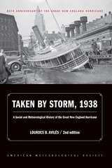
The storm formed near the Cape Verde Islands on September 10, but was not spotted until several days later, and was predicted by the understaffed Weather Bureau to head toward Florida. Junior forecaster Charlie Pierce correctly projected the northerly storm track, but senior meteorologists ignored his forecast, a mistake that cost many lives—including those of immigrants who had arrived to the Northeast in waves in the preceding decades. Updated for the 80th anniversary of the hurricane, this compelling history successfully weaves science, historical accounts, and social analyses to create a comprehensive picture of the most powerful and devastating hurricane to hit New England to date.
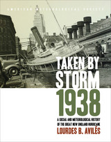
On September 21, 1938 one of the most powerful storms of the twentieth century came unannounced into the lives of New Yorkers and New Englanders, leaving utter devastation in its wake. The Great Hurricane, as it came to be known, changed everything, from the landscape and its inhabitants’ lives, to Weather Bureau practices, to the measure and kind of relief New Englanders would receive during the Great Depression and the resulting pace of regional economic recovery.
Taking Place argues that the relation between geographical location and the moving image is fundamental and that place grounds our experience of film and media. Its original essays analyze film, television, video, and installation art from diverse national and transnational contexts to rethink both the study of moving images and the theorization of place. Through its unprecedented—and at times even obsessive— attention to actual places, this volume traces the tensions between the global and the local, the universal and the particular, that inhere in contemporary debates on global cinema, television, art, and media.
Contributors: Rosalind Galt, U of Sussex; Frances Guerin, U of Kent; Ji-hoon Kim; Hugh S. Manon, Clark U; Ara Osterweil, McGill U; Brian Price, U of Toronto; Linda Robinson, U of Wisconsin–Whitewater; Michael Siegel; Noa Steimatsky, U of Chicago; Meghan Sutherland, U of Toronto; Mark W. Turner, Kings College London; Aurora Wallace, New York U; Charles Wolfe, U of California, Santa Barbara.
Temperate and Boreal Rainforests of the World brings together leading scientists from around the world to describe the ecology and conservation of these lesser-known rainforests in an attempt to place them on par with tropical rainforests in conservation efforts. The book
- summarizes major scientific findings
- presents new computer models that were used to standardize rainforest definitions
- identifies regions previously not widely recognized as rainforest
- provides the latest estimates on rainforest extent and degree of protection
- explores conservation strategies
In Terra Incognita, Alfred Hiatt draws on sources both literary and visual to understand the appeal of the antipodes. Examining maps and diagrams, as well as evidence contained in geographical and historical works, poetry, travel narratives, and legal documents, he challenges long-standing characterizations of medieval spatiality as exclusively symbolic and religious. Instead, Hiatt finds, the idea of people on the other side of the Earth provided a potent and malleable symbol for political theorists, satirists, scholars, and poets—as well as for map makers. Terra Incognita is, in the end, the history of a non-place, of lands conjured by the scientific imagination, which nevertheless drove exploration, and which continued to shape the world map, even as they slowly vanished from it.
In Terrestrial Lessons, Ramaswamy provides the first in-depth analysis of the globe’s history in and impact on the Indian subcontinent during the colonial era and its aftermath. Drawing on a wide array of archival sources, she delineates its transformation from a thing of distinction possessed by elite men into that mass-produced commodity used in classrooms worldwide—the humble school globe. Traversing the length and breadth of British India, Terrestrial Lessons is an unconventional history of this master object of pedagogical modernity that will fascinate historians of cartography, science, and Asian studies.
Originally published in 1882, Clarence Dutton’s Tertiary History of the Grand Cañon District has become one of the definitive books on the Grand Canyon. Commissioned as a study of the region’s geology and issued by the fledgling U.S. Geological Survey, it is as much admired today for its literary as its scientific merits. With its beautiful illustrations by Thomas Moran and William Henry Holmes, it is a seminal work on the Canyon that has never been surpassed for its eloquence and authority.
This new edition of Dutton’s magnum opus makes that work available once again. Visitors to the Canyon will gain a new appreciation of its majesty as Dutton takes readers on several excursions among its castellated and cathedral-like peaks and ridges. Along the way, he explains the peculiar characteristics of different rocks, the water-sculpturing process, volcanic cones and outflows, the extent of the river’s erosion, and other geological features.
Dutton’s Tertiary History remains arguably the most evocative and compelling geological writing ever done on the Grand Canyon region. As Stephen J. Pyne observes in his foreword, Dutton “recast a rocky peninsula into geo-poetry, reshaped an amorphous panorama of Time into narrative History, and transformed an American scene into a universal symbol.” No one who has thrilled to the majesty of the Grand Canyon will fail to be moved by this timeless work.
Not quite a history of geology, Thinking about the Earth is a history of the geological tradition of Western science. Beginning with a discussion of "organic" views of the earth in ancient cultures, David Oldroyd traverses such topics as "mechanical" and "historicist" views of the earth, map-work, chemical analyses of rocks and minerals, geomorphology, experimental petrology, seismology, theories of mountain building, and geochemistry. He brings us back to the idea that the earth may, in a sense, be regarded as a living entity, or at least that life is an essential feature of its behavior.
Oldroyd offers a broad-brush contribution to the history of ideas and theories about the earth, providing a general synthesis of what science-historians have written about the history of the earth sciences. He shows us that ideas about the earth have been changing constantly since the beginnings of geological science in the seventeenth and eighteenth centuries, and indeed that ideas changed much more rapidly after the establishment of this science than in preceding centuries.
Thinking about the Earth does not assume previous knowledge of earth science. What it does require is an openness to the notion that an understanding of what geologists have to tell us today about the earth can be achieved by examining the evolving history of ideas in geology. This book will be of considerable interest to historians of science, historians of ideas, geologists, students of earth science, and general readers as well.
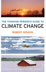
Using global research and written with nonscientists in mind, the Guide breaks down the issues into straightforward categories: “Symptoms” covers signs such as melting ice and extreme weather, while “Science” lays out what we know and how we figured it out. “Debates” tackles the controversy and politics, while “Solutions” and “Actions” discuss what we can do as individuals and communities to create the best possible future. Full-color illustrations offer explanations of everything from how the greenhouse effect traps heat to which activities in everyday life emit the most carbon. Special-feature boxes zoom in on locations across the globe already experiencing the effects of a shifting climate.
The Thinking Person's Guide to Climate Change combines years of data with recent research, including conclusions from the Fifth Assessment Report of the Intergovernmental Panel on Climate Change. This reference provides the most comprehensive, yet accessible, overview of where climate science stands today, acknowledging controversies but standing strong in its stance that the climate is changing— and something needs to be done.
The Thinking Person's Guide to Climate Change is a full update and revision of Robert Henson’s The Rough Guide to Climate Change and is now published through the American Meteorological Society, with distribution through University of Chicago Press.
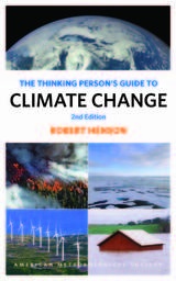
Using global research and written with nonscientists in mind, the Guide breaks down the issues into straightforward categories: “Symptoms” covers signs such as melting ice and extreme weather, while “Science” lays out what we know and how we figured it out. “Debates” tackles the controversy and politics, while “Solutions” and “Actions” discuss what we can do as individuals and communities to create the best possible future. Full-color illustrations offer explanations of everything from how the greenhouse effect traps heat to which activities in everyday life emit the most carbon. Special-feature boxes zoom in on locations across the globe already experiencing the effects of a shifting climate.
The new edition of The Thinking Person's Guide to Climate Change has been thoroughly updated, including content on new global record highs, new research across the spectrum, and the Paris Agreement to cut greenhouse gases. This reference provides the most comprehensive, yet accessible, overview of where climate science stands today, acknowledging controversies but standing strong in its stance that the climate is changing—and something needs to be done.
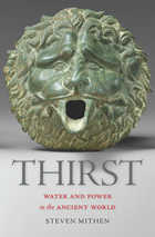
Water is an endangered resource, imperiled by population growth, mega-urbanization, and climate change. Scientists project that by 2050, freshwater shortages will affect 75 percent of the global population. Steven Mithen puts our current crisis in historical context by exploring 10,000 years of humankind’s management of water. Thirst offers cautionary tales of civilizations defeated by the challenges of water control, as well as inspirational stories about how technological ingenuity has sustained communities in hostile environments.
As in his acclaimed, genre-defying After the Ice and The Singing Neanderthals, Mithen blends archaeology, current science, and ancient literature to give us a rich new picture of how our ancestors lived. Since the Neolithic Revolution, people have recognized water as a commodity and source of economic power and have manipulated its flow. History abounds with examples of ambitious water management projects and hydraulic engineering—from the Sumerians, whose mastery of canal building and irrigation led to their status as the first civilization, to the Nabataeans, who created a watery paradise in the desert city of Petra, to the Khmer, who built a massive inland sea at Angkor, visible from space.
As we search for modern solutions to today’s water crises, from the American Southwest to China, Mithen also looks for lessons in the past. He suggests that we follow one of the most unheeded pieces of advice to come down from ancient times. In the words of Li Bing, whose waterworks have irrigated the Sichuan Basin since 256 BC, “Work with nature, not against it.”
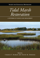
Tidal Marsh Restoration provides the scientific foundation and practical guidance necessary for coastal zone stewards to initiate salt marsh tidal restoration programs. The book compiles, synthesizes, and interprets the current state of knowledge on the science and practice of salt marsh restoration, bringing together leaders across a range of disciplines in the sciences (hydrology, soils, vegetation, zoology), engineering (hydraulics, modeling), and public policy, with coastal managers who offer an abundance of practical insight and guidance on the development of programs.
The work presents in-depth information from New England and Atlantic Canada, where the practice of restoring tidal flow to salt marshes has been ongoing for decades, and shows how that experience can inform restoration efforts around the world. Students and researchers involved in restoration science will find the technical syntheses, presentation of new concepts, and identification of research needs to be especially useful as they formulate research and monitoring questions, and interpret research findings.
Tidal Marsh Restoration is an essential work for managers, planners, regulators, environmental and engineering consultants, and others engaged in planning, designing, and implementing projects or programs aimed at restoring tidal flow to tide-restricted or diked salt marshes.
Rarely has a scholar attained such popular acclaim merely by doing what he does best and enjoys most. But such is Stephen Jay Gould’s command of paleontology and evolutionary theory, and his gift for brilliant explication, that he has brought dust and dead bones to life, and developed an immense following for the seeming arcana of this field.
In Time’s Arrow, Time’s Cycle his subject is nothing less than geology’s signal contribution to human thought—the discovery of “deep time,” the vastness of earth’s history, a history so ancient that we can comprehend it only as metaphor. He follows a single thread through three documents that mark the transition in our thinking from thousands to billions of years: Thomas Burnet’s four-volume Sacred Theory of the Earth (1680–1690), James Hutton’s Theory of the Earth (1795), and Charles Lyell’s three-volume Principles of Geology (1830–1833).
Gould’s major theme is the role of metaphor in the formulation and testing of scientific theories—in this case the insight provided by the oldest traditional dichotomy of Judeo-Christian thought: the directionality of time’s arrow or the immanence of time’s cycle. Gould follows these metaphors through these three great documents and shows how their influence, more than the empirical observation of rocks in the field, provoked the supposed discovery of deep time by Hutton and Lyell. Gould breaks through the traditional “cardboard” history of geological textbooks (the progressive march to truth inspired by more and better observations) by showing that Burnet, the villain of conventional accounts, was a rationalist (not a theologically driven miracle-monger) whose rich reconstruction of earth history emphasized the need for both time’s arrow (narrative history) and time’s cycle (immanent laws), while Hutton and Lyell, our traditional heroes, denied the richness of history by their exclusive focus upon time’s arrow.
In demystifying the old and new Europe across a multiplicity of texts, images, media, and cultural practices in various times and locations, Verstraete lays bare a territorial persistence in the European imaginary, one which has been differently tied up with the politics of inclusion and exclusion. Tracking Europe moves from policy papers, cultural tourism, and migration to philosophies of cosmopolitanism, nineteenth-century travel guides, electronic surveillance at the border, virtual pilgrimages to Spain, and artistic interventions in the Balkan region. It is a sustained attempt to situate current developments in Europe within a complex matrix of tourism, migration, and border control, as well as history, poststructuralist theory, and critical media and art projects.
Tracks in Deep Time presents, for the first time, an engaging, thoroughly readable account of the history, geology, and paleontology of this important site. Two hundred million years ago, Lake Dixie covered the site. Within its waters and along its shores, a diverse ecosystem of dinosaurs, early crocodylians, fishes, plants, and other organisms thrived, leaving behind thousands of footprints and other fossils preserved in layers of rock. Unusual fossils found here include the world’s largest collection of tracks left by swimming dinosaurs and one of only six traces known to have been made by a sitting, meat-eating dinosaur. With approachable text and lavish, full-color photographs and illustrations, Jerald Harris and Andrew Milner describe how geologists and paleontologists have painstakingly reconstructed a vivid “snapshot” of life from the Early Jurassic epoch.
Driving across I-70 in southern Utah one can’t help but wonder about the magnificent upturned rocks of the San Rafael Reef. With A Travelers Guide to the Geology of the Colorado Plateau in hand, you’ll soon discover that you were driving through Page and Navajo Sandstone formations, sharply folded into a monocline along one of the "Basin and Range" fault lines. Nearing Flagstaff, Arizona, on Highway 89, you will learn that Mt. Humphry of the San Francisco Peaks, a Navajo Sacred Mountain, was once an active volcano. Keep reading and you’ll find many things worth a slight detour.
A Traveler's Guide to the Geology of the Colorado Plateau will enrich and enliven all of your trips through the varied landscapes of the Colorado Plateau as you learn about the geological forces that have shaped its natural features. The mile-by-mile road logs will take you from Vernal, Utah, in the north to the southernmost reaches of the Plateau in Sedona, Arizona; from the red rocks of Cedar Breaks National Monument near Cedar City, Utah, to the edges of the soaring peaks of the San Juan Mountains near Durango, Colorado. The most comprehensive geological guide to the Colorado Plateau
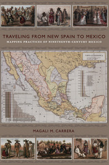
From the sixteenth century until the early nineteenth, Europeans had envisioned New Spain (colonial Mexico) in texts, maps, and other images. In the first decades of the 1800s, ideas about Mexican, rather than Spanish, national character and identity began to cohere in written and illustrated narratives produced by foreign travelers. During the nineteenth century, technologies and processes of visual reproduction expanded to include lithography, daguerreotype, and photography. New methods of display—such as albums, museums, exhibitions, and world fairs—signaled new ideas about spectatorship. García Cubas participated in this emerging visual culture as he reconfigured geographic and cultural imagery culled from previous mapping practices and travel writing. In works such as the Atlas geográfico (1858) and the Atlas pintoresco é historico (1885), he presented independent Mexico to Mexican citizens and the world.
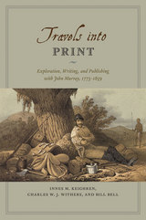
Drawing on detailed examination of the John Murray Archive of manuscripts, images, and the firm’s correspondence with its many authors—a list that included such illustrious explorers and scientists as Charles Darwin and Charles Lyell, and literary giants like Jane Austen, Lord Byron, and Sir Walter Scott—Travels into Print considers how journeys of exploration became published accounts and how travelers sought to demonstrate the faithfulness of their written testimony and to secure their personal credibility. This fascinating study in historical geography and book history takes modern readers on a journey into the nature of exploration, the production of authority in published travel narratives, and the creation of geographical authorship—a journey bound together by the unifying force of a world-leading publisher.
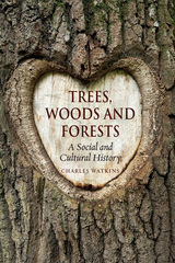
Drawing on the most recent work of historians, ecologist geographers, botanists, and forestry professionals, Charles Watkins reveals how established ideas about trees—such as the spread of continuous dense forests across the whole of Europe after the Ice Age—have been questioned and even overturned by archaeological and historical research. He shows how concern over woodland loss in Europe is not well founded—especially while tropical forests elsewhere continue to be cleared—and he unpicks the variety of values and meanings different societies have ascribed to the arboreal. Altogether, he provides a comprehensive, interdisciplinary overview of humankind’s interaction with this abused but valuable resource.
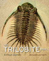
Featuring specimens from Bohemia to Newfoundland, California to the Tucson Gem and Mineral Show, and Wales to the Anti-Atlas Mountains of Morocco, Levi-Setti’s magnificent book reanimates these “butterflies of the seas” in 235 astonishing full-color photographs. All original, Levi-Setti’s images serve as the jumping-off point for tales of his global quests in search of these highly sought-after fossils; for discussions of their mineralogical origins, as revealed by their color; and for unraveling the role of the now-extinct trilobites in our planetary history.
Sure to enthrall paleontologists with its scientific insights and amateur enthusiasts with its beautiful and informative images, The Trilobite Book combines the best of science, technology, aesthetics, and personal adventure. It will inspire new collectors for eras to come.
Tsunami explores how these treacherous sea-surges happen, what makes them so powerful, and what can be done to safeguard vulnerable coastlines. Hamblyn details their cultural significance in tsunami-prone places such as Japan, Hawaii, and Chile, while also considering their importance in the more seismically stable West, where their appearances are limited to popular culture and blockbuster films. From the legend of Atlantis to the present day, this book casts new light on these deadly waves.
READERS
Browse our collection.
PUBLISHERS
See BiblioVault's publisher services.
STUDENT SERVICES
Files for college accessibility offices.
RECENTLY PUBLISHED


UChicago Accessibility Resources
home | accessibility | search | about | contact us
BiblioVault ® 2001 - 2024
The University of Chicago Press