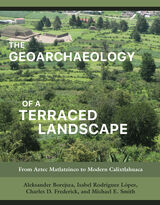
Working at a settlement in the Toluca Valley of central Mexico, the authors used fieldwalking, excavation, soil and artifact analyses, maps, aerial photos, land deeds, and litigation records to reconstruct the changing landscape through time. Exploiting the methodologies and techniques of several disciplines, they bring context to eight centuries of the region’s agrarian history, exploring the effects of the Aztec and Spanish Empires, reform, and revolution on the physical shape of the Mexican countryside and the livelihoods of its people. Accessible to specialists and nonspecialists alike, this well-illustrated and well-organized volume provides a step-by-step guide that can be applied to the study of terraced landscapes anywhere in the world.
The four authors share an interest in terraced landscapes and have worked together and on their own on a variety of archaeological projects in Mesoamerica, the Mediterranean, Poland, and the United Kingdom.
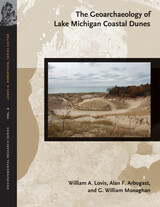
Complex sets of environmental factors have interacted over the past 5,000 years to affect how changes in climate, temperature, relative precipitation, and the levels of Lake Michigan influence the preservation of archaeological sites in coastal sand dunes along Lake Michigan. As a collaboration between earth scientists, archaeologists, and geoarchaeologists, this study draws on a wealth of research and multidisciplinary insights to explore the conditions necessary to safeguard ancient human settlements in these landscapes. A variety of contemporary and innovative techniques, including numerous dating methods and approaches, were employed to determine when and for how long sand dunes were active and when and for how long archaeological sites were occupied. Knowledge of dune processes and settlement patterns not only affects archaeological interpretations, but it is also consummately important to land planners responsible for managing heritage archaeological sites in the Lake Michigan coastal zone.
"A welcome addition to our library of southwestern studies. Well-written, extremely well illustrated, and filled with useful dates, field techniques, and stratigraphic data." —International Journal of Geoarchaeology
"This geoarchaeological study is in the very best tradition of interdisciplinary research that applies geological concepts and methods to the study of archaeological contexts." —The Kiva
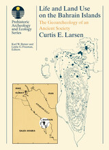
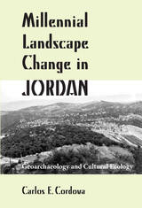
Cordova focuses on geoarchaeological and cultural ecological aspects of research, presenting data from physical, chemical, and biological sources. He examines the changing influence of climate, vegetation, and hunting opportunities on cultural exploitation tactics, as well as the effects of the growing population and agriculture on the environment. Cordova argues that an interdisciplinary approach to studying the area is crucial to achieving a true understanding of Jordan’s changing landscape.
Chapter topics include approaches to the study of ancient Jordanian landscapes in the Near Eastern context; the physical scene; endowed landscapes of the woodlands; the encroaching drylands; the current and future state of the paleoecological and geoarchaeological record; patterns of millennial landscape change; and the process of interpreting millennial landscape change. The text is abundantly illustrated with photos, line illustrations, tables, and maps, providing a valuable assessment of archaeological developments over the prehistory and history of what today is the Hashemite Kingdom of Jordan. This volume will be especially welcomed by scholars interested in the archaeology, history, and geography of Jordan, the Levant, and the Near East and by field-school students working on archaeological projects in Jordan.
CONTENTS
1. Research Objectives of Geoarchaeology
2. Geoarchaeological Foundations: The Archaeological Site Matrix: Sediments and Soils / Stratigraphy / The Geoarchaeological Interpretation of Sediments, Soils, and Stratigraphy
3. Alluvial Environments: Streamflow / Sediment Erosion, Transport, and Deposition / Alluvial Environments: Rivers, Arroyos, Terraces, and Fans / Alluvial Landscapes Evolution and the Archaeological Record / Alluvial Landscape Reconstruction
4. Eolian Environments: Sediment Erosion, Transport, and Deposition / Sand Dunes / Loess and Dust / Stone Pavements / Eolian Erosion / Volcanic Ash (Tephra)
5. Springs, Lakes, Rockshelters, and Other Terrestrial Environments: Springs / Lakes / Slopes / Glaciers / Rockshelters and Caves
6. Coastal Environments: Coastal Processes / Late Quaternary Sea Level Changes / Coastal Environments / Coastal Landscape Evolution and the Archaeological Record / Coastal Landscape Reconstruction
7. The Postburial Disturbance af Archaeological Site Contexts: Cryoturbation / Argilliturbation / Graviturbation / Deformation / Other Physical Disturbances / Floralturbation / Faunalturbation
8. Geoarchaeological Research
Appendix A: Geoarchaeological Studies Illustrating the Effects of Fluvial Landscape Evolution on the Archaeological Record
Appendix B: Geoarchaeological Studies Illustrating Site-Specific Synchronic and Diachronic Alluvial Landscape Reconstructions
Appendix C: Geoarchaeological Studies Illustrating Regional Synchronic and Diachronic Alluvial Landscape Reconstructions
READERS
Browse our collection.
PUBLISHERS
See BiblioVault's publisher services.
STUDENT SERVICES
Files for college accessibility offices.
UChicago Accessibility Resources
home | accessibility | search | about | contact us
BiblioVault ® 2001 - 2024
The University of Chicago Press


