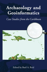
Addressing the use of geoinformatics in Caribbean archaeology, this volume is based on case studies drawn from specific island territories, namely, Barbados, St. John, Puerto Rico, Jamaica, Nevis, St. Eustatius, and Trinidad and Tobago, as well as inter-island interaction and landscape conceptualization in the Caribbean region. Geoinformatics is especially critical within the Caribbean where site destruction is intense due to storm surges, hurricanes, ocean and riverine erosion, urbanization, industrialization, and agriculture, as well as commercial development along the very waterfronts that were home to many prehistoric peoples. By demonstrating that the region is fertile ground for the application of geoinformatics in archaeology, this volume places a well-needed scholarly spotlight on the Caribbean.
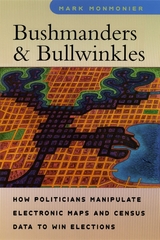
Written from the perspective of a cartographer rather than a political scientist, Bushmanders and Bullwinkles examines the political tales maps tell when votes and power are at stake. Monmonier shows how redistricting committees carve out favorable election districts for themselves and their allies; how disgruntled politicians use shape to challenge alleged racial gerrymanders; and how geographic information systems can make reapportionment a controversial process with outrageous products. He also explores controversies over the proper roles of natural boundaries, media maps, census enumeration, and ethnic identity. Raising important questions about Supreme Court decisions in regulating redistricting, Monmonier asks if the focus on form rather than function may be little more than a distraction from larger issues like election reform.
Characterized by the same wit and clarity as Monmonier's previous books, Bushmanders and Bullwinkles is essential background for understanding what might prove the most contentious political debate of the new decade.
Maps are stories as much about us as about the landscape. They reveal changing perceptions of the natural world, as well as conflicts over the acquisition of territories. Cartographic Fictions looks at maps in relation to journals, correspondence, advertisements, and novels by authors such as Joseph Conrad and Michael Ondaatje. In her innovative study, Karen Piper follows the history of cartography through three stages: the establishment of the prime meridian, the development of aerial photography, and the emergence of satellite and computer mapping.
Piper follows the cartographer’s impulse to “leave the ground” as the desire to escape the racialized or gendered subject. With the distance that the aerial view provided, maps could then be produced “objectively,” that is, devoid of “problematic” native interference. Piper attempts to bring back the dialogue of the “native informant,” demonstrating how maps have historically constructed or betrayed anxieties about race. The book also attempts to bring back key areas of contact to the map between explorer/native and masculine/feminine definitions of space.
Do you have a smartphone? Billions of people on the planet now navigate their daily lives with the kind of advanced Global Positioning System capabilities once reserved for the most secretive elements of America’s military-industrial complex. But when so many people have access to the most powerful technologies humanity has ever devised for the precise determination of geographical coordinates, do we still need a specialized field of knowledge called geography?
Just as big data and artificial intelligence promise to automate occupations ranging from customer service and truck driving to stock trading and financial analysis, our age of algorithmic efficiency seems to eliminate the need for humans who call themselves geographers—at the precise moment when engaging with information about the peoples, places, and environments of a diverse world is more popular than ever before. How did we get here? This book traces the recent history of geography, information, and technology through the biography of Edward A. Ackerman, an important but forgotten figure in geography’s “quantitative revolution.” It argues that Ackerman’s work helped encode the hidden logics of a distorted philosophical heritage—a dangerous, cybernetic form of thought known as militant neo-Kantianism—into the network architectures of today’s pervasive worlds of surveillance capitalism.

A riveting introduction to the complex and evolving field of geospatial intelligence.
Although geospatial intelligence is a term of recent origin, its underpinnings have a long and interesting history. Geospatial Intelligence: Origins and Evolution shows how the current age of geospatial knowledge evolved from its ancient origins to become ubiquitous in daily life across the globe. Within that framework, the book weaves a tapestry of stories about the people, events, ideas, and technologies that affected the trajectory of what has become known as GEOINT.
Author Robert M. Clark explores the historical background and subsequent influence of fields such as geography, cartography, remote sensing, photogrammetry, geopolitics, geophysics, and geographic information systems on GEOINT. Although its modern use began in national security communities, Clark shows how GEOINT has rapidly extended its reach to other government agencies, NGOs, and corporations. This global explosion in the use of geospatial intelligence has far-reaching implications not only for the scientific, academic, and commercial communities but for a society increasingly reliant upon emerging technologies. Drones, the Internet of things, and cellular devices transform how we gather information and how others can collect that information, to our benefit or detriment.
A growing number of archaeologists are applying Geographic Information Science (GIS) technologies to their research problems and questions. Advances in GIS and its use across disciplines allows for collaboration and enables archaeologists to ask ever more sophisticated questions and develop increasingly elaborate models on numerous aspects of past human behavior. Least cost analysis (LCA) is one such avenue of inquiry. While least cost studies are not new to the social sciences in general, LCA is relatively new to archaeology; until now, there has been no systematic exploration of its use within the field.
This edited volume presents a series of case studies illustrating the intersection of archaeology and LCA modeling at the practical, methodological, and theoretical levels. Designed to be a guidebook for archaeologists interested in using LCA in their own research, it presents a wide cross-section of practical examples for both novices and experts. The contributors to the volume showcase the richness and diversity of LCA’s application to archaeological questions, demonstrate that even simple applications can be used to explore sophisticated research questions, and highlight the challenges that come with injecting geospatial technologies into the archaeological research process.
New Lines takes the pulse of a society increasingly drawn to the power of the digital map, examining the conceptual and technical developments of the field of geographic information science as this work is refracted through a pervasive digital culture. Matthew W. Wilson draws together archival research on the birth of the digital map with a reconsideration of the critical turn in mapping and cartographic thought.
Seeking to bridge a foundational divide within the discipline of geography—between cultural and human geographers and practitioners of Geographic Information Systems (GIS)—Wilson suggests that GIS practitioners may operate within a critical vacuum and may not fully contend with their placement within broader networks, the politics of mapping, the rise of the digital humanities, the activist possibilities of appropriating GIS technologies, and more.
Employing the concept of the drawn and traced line, Wilson treads the theoretical terrain of Deleuze, Guattari, and Gunnar Olsson while grounding their thoughts with the hybrid impulse of the more-than-human thought of Donna Haraway. What results is a series of interventions—fractures in the lines directing everyday life—that provide the reader with an opportunity to consider the renewed urgency of forceful geographic representation. These five fractures are criticality, digitality, movement, attention, and quantification. New Lines examines their traces to find their potential and their necessity in the face of our frenetic digital life.
Using concepts and methods derived from the work of Michel Foucault, Crampton outlines a new mapping of cyberspace to help define the role of space in virtual worlds and to provide constructive ways in which humans can exist in another spatial dimension. He delineates the critical role maps play in constructing the medium as an object of knowledge and demonstrates that by processes of mapping we come to understand cyberspace. Maps, he argues, shape political thinking about cyberspace, and he deploys in-depth case studies of crime mapping, security maintenance, and geo-surveillance to show how we map ourselves onto cyberspace, inexorably, and indelibly.
Offering a powerful reinterpretation of technology and contemporary life, this innovative book will be an essential touchstone for the study of cartography and cyberspace in the twenty-first century.
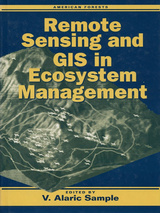
Recent advances in remote-sensing technology and the processing of remote-sensing data through geographic information systems (GIS) present ecologists and resource managers with a tremendously valuable tool -- but only if they are able to understand its capabilities and capture its potential.
Remote Sensing and GIS in Ecosystem Management identifies and articulates current and emerging information needs of those involved with the management of forest ecosystems. It explores the potential of remote-sensing/GIS technologies to address those needs, examining:
- the need for landscape-scale analysis to support forest ecosystem research and management
- current challenges in the development of remote-sensing/GIS applications
- case studies of different forest regions in the United States
- the potential for further development or declassification of military and aerospace remote-sensing/GIS technologies
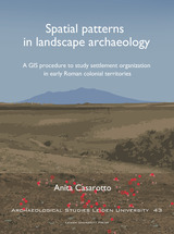
This book develops and applies a GIS procedure to use legacy survey data in settlement pattern analysis. It consists of two parts. One part regards the assessment of biases that can affect the spatial patterns exhibited by survey data. The other part aims to shed light on the location preferences and settlement strategy of ancient communities underlying site patterns. In this book, a case-study shows how the method works in practice. As part of the research by the Landscapes of Early Roman Colonization project (NWO, Leiden University, KNIR) site-based datasets produced by survey projects in central-southern Italy are examined in a comparative framework to investigate settlement patterns in the early Roman colonial period (3rd century B.C.).
READERS
Browse our collection.
PUBLISHERS
See BiblioVault's publisher services.
STUDENT SERVICES
Files for college accessibility offices.
UChicago Accessibility Resources
home | accessibility | search | about | contact us
BiblioVault ® 2001 - 2024
The University of Chicago Press


