11 start with D start with D
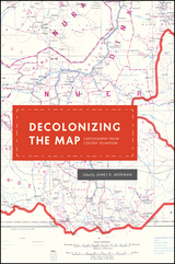
These essays, originally delivered as the 2010 Kenneth Nebenzahl, Jr., Lectures in the History of Cartography at the Newberry Library, encompass more than two centuries and three continents—Latin America, Africa, and Asia. Ranging from the late eighteenth century through the mid-twentieth, contributors study topics from mapping and national identity in late colonial Mexico to the enduring complications created by the partition of British India and the racialized organization of space in apartheid and post-apartheid South Africa. A vital contribution to studies of both colonization and cartography, Decolonizing the Map is the first book to systematically and comprehensively examine the engagement of mapping in the long—and clearly unfinished—parallel processes of decolonization and nation building in the modern world.
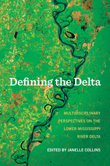
Here are essays examining the Delta’s physical properties, boundaries, and climate from a geologist, archeologist, and environmental historian. The Delta is also viewed through the lens of the social sciences and humanities—historians, folklorists, and others studying the connection between the land and its people, in particular the importance of agriculture and the culture of the area, especially music, literature, and food.
Every turn of the page reveals another way of seeing the seven-state region that is bisected by and dependent on the Mississippi River, suggesting ultimately that there are myriad ways of looking at, and defining, the Delta.
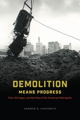
In one of the most comprehensive works yet written on the history of inequality and metropolitan development in modern America, Andrew R. Highsmith uses the case of Flint to explain how the perennial quest for urban renewal—even more than white flight, corporate abandonment, and other forces—contributed to mass suburbanization, racial and economic division, deindustrialization, and political fragmentation. Challenging much of the conventional wisdom about structural inequality and the roots of the nation’s “urban crisis,” Demolition Means Progress shows in vivid detail how public policies and programs designed to revitalize the Flint area ultimately led to the hardening of social divisions.
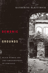
Demonic Grounds moves between past and present, archives and fiction, theory and everyday, to focus on places negotiated by black women during and after the transatlantic slave trade. Specifically, the author addresses the geographic implications of slave auction blocks, Harriet Jacobs’s attic, black Canada and New France, as well as the conceptual spaces of feminism and Sylvia Wynter’s philosophies.
Central to McKittrick’s argument are the ways in which black women are not passive recipients of their surroundings and how a sense of place relates to the struggle against domination. Ultimately, McKittrick argues, these complex black geographies are alterable and may provide the opportunity for social and cultural change.
Katherine McKittrick is assistant professor of women’s studies at Queen’s University.
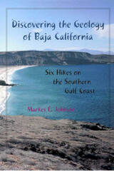
For those who wish to unlock the mysteries of Baja California, geologist Markes Johnson offers the key. He has taken a body of technical research on the geology and paleontology of the region and made it accessible in plain language for anyone who visits the peninsula, whether for study or recreation. His book teaches general concepts in coastal geomorphology and tectonics, as well as the basic geological and natural history of the Gulf of California, in a conversive, intellectually stimulating fashion.
Johnson's guide takes the form of six day-long hikes in the area of Punta Chivato on the east coast of the southern Baja California peninsula. Punta Chivato is presented as a microcosm of the entire region; it can enable visitors to better understand major themes in the natural history of the Gulf of California and its geological past. All of the hikes begin at the southeast corner of the Punta Chivato promontory and loop out in different directions. Each circuit is designed to minimize overlap with adjacent hikes and to maximize the visitor's exposure to instructive variations in the landscape. Each chapter features additional reflections on a geologist of another time and place who has advanced the field in a way that elucidates the material covered in that chapter. Through these asides, readers will learn the basic lessons about how geologists read the secrets hidden in landscapes.
Discovering the Geology of Baja California invites visitors to these shores to explore not only rocks and fossils but also the continuum of past ecosystems with the ecology of the present. It offers both an unparalleled guide to a remote area and a new understanding of life caught in an endless cycle of change.

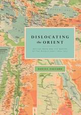
Using a wide variety of primary texts and historical maps to show how the idea of the Middle East came into being, Dislocating the Orient will interest historians of the Middle East, the British empire, cultural geography, and cartography.
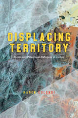
Based on fieldwork with Palestinian and Syrian refugees in Jordan, Displacing Territory explores how the lived realities of refugees are deeply affected by their imaginings of what constitutes territory and their sense of belonging to different places and territories. Karen Culcasi shows how these individual conceptualizations about territory don’t always fit the Western-centric division of the world into states and territories, thus revealing alternative or subordinated forms and scales of territory. She also argues that disproportionate attention to “refugee crises” in the Global North has diverted focus from other parts of the world that bear the responsibility of protecting the majority of the world’s refugees. By focusing on Jordan, a Global South state that hosts the world’s second-largest number of refugees per capita, this book provides insights to consider alternate ways to handle the situation of refugees elsewhere. In the process, Culcasi brings the reader into refugees’ diverse realities through their own words, inherently arguing against the tendency of many people in the Global North to see refugees as aberrant, burdensome, or threatening.

States are inherently and fundamentally geographical. Sovereignty is based on control of territory. This book uses Song China to explain how a pre-industrial regime organized itself spatially in order to exercise authority. On more than a thousand occasions, the Song court founded, abolished, promoted, demoted, and reordered jurisdictions in an attempt to maximize the effectiveness of limited resources in a climate of shifting priorities, to placate competing constituencies, and to address military and economic crises. Spatial transformations in the Song field administration changed the geography of commerce, taxation, revenue accumulation, warfare, foreign relations, and social organization, and even determined the terms of debates about imperial power.
The chronology of tenth-century imperial consolidation, eleventh-century political reform, and twelfth-century localism traced in this book is a familiar one. But by detailing the relationship between the court and local administration, this book complicates the received paradigm of Song centralization and decentralization. Song frontier policies formed a coherent imperial approach to administering peripheral regions with inaccessible resources and limited infrastructure. And the well-known events of the Song—wars and reforms—were often responses to long-term spatial and demographic change.

Routledge vividly depicts the experiences of American whalers and explorers in Inuit homelands. Conversely, she relates stories of Inuit who traveled to the northeastern United States and were similarly challenged by the norms, practices, and weather they found there. Standing apart from earlier books of Arctic cultural research—which tend to focus on either Western expeditions or Inuit life—Do You See Ice? explores relationships between these two groups in a range of northern and temperate locations. Based on archival research and conversations with Inuit Elders and experts, Routledge’s book is grounded by ideas of home: how Inuit and Americans often experienced each other’s countries as dangerous and inhospitable, how they tried to feel at home in unfamiliar places, and why these feelings and experiences continue to resonate today.
The author intends to donate all royalties from this book to the Elders’ Room at the Angmarlik Center in Pangnirtung, Nunavut.
READERS
Browse our collection.
PUBLISHERS
See BiblioVault's publisher services.
STUDENT SERVICES
Files for college accessibility offices.
UChicago Accessibility Resources
home | accessibility | search | about | contact us
BiblioVault ® 2001 - 2024
The University of Chicago Press


