12 start with N start with N
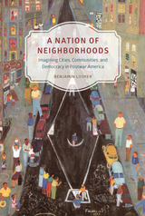
Looker investigates the cultural, social, and political complexities of the idea of “neighborhood” in postwar America and how Americans grappled with vast changes in their urban spaces from World War II to the Reagan era. In the face of urban decline, competing visions of the city neighborhood’s significance and purpose became proxies for broader debates over the meaning and limits of American democracy. By studying the way these contests unfolded across a startling variety of genres—Broadway shows, radio plays, urban ethnographies, real estate documents, and even children’s programming—Looker shows that the neighborhood ideal has functioned as a central symbolic site for advancing and debating theories about American national identity and democratic practice.
What are the limits and potentials of indigenous acts of spatial production? Native Space argues that control over the notion of “Indianness” still sits at the center of how space is produced in a neocolonial nation, and shows how non-indigenous communities uniquely deploy Native identities in the direct construction of colonial geographies. In short, “the Indian” serves to create White space in concrete ways. Yet, Native geographies effectively reclaim indigenous identities, assert ongoing relations to the land, and refuse the claims of settler colonialism.
Barnd creatively and persuasively uses original cartographic research and demographic data, a series of interrelated stories set in the Midwestern Plains states of Kansas and Oklahoma, an examination of visual art by contemporary indigenous artists, and discussions of several forms of indigenous activism to support his argument. With its highly original, interdisciplinary approach, Native Space makes a significant contribution to the literature in cultural and critical geography, comparative ethnic studies, indigenous studies, cultural studies, American Studies, and related fields.
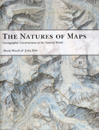
To answer that question, the authors turn to a category of maps with a particularly strong reputation for objectivity: maps of nature. From depictions of species habitats and bird migrations to portrayals of the wilds of the Grand Canyon and the reaches of the Milky Way, such maps are usually presumed—even by users who should know better—to be strictly scientific. Yet by drawing our attention to every aspect of these maps’ self-presentation, from place names to titles and legends, the authors reveal the way that each piece of information collaborates in a disguised effort to mount an argument about reality. Without our realizing it, those arguments can then come to define our very relationship to the natural world—determining whether we see ourselves as humble hikers or rampaging despoilers, participants or observers, consumers or stewards.
Richly illustrated, and crafted in vivid and witty prose, The Natures of Maps will enlighten and entertain map aficionados, scholars, and armchair navigators alike. You’ll never be able to look at Google Maps quite the same way again.

Newcomers to older neighborhoods are usually perceived as destructive, tearing down everything that made the place special and attractive. But as A Neighborhood That Never Changes demonstrates, many gentrifiers seek to preserve the authentic local flavor of their new homes, rather than ruthlessly remake them. Drawing on ethnographic research in four distinct communities—the Chicago neighborhoods of Andersonville and Argyle and the New England towns of Provincetown and Dresden—Japonica Brown-Saracino paints a colorful portrait of how residents new and old, from wealthy gay homeowners to Portuguese fishermen, think about gentrification.
The new breed of gentrifiers, Brown-Saracino finds, exhibits an acute self-consciousness about their role in the process and works to minimize gentrification’s risks for certain longtime residents. In an era of rapid change, they cherish the unique and fragile, whether a dilapidated house, a two-hundred-year-old landscape, or the presence of people deeply rooted in the place they live. Contesting many long-standing assumptions about gentrification, Brown-Saracino’s absorbing study reveals the unexpected ways beliefs about authenticity, place, and change play out in the social, political, and economic lives of very different neighborhoods.
The history of New York City’s urban development often centers on titanic municipal figures like Robert Moses and on prominent inner Manhattan sites like Central Park. New York Recentered boldly shifts the focus to the city’s geographic edges—the coastlines and waterways—and to the small-time unelected locals who quietly shaped the modern city. Kara Murphy Schlichting details how the vernacular planning done by small businessmen and real estate operators, performed independently of large scale governmental efforts, refigured marginal locales like Flushing Meadows and the shores of Long Island Sound and the East River in the late nineteenth and early twentieth centuries. The result is a synthesis of planning history, environmental history, and urban history that recasts the story of New York as we know it.
The nineteenth century was a time of unprecedented discovery and exploration throughout the globe, a period when the “blank spaces” of the earth were systematically investigated, occupied, and exploited by the major imperial powers of Western Europe and the United States. The lived experience of space was also changing in dramatic ways for people as a result of new developments in technology, communication, and transportation. As a result, the century was characterized by a new and intense interest in place, both local and global.
The collection is comprised of seventeen essays from various disciplines organized into four areas of geographic concern. The first, “Time Zones,” examines several ways that place gets expressed as time during the period, how geography becomes history. A second grouping, “Commodities and Exchanges,” explores the role of geographic origin as it was embodied in particular objects, from the souvenir map to imported tea. The set of essays on “Domestic Fronts” moves the discussion from the public to the private sphere by looking at how domestic space became defined in terms of its boundary with the foreign. The final section, “Orientations,” takes up the changing relations of bodies, identities, and the spaces they inhabit and through which they moved. The collection as a whole also traces the development of the discipline of geography with its different institutional and political trajectories in the United States and Great Britain.

Written by Number 10’s first ever ‘Researcher in Residence,’ with unprecedented access to people and papers, No. 10: The Geography of Power at Downing Street sheds new light on unexplored aspects of Prime Ministers’ lives. Jack Brown tells the story of the intimately entwined relationships between the house and its post-war residents, telling how each occupant’s use and modification of the building reveals their own values and approaches to the office of Prime Minister. The book reveals how and why Prime Ministers have stamped their personalities and philosophies upon Number 10 and how the building has directly affected the ability of some Prime Ministers to perform the role. Both fascinating and extremely revealing, No. 10 offers an intimate account of British political power and the building at its core. It is essential reading for anyone interested in the nature and history of British politics.
Some maps help us find our way; others restrict where we go and what we do. These maps control behavior, regulating activities from flying to fishing, prohibiting students from one part of town from being schooled on the other, and banishing certain individuals and industries to the periphery. This restrictive cartography has boomed in recent decades as governments seek regulate activities as diverse as hiking, building a residence, opening a store, locating a chemical plant, or painting your house anything but regulation colors. It is this aspect of mapping—its power to prohibit—that celebrated geographer Mark Monmonier tackles in No Dig, No Fly, No Go.
Rooted in ancient Egypt’s need to reestablish property boundaries following the annual retreat of the Nile’s floodwaters, restrictive mapping has been indispensable in settling the American West, claiming slices of Antarctica, protecting fragile ocean fisheries, and keeping sex offenders away from playgrounds. But it has also been used for opprobrium: during one of the darkest moments in American history, cartographic exclusion orders helped send thousands of Japanese Americans to remote detention camps. Tracing the power of prohibitive mapping at multiple levels—from regional to international—and multiple dimensions—from property to cyberspace—Monmonier demonstrates how much boundaries influence our experience—from homeownership and voting to taxation and airline travel. A worthy successor to his critically acclaimed How to Lie with Maps, the book is replete with all of the hallmarks of a Monmonier classic, including the wry observations and witty humor.
In the end, Monmonier looks far beyond the lines on the page to observe that mapped boundaries, however persuasive their appearance, are not always as permanent and impermeable as their cartographic lines might suggest. Written for anyone who votes, owns a home, or aspires to be an informed citizen, No Dig, No Fly. No Go will change the way we look at maps forever.

Few subjects are as intensely debated in the United States as the death penalty. Some form of capital punishment has existed in America for hundreds of years, yet the justification for carrying out the ultimate sentence is a continuing source of controversy. No Winners Here Tonight explores the history of the death penalty and the question of its fairness through the experience of a single state, Ohio, which, despite its moderate midwestern values, has long had one of the country’s most active death chambers.
In 1958, just four states accounted for half of the forty-eight executions carried out nationwide, each with six: California, Georgia, Ohio, and Texas. By the first decade of the new century, Ohio was second only to Texas in the number of people put to death each year. No Winners Here Tonight looks at this trend and determines that capital punishment has been carried out in an uneven fashion from its earliest days, with outcomes based not on blind justice but on the color of a person’s skin, the whim of a local prosecutor, or the biases of the jury pool in the county in which a crime was committed.
Andrew Welsh-Huggins’s work is the only comprehensive study of the history of the death penalty in Ohio. His analysis concludes that the current law, crafted by lawmakers to punish the worst of the state’s killers, doesn’t come close to its intended purpose and instead varies widely in its implementation. Welsh-Huggins takes on this controversial topic evenhandedly and with respect for the humanity of the accused and the victim alike. This exploration of the law of capital punishment and its application will appeal to students of criminal justice as well as those with an interest in law and public policy.
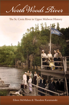
North Woods River is a thoughtful biography of the river over the course of more than three hundred years. Eileen McMahon and Theodore Karamanski track the river’s social and environmental transformation as newcomers changed the river basin and, in turn, were changed by it. The history of the St. Croix revealed here offers larger lessons about the future management of beautiful and fragile wild waters.
READERS
Browse our collection.
PUBLISHERS
See BiblioVault's publisher services.
STUDENT SERVICES
Files for college accessibility offices.
UChicago Accessibility Resources
home | accessibility | search | about | contact us
BiblioVault ® 2001 - 2024
The University of Chicago Press


