
 A SCHOLARLY BOOK REPOSITORY
13 start with P start with P
When Henry Hudson explored the Delaware River in 1609, he dubbed it “one of the finest, best, and pleasantest rivers in the world.” Today, those same qualities make the Delaware one of the most popular rivers for recreational use in the United States. Although in places a near-wilderness, the Delaware is easily accessible to millions of residents. On any summer day there may be thousands of people rushing down its exciting rapids or lazing through its serene eddies.
A Paddler’s Guide to the Delaware River is an indispensable resource for anyone who wants to experience the Delaware River in a kayak, canoe, raft, or tube—or, for that matter, an automobile or an armchair. Reading the book is like travelling down the river with an experienced guide. It charts the non-tidal Delaware 200 miles from Hancock, New York, to Trenton, New Jersey, describing access points, rapids, natural features, villages, historical sites, campgrounds, outfitters, and restaurants. The Delaware comes alive as the author introduces some of the people, places, events, and controversies that have marked the river from earliest times to the present day.
Completely revised, the third edition offers:
- An overview of the river including watershed, history, place names, paddlecraft, safety, and fishing.
- The River Guide: ten sections that can each be paddled in one day (about 20 miles), with a mile-by-mile account of rapids, access, natural features, historic sites, and other features.
- All new maps, with names for virtually every rapid, eddy, and other river feature, plus detailed diagrams for routes through even the most severe rapids.
- Features in the River Guide highlight the people, events, natural history, and communities that define the river experience, such as Tom Quick, the infamous “avenger of the Delaware”; the mysterious migration of eels, the battle over Tocks Island Dam; and many others.
- Appendices of Important Contacts, Outfitters and Campgrounds, River Trip Checklists, and more.
Whether you are a novice out for an afternoon float, a seasoned adventurer on an overnight expedition, or a resident fascinated by the lore of the Delaware Valley, this book is an invaluable guide.
Whether you are an ardent hiker or prefer to enjoy the great outdoors from your living-room armchair, Jeffrey Perls has written the essential guidebook on one of the most majestic natural areas of the eastern United States-the Hudson River.
From the rugged topography of the Hudson Highlands Gorge to the crowded towers of Manhattan, the Hudson has been an inspiration for poets, writers, artists, and countless others who have enjoyed the many wonders of the river. The area surrounding the Hudson abounds in history. It’s played a pivotal part in our country's development, from its strategic role in the American Revolution to its heritage as the nation’s primary entry point for immigrants to this country. The river also supports an incredibly rich diversity of flora and fauna, from the bald eagle to the short-nosed sturgeon.
Perls brings together the culture, history, nature, and recreational activities along the Hudson River in one convenient guide book. He not only maps out walks and bike trails, both urban and rural, but also introduces readers to the landscape, geology, history, and culture of the Hudson Valley region. Perls provides a practical and geographically comprehensive guide to exploring the area on foot and by bike. The trail routes bring readers as close to the river as possible and guides them to rewarding vistas, nature preserves, and historic landmarks. It’s a useful guide for visitors to the Hudson region and local residents as it acquaints them to the natural treasures to be found in their own backyards.
- Agnew's exclusive choices on which beers to try at each location
- Entries on every brewery's history and philosophy
- Information on tours, tasting rooms and attached pubs, and dining options and other amenities
- A survey of each brewery's brands, including its flagship beer plus seasonal brews and special releases
- Brewery equipment and capacity
- Nearby attractions
In addition, Agnew sets the stage with a history of Midwestern beer spanning the origins of the immigrant brewers who arrived in the 1800s to the homebrewers-made-good who have built a new kind of brewing culture founded on creativity, dedication to quality, and attention to customer feedback.
Informed and unique, A Perfect Pint's Beer Guide to the Heartland is the essential companion for beer aficionados and curious others determined to drink the best the Midwest has to offer.
Includes more than 150 full color images, including the region's most distinctive beer labels, trademarks, and company logos.
What's on the menu:
* Profiles of Philadelphia's most influential chefs and restaurant owners, including Le Bec-Fin's Georges Perrier, and restaurant mogul Stephen Starr.
* A behind-the-scenes look at the Philadelphia food purveyors, who are responsible for some of the nation's hottest food trends—from La Colombe coffee to Metropolitan Bakery's artisanal breads to Jubilee Chocolates.
* Reviews of more than 230 of the best restaurants in the Philadelphia region, from Center City mainstays Susanna Foo and Morimoto to suburban destinations Alison at Blue Bell and Carmine's Café.
* Easy-to-use index of restaurants by cuisine and neighborhood.


Toker highlights this remarkable story of urban reinvention by focusing on what makes Pittsburgh so resilient and appealing - its strong neighborhoods and their surprisingly rich architectural history. The many unique, lively urban communities that make up Pittsburgh are a treasure trove of every imaginable style of structure, from Victorian to Bauhaus, Gothic to Art Deco, and from Industrial to Green. These ordinary homes expressed the aspirations of people who came from around the world to settle in Pittsburgh, while they built the city itself into an economic powerhouse. With the wealth generated by this everyday work, local captains of industry could build their own monumental additions to Pittsburgh's urban landscape, including two of America's greatest buildings: H. H. Richardson's Allegheny Courthouse and Frank Lloyd Wright's Fallingwater.
With accessible prose, Toker examines Pittsburgh in its historical context (from Indian settlement to postmodern city), in its regional setting (from the playgrounds of the Laurel Highlands to the hard-working mill towns dotting the landscape), and from the street level (leading the reader on a personal tour through every neighborhood). Lavishly illustrated with photos and maps, Pittsburgh: A New Portrait reveals the true colors of a truly great American city.

In this funny, fascinating book, Genovese explores the bloggers who write about New York pizza, the obsessive city dwellers who collect and analyze the delivery boxes, Mark Bello’s school where students spend a day making pies from scratch, and Scott Wiener’s pizza bus tours.
Along the way, readers learn the history of legendary Totonno’s on Coney Island (Zagat’s number-one pizzeria for 2012), along with behind-the-scenes stories about John’s on Bleecker Street, Joe’s on Carmine, Lombardi’s, Paulie Gee’s, Motorino, and more than a dozen other favorite spots and their owners. Throughout these profiles, Genovese presents a brief history of how pizza came to the city in 1905 and developed into a major attraction in Little Italy, a neighborhood that became a training ground for many of the city’s best-loved pizzerias. Enjoyable facts and figures abound. Did you know that Americans put 250 million pounds of pepperoni on their pies every year? Or that Domino’s has more outlets per capita in Iceland than in any other country?
Beyond the stories and tidbits, Genovese provides detailed, borough-by-borough reviews of 250 pizzerias, from simple “slice shops” with scant atmosphere to gourmet pizzerias, including shops that use organic ingredients and experiment with new variations of crusts and toppings. Complemented by hundreds of current and never-before-seen archival photos, the book gives the humble slice its proper due and will leave readers overwhelmed by a sudden desire for New York pizza.
The Poconos, a rich plateau nestled in northeastern Pennsylvania between the Delaware River and the Moosic Mountains, encompass a variety of alluring features. The perfect reference for amateur naturalists, outdoor enthusiasts, tourists, and others who wish to explore the area, this classic guide clearly explains the unique geographic characteristics, animal habits and habitats, climate, geology, and vegetation of the area.
The authors trace the region from its beginnings millions of years ago as part of a shallow sea, through the reshaping forces of great glaciers, to today’s roadways and turnpikes. This revised and expanded edition also includes brief profiles of individuals who played significant roles in the preservation or understanding of the area’s ecology. Chapters provide a general survey of the area, including its history and places to be explored and observed, information on forest types, wildlife, and aquatic habitats, updated facts and figures on animal populations, as well as new details on invasive species.
Throughout the book, numerous boxes direct readers to observatory points for specific birds, ecosystems, vegetation types, and geological features, while maps, tables, original pen-and-ink illustrations, and a select list of field guides and other references enhance the book’s appeal. An indispensable companion for visitors as well as residents, The Poconos is a must-read for everyone who wants to discover or better understand the beauty and natural history of this unique region.
North America’s grasslands once stretched from southern Canada to northern Mexico, and across this considerable space different prairie types evolved to express the sum of their particular longitude and latitude, soils, landforms, and aspect. This prairie guide is your roadmap to what remains of this varied and majestic landscape.
Suzanne Winckler’s goal is to encourage travelers to get off the highways, out of their cars, and onto North America’s last remaining prairies. She makes this adventure as easy as possible by providing exact driving directions to the more than three hundred sites in her guide. She also includes information about size, management, phone numbers, and outstanding characteristics for every prairie site and provides readers with a thorough list of recommended readings and Web sites.
The scope of the guide is impressive. It encompasses prairies found within national grasslands, parks, forests, recreation areas, wildlife refuges, state parks, preserves, and natural areas and on numerous working ranches in Saskatchewan and Manitoba, the Dakotas, Minnesota, Illinois, Iowa, Kansas, Missouri, Nebraska, Oklahoma, and Texas. A series of maps locate the prairies both geographically and by name.
From “the largest restoration project within the historic range of tallgrass prairie” at Neal Smith National Wildlife Refuge in Iowa to Big Bend National Park in Texas, where “the Chisos Mountains, completely surrounded by the park, rise up majestically from the Chihuahuan Desert floor,” Winckler celebrates the dramatic expanses of untouched prairie, the crown jewels of prairie reconstruction and restoration, and the neglected remnants that deserve to be treasured.
Nye County is Nevada’s largest and least populated county, but it is also the site of many of the state’s most colorful ghost towns and mining camps. The county’s economy throughout its history has been largely based on its mines--first, exploiting veins of gold and silver, and more recently deposits of raw materials for modern industry, such as molybdenum and barite. It was here that famous boomtowns like Tonopah and Rhyolite sprang up after the discovery of nearby lodes brought in rushes of prospectors and the merchants who supported them. But the county includes many smaller, shorter-lived camps and numerous abandoned stagecoach and railroad stops associated with defunct mining operations.This book offers a lively, informative record of Nevada’s isolated interior. Hall first published a guide to Nye County’s ghost towns in 1981. Since then, he has continued his research into the county’s past and has uncovered much new information and corrected some errors. To prepare this revised and greatly expanded edition, he revisited all 175 sites recorded earlier and has added more than 20 previously unlisted sites.
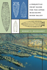
The most common relics of the 12,000-year occupancy of the Upper Mississippi River Valley may be the chipped stone projectile points that Native Americans fastened to the ends of their spears, darts, and arrow shafts. This useful guide provides a key to identifying the various styles of points found along the Upper Mississippi River in the Driftless region stretching roughly from Dubuque, Iowa, to Red Wing, Minnesota, but framed within a somewhat larger area extending from the Rock Island Rapids at the modern Moline-Rock Island area to the Falls of St. Anthony at Minneapolis-St. Paul.
Logging tens of thousands of miles and visiting private collectors from all walks of life since 1982, Robert Boszhardt has documented thousands of projectile points found in this region. In addition to drawings of each style, he provides other accepted names as well as names of related points, age, distribution, a description (including length and width), material, and references for each type. The guide is meant for the many avocational archaeologists who collect projectile points in the Upper Midwest and will be a useful reference tool for professional field archaeologists as well.
Emphasizing the preservation of sites as well as a mutual exchange of information between professional and avocational archaeologists, this guide will reveal projectile points as clues to the past, time markers which embody crucial information about the cultures of the Mississippi River Valley's early inhabitants.
READERS
Browse our collection.
PUBLISHERS
See BiblioVault's publisher services.
STUDENT SERVICES
Files for college accessibility offices.
RECENTLY PUBLISHED


UChicago Accessibility Resources
home | accessibility | search | about | contact us
BiblioVault ® 2001 - 2024
The University of Chicago Press