
 A SCHOLARLY BOOK REPOSITORY
The thirty walks range from two-hour jaunts over level terrain to more taxing full-day hikes. Walks in the Kittatiny Ridge, the Highlands, the Piedmont, the Delaware River Valley, the Pinelands, Cape May, along the Atlantic Coast, and communities of historical interest are all included. For each trip, the authors guide the walker along the way, pointing out distinctive rock formations, plant communities, and wildlife as well as noting the ways human activity has shaped the landscape. They provide clear maps to the route, directions, and hours of operation.
One of the area’s foremost experts on the outdoors, Mike White, author of 50 of the Best Strolls, Walks, and Hikes Around Reno, returns with a new guidebook dedicated to Carson City and its surrounding areas in northern Nevada. With over three hundred days of sunshine a year, this capital city’s parks, trails, lakes, and soaring peaks provide the perfect attractions for residents and visitors alike. This guide provides readers with the most precise information for a wide range of detailed paths and trails throughout the greater Carson City region and includes interesting sidebars about human and natural history for each trip.
From Virginia City and the Carson River on the east to the Sierra Nevada mountains to the west, this comprehensive guidebook offers the most complete guide for walkers, joggers, and hikers. Whether you are looking for a short and easy stroll on a city path or an extended hike along the Tahoe Rim Trail, this is your all-inclusive resource for your next outdoor adventure.
Reno, Nevada is one of the best communities in the nation for outdoor recreational opportunities. With over three hundred days of sunshine a year, the weather beckons residents and visitors alike to step outside and enjoy a casual stroll in a city park, a stiff climb to the top of one of the area’s surrounding mountains, or just about anything in between. White offers the most complete guide for walkers, joggers, runners, and hikers to the best paths and trails in the greater Reno-Sparks region.
This guide provides readers the most complete and detailed information for each excursion, from the Truckee River corridor to the Northern Valleys, including lakes, parks, trails, and mountains. Whether you are looking for a short and easy stroll on a paved path along one of the city’s greenbelts, or an extended hike into the mountains of the Mount Rose wilderness, this is your all-inclusive resource. White is one of the area’s foremost experts on the outdoors, and he includes interesting sidebars about human and natural history for each trip. This is a guide for anyone who enjoys a stroll, walk, or hike in and around Northern Nevada’s premier outdoor playgrounds.
Confident in his identity as a Deaf “mute,” he notes with wry humor the varied perceptions of deafness that he encounters. As a signing Deaf person from a prominent multigenerational Deaf family, he counters negative stereotypes with generosity and a smart wit. He takes pride in his physical abilities, which he showcases through various stunts and arduous treks in the wilderness. However, Swett’s writing also reveals a deep awareness of the fragility and precariousness of life. This is a portrait of a man testing his physical and emotional limits, written from the vantage point of someone who is no longer a young man but is still very much in the prime of his life.
This collection also includes “Mr. Swett and His Diorama,” an article from 1859 in which Swett describes his miniature recreation of the Battle of Lexington, as well as Manual Alphabets, a pamphlet published in 1875 on the history of manual alphabets that includes short biographies of Thomas Hopkins Gallaudet and Laurent Clerc, two pioneers of Deaf education in the United States. The work is accompanied by a new introduction that offers a reflection on Swett’s life and the time in which he lived.

With 65 photographs and 77 detailed maps, this indispensable guide to the state's hiking trails gives beginners to advanced hikers all the information they need to plan their next Michigan overnight or weekend backpacking trip. Featuring 50 trails---27 in the Lower Peninsula---ranging from one-hour to multiple-day treks in both the Upper and Lower Peninsulas, Backpacking in Michigan has something for every hiker.
Information on hike length and difficulty, elevation gain, the amount of time needed to complete the hike, camping facilities, and nearby towns accompanies each of the trail listings. The author also provides extensive reference maps along with a description of scenic highlights. In addition to backcountry explorations of remote trails, Backpacking in Michigan includes classic Michigan adventures such as the Lakeshore Trail in Pictured Rocks National Lakeshore, the Greenstone Ridge Trail in Isle Royale National Park, North Manitou Island in Sleeping Bear Dunes National Lakeshore, and Jordan River Pathway in the Mackinaw State Forest.
While Backpacking in Michigan focuses primarily on the trails themselves, it also makes planning your Michigan adventure as easy as possible by providing important information on routes to and from the trailhead, as well as park fees and reservation information for shelters, walk-in cabins, rental yurts, and overnight camping.
Jim DuFresne is a Michigan native and author of more than a dozen wilderness, travel, and hiking guidebooks. He is author of Isle Royale National Park: Foot Trails and Water Routes; 50 Hikes in Michigan: The Best Walks, Hikes, and Backpacks in the Lower Peninsula; Best Hikes with Children: Michigan; Porcupine Mountains Wilderness State Park: A Backcountry Guide for Hikers, Campers, Backpackers, and Skiers; as well as The Complete Guide to Michigan Sand Dunes, copublished by the University of Michigan Press and Petoskey Publishing.

“The reason I travel and explore the outdoors is simple,” writes Johnny Molloy, “the world is a beautiful place!” And Molloy would know: he has backpacked more than 2,500 nights in forty states. It is this experience—much of it garnered in his home state of Tennessee—combined with his extensive production of guidebooks spanning activities from hiking and camping to paddling and bicycling, that enabled him to produce Backpacking Tennessee: Overnight Trail Adventures from the Mississippi River to the Appalachian Mountains.
Complete with directions, distances, descriptions, and maps, Backpacking Tennessee is divided into four sections that together outline forty overnight hikes across West Tennessee, Middle Tennessee, the Cumberland Plateau, and East Tennessee and the Appalachian Mountains. The trails Molloy has chosen to highlight are a mix of well-known hikes and lesser-known areas, ranging in distance and difficulty for both novice hikers and experienced backpackers. Woven throughout the trail descriptions are comments on scenery, notes about safety, and historical information that help readers get a true feel for each hike. To round out his comprehensive guide, Molloy also includes ratings, 1–5, on the family- and dog-friendliness of each trail—an especially helpful feature for readers bringing loved ones along.
From the Great Smoky Mountains National Park and Cherokee National Forest to Big South Fork and Land Between the Lakes, Tennessee offers thousands of miles of trails for adventurers looking to explore. For budding outdoor enthusiasts and experienced backpackers alike, Backpacking Tennessee answers the timeless question: where do we go next?

Wisconsin is a premier backpacking state, with outstanding opportunities for weekend trips. With its Great Lakes and river boundaries, national and state parks and forests, and stunning geological diversity, it offers a variety of experiences for both novice and experienced backpackers. In Backpacking Wisconsin Jack and Liz Hailman, drawing on years of personal experience, provide first-hand information for trails in every corner of the state—from the wooded Apostle Islands National Lakeshore, inhabited by whitetailed deer and black bears, to picturesque Newport State Park in Door County, set upon Silurian-age limestone laid down over 100 million years ago.
For each backpacking site you’ll find:
• information on entrance fees and permits, campsites, & contact sources
• directions to the location
• detailed trail maps with keys that pinpoint roads, parking, trail shelters, water supplies, outhouses
• ratings for trails, scenery, quiet, solitude, and interest
• background information on history, geology, and terrain
• trail notes describing trees, shrubs, wildflowers, birds, and animals you may encounter.
Backpacking Wisconsin also provides an overview of the backpacking experience, tips for the beginner and the expert, hints on how to choose equipment (boots, packs, tents, sleeping bags, rain gear, stoves), notes on troublesome plants and animals, a list of state areas that no longer offer backpacking, schedules of fees, a checklist for backpacks, and a list of trail, outdoor, and conservation organizations. For those hesitant to venture deep into wilderness, the Hailmans spotlight “quasi-backpacking” sites. All you have to do is pick a trail!
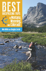
Best Backpacking Trips in Montana, Wyoming, and Colorado provides everything you need to know to organize and execute the best backpacking trips in the Mountain West. Mike White and Douglas Lorain, who have walked every mile of the trails described inside, take readers and hikers into some of the wildest and most scenic backcountry landscapes in the nation and help them design the ultimate trip.
Focusing on one-week excursions, the book offers details on all the aspects of trip planning—trail narratives, technical data, maps, gear, food, information on regulations and permits, and more. But it is more than a basic guidebook. Trip information is enriched by valuable and interesting sidebars on history and ecology that will increase appreciation for these natural areas and the people who were instrumental in their discovery or protection.
In Best Backpacking Trips in Montana, Wyoming, and Colorado, White and Lorain pass on their knowledge of quality hikes, planning and preparation, and the unique satisfaction of multi-day backpacking. This guide, put into practice, will result in the trip of a lifetime.

For anyone who has yet to discover the beauty of the Smokies, the highest North American mountains east of the Mississippi, the trails described here offer a splendid introduction. Scenic overlooks at Mount Le Conte, Clingmans Dome, Gregory Bald, and other peaks are included along these pathways, as are some of the well-known waterfalls of the Park, such as Laurel Falls, Rainbow Falls, and Ramsay Cascades. In addition to vital data about the length of the trail, its elevation gain, and “how to get there,” each trail description is packed with interesting facts and Smoky Mountain lore. Detailed maps are also included. In their introduction, the authors provide a brief overview of the park’s history as well as useful tips for novice hikers.
The Authors: Kenneth Wise, an administrator at the University of Tennessee Library, Knoxville, has hiked in the Great Smoky Mountains National Park for more than twenty years. He is the author of <i>Hiking Trails of the Great Smoky Mountains: A Comprehensive Guide</i>.
James Andrews,a partner in the firm of Andrews, Hudson & Wall, P.C., has hiked the Park trails for more than a decade. He is the coauthor, with Wise, of <i>The Best Overnight Hikes in the Great Smoky Mountains</i>.

Kenneth Wise and James Andrews
Located astride the Tennessee–North Carolina border, the Great Smoky Mountains National Park contains more than one hundred trails that trace eight hundred miles of rugged terrain. This fact is certain to bewilder any newcomer who might be eager to explore the Park’s backcountry but is unsure where to start. This book, intended as a beginner’s guide to hiking the Smokies, offers lively, informative descriptions of twenty-two trails that can be completed in a day or less.
For anyone who has yet to discover the beauty of the Smokies, the highest North American mountains east of the Mississippi, the trails described here offer a splendid introduction. Scenic overlooks at Mount Le Conte, Clingmans Dome, Gregory Bald, and other peaks are included along these pathways, as are some of the well-known waterfalls of the Park, such as Laurel Falls, Rainbow Falls, and Ramsay Cascades. In addition to vital data about the length of the trail, its elevation gain, and “how to get there,” each trail description is packed with interesting facts and Smoky Mountain lore. Detailed maps are also included. In their introduction, the authors provide a brief overview of the park’s history as well as useful tips for novice hikers.
The Authors: Kenneth Wise, an administrator at the University of Tennessee Library, Knoxville, has hiked in the Great Smoky Mountains National Park for more than twenty years. He is the author of Hiking Trails of the Great Smoky Mountains: A Comprehensive Guide.
James Andrews,a partner in the firm of Andrews, Hudson & Wall, P.C., has hiked the Park trails for more than a decade. He is the coauthor, with Wise, of The Best Overnight Hikes in the Great Smoky Mountains.

Canyoneering 2: Technical Loop Hikes is a guide to seven, week-long backpack trips into some for the most unspoiled and least-visited areas in the Utah section of the Colorado Plateau. Every hike contains the four essentials of a great canyoneering route: spectacular canyons, intimate narrows, big views, and physical challenge. Although the routes are difficult, newcomers to the canyons will also find detailed information here that can be used to plan less demanding excursions. Hikes include Muddy Creek in the San Rafael Swell, Dirty Devil North, Dirty Devil South, Dark Canyon, White Canyon, Escalante East, and Escalante South. For experienced canyoneers.

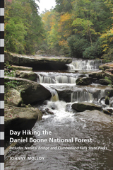
In this guide, Molloy leads readers through forty hikes within the natural wonders of DBNF, including Natural Bridge and Cumberland Falls. Descriptions of each hike are straightforward and accurate, so readers can focus on enjoying natural features, scenic overlooks, interesting geological formations, and landmarks along the trails. Hikers will see the best of the Cumberland Plateau, from exquisite arches to bluffs that offer extensive vistas to waterfalls that descend into sandstone cathedrals. The paths tread through deep forests in gorges cut by creeks and rivers and atop the Cumberland Plateau, where oak and pine forests range long distances. Rockhouses, caves, and other geological features stand out in these rich woodlands. Hikers may also encounter protected plants and animals along these trails, including the red-cockaded woodpecker, Virginia big-eared bat, freshwater mussels, white-haired goldenrod, and the black bear.
Detailed, easy-to-follow directions for each trail will allow hikers to progress on their chosen course without frustrating detours. The hikes range in distance, difficulty, and destination, offering the full breadth of hiking experiences to be had within the DBNF. The shortest hike is under a mile, and the longest is ten, with most somewhere in the middle. Hikers can use the chart at beginning of the book to select the perfect trail for their experience level and desires. Also included are detailed trail maps and photos.
For the new hiker as well as the experienced outdoor adventurer, Day Hiking Kentucky’s Daniel Boone National Forest is sure to become an indispensable guide to one of Kentucky’s national treasures.
Johnny Molloy has published more than sixty books about hiking and other forms of outdoor adventure, including Trial by Trail: Backpacking in the Smoky Mountains, second edition, and Mount Rogers National Recreation Area Guidebook: A Complete Resource for Outdoor Enthusiasts, third edition.

The Battle of Antietam has long been known as the bloodiest day in American military history with more than twenty thousand soldiers either dead, wounded, or missing. The Confederacy, emboldened after a conclusive victory at the Battle of Second Manassas, launched the Maryland Campaign and considered a decisive battle on northern soil as a lynchpin to their objectives. As Gen. Robert E. Lee pushed his veteran Army of Northern Virginia deeper into Maryland, Gen. George B. McClellan hastily assembled a refurbished Army of the Potomac. After engagements at South Mountain and Harpers Ferry, Lee concentrated his forces near the small village of Sharpsburg. On September 17, 1862, McClellan attacked at dawn, igniting a battle that raged until sunset. By the end of the following day, Lee’s battered army began its withdrawal. The eventual Confederate retreat provided the Lincoln Administration a much sought after victory. President Lincoln announced the Emancipation Proclamation just four days later, dramatically altering the very nature of the war.
Decisions at Antietam introduces readers to critical decisions made by Confederate and Union commanders throughout the battle. Michael S. Lang examines the decisions that prefigured the action and shaped the contest as it unfolded. Rather than a linear history of the battle, Lang’s discussion of the critical decisions presents readers with a vivid blueprint of the battle’s developments. Exploring the critical decisions in this way allows the reader to progress from a sense of what happened in these battles to why they happened as they did
Complete with maps and a guided tour, Decisions at Antietam is an indispensable primer, and readers looking for a concise introduction to the battle can tour this sacred ground—or read about it at their leisure—with key insights into the battle and a deeper understanding of the Civil War itself.
Decisions at Antietam is the ninth in a series of books that will explore the critical decisions of major campaigns and battles of the Civil War.

A Dog Lover’s Guide to Hiking Wisconsin’s State Parks divides Wisconsin into five regions and further details specific trails, graded for dog reactivity as well as the fitness level of human and canine alike. St. Louis also helpfully notes the availability of nearby facilities such as bathrooms, water stations, trashcans, designated dog swimming areas, and veterinarians. Truly one of a kind, this book is a must have for any Wisconsin dog lover looking to go out into nature with their pup.

In this captivating collection of twelve essays, a testament to a lifetime’s fascination with the outdoors and its myriad wonders, naturalist Stephen Lyn Bales examines a variety of flora and fauna that in one way or another can be described as “ephemeral”—that is, fleeting, short-lived, or transient.
Focusing on his native East Tennessee, Bales introduces us to several oddities, including the ghost plant, a wispy vascular plant that resembles a rooster’s tail and grows mainly in areas devoid of sunlight; the Appalachian panda, an ancestor of today’s red panda that wandered the region millions of years ago and whose fossil remains have only recently been discovered; and the freshwater jellyfish, a tiny organism that is virtually invisible except for those hot summer days when clusters of them bloom into shimmering “medusae,” sometimes by the thousands. Other essays consider such topics as the plight of the monarch butterfly, a gorgeous insect whose populations have dropped by 90 percent in only the last two decades; the reintroduction of the lake sturgeon, one of nature’s most primitive and seldom-seen fish, into the waters of the Tennessee Valley; and the surprising emergence of coyote-wolf and coyote-dog hybrids in the eastern states.
Written with insight, humor, and heart, Ephemeral by Nature is as entertaining as it is instructive. Along with a wealth of biological details—and his own handsome pen-and-ink drawings—Bales fills the book with delightful anecdotes of field trips, species-protection efforts, and those thrilling occasions when some elusive member of the natural order shows itself to us, if only for a brief moment.
Stephen Lyn Bales, senior naturalist at Ijams Nature Center in Knoxville, is the author of Natural Histories: Stories from the Tennessee Valley and Ghost Birds: Jim Tanner and the Quest for the Ivory-billed Woodpecker, 1935–1941, both published by the University of Tennessee Press.

Exploring the Big Woods: A Guide to the Last Great Forest of Eastern Arkansas is both a natural history and a guide to one of the last remnants of Mississippi bottomland forest, an ecosystem that once stretched from southern Illinois to the Gulf Coast.
Crossed by the White River and its tributaries, which periodically flood and release nutrients, the Big Woods is one of the few places in the Mississippi River Valley where this life-giving flood cycle persists. As a result, it is home to an unusual abundance of animals and plants.
Immense cypresses, hickories, sweetgums, oaks, and sycamores; millions of migrating waterfowl; incredible scenery; and the complex relationship between humans and nature are all to be discovered here.
Exploring the Big Woods will introduce readers to the natural features, plants, animals, and hiking and canoeing trails going deep into the forests and swamps of this rare and beautiful natural resource.

Intrepid explorers Kenneth M. Wills and L. J. Davenport divide Alabama into eleven geographic regions that feature state parks and preserves, national monuments and forests, wildlife management areas, Nature Conservancy and Forever Wild properties, botanical gardens and arboreta, as well as falls, caverns, and rock cliffs. Exploring Wild Alabama provides detailed site entries to one hundred and fifty destinations. Each section is beautifully illustrated with color photographs and area maps.
Exploring Wild Alabama includes a large state map and numerous local topographic maps to help readers locate each site. Individual site entries include
· written directions to each site and GPS coordinates;
· engaging notes about the ecology, landscape features, and local species of plants and animals of the sites; and
· international recreation symbols for hiking, fishing, boating, camping, hunting, and other fun outdoor activities.
Wills and Davenport guide travelers to Alabama jewels such as Sand Mountain’s Chitwood Barrens, which harbors the rare Green Pitcher Plant and other exotic botanical species; Blowing Springs Cave in Lauderdale County, named for the cool air and the clear spring flowing out of the cave opening; Jackson Prairies in the Lime Hills region; and Booker’s Mill in Conecuh County, offering diverse habitats and historic structures.
Long a favorite destination for outdoor sports enthusiasts, Alabama is fast becoming a major “ecotourism” destination, with thousands of travelers discovering the state’s unsung natural treasures. Exploring Wild Alabama will be used and trusted by anyone who loves the outdoors—birders, botanists, cave explorers, cyclists, hunters, fishermen, rock climbers, canoeists, teachers, and other outdoor enthusiasts.
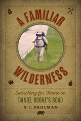
In 1775, renowned pioneer Daniel Boone was commissioned to blaze a road through the Appalachian and Cumberland Plateau regions as a fledgling American nation steadily pushed westward. What would come to be known as the Wilderness Road was the first major route into the West, and it allowed settlers to migrate northwest into Kentucky and later settle parts of Ohio, Indiana, and Illinois. In 2012, Jim Dahlman stopped to stretch his legs on a brief hike into the Cumberland Gap and stumbled upon an adventure. After months of preparation, Dahlman grabbed a pack and set out to hike as accurately as possible Daniel Boone’s original trace.
In A Familiar Wilderness, Dahlman illustrates that the Wilderness Road is more than an old track through Appalachia. Many of the towns grew up along Boone’s original footpath, and people in these areas can draw direct connections to Boone himself or to other early settlers who traversed this trans-Appalachian route. Dahlman uses these and other encounters to uncover the history of the Wilderness Road and show how we are all a product of our past.
The hospitality of strangers becomes especially instrumental in making Dahlman’s hike come alive. Robert, one such stranger, offers to personally guide Dahlman over Powell Mountain. As they make their ascent, Robert provides a splendid view of the mountain, blending careful observation of their surroundings with deep knowledge of the place. A finale to Dahlman’s almost 300-mile hike occurs on Hackberry Ridge overlooking Fort Boonesborough State Park—a fitting tribute to Boone’s own arrival on the ridge famously overlooking a herd of buffalo.
A Familiar Wilderness takes readers on a winding path where geography, history, and local memory intersect with daily life, and Dahlman’s lively writing, sensitive to every detail, will bring readers into thrilling touch with a past that still shapes and challenges the present.


Many changes have taken place in the decade since Follow the Blue Blazes was first published, changes in the trails themselves and in the way we hike them. The Buckeye Trail still wends its way around the state of Ohio, following the course marked out by the characteristic blue blazes on trees and signposts along the way. In the intervening years, however, sections of the trail have changed their route, added amenities, or just grown more interesting. From the startling rock formations and graceful waterfalls of Old Man’s Cave, to Native American mounds, battlefields, and scenic rivers, Connie and Robert J. Pond provide a captivating guide to often-overlooked treasures around the state.
Each chapter features an overview of a 100-mile section of the trail and three self-guided featured hikes. The overviews and the accompanying maps may be read consecutively to acquaint the reader with the entire course of the trail. But most readers will best enjoy the trail by taking the guide along on one of the featured hikes. Each route is outlined on an easy-to-read map with GPS coordinates and waypoints to guide the hiker, as well as explicit directions from parking lot to trailhead.
The Buckeye Trail is readily accessible from Cincinnati, Dayton, Toledo, Cleveland, and Akron. Even a short trip can lead to an adventure near your own backyard.

Unique among hiking trails is the one that forms a complete loop around the state of Ohio. That 1,200-mile trail is called the Buckeye Trail. Showing the way on tree trunks, rocks, and other natural signposts are the blue painted markings called “the blue blazes.” In Follow the Blue Blazes, the reader embarks on a journey to discover a part of Ohio largely unseen except along this great path.
Beginning with the startling rock formations and graceful waterfalls of Old Man’s Cave in southern Ohio, and leading clockwise around the state to visit expansive forests, lovely parks, ancient mounds, historic canals and battlefields, and scenic river trails, experienced trailsman Robert J. Pond provides a captivating look at each section of the trail.
Each chapter features an overview of a 100-mile section of the trail and three self-guided featured hikes. The overviews, with accompanying maps, may be read consecutively to acquaint the reader with the entire course of the blue blazes. But most readers will best enjoy the Buckeye Trail by taking the guide along on featured hikes. Each hike is supported by a detailed but easy-to-follow map and includes explicit directions to trailheads and approximate hiking times.
In addition to many outlying areas, the extensive Buckeye Trail is accessible in or near Cincinnati, Dayton, Toledo, Cleveland, and Akron. Robert Pond has supplemented each description with interesting details about the geology and the diverse habitats of flora and fauna. Readers, too, can enjoy the beauty and wonders of Ohio if they Follow the Blue Blazes.

Situated in the rugged hills west of downtown Portland, Forest Park is the nation’s premier urban natural sanctuary. It supports essential habitat for hundreds of native plants and animals, including species at risk, and is one of the largest city parks in the world. While extending critical ecosystem services to the region, it offers miles of outstanding hiking trails, all within minutes of the downtown core.
Forest Park: Exploring Portland’s Natural Sanctuary showcases this treasure in a new light, offering a compendium of the most up-to-date and comprehensive information available. Twenty-one hikes covering seventy-five miles bring a full awareness of the park’s outstanding attributes. Hikes are grouped by theme to encourage people to explore Forest Park’s watersheds, geology, lichens and mosses, vegetation, amphibians and reptiles, pollinators, native wildlife, and wildlife corridors. Beautiful photographs and full-color maps accompany each trail description.
Forest Park is a shining example of the Pacific Northwest western hemlock community—an ecosystem unique among all temperate forests of the world. It is also an exciting model for a future Urban Biodiversity Reserve, a concept that would recognize the park’s scientific, natural, and cultural qualities. Forest Park will help all visitors discover the beauty and wonders of this extraordinary natural resource.

For Venable, the outdoor world is meant to be enjoyed. Whether he is casting popping bugs to bluegills during the frenzy of a willow fly hatch, lying motionless on his back in muddy corn stubble as mallards warily circle his decoys, savoring the sounds and scents of a moonlit summer night when smallmouth bass are on the prowl, or issuing plaintive love calls to an amorous wild turkey gobbler, the author's fascination with outdoor recreation never diminishes. And, as the reader quickly finds, this fascination is contagious.
Along with the lightheartedness and rich humor in these pages, there is an unmistakable love of the land and a deep concern for the endangered bond between nature and humankind. Like the trout in the stream or the deer in the forest, Venable suggests, we are as much a product of the land as any living creature. And what affects one - for better or worse - ultimately affects all.
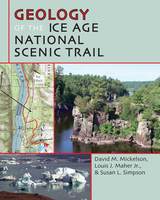
The Ice Age National Scenic Trail meanders across the state of Wisconsin through scenic glacial terrain dotted with lakes, steep hills, and long, narrow ridges. David M. Mickelson, Louis J. Maher Jr., and Susan L. Simpson bring this landscape to life and help readers understand what Ice Age Wisconsin was like. An overview of Wisconsin’s geology and key geological concepts helps readers understand geological processes, materials, and landforms. The authors detail geological features along each segment of the Ice Age Trail and at each of the nine National Ice Age Scientific Reserve sites.
Readers can experience the Ice Age Trail through more than one hundred full-color photographs, scores of beautiful maps, and helpful diagrams. Science briefs explain glacial features such as eskers, drumlins, and moraines. Geology of the Ice Age National Scenic Trail also includes detailed trail descriptions that are cross referenced with the science briefs to make it easy to find the geological terms used in the trail descriptions. Whatever your level of experience with hiking or knowledge of glaciers, this book will provide lively, informative, and revealing descriptions for a new understanding of the shape of the land beneath our feet.

Hauserman hikes the John Muir Trail through rainstorms and challenging climbs, explores the Tahoe Rim Trail on a fourteen-day excursion, and travels to Minnesota to conquer the Superior Hiking Trail, where he is inundated with bugs, faces drought, and is eerily alone on the trail with not a single other hiker in sight for days. Going It Alone combines his self-deprecating humor, what he identifies as “Stupid Tim Tricks,” and delightful descriptions of the natural surroundings.
Some might describe the wilderness as the middle of nowhere or as nothingness, but for Hauserman, it is everything. While his love for nature remains undaunted through these experiences, he also discovers that he has overly high expectations for his capabilities and that he cannot just wish his loneliness away. He eventually discovers that his long walks in the woods are less about hiking and more about learning how he wants to live his life.
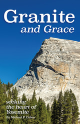
Drawing together the humanistic and scientific significance of the wild landscapes he traverses, Michael uncovers relationships between people and places and meaning and substance, rendering this text part memoir—but also considerably more. On-the-rock encounters by hand and foot open up a dialogue between the heart of a philosopher and the mind of a geologist. Michael adds a literary softness to this hard landscape, blending excursions with exposition and literature with science. It is through his graceful representations that the geological becomes metaphorical, while the science turns mythological.
This high country, where in 1889 John Muir and Robert Underwood Johnson planned what would become Yosemite National Park, is significant for cultural as well as natural reasons. Discoursing on everything from Camus’s “Myths of Sisyphus” to the poems of Gary Snyder, Michael adds depth to an already splendorous landscape. Premier early geologists, such as François Matthes, shaped the language of Yosemite’s landscape. Even though Yosemite has changed over half a century, the rock has not. As Michael explores the beauty and grace of his familiar towering vistas, he demonstrates why, of the many aspects of the world to which one might get attached, the most secure is granite.
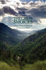
The new preface chronicles developments in the park since the book’s original publication in 2000. Over the past decade and a half, the park has experienced a dramatic and improbable improvement in air quality, a variety of successful animal reintroduction programs—including, most spectacularly, elk—numerous improvements to trails and roads, and the ending of long-standing dispute over the “Road to Nowhere,” which had its origins in the founding of the park eight decades ago. Pierce also points out new challenges that have emerged in the park—and there is none more dangerous than the invasive species known as the wooly adelgid, which threatens to annihilate the park’s 800 acres of old-growth hemlocks. The recent history of the Great Smoky Mountains National Park provides ample proof of Pierce’s conclusion: “just as people have the power to set aside places as wonderful as the Cataloochee Valley and the Great Smoky Mountains National Park, they also have the power to destroy it.”
Daniel S. Pierce is professor of history at the University of North Carolina, Asheville. He is the author of Real NASCAR: White Lightning, Red Clay, and Big Bill France, and Corn from a Jar: Moonshining in the Great Smoky Mountains.

Winner of the New Jersey Studies Academic Alliance Book Award for Non-fiction popular book
New Jersey is a state of surprises. Did you know there was a castle in Passaic County? Or that Essex County’s Branch Brook Park, rather than Washington, D.C., has the largest concentration of flowering cherry trees outside of Japan? Did you know you could walk through a bamboo forest on the Rutgers University campus, dig for fossils in Middletown’s Poricy Brook, visit an owl haven on the site of the Battle of Monmouth, or see wild river otters in Salem County?
Despite its proximity to major urban areas and its high population density, the state has dozens of absolutely marvelous natural areas and preserved spaces. It boasts something for everyone, from Atlantic seashore to rugged mountains, rolling farmland to winding canals, historic trails to formal gardens, bird-filled marshes to hardwood forests, pine barrens to fragrant vineyards and orchards. There are outings for hikers, bikers, beachcombers, gardeners, power-walkers, and strollers of all kinds, and A Guide to Green NewJersey is your key to finding it all.
The book is conveniently organized into forty geographic areas, spotlighting more than 200 nature walks. Each entry includes a description, visitor hours, fees, driving accessibility, and other pertinent information for walkers. At the end of the book, the authors provide an index with the names of each site, and their guide to choosing an outing according to individual tastes and interests. They identify sites that are wheelchair accessible, especially fun for kids, best for bicyclists, and those that are particularly physically challenging.
Newcomers to the state will find the book indispensable, and long-time New Jerseyans will find it a pleasantly eye-opening guide to wonderful walks right in their own backyards.
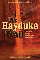
Joe Mitchell and Mike Coronella pioneered Hayduke after concluding that a long trail—such as the Appalachian or Pacific Crest— was possible on the Plateau, thus introducing more people to these unique and threatened public lands. The Hayduke Trail includes detailed maps of the entire route, suggested cache points, and a wealth of description and tips for tackling this intense undertaking.
Hiking the entire route requires at least three months, though like other long trails it can be broken into smaller segments. The guide, featured in the March 2005 issue of National Geographic Adventure Magazine, is designed for experienced desert trekkers seeking a thorough-hiking experience on a well-tested route.

The highpoints of the fifty states range from Alaska’s 20,310-foot-high Mount McKinley to 345 feet at Lakewood Park in Florida. Some highpoints, such as Mount Mitchell in North Carolina and New Hampshire’s Mount Washington, can be reached by car on a sightseeing drive. Others, including Colorado’s Mount Elbert or Mount Marcy in New York, are accessible as wilderness day hikes. Still others, such as Mount Rainier in Washington or Gannett Peak in Wyoming, are strenuous and risky mountaineering challenges that should be attempted only by experienced climbers. Whatever your level of skill and interest, these varied highpoints offer a diverse range of experiences.
The third edition of this classic guide updates route descriptions and maps, changes to private property ownership and public lands requirements, lists of guides and outfitters, and essential online resources. As with the two popular previous editions, Highpoints of the United States is arranged alphabetically by state, each site description accompanied with a map, photographs, information on trailhead, main and alternative routes, elevation gain, conditions, historical and natural history notes, and lists of potential guides or outfitters. Appendices include a list of highpoints by region and by elevation, useful resources, and a personal log for the unashamed “peak-bagger.”
Whether you’re an armchair hiker or a seasoned climber, interested only in your state’s highest point or all fifty, this book will be an invaluable companion and reference.

The highpoints of the fifty states range from Alaska’s 20,320 foot high Mount McKinley to 345 feet at Lakewood Park in Florida. Some highpoints, such as Mount Mitchell in North Carolina and New Hampshire’s Mount Washington can be reached by automobile on a sightseeing drive. Others such as Colorado’s Mount Elbert or Mount Marcy in New York are accessible as wilderness day hikes. Still others, such as Mount Rainier in Washington or Gannett Peak in Wyoming, are strenuous and risky mountaineering challenges that should be attempted only by experienced climbers. Whatever your level of skill and interest, Highpoints of the United States offers a diverse range of experiences.
Arranged alphabetically by state, each listing has a map, photographs, and information on trailhead, main and alternative routes, elevation gain, and conditions. Historical and natural history notes are also included, as are suggestions for specific guidebooks to a region or climb. Appendices include a list of highpoints by region, by elevation, and a personal log for the unashamed "peak-bagger."
Whether you’re an armchair hiker or a seasoned climber, interested only in your state’s highest point or all fifty, this book will be an invaluable companion and reference.

These are only five of the forty hiking trails described in Hikes Around Philadelphia. All are within an hour and a half's drive of the city. Ranging from 1.0 to 12.6 miles in length, they will take you through dense forests or wide-open meadows, past early farmsteads or a ringing boulder field from the last ice age. You can break your hike with a visit to a restored home or leave civilization behind on an isolated mountain ridge. Some of the trails are gravel or paved, or are canal towpaths, and are quite suitable for young children, older adults, or wheelchair hikers. Others are longer and more challenging, including rugged sections of the Appalachian Trail and the Horseshoe Trail.
For each hike Boyd Newman and Linda Newman provide a detailed write-up, a trail map showing the hike route on a USGS survey map, and directions to the trailhead. They also include information on distance, elevation, probable time, surface, interesting features, facililities, disability access, whether hunting is allowed in the vicinity, and availability to public transportation. This format allows you to browse through the book and easily locate the particular hike that appeals to you today.
In a concise introduction, the authors not only explain how to get the most out of the book but also give some hints on hiking safety and appropriate clothing and equipment.
This handy reference offers:
*a detailed write-up of each hike
*easy-to-read trail maps
*directions to the trail heads
*information that are accessible by public transportation
*details about handicap accessibility
*lots of other pointers that make planned or last-minute hikes fun and easy for everyone

The book features detailed maps; checklists of mammals, birds, and wildflowers; and valuable advice on safety, park rules and regulations, and accommodations. The trail descriptions include difficulty ratings, distance and time information, notes on accommodations and special considerations, and detailed mileage indicators to keep hikers informed of their progress and to clarify points of confusion. Also included is a handy chart designed for backpackers who wish to combine trails for longer excursions.
Strollers, hikers, and backpackers looking for a less-crowded alternative to the Great Smoky Mountains National Park will enjoy discovering this beautiful, rugged National Park service area. Only a ninety-minute drive northwest of Knoxville, the Big South Fork National River and Recreation Area is easily reached in half a day or less from Louisville, Nashville, Chattanooga, and Atlanta.
The Authors: Brenda G. Deaver is a park ranger at the Big South Fork National River and Recreation Area. Jo Anna Smith, a former ranger-historian with the National Park Service, now lives in Idaho with her husband, Steve. Howard Ray Duncan, a native of the Big South Fork area, has spent many years exploring the region. A former school teacher and principal, he has been a ranger at Big South Fork since 1985.
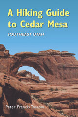
A Hiking Guide to Cedar Mesa describes sixty-three routes, ranging from quarter-mile walks to fifteen-mile day hikes, loops, and multi-day backpack trips. There is essential information on permits, weather, gear, road, trailhead access, geology, human history in the region, and leave-no-trace camping.
Care is given to name only those well-known archaeological sites that are visible or immediately accessible from roads. Throughout, the author emphasizes proper visitation protocol for fragile archaeological sites. He states, "I have been touched by this landscape and would prefer to keep its teachings and secrets to myself, but I cannot. The experience of the desert should be available to everyone with the motivation to encounter it."

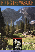
Northern Utah’s Wasatch Mountains are popular destinations for outdoor enthusiasts in every season. These mountains rise spectacularly from the relatively flat valley floor to thirteen peaks over 11,000 feet in elevation. An additional nineteen peaks rise more than 10,000 feet in elevation. Although many hiking guides exist for the Wasatch Mountains, there has been no guide book that focuses on the geologic features visible from the trails—until now.
Written by a recognized authority on the geology of the Wasatch Mountains, this guide is meant to enrich the experience of outdoor enthusiasts who want to understand the geological history and development of the Wasatch range. The first section of the book introduces the major geological time periods—the record of mountain building events from oldest to youngest, the effects of glaciation, and the development of the present topography. It then follows with a descriptive trail guide for each major trail system, including Mill Creek and Neffs Canyons, Mount Olympus, Little and Big Cottonwood Canyons, and Bells Canyon. Trail length, elevation gain, relative difficulty, and major geological features are outlined for each trail. Now you can hike these trails with the answers to all your geologic questions right at your fingertips.
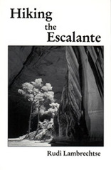
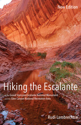
An invaluable resource to anyone traversing the Escalante, this comprehensive guide details 43 hikes.
Publisher's Note: Realizing there are virtually no marked trails in the Escalante country (mostly canyons that wander and have many intersections, challenging anyone to write explicit description), this book includes directions to the trailhead, how to follow a particular route with choices of side canyons along the way, and occasional alternate endings. Some of the hikes may be appropriate for beginners. Some only the most experienced should attempt.

Each chapter contains detailed directions, a hand-drawn map, suggestions for the optimal time and season to visit, and GPS coordinates to specific sites. Bringing fifteen years of experience as a leader of hikes, Steinberg leaves no part of the trip unplanned. He even suggests ideal conditions for the outing. An overcast day, for instance, sets up the haunted atmosphere appropriate for visiting a water tower in Mountainside, New Jersey, that has links to a murder-suicide in the 1970s.
For less experienced hikers, the guide also includes a chapter on equipment and safety, detailed instructions on how to program a hand-held Global Positioning System receiver, and a glossary of terms.
Both a practical guide and a creative chronicle, this book is bound to please hikers and history buffs alike.

Beginners will find detailed descriptions of easy hikes on well-maintained trails. Challenging routes to seldom-visited cirques and summits are suggested for the expert.
Maps, photos, and line drawings accompany the trail descriptions. Data tables list distances and hiking times. The geology, native plants, human history, and contemporary issues are discussed to aid in understanding these wonderful mountains.

breathtaking and rugged national parks. The second edition of this compellingly readable
and useful book is completely updated, giving outdoor enthusiasts the most current
information they need to explore this world-renowned wilderness.
Included here are facts on more than 125 official trails recognized by the Park Service.
Each one has its own setting, purpose, style, and theme, and author Kenneth Wise
describes them in rich and vivid detail. For every route, he includes a set of driving directions
to the trailhead, major points of interest, a schedule of distances to each one, a
comprehensive outline of the trail’s course, specifics about where it begins and ends, references
to the U.S. Geological Survey’s quadrangle maps, and, when available, historical
anecdotes relating to the trail. His colorful descriptions of the area’s awe-inspiring beauty
are sure to captivate even armchair travelers.
Organized by sections that roughly correspond to the seventeen major watersheds
in the Smokies, Wise starts in Tennessee and moves south into North Carolina, with
two major trails—the Lakeshore and the Appalachian—that traverse several watersheds
treated independently. Further enhancing the utility of this volume is the inclusion of the
Great Smoky Mountains’ official trail map as well as an informative introduction filled
with details about the geology, climate, vegetation, wildlife, human history, and environmental
concerns of the region.
A seasoned outdoorsman with more than thirty years of experience in the area and
codirector of the Great Smoky Mountains Regional Project at the University of Tennessee,
Knoxville, Wise brings an exceptional depth of knowledge to this guide. Both experienced
hikers and novices will find this newly revised edition an invaluable resource for trekking in
the splendor of the Smokies.

The Last Billion Years: A Geologic History of Tennessee is the first general overview in more than thirty years to interpret the state’s geological record. With minimal jargon, numerous illustrations and photographs, and a glossary of scientific terms, this volume provides the tools necessary for readers with little or no background in the subject to learn about the geologic formation of Tennessee, making it an excellent resource for high school students, college students, and interested general readers. Yet, because of the depth of its scholarship, the book is also an invaluable reference for professional geologists.
Recognizing that every reader is familiar with the roles of wind, water, gravity, and organisms in their everyday environment, author Don Byerly employs the Earth Systems Science approach, showing how the five interacting parts of the Earth—the geosphere, hydrosphere, atmosphere, biosphere, and cryosphere—have worked together for eons to generate the rock compositions that make up Tennessee’s geologic past.
All regions of the state are covered. Featuring a unique time chart that illustrates the state’s geologic history from east to west, The Last Billion Years shows that while the geologic aspects of the state’s three grand divisions are related in many ways, each division has a distinctly different background. The organization of the book further enhances its usability, allowing the reader to see and compare what was happening contemporaneously across the state during the key sequences of its geologic history. Written in a clear and engaging style, The Last Billion Years will have broad appeal to students, lay readers, and professionals.
In print for the first time in fifty years, Mount Le Conte is a reissue of the important 1966 self-published memoir by Paul J. Adams (1901–1985), a well-known Tennessee naturalist and the first custodian of the Smoky Mountain’s majestic summit in the years before the area was declared a national park.
Appointed custodian of Mount Le Conte in 1925 by the Great Smoky Mountains Conservation Association, Adams went to work immediately and spent a year making the camp suitable for overnight visitors. Mount Le Conte, a massive mile-high formation extending five miles from the main divide of the Great Smoky Mountains, with its rugged landscapes, rushing streams, and fecund forests, was considered a prime showplace in efforts to establish the Smokies as a national park.
In addition to an extensive introduction, the editors have augmented the original text of Mount Le Conte with several photographs and sketches gleaned from Adams’s personal papers, resulting in a fuller, more complete reconstruction of Adams’s role in establishing the camp that would later come to be known as Le Conte Lodge.
An important source on the fascinating history of Mount Le Conte in the pre-Park era, this book is a companion to the recently published Smoky Jack: The Adventures of a Dog and his Master on Mount Le Conte (University of Tennessee Press, 2016).


The North Country Trail is the longest of America’s eleven congressionally designated National Scenic Trails. Winding through seven states—New York, Pennsylvania, Ohio, Michigan, Wisconsin, Minnesota, and North Dakota—the NCT’s 4,600 miles attract more than one million visitors annually. These hikers are treated to a smorgasbord of Upper Midwest hiking featuring everything from urban strolls to backcountry adventure through mountains, rivers, prairies, and shoreline. This book is the definitive guide for NCT hikers—whether first-timers, seasoned backpackers, or any level in between—who wish to maximize their experience on this splendid trail.
In addition to a full overview of the trail’s tread in each state, the guide describes in detail forty of the NCT’s premier segments, with helpful information including easy-to-read trail descriptions, physical and navigation difficulties, trail highlights, hiking tips, and precise maps incorporating the latest GPS technology.

No other book on the Southern Appalachians is more widely known or cited.
"Awonderful book. I like it especially for its color and anecdotes. It is a classic, not only for its accuracy and breadth of insights into the people of the region, but because these people themselves are so interesting and strong."
—Annie Dillard, author of Pilgrim at Tinker Creek
Ron Strickland has spent a good deal of time walking. He hiked the 1200 miles of the Pacific Northwest Trail in 1983. In 2004, he completed the Pacific Crest Trail, with a 1500-mile hike from the Mojave Desert to the Columbia River. In 2009, he hiked the length of the New England Trail.
He has also held a longtime dream of showcasing the best hiking of the Rockies, Purcells, Okanogan, Cascades, Olympics, and Wilderness Coast. He spent years raising funds, recruiting volunteers, cutting brush, digging dirt, and lobbying landowners, officials, and politicians—and in 2009, the Pacific Northwest Trail, which runs from the Continental Divide to the Pacific Ocean, traversing three National Parks and seven National Forests, was finally declared a National Scenic Trail.
In this adventurous and moving memoir, Strickland—known in the backcountry as “Pathfinder”—shares his insider view of the joys and adventures of long-distance hiking. He intersperses colorful portraits of memorable trail characters and lush descriptions of hikes he knows firsthand. He also describes the experience of conceiving and establishing the Pacific Northwest Trail, detailing the setbacks and triumphs along the way.
Pathfinder offers the rich insights and experiences of a longtime hiker, inspiring readers to the wonder of hiking and the outdoors.
Whether you are an ardent hiker or prefer to enjoy the great outdoors from your living-room armchair, Jeffrey Perls has written the essential guidebook on one of the most majestic natural areas of the eastern United States-the Hudson River.
From the rugged topography of the Hudson Highlands Gorge to the crowded towers of Manhattan, the Hudson has been an inspiration for poets, writers, artists, and countless others who have enjoyed the many wonders of the river. The area surrounding the Hudson abounds in history. It’s played a pivotal part in our country's development, from its strategic role in the American Revolution to its heritage as the nation’s primary entry point for immigrants to this country. The river also supports an incredibly rich diversity of flora and fauna, from the bald eagle to the short-nosed sturgeon.
Perls brings together the culture, history, nature, and recreational activities along the Hudson River in one convenient guide book. He not only maps out walks and bike trails, both urban and rural, but also introduces readers to the landscape, geology, history, and culture of the Hudson Valley region. Perls provides a practical and geographically comprehensive guide to exploring the area on foot and by bike. The trail routes bring readers as close to the river as possible and guides them to rewarding vistas, nature preserves, and historic landmarks. It’s a useful guide for visitors to the Hudson region and local residents as it acquaints them to the natural treasures to be found in their own backyards.

Small farms once occupied the heights that John Elder calls home, but now only a few cellar holes and tumbled stone walls remain among the dense stands of maple, beech, and hemlocks on these Vermont hills. Reading the Mountains of Homeis a journey into these verdant reaches where in the last century humans tried their hand and where bear and moose now find shelter. As John Elder is our guide, so Robert Frost is Elder's companion, his great poem "Directive" seeing us through a landscape in which nature and literature, loss and recovery, are inextricably joined.
Over the course of a year, Elder takes us on his hikes through the forested uplands between South Mountain and North Mountain, reflecting on the forces of nature, from the descent of the glaciers to the rush of the New Haven River, that shaped a plateau for his village of Bristol; and on the human will that denuded and farmed and abandoned the mountains so many years ago. His forays wind through the flinty relics of nineteenth-century homesteads and Abenaki settlements, leading to meditations on both human failure and the possibility for deeper communion with the land and others.
An exploration of the body and soul of a place, an interpretive map of its natural and literary life, Reading the Mountains of Home strikes a moving balance between the pressures of civilization and the attraction of wilderness. It is a beautiful work of nature writing in which human nature finds its place, where the reader is invited to follow the last line of Frost's "Directive," to "Drink and be whole again beyond confusion."

Rim to River is the story of this extraordinary journey through redrock country, down canyons, up mesas, and across desert plains to the obscure valley in Mexico that gave the state its enigmatic name. The trek is interspersed with incisive essays that pick apart the distinctive cultural landscape of Arizona: the wine-colored pinnacles and complex spirituality of Navajoland, the mind-numbing stucco suburbs, desperate border crossings, legislative skullduggery, extreme politics, billion-dollar copper ventures, dehydrating rivers, retirement kingdoms, old-time foodways, ghosts of old wars, honky-tonk dreamers, murder mysteries, and magical Grand Canyon reveries.
In Rim to River, Zoellner does for Arizona what Larry McMurtry did for Texas in In a Narrow Grave and what Wallace Stegner did for Utah in Mormon Country: paint an enduring portrait of a misunderstood American state. An indictment, a love letter, and a homecoming story all at once.

This catalog documents a 2022 exhibition of original editorial illustrations commissioned by the University of Tennessee Libraries to complement the Chimney Tops 2 Wildfires Oral History Project. The four illustrators showcased here have strong ties to East Tennessee. Paige Braddock, author of the Eisner-nominated comic strip Jane’s World and Chief Creative Officer at Charles M. Schulz Creative Associates, is an ’85 UT alumna; Charlie Daniel, beloved Knoxville News Sentinel editorial illustrator, has been a Knoxville resident since 1958; Marshall Ramsey, syndicated editorial illustrator and Pulitzer nominee, is a ’91 UT alumnus; and professional illustrator Danny Wilson has been a visible part of Knoxville’s graphic landscape since graduating from UT in 1984. The artists were given access to the project’s digital archive of oral interviews—to date, 139 have been recorded—and were asked to respond creatively to what they heard and read.
The result is Rising from the Ashes, a candid and deeply felt collection of illustrations encapsulating accounts of the merciless firestorm that enveloped Sevier County in November 2016. The flexible medium of the editorial illustration shows itself capable of extended narrative, disquieting detail, and poignant synthesis, as well as moments of beauty, hope, horror, and even humor as it ushers viewers into the recollections of wrestling and sorrow that animate the project’s still expanding archive. Bales writes, “Ultimately, the multiple fires destroyed or damaged 2,500 homes and buildings, killed 14 trapped people, injured another 200 or more, and burned over 17,000 acres of mostly woodlands that were a powder keg of dried leaves, all in a matter of three hours.” Years later, the ramifications of this event are still being felt in the community and region. Rising from the Ashes is a tribute to a people who suffered, lost, banded together, and rebuilt; and no less important, it is an expression of solidarity, recognizing how much remains to be done.

Born in Bryson City, North Carolina, Jim Casada has had a long career as a teacher, author, and avid outdoorsman. He grew up in a time and place where families depended on the land and their community to survive. Many of the Smoky Mountain customs and practices that Casada reflects on are gradually disappearing or have vanished from our collective memories.
In A Smoky Mountain Boyhood, Casada pairs his gift for storytelling and his training as a historian to produce a highly readable memoir of mountain life in East Tennessee and western North Carolina. His stories evoke a strong sense of place and reflect richly on the traits that make the people of Southern Appalachia a unique American demographic. Casada discusses traditional folkways; hunting, growing, preparing, and eating wide varieties of food available in the mountain region; and the overall fabric of mountain life. Divided into four main sections—High Country Holiday Tales and Traditions; Seasons of the Smokies; Tools, Toys, and Boyhood Treasures; and Precious Memories—each part reflects on a unique and memorable coming-of-age in the Smokies.
Containing a strong sense of adventure, nostalgic tone, and well-paced prose, Casada’s memoir will be appreciated by those who yearn to rediscover the Smokies of their childhoods as well as those who wish to imaginatively climb these mountains for the first time.
“Want to know what wilderness means to people who live it for over two thousand miles? Then read this extremely interesting, informative, intelligent, and thoughtful book.” —Roger S. Gottlieb, author of Engaging Voices: Tales of Morality and Meaning in an Age of Global Warming
“There is no doubt that Bratton’s book will be of value to students and scholars of leisure studies, recreation, and religion. Those who are familiar with the Appalachian Trail sense intuitively that a journey along its length kindles spiritual awakening; this book provides the hard data to prove it’s true.” —David Brill, author of As Far as the Eye Can See: Reflections of an Appalachian Trail Hiker
The Appalachian Trail covers 2,180 miles, passing through fourteen states from Georgia to Maine. Each year, an estimated 2–3 million people visit the trail, and almost two thousand attempt a “thru-hike,” walking the entire distance of the path. For many, the journey transcends a mere walk in the woods and becomes a modern-day pilgrimage.
In The Spirit of the Appalachian Trail: Community, Environment, and Belief, Susan Power Bratton addresses the spiritual dimensions of hiking the Appalachian Trail (AT). Hikers often comment on how their experience as thru-hikers changes them spiritually forever, but this is the first study to evaluate these religious or quasireligious claims critically. Rather than ask if wilderness and outdoor recreation have benefits for the soul, this volume investigates specifically how long-distance walking might enhance both body and mind.
Most who are familiar with the AT sense intuitively that a trek along its length kindles spiritual awakening. Using both a quantitative and qualitative approach, this book provides the hard data to support this notion. Bratton bases her work on five sources: an exhaustive survey of long-distance AT hikers, published trail diaries and memoirs, hikers? own logs and postings, her own personal observations from many years on the trail, and conversations with numerous members of the AT community, including the “trail angels,” residents of small towns along the path who attend to hikers? need for food, shelter, or medical attention.
The abundant photographs reinforce the text and enable visualization of the cultural and natural context. This volume is fully indexed with extensive reference and notes sections and detailed appendixes. Written in an engaging and accessible style, The Spirit of the Appalachian Trail presents a full picture of the spirituality of the AT.
Susan Power Bratton is professor of environmental studies. She is the author of Six Billion and More: Human Population Regulation and Christian Ethics, Environmental Values in Christian Art, and Christianity, Wilderness, and Wildlife: The Original Desert Solitaire.
Frome's recent conversations with residents, new and old, along with a complement of historic and contemporary photographs, confirm the views stated in the book's original 1966 edition.
The author brings his knowledge, experience, and insights to bear on "one of God's special places." He suggests alternatives to commercial overdevelopment and the destruction of the Great Smokies' flora and fauna, citing recent cases such as the Tellico Dam project and the continuing pollution of the Pigeon River. Always emphasizing our inevitable relationship with our surroundings, Frome relates the story of the Great Smoky Mountains with respect and affection for the region, its people, and their history.
Michael Frome ranks among the foremost American authors on travel and conservation. His interests are closely associated with national parks, national forests, and natural beauty in the United States and other countries. He has been a columnist and correspondent for major newspapers and magazines and a university lecturer. He is author of Conscience of a Conservationist: Selected Essays.

In thirty-six thrilling days, Melanie Radzicki McManus hiked 1,100 miles around Wisconsin, landing her in the elite group of Ice Age Trail thru-hikers known as the Thousand-Milers. In prose that’s alternately harrowing and humorous, Thousand-Miler takes you with her through Wisconsin’s forests, prairies, wetlands, and farms, past the geologic wonders carved by long-ago glaciers, and into the neighborhood bars and gathering places of far-flung small towns. Follow along as she worries about wildlife encounters, wonders if her injured feet will ever recover, and searches for an elusive fellow hiker known as Papa Bear. Woven throughout her account are details of the history of the still-developing Ice Age Trail—one of just eleven National Scenic Trails—and helpful insight and strategies for undertaking a successful thru-hike.
In addition to chronicling McManus’s hike, Thousand-Miler also includes the little-told story of the Ice Age Trail’s first-ever thru-hiker Jim Staudacher, an account of the record-breaking thru-run of ultrarunner Jason Dorgan, the experiences of a young combat veteran who embarked on her thru-hike as a way to ease back into civilian life, and other fascinating tales from the trail. Their collective experiences shed light on the motivations of thru-hikers and the different ways hikers accomplish this impressive feat, providing an entertaining and informative read for outdoors enthusiasts of all levels.
Two generations have passed since the publication of Wilma Dykeman’s landmark environmental history, The French Broad. In Through the Mountains: The French Broad River and Time, John Ross updates that seminal book with groundbreaking new research. More than the story of a single river, Through the Mountains covers the entire watershed from its headwaters in North Carolina’s Blue Ridge and the Great Smoky Mountains to its mouth in Knoxville, Tennessee.
The French Broad watershed has faced new perils and seen new discoveries since 1955, when The French Broad was published. Geologists have learned that the Great Smoky Mountains are not among the world’s oldest as previously thought; climatologists and archaeologists have traced the dramatic effects of global warming and cooling on the flora, fauna, and human habitation in the watershed; and historians have deepened our understanding of enslaved peoples once thought not to be a part of the watershed’s history. Even further, this book documents how the French Broad and its tributaries were abused by industrialists, and how citizens fought to mitigate the pollution.
Through the Mountains also takes readers to notable historic places: the hidden mound just inside the gate of Biltmore where Native Americans celebrated the solstices; the once-secret radio telescope site above Rosman where NASA eavesdropped on Russian satellites; and the tiny hamlet of Gatlinburg where Phi Beta Phi opened its school for mountain women in 1912.
Wilma Dykeman once asked what the river had meant to the people who lived along it. In the close of Through the Mountains, Ross reframes that question: For 14,000 years the French Broad and its tributaries have nurtured human habitation. What must we start doing now to ensure it will continue to nourish future generations? Answering this question requires a knowledge of the French Broad’s history, an understanding of its contemporary importance, and a concern for the watershed’s sustainable future. Through the Mountains fulfills these three criteria, and, in many ways, presents the larger story of America’s freshwater habitats through the incredible history of the French Broad.
As a youth in Denver, Donald Mace Williams developed an affection for high mountain country. After a journalistic career spent mostly on flat lands, he set out to rediscover what was special about country above timberline. He hiked the high alpine in four of America's major ranges-the Rockies, Sierra Nevada, Cascades, and northern Appalachians-and in his narrative of his travels, he tells us what he saw and learned and who he met. Having visited some of these areas when younger, Williams compares his psychological and physical responses as an older man and how his ideas about how to treat the environment have evolved. A recurring theme is the compromises that people such as he make between the pull of mountains and freedom and the responsibilities of making a living in the lowlands. Mainly, he observes and experiences what is distinctive about the timberline environment.
Throughout his book, Williams gently informs readers regarding timberline history, nature, weather, and archaeology; high altitude physiology; and environmental concerns. Frequently, he recounts encounters with interesting and varied people he meets on the trails: a young British hiking companion who has come back to Colorado to repeat a climb on which, a year previously, his two fellow climbers died; a pilot who climbs isolated peaks in the Sierra Nevada in search of bouillon-can scrolls signed by famous early mountaineers; a "Literate Farmer" who pauses on a mountain trail in Vermont to discuss Robert Frost.
Donald Mace Williams is a retired journalist who has worked for such newspapers as The Wichita Eagle, Newsday, and the Fort Worth Star-Telegram. He has a Ph.D. in English from the University of Texas, has published one previous book (Interlude in Umbarger: Italian POWs and a Texas Church); poems in Western Humanities Review, Iron Horse Literary Review, and South Dakota Review; and a short story in Southwest Review. He now lives in Texas.

Eastern Massachusetts offers incredible trail-running opportunities, ranging from popular long-distance routes like the Bay Circuit Trail to lesser-known loops that run through the mountains and forests of the Quabbin watershed and Merrimack Valley region, and trails that pass alongside the shores of Cape Cod. All over the Bay State, there are trails suitable for runners of all levels waiting to be discovered and explored.
Avid trail runner Ben Kimball offers a selection of fifty-one of eastern Massachusetts’s most spectacular trail sites, including detailed trail descriptions, topographic maps, directions, parking information, safety tips, and much more. Both experienced and novice trail runners will find Trail Running Eastern Massachusetts to be an invaluable resource for exploring nature and getting a good workout, in the Boston area and beyond.

The wild and rural landscape of southern Vermont offers a true bounty of great trail-running opportunities, from out-and-back (or pointtopoint) runs on popular long-distance routes, such as segments of the Long Trail or Appalachian Trail, to quiet, little-known loops hidden away in the woods. This helpful guide is just the resource needed for trip planning or for a spontaneous run in a beautiful place.
Local expert trail runner Ben Kimball offers a range of suggested route options, sometimes even several at the same site, for runners of all skill levels. He also provides important practical information, such as the full distance of the suggested route; a difficulty rating; the trail style and type; the total ascent; and directions, along with a detailed description of the trail itself. There are also scannable codes for downloading trail maps to your smartphone. The trails included vary in difficulty and terrain type, and range from low elevations in the Connecticut River Valley to as high as 4,000 feet at Killington Peak in the Green Mountains. This indispensable book is the perfect companion for adventurous runners and hikers interested in exploring southern Vermont.
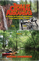
Trails of Central Arkansas delivers:
* Sixty trails in 36 parks or locations from Benton and Bryant to Cabot, from Wrightsville to Conway
* Color maps of every trail
* GPS coordinates for every trailhead
* Color-coded distinctions between paved and unpaved trails
* Level of difficulty ratings
* Scenery Scores
* Top-ten lists: Most Scenic, Trails for Kids, and Trails for Solitude


Now updated with a new preface that examines dramatic changes in his favorite hiking and camping area, the Great Smoky Mountains National Park, this classic adventure chronicle, which first appeared in 1996, launched the outdoor writing career of Johnny Molloy. The author of over sixty invaluable hiking, camping, and paddling guides to natural destinations all over the country, Molloy has turned irresistible enthusiasm for the great outdoors, evident in this book, into a profound career, dedicated to honoring and celebrating our greatest wild places—and helping others enjoy them as much as he has.
In fourteen lively personal essays, Johnny Molloy describes the adventures by which he came of age as a backpacker. Born a “flatlander” in Memphis, he first visited the Smokies while attending the University of Tennessee-Knoxville in the 1980s. Initially, he treated the park as a personal playground—a place to cut loose, break rules, and act irresponsibly. After many hiking excursions, however, he gained a more profound appreciation of the mountains, becoming an avid park volunteer intent on the protection and improvement of the area. He grew, as he puts it, both as an outdoor adventurer and as a human being.
Interwoven throughout these pieces is a wealth of Smoky Mountains lore and history along with dozens of tips for novice backpackers. Molloy’s stories encompass backpacking during all four seasons as well as accounts of solo hiking, off-trail hiking, and whitewater canoeing. Whether describing the hazards of crossing a stream in winter or what to do—and not to do—when one encounters a bear or a rattlesnake, Molloy writes with an infectious enthusiasm that will delight any lover of the outdoors.

With hopes of being listed in the Guinness Book of World Records, Jim led the first documented walk from the highest to lowest point in the contiguous United States in 1974. He lived, albeit just barely, to tell the tale to his daughter, sparking a desire in Withanee to retrace his steps in his honor. In 2017, she took on the incredible task of recreating Jim’s legacy trek of 131 miles with the help of divine intervention, ice-cold beer, and her parents, who were following along as the support party.
Walk of Ages humorously relates the parallel journey of an epic adventure told from two perspectives–a daughter’s difficult quest, and a father who supports her through it while recalling his own experiences from four decades earlier. Throughout this momentous odyssey, readers will realize how a once-in-a-generation adventure leads to life-changing transformation, and that the bond between father and daughter knows no bounds.

The most famous long-distance hiking trail in North America, the 2,181-mile Appalachian Trail—the longest hiking-only footpath in the world—runs along the Appalachian mountain range from Georgia to Maine. Every year about 2,000 individuals attempt to “thru-hike” the entire trail, a feat equivalent to hiking Mount Everest sixteen times. In Walking on the Wild Side, sociologist Kristi M. Fondren traces the stories of forty-six men and women who, for their own personal reasons, set out to conquer America’s most well known, and arguably most social, long-distance hiking trail.
In this fascinating in-depth study, Fondren shows how, once out on the trail, this unique subculture of hikers lives mostly in isolation, with their own way of acting, talking, and thinking; their own vocabulary; their own activities and interests; and their own conception of what is significant in life. They tend to be self-disciplined, have an unwavering trust in complete strangers, embrace a life of poverty, and reject modern-day institutions. The volume illuminates the intense social intimacy and bonding that forms among long-distance hikers as they collectively construct a long-distance hiker identity. Fondren describes how long-distance hikers develop a trail persona, underscoring how important a sense of place can be to our identity, and to our sense of who we are. Indeed, the author adds a new dimension to our understanding of the nature of identity in general.
Anyone who has hiked—or has ever dreamed of hiking—the Appalachian Trail will find this volume fascinating. Walking on the Wild Side captures a community for whom the trail is a sacred place, a place to which they have become attached, socially, emotionally, and spiritually.
A companion to the popular Walking Trails of Southern Wisconsin, this book describes more than 200 trails in 72 locations throughout five of the state's major regions. Bob Crawford provides maps and detailed instructions to make the trails easy to locate.
With each trail description you'll find:
* details about the route and terrain, as well as geographical, biological, or historical features of interest;
* regulations including open days and hours, and rules regarding dogs, trail bikes, cross-country skiing, and other activities;
* information about available restrooms, drinking water, nature centers, and other facilities at the site;
* a description assessing degree of difficulty—slope, width, maintenance, and other such factors—and a helpful rating of "walkability" on a scale from 1 to 5.
The only comprehensive guide to hiking locations in the eastern part of the state, this book also provides lists of trail locations that include playground equipment for kids and picnic facilities for those who want to make a day trip of their hiking outing. Appendices spotlight trails that boast historical significance, ice age features, picnic areas, and cross-country skiing opportunities.

This guide provides information on trailhead access, approaches, and routes for every 11,000-foot peak. It includes overview maps of major roads, topographical overview maps, and detailed route maps for each peak. There are also total roundtrip mileages, elevation-gain (or loss) figures, and alternate routes to help hikers plan their adventures.
Featured peaks include North Mount Nebo, South Mount Nebo, Middle Mount Nebo, Mount Timpanogos, 'South' Timpanogos, West American Fork Twin Peak, 'North' Timpanogos, 'South' American Fork Twin Peak, Unnamed 11,383, Unnamed 11,347, East Broads Fork Twin Peak, West Broads Fork Twin Peak, Pfeifferhorn, White Baldy, Sunrise Peak, Unnamed 11,288, Lone Peak, North Peak, Red Baldy, Red Top Mountain, South Thunder, North Thunder, Unnamed 11,137, Monte Cristo Peak, Dromedary Peak, Box Elder Peak, Mount Baldy, Provo Peak, Sugarloaf Mountain, 'East' Provo Peak, Mount Superior, and 'East' American Fork Twin Peak.
READERS
Browse our collection.
PUBLISHERS
See BiblioVault's publisher services.
STUDENT SERVICES
Files for college accessibility offices.
RECENTLY PUBLISHED


UChicago Accessibility Resources
home | accessibility | search | about | contact us
BiblioVault ® 2001 - 2024
The University of Chicago Press