
 A SCHOLARLY BOOK REPOSITORY
The paramount historian of the early Roman empire.
Tacitus (Cornelius), famous Roman historian, was born in AD 55, 56 or 57 and lived to about 120. He became an orator, married in 77 a daughter of Julius Agricola before Agricola went to Britain, was quaestor in 81 or 82, a senator under the Flavian emperors, and a praetor in 88. After four years’ absence he experienced the terrors of Emperor Domitian’s last years and turned to historical writing. He was a consul in 97. Close friend of the younger Pliny, with him he successfully prosecuted Marius Priscus.
Works: (i) Life and Character of Agricola, written in 97–98, specially interesting because of Agricola’s career in Britain. (ii) Germania (98–99), an equally important description of the geography, anthropology, products, institutions, and social life and the tribes of the Germans as known to the Romans. (iii) Dialogue on Oratory (Dialogus), of unknown date; a lively conversation about the decline of oratory and education. (iv) Histories (probably issued in parts from 105 onwards), a great work originally consisting of at least twelve books covering the period AD 69–96, but only Books 1–4 and part of Book 5 survive, dealing in detail with the dramatic years 69–70. (v) Annals, Tacitus’s other great work, originally covering the period AD 14–68 (Emperors Tiberius, Gaius, Claudius, Nero) and published between 115 and about 120. Of sixteen books at least, there survive Books 1–4 (covering the years 14–28); a bit of Book 5 and all Book 6 (31–37); part of Book 11 (from 47); Books 12–15 and part of Book 16 (to 66).
Tacitus is renowned for his development of a pregnant concise style, character study, and psychological analysis, and for the often terrible story which he brilliantly tells. As a historian of the early Roman empire he is paramount.
The Loeb Classical Library edition of Tacitus is in five volumes.
In Ancient Ocean Crossings: Reconsidering the Case for Contacts with the Pre-Columbian Americas, Stephen Jett encourages readers to reevaluate the common belief that there was no significant interchange between the chiefdoms and civilizations of Eurasia and Africa and peoples who occupied the alleged terra incognita beyond the great oceans.
More than a hundred centuries separate the time that Ice Age hunters are conventionally thought to have crossed a land bridge from Asia into North America and the arrival of Columbus in the Bahamas in 1492. Traditional belief has long held that earth’s two hemispheres were essentially cut off from one another as a result of the post-Pleistocene meltwater-fed rising oceans that covered that bridge. The oceans, along with arctic climates and daunting terrestrial distances, formed impermeable barriers to interhemispheric communication. This viewpoint implies that the cultures of the Old World and those of the Americas developed independently.
Drawing on abundant and concrete evidence to support his theory for significant pre-Columbian contacts, Jett suggests that many ancient peoples had both the seafaring capabilities and the motives to cross the oceans and, in fact, did so repeatedly and with great impact. His deep and broad work synthesizes information and ideas from archaeology, geography, linguistics, climatology, oceanography, ethnobotany, genetics, medicine, and the history of navigation and seafaring, making an innovative and persuasive multidisciplinary case for a new understanding of human societies and their diffuse but interconnected development.
One summer evening in 1918, a leopard wandered into the gardens of an Indian palace. Roused by the alarms of servants, the prince’s eldest son and his entourage rode elephant-back to find and shoot the intruder. An exciting but insignificant vignette of life under the British Raj, we may think. Yet to the participants, the hunt was laden with symbolism. Carefully choreographed according to royal protocols, recorded by scribes and commemorated by court artists, it was a potent display of regal dominion over men and beasts alike. Animal Kingdoms uncovers the far-reaching cultural, political, and environmental importance of hunting in colonial India.
Julie E. Hughes explores how Indian princes relied on their prowess as hunters to advance personal status and solidify power. Believing that men and animals developed similar characteristics by inhabiting a shared environment, they sought out quarry—fierce tigers, agile boar—with traits they hoped to cultivate in themselves. Largely debarred from military activities under the British, they also used the hunt to establish meaningful links with the historic battlefields and legendary deeds of their ancestors.
Hunting was not only a means of displaying masculinity and heroism, however. Indian rulers strove to present a picture of privileged ease, perched in luxuriously outfitted shooting boxes and accompanied by lavish retinues. Their interest in being sumptuously sovereign was crucial to elevating the prestige of prized game. Animal Kingdoms will inform historians of the subcontinent with new perspectives and captivate readers with descriptions of its magnificent landscapes and wildlife.
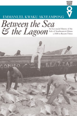
This study offers a “social interpretation of environmental process” for the coastal lowlands of southeastern Ghana. The Anlo-Ewe, sometimes hailed as the quintessential sea fishermen of the West African coast, are a previously non-maritime people who developed a maritime tradition. As a fishing community the Anlo have a strong attachment to their land. In the twentieth century coastal erosion has brought about a collapse of the balance between nature and culture. The Anlo have sought spiritual explanations but at the same time have responded politically by developing broader ties with Ewe-speaking peoples along the coast.
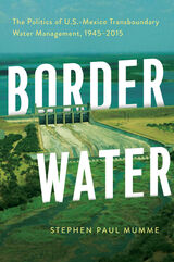
The international boundary between the United States and Mexico spans more than 1,900 miles. Along much of this international border, water is what separates one country from the other. Border Water provides a historical account of the development of governance related to transboundary and border water resources between the United States and Mexico in the last seventy years.
This work examines the phases and pivot points in the development of U.S.-Mexico border water resources and reviews the theoretical approaches and explanation that impart a better understanding of these events. Author Stephen Paul Mumme, a leading expert in water policy and border studies, describes three important periods in the chronology of transboundary water management. First, Mumme examines the 1944 Water Treaty, the establishment of the International Boundary and Water Commission (IBWC) in 1945, and early transborder politics between the two governments. Next, he describes the early 1970s and the rise of environmentalism. In this period, pollution and salinization of the Colorado River Delta come into focus. Mumme shows how new actors, now including environmentalists and municipalities, broadened and strengthened the treaty’s applications in transboundary water management. The third period of transborder interaction described covers the opening and restricting of borders due to NAFTA and then 9/11.
Border Water places transboundary water management in the frame of the larger binational relationship, offering a comprehensive history of transnational water management between the United States and Mexico. As we move into the next century of transnational water management, this important work offers critical insights into lessons learned and charts a path for the future.
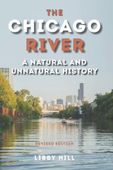
This widely acclaimed volume weaves the perspectives of science, engineering, commerce, politics, economics, and the natural world into a chronicle of the river from its earliest geologic history through its repeated adaptations to the city that grew up around it. While explaining the river’s role in massive public works, such as drainage and straightening, designed to address the infrastructure needs of a growing population, Hill focuses on the synergy between the river and the people of greater Chicago, whether they be the tribal cultures that occupied the land after glacial retreat, the first European inhabitants, or more recent residents.
In the first edition, Hill brought together years of original research and the contributions of dozens of experts to tell the Chicago River’s story up until 2000. This revised edition features discussions of disinfection, Asian carp, green strategies, the evolution of the Chicago Riverwalk, and the river’s rejuvenation. It also explores how earlier solutions to problems challenge today’s engineers, architects, environmentalists, and public policy agencies as they address contemporary issues.
Revealing the river to be a microcosm of the uneasy relationship between nature and civilization, The Chicago River offers the tools and knowledge for the city’s residents to be champions on the river’s behalf.
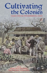
The essays collected in Cultivating the Colonies demonstrate how the relationship between colonial power and nature revealsthe nature of power. Each essay explores how colonial governments translated ideas about the management of exoticnature and foreign people into practice, and how they literally “got their hands dirty” in the business of empire.
The eleven essays include studies of animal husbandry in the Philippines, farming in Indochina, and indigenous medicine in India. They are global in scope, ranging from the Russian North to Mozambique, examining the consequences of colonialismon nature, including its impact on animals, fisheries, farmlands, medical practices, and even the diets of indigenouspeople.
Cultivating the Colonies establishes beyond all possible doubt the importance of the environment as a locus for studyingthe power of the colonial state.
Farming and pastoral societies inhabit ever-changing environments. This relationship between environment and rural culture, politics and economy in Tanzania is the subject of this volume which will be valuable in reopening debates on Tanzanian history.
In his conclusion, Isaria N. Kimambo, a founding father of Tanzanian history, reflects on the efforts of successive historians to strike a balance between external causes of change and local initiative in their interpretations of Tanzanian history.
He shows that nationalist and Marxist historians of Tanzanian history, understandably preoccupied through the first quarter-century of the country's post-colonial history with the impact of imperialism and capitalism on East Africa, tended to overlook the initiatives taken by rural societies to transform themselves.
Yet there is good reason for historians to think about the causes of change and innovation in the rural communities of Tanzania, because farming and pastoral people have constantly changed as they adjusted to shifting environmental conditions.
Histories of remote islands around Japan are usually told through the prism of territorial disputes. In contrast, Takahiro Yamamoto contends that the transformation of the islands from ambiguous border zones to a territorialized space emerged out of multilateral power relations. Sakhalin, the Kuril Islands, Tsushima, the Bonin Islands, and the Ryukyu Islands became the subject of inter-imperial negotiations during the formative years of modern Japan as empires nudged each other to secure their status with minimal costs rather than fighting a territorial scramble. Based on multiarchival, multilingual research, Demarcating Japan argues that the transformation of border islands should be understood as an interconnected process, where inter-local referencing played a key role in the outcome: Japan’s geographical expansion in the face of domineering Extra-Asian empires.
Underneath this multilateral process were the connections forged by individuals. Translators, doctors, traffickers, castaways, and indigenous hunters crisscrossed border regions and enacted violence, exchanged knowledge, and forged friendships. Although their motivations were eclectic and their interactions transcended national borders, the linkages they created were essential in driving territorialization forward. Demarcating Japan demonstrates the crucial role of nonstate actors in formulating a territory.
Antiquity’s original travel guide.
Pausanias, born probably in Lydia in Asia Minor, was a Greek of the second century AD, about 120–180, who traveled widely not only in Asia Minor, Palestine, Egypt, and North Africa, but also in Greece and in Italy, including Rome. He left a description of Greece in ten books, which is like a topographical guidebook or tour of Attica, the Peloponnese, and central Greece, filled out with historical accounts and events and digressions on facts and wonders of nature. His chief interest was in monuments of art and architecture, especially the most famous of them; the accuracy of his descriptions is proved by surviving remains.
The Loeb Classical Library edition of Pausanias is in five volumes; the fifth volume contains maps, plans, illustrations, and a general index.
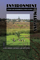
Environment at the Margins brings literary and environmental studies into a robust interdisciplinary dialogue, challenging dominant ideas about nature, conservation, and development in Africa and exploring alternative narratives offered by writers and environmental thinkers. The essays bring together scholarship in geography, anthropology, and environmental history with the study of African and colonial literatures and with literary modes of analysis. Contributors analyze writings by colonial administrators and literary authors, as well as by such prominent African activists and writers as Ngugi wa Thiong’o, Mia Couto, Nadine Gordimer, Wangari Maathai, J. M. Coetzee, Zakes Mda, and Ben Okri. These postcolonial ecocritical readings focus on dialogue not only among disciplines but also among different visions of African environments. In the process, Environment at the Margins posits the possibility of an ecocriticism that will challenge and move beyond marginalizing, limiting visions of an imaginary Africa.
Contributors:
Jane Carruthers
Mara Goldman
Amanda Hammar
Jonathan Highfield
David McDermott Hughes
Roderick P. Neumann
Rob Nixon
Anthony Vital
Laura Wright
Back by popular demand and new in paperback, this spirited collection of nearly twenty papers celebrates the 450th anniversary of Hernando de Soto’s epic expedition across the Southeast and West.
Originally presented at two symposia conducted by the University Museum at the University of Arkansas, the collection offers an array of viewpoints and diverse approaches to de Soto scholarship. Archaeologists, anthropologists, historians, museum curators, and folklorists all contribute to this lively debate on the Spanish explorer and his travels.
The book focuses on research that challenges traditional interpretation of de Soto’s entrada and travel route, particularly after the expedition crossed the Mississippi River. David H. Dye hypothesizes a route across the river and the alluvial plain by linking the narrative accounts with geography and archaeological knowledge. Phyllis A. Morse asserts that the Parkin site is the location of the capital of Casqui, one of the polities visited by de Soto. Charles M. Hudson repostulates his version of the expedition route, which in 1988 severely challenged the De Soto Commission theory of 1939. Ann M. Early redraws the trail in the uplands of the Ouachita Mountains And Frank E. Schambach tests the possibility that the expedition wandered through Caddoan territory in east Texas after de Soto’s death.
Several chapters examine the Native Americans whom de Soto and his expedition encountered in their journey; other contributions provide a fresh look at the chronicles of the expedition that have survived. What emerges is a redrawn map of de Soto’s exploration—and a deeper understanding of the impact of European contact on the New World.
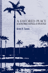
The wetlands of the San Juan Basin in Central Veracruz, Mexico, have been a favored place since the fifth century A.D., when Prehispanic people built an extensive network of canals and raised fields that allowed for almost year-round agriculture. Alfred Siemens' discovery of the remains of this network in the 1970s led him to uncover fifteen centuries of land-use history in the region. This book contains a full record of his findings.
Siemens organizes his history of the San Juan Basin around the question: What relationships exist between Prehispanic agriculture and the production systems of the tropical lowlands in our own time? This focus allows him to chart the changes in human perceptions and uses of the landscape, from the Prehispanic wetland agricultural system to the drained pastures of today's cattle ranches.
Amplified with air oblique photography, maps, and tables, and enriched with data from archaeology and colonial archives, this is an authoritative historical geography of a wetland landscape. Or, in the author's more modest words, "It seems to me that what I have here is a biography of a swamp."
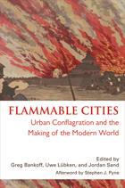
In most cities today, fire has been reduced to a sporadic and isolated threat. But throughout history the constant risk of fire has left a deep and lasting imprint on almost every dimension of urban society. This volume, the first truly global study of urban conflagration, shows how fire has shaped cities throughout the modern world, from Europe to the imperial colonies, major trade entrepôts, and non-European capitals, right up to such present-day megacities as Lagos and Jakarta. Urban fire may hinder commerce or even spur it; it may break down or reinforce barriers of race, class, and ethnicity; it may serve as a pretext for state violence or provide an opportunity for displays of state benevolence. As this volume demonstrates, the many and varied attempts to master, marginalize, or manipulate fire can turn a natural and human hazard into a highly useful social and political tool.
From Improvement to City Planning emphasizes the ways people in nineteenth-century America managed urban growth. Historian Henry Binford shows how efforts to improve space were entwined with the evolution of urban governance (i.e., regulation)—and also influenced by a small group of advantaged families.
Binford looks specifically at Cincinnati, Ohio, then the largest and most important interior city west of the Appalachian Mountains. He shows that it was not just industrialization, but also beliefs about morality, race, health, poverty, and “slum” environments, that demanded an improvement of urban space. As such, movements for public parks and large-scale sanitary engineering in the 1840s and ’50s initiated the beginning of modern city planning. However, there were limitations and consequences to these efforts..
Many Americans believed that remaking city environments could also remake citizens. From Improvement to City Planning examines how the experiences of city living in the early republic prompted city dwellers to think about and shape urban space.
The ecumene in prose.
Strabo (ca. 64 BC to ca. AD 25), an Asiatic Greek of Amasia in Pontus, studied at Nysa and after 44 BC at Rome. He became a keen traveler who saw a large part of Italy, various near eastern regions including the Black Sea, various parts of Asia Minor, Egypt as far as Ethiopia, and parts of Greece. He was a long time in Alexandria where he no doubt studied mathematics, astronomy, and history.
Strabo’s historical work is lost, but his most important Geography in seventeen books has survived. After two introductory books, numbers 3 and 4 deal with Spain and Gaul, 5 and 6 with Italy and Sicily, 7 with north and east Europe, 8–10 with Greek lands, 11–14 with the main regions of Asia and with Asia Minor, 15 with India and Iran, 16 with Assyria, Babylonia, Syria, and Arabia, 17 with Egypt and Africa. In outline he follows the great mathematical geographer Eratosthenes, but adds general descriptions of separate countries including physical, political, and historical details. A sequel to his historical memoirs, Geography is planned apparently for public servants rather than students—hence the accounts of physical features and of natural products. On the mathematical side it is an invaluable source of information about Eratosthenes, Hipparchus, and Posidonius.
The Loeb Classical Library edition of Strabo is in eight volumes.
Transference of orientalist images and identities to the American landscape and its inhabitants, especially in the West—in other words, portrayal of the West as the “Orient”—has been a common aspect of American cultural history. Place names, such as the Jordan River or Pyramid Lake, offer notable examples, but the imagery and its varied meanings are more widespread and significant. Understanding that range and significance, especially to the western part of the continent, means coming to terms with the complicated, nuanced ideas of the Orient and of the North American continent that European Americans brought to the West. Such complexity is what historical geographer Richard Francaviglia unravels in this book.
Since the publication of Edward Said’s book, Orientalism, the term has come to signify something one-dimensionally negative. In essence, the orientalist vision was an ethnocentric characterization of the peoples of Asia (and Africa and the “Near East”) as exotic, primitive “others” subject to conquest by the nations of Europe. That now well-established point, which expresses a postcolonial perspective, is critical, but Francaviglia suggest that it overlooks much variation and complexity in the views of historical actors and writers, many of whom thought of western places in terms of an idealized and romanticized Orient. It likewise neglects positive images and interpretations to focus on those of a decadent and ostensibly inferior East.
We cannot understand well or fully what the pervasive orientalism found in western cultural history meant, says Francaviglia, if we focus only on its role as an intellectual engine for European imperialism. It did play that role as well in the American West. One only need think about characterizations of American Indians as Bedouins of the Plains destined for displacement by a settled frontier. Other roles for orientalism, though, from romantic to commercial ones, were also widely in play. In Go East, Young Man, Francaviglia explores a broad range of orientalist images deployed in the context of European settlement of the American West, and he unfolds their multiple significances.
This inaugural volume in the Ohio University Press Series in Ecology and History is the paperback edition of Conrad Totman’s widely acclaimed study of Japan’s environmental policies over the centuries.
Professor Totman raises the critical question of how Japan’s steeply mountainous woodland has remained biologically healthy despite centuries of intensive exploitation by a dense human population that has always been dependent on wood and other forest products. Mindful that in global terms this has been a rare outcome, and one that bears directly on Japan’s recent experience as an affluent, industrial society, Totman examines the causes, forms, and effects of forest use and management in Japan during the millennium to 1870. He focuses mainly on the centuries after 1600 when the Japanese found themselves driven by their own excesses into programs of woodland protection and regenerative forestry.
For more than a century, the world has recognized the extraordinary biological diversity of the forests of Tanzania’s Usambara Mountains. As international attention has focused on forest conservation, farmers, foresters, biologists, and the Tanzanian state have realized that only complex negotiations will save these treasured, but rapidly disappearing, landscapes.
Highland Sanctuary unravels the complex interactions among agriculture, herding, forestry, the colonial state, and the landscape itself. In his examination of the region’s history of ecological transformation, Christopher Conte demonstrates how these forces have combined to create an ever-changing mosaic of forest and field. His study illuminates the debate over conservation, arguing that contingency and chance, the stuff of human history, have shaped forests in ways that rival the power of nature. In Highland Sanctuary, the forest becomes part of human history, rather than something outside of it.
Highland Sanctuary cuts through a legacy of contention and ill will to inform contemporary conservation initiatives. Professor Conte explains how ecological changes take divergent paths in similar environments, in this case on mountains that harbor unique flora and fauna, and how these mountain environments achieve international importance as centers of biodiversity.
Malaria is an infectious disease like no other: it is a dynamic force of nature and Africa’s most deadly and debilitating malady. James C. McCann tells the story of malaria in human, narrative terms and explains the history and ecology of the disease through the science of landscape change. All malaria is local. Instead of examining the disease at global or continental scale, McCann investigates malaria’s adaptation and persistence in a single region, Ethiopia, over time and at several contrasting sites.
Malaria has evolved along with humankind and has adapted to even modern-day technological efforts to eradicate it or to control its movement. Insecticides, such as DDT, drug prophylaxis, development of experimental vaccines, and even molecular-level genetic manipulation have proven to be only temporary fixes. The failure of each stand-alone solution suggests the necessity of a comprehensive ecological understanding of malaria, its transmission, and its persistence, one that accepts its complexity and its local dynamism as fundamental features.
The story of this disease in Ethiopia includes heroes, heroines, witches, spirits—and a very clever insect—as well as the efforts of scientists in entomology, agroecology, parasitology, and epidemiology. Ethiopia is an ideal case for studying the historical human culture of illness, the dynamism of nature’s disease ecology, and its complexity within malaria.
The Nazis created nature preserves, championed sustainable forestry, curbed air pollution, and designed the autobahn highway network as a way of bringing Germans closer to nature. How Green Were the Nazis?: Nature, Environment, and Nation in the Third Reich is the first book to examine the Third Reich's environmental policies and to offer an in-depth exploration of the intersections between brown ideologies and green practices.
Environmentalists and conservationists in Germany welcomed the rise of the Nazi regime with open arms and hoped that it would bring about legal and institutional changes. However, environmentalists soon realized that the rhetorical attention they received from the regime did not always translate into action. By the late 1930s, nature and the environment had become less pressing concerns as Nazi Germany prepared for and executed a global conflagration.
Based on prodigious archival research, and written by some of the most important scholars in the field of twentieth-century German history, How Green Were the Nazis? examines the overlap between Nazi ideology and conservationist agendas. This landmark book underscores the fact that the “green” policies of the Nazis were more than a mere episode or aberration in environmental history.
Contributors: Franz-Josef Brüggemeier, Mark Cioc, Thomas Zeller, Charles Closmann, Michael Imort, Thomas Lekan, Frank Uekötter, Gesine Gerhard, Thomas Rohkrämer, Mark Bassin, and Joachim Wolschke-Bulmahn.
This collaborative volume focuses on imagined geography and the relationships among power, knowledge, and space. A sequel to Imperial Geographies in Byzantine and Ottoman Space, Imagined Geographies in the Mediterranean, Middle East, and Beyond shares with its predecessor a strong focus on the role of empire and ideas of space viewed in inter-regional and interdisciplinary terms.
Both volumes bring together specialists on history, art history, literature, and theater studies, but the present volume covers an even wider geography than the first. In addition to the core provinces of Byzantium and the Ottoman Empire in the eastern Mediterranean and Middle East, it also includes connections between these regions and others further away—notably Iran, Inner Asia, and the Indian Ocean. The essays collected here suggest that the phenomenon of imagined geographies is essentially discursive in nature, since Self and Other may only be defined relative to one another.
Many students come to African history with a host of stereotypes that are not always easy to dislodge. One of the most common is that of Africa as safari grounds—as the land of expansive, unpopulated game reserves untouched by civilization and preserved in their original pristine state by the tireless efforts of contemporary conservationists. With prose that is elegant in its simplicity and analysis that is forceful and compelling, Jan Bender Shetler brings the landscape memory of the Serengeti to life. She demonstrates how the social identities of western Serengeti peoples are embedded in specific spaces and in their collective memories of those spaces. Using a new methodology to analyze precolonial oral traditions, Shetler identifies core spatial images and reevaluates them in their historical context through the use of archaeological, linguistic, ethnographic, ecological, and archival evidence. Imagining Serengeti is a lively environmental history that will ensure that we never look at images of the African landscape in quite the same way.
Once the grain basket for South Africa, much of Lesotho has become a scarred and degraded landscape. The nation’s spectacular erosion and gullying have concerned environmentalists and conservationists for more than half a century. In Imperial Gullies: Soil Erosion and Conservation in Lesotho, Kate B. Showers documents the truth behind this devastation.
Showers reconstructs the history of the landscape, beginning with a history of the soil. She concludes that Lesotho’s distinctive erosion chasms, called dongas—often cited as an example of destructive land-use practices by African farmers—actually were caused by colonial and postcolonial interventions. The residents of Lesotho emerge as victims of a failed technology. Their efforts to mitigate or resist implementation of destructive soil conservation engineering works were thwarted, and they were blamed for the consequences of policies promoted by international soil conservationists since the 1930s.
Imperial Gullies calls for an observational, experimental, and, most important, a fully consultative and participatory approach to address Lesotho’s serious contemporary problems of soil erosion. The first book to bring to center stage the historical practice of colonial soil science—and a cautionary tale of western science in unfamiliar terrain—it will interest a broad, interdisciplinary audience in African and environmental studies, social sciences, and history.
Indigenous knowledge has become a catchphrase in global struggles for environmental justice. Yet indigenous knowledges are often viewed, incorrectly, as pure and primordial cultural artifacts. This collection draws from African and North American cases to argue that the forms of knowledge identified as “indigenous” resulted from strategies to control environmental resources during and after colonial encounters.
At times indigenous knowledges represented a “middle ground” of intellectual exchanges between colonizers and colonized; elsewhere, indigenous knowledges were defined through conflict and struggle. The authors demonstrate how people claimed that their hybrid forms of knowledge were communal, religious, and traditional, as opposed to individualist, secular, and scientific, which they associated with European colonialism.
Indigenous Knowledge and the Environment offers comparative and transnational insights that disturb romantic views of unchanging indigenous knowledges in harmony with the environment. The result is a book that informs and complicates how indigenous knowledges can and should relate to environmental policy-making.
Contributors: David Bernstein, Derick Fay, Andrew H. Fisher, Karen Flint, David M. Gordon, Paul Kelton, Shepard Krech III, Joshua Reid, Parker Shipton, Lance van Sittert, Jacob Tropp, James L. A. Webb, Jr., Marsha Weisiger
John Cabot, Giovanni Caboto in his native Italian, led an expedition to the New World in 1497 on behalf of King Henry VII of England. He is considered the first European to explore North America since the Viking voyages five hundred years earlier. Although Cabot’s exact landfall on his first voyage is not known—it could have been Nova Scotia, Newfoundland, or even Maine—his claim for England to this territory countered the Spanish and Portuguese explorations to the south, and changed world history. Cabot made three roundtrips between Bristol, England, and North America, and later, his son Sebastian, made two similar voyages. John and Sebastian Cabot: The Discovery of North America by historian Sir Charles Raymond Beazley was first published in 1898. Its enduring value in addition to its lucid, well-balanced and researched narrative is the author’s detailed history of prior voyages to the North American continent, including those from China and the Pacific Islands as well as those from the realms of mythology. The author also includes all extant references to the Cabots in historical documents.
For a British Empire that stretched across much of the globe at the start of the nineteenth century, the interiors of Africa and Australia remained intriguing mysteries. The challenge of opening these continents to imperial influence fell to a proto-professional coterie of determined explorers. They sought knowledge, adventure, and fame, but often experienced confusion, fear, and failure. The Last Blank Spaces follows the arc of these explorations, from idea to practice, from intention to outcome, from myth to reality.
Those who conducted the hundreds of expeditions that probed Africa and Australia in the nineteenth century adopted a mode of scientific investigation that had been developed by previous generations of seaborne explorers. They likened the two continents to oceans, empty spaces that could be made truly knowable only by mapping, measuring, observing, and preserving. They found, however, that their survival and success depended less on this system of universal knowledge than it did on the local knowledge possessed by native peoples.
While explorers sought to advance the interests of Britain and its emigrant communities, Dane Kennedy discovers a more complex outcome: expeditions that failed ignominiously, explorers whose loyalties proved ambivalent or divided, and, above all, local states and peoples who diverted expeditions to serve their own purposes. The collisions, and occasional convergences, between British and indigenous values, interests, and modes of knowing the world are brought to the fore in this fresh and engaging study.
No book on the emergence of Los Angeles, today a metropolis of more than four million people, has been more influential or elusive than this volume by Anton Wagner. Originally published in German in 1935 as Los Angeles: Werden, Leben und Gestalt der Zweimillionenstadt in Südkalifornien, it is one of the earliest geographical investigations of a city understood as a series of layered landscapes. Wagner demonstrated that despite its geographical disadvantages, Los Angeles grew rapidly into a dominant urban region, bolstered by agriculture, real estate development, transportation infrastructure, tourism, the oil and automobile industries, and the film business. Although widely reviewed upon its initial publication, his book was largely forgotten until reintroduced by architectural historian Reyner Banham in his 1971 classic Los Angeles: The Architecture of Four Ecologies.
This definitive translation is annotated by Edward Dimendberg and preceded by his substantial introduction, which traces Wagner's biography and intellectual formation in 1930s Germany and contextualizes his work among that of other geographers. It is an essential work for students, scholars, and curious readers interested in urban geography and the rise of Los Angeles as a global metropolis.
“This fine new translation by Timothy Grundy of Anton Wagner's Los Angeles with Edward Dimendberg's lucidly probing introduction constitutes a major contribution to urban history and our understanding of one of the world's most enigmatic and significant cities.”
—Thomas S. Hines, Research Professor of History and Architecture and Urban Design, UCLA
“Edward Dimendberg has done a remarkable job bringing Anton Wagner's classic study of Los Angeles to a wider readership. This landmark publication will enable many strands of urban scholarship to enter into dialogue for the first time.”
—Matthew Gandy, Professor of Geography, University of Cambridge, and author of Natura Urbana: Ecological Constellations in Urban Space (2022)
“Anton Wagner was a prescient and troubling historical figure. Nearly a century ago, with his camera in hand, he walked Los Angeles in fervent exploration of metropolitan growth. This beautiful and expert book takes Wagner every bit as seriously as he took Los Angeles.”
—William Deverell, Director, Huntington-USC Institute on California and the West
"Anton Wagner’s geographic and ethnographic history of the urbanization of Los Angeles has long been unavailable to English-speaking readers. This early study, accompanied by Edward Dimendberg’s comprehensive introduction, will be of interest to all who, like Reyner Banham, admire its impressive scholarship and firsthand account of a city and ecology already in the throes of dynamic transformation."
—Joan Ockman, Vincent Scully Visiting Professor of Architectural History, Yale School of Architecture
"Encompassing copious photographs, insightful commentary, and thorough reconstruction of Wagner’s life and times, this new translation of Anton Wagner’s Los Angeles provides the missing link in scholarship about the metropolis during the early twentieth century. Its continuing relevance and controversial edge will appeal to urban researchers and college students beyond Southern California."
—Michael Dear, Professor Emeritus of City & Regional Planning, University of California, Berkeley
"Scholars of Los Angeles, or any city, must rejoice at this first proper English-language publication of Wagner's brilliant, if problematic, urban studies masterpiece. The edition is made accessible and relevant by Edward Dimendberg's indispensable prefatory material and contextualization."
—Roger Keil, Professor of Environmental and Urban Change, York University
“Finally translating this fascinating book into English fills an important gap in our historical knowledge of Los Angeles and its interpretation. Edward Dimendberg's invaluable introduction situates Anton Wagner in a comprehensive intellectual context. Of more than merely historical interest, this in-depth picture of Los Angeles in 1933 is essential reading for anyone interested in cities.”
—Margaret Crawford, Professor of Architecture, University of California, Berkeley
“This key text from 1935 for understanding Los Angeles urbanism is finally available in an excellent English translation by Timothy Grundy. Revelatory introductory essays by Anthony Vidler and Edward Dimendberg explain how German geographer (and later Nazi Party member) Anton Wagner was able to map and conceptualize the radical originality of this archetypal American metropolis in ways that deeply influenced Reyner Banham and so many subsequent writers on the city.”
—Robert Fishman, Taubman College of Architecture and Planning, University of Michigan
"Expertly annotated by Edward Dimendberg, Anton Wagner’s book on the growth of Los Angeles, which first appeared in German in 1935, is a landmark study in the history of urbanization. At the same time, it can be read as an example of transnational and comparative history, in which an observer from one country commented on developments in another. This volume will interest historians of the modern city, both in America and in Germany."
—Andrew Lees, Distinguished Professor of History Emeritus, Rutgers University
“Blending his wide knowledge and his acute wit, Edward Dimendberg has meticulously reconstructed the genesis of a forgotten doctoral thesis, which had remained unread for more than eighty years, despite its acknowledgement by Reyner Banham. This pioneering scholarly study of the Southern Californian metropolis is now available for the first time in English, inscribed with subtlety in both its German and its American contexts on the basis of thorough investigations.”
—Jean-Louis Cohen, Sheldon H. Solow Professor in the History of Architecture, Institute of Fine Arts, New York University
"This is the odyssey of a book written and published in 1930s Nazi Germany, forgotten after the war, and rediscovered by Reyner Banham in the ‘70s. Los Angeles is a seminal text of modern architectural history and confronts readers in the present with the paradox of an unknown classic.“
—Wolfgang Schivelbusch, author of The Railway Journey
“Finally, a translation of Anton Wagner’s Los Angeles, with extensive notes and a superb and deeply researched introduction by Edward Dimendberg, has arrived. It turns out that it was worth the wait. This volume is not only an important historic document, but a still-unrivaled portrait of a great city.”
—Robert Bruegmann, Distinguished Professor Emeritus of Art History, Architecture, and Urban Planning at the University of Illinois at Chicago and author of Sprawl: A Compact History
"Scholars of Los Angeles can rejoice that Anton Wagner’s legendary study of early 1930s Los Angeles is at last available in a masterful translation, with a luminous introduction by Edward Dimendberg that captures Wagner’s analytical brilliance as well as his troubling politics and racial views. An essential addition to any library of Southern California."
—Louis S. Warren, W. Turrentine Jackson Professor of Western U.S. History, University of California, Davis
“Anton Wagner’s study provides an invaluable and frequently perceptive window into the evolution of Los Angeles during the early twentieth century, showing how human agency transformed regional resources into a booming major city. The translation is immensely enhanced by Edward Dimendberg’s skillful provision of context, including fascinating intellectual history.”
—Stephen Bell, Professor of Geography and History, UCLA
"Los Angeles: The Development, Life, and Structure of the City of Two Million in Southern California has always had an elusive presence in the conversation about the explosive growth of the Southern California metropolis at the beginning of the twentieth century: an arcane text known to exist, but only accessible to very few. This expert first translation in English almost ninety years after it originally appeared in German is prefaced by a complex and engaging introduction by Edward Dimendberg that situates the original study in a multidisciplinary conversation. It elucidates the many ways this landmark essay on Los Angeles’s urban geography was not only filtered into subsequent scholarship on the city—Reyner Banham’s iconic Los Angeles: The Architecture of Four Ecologies in particular—but also how it resonates with contemporary debates about cities as complex social organisms. This book will be essential reading not only for historians of Los Angeles but for those interested in the theorization of the modern metropolis more broadly. That the volume editor addresses Wagner’s problematic views on race and territorial conquest front and center, within their historic context, only adds to the significance of this undertaking."
—Martino Stierli, The Philip Johnson Chief Curator of Architecture and Design, The Museum of Modern Art, New York
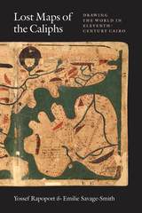
Lost Maps of the Caliphs provides the first general overview of The Book of Curiosities and the unique insight it offers into medieval Islamic thought. Opening with an account of the remarkable discovery of the manuscript and its purchase by the Bodleian Library, the authors use The Book of Curiosities to re-evaluate the development of astrology, geography, and cartography in the first four centuries of Islam. Their account assesses the transmission of Late Antique geography to the Islamic world, unearths the logic behind abstract maritime diagrams, and considers the palaces and walls that dominate medieval Islamic plans of towns and ports. Early astronomical maps and drawings demonstrate the medieval understanding of the structure of the cosmos and illustrate the pervasive assumption that almost any visible celestial event had an effect upon life on Earth. Lost Maps of the Caliphs also reconsiders the history of global communication networks at the turn of the previous millennium. It shows the Fatimid Empire, and its capital Cairo, as a global maritime power, with tentacles spanning from the eastern Mediterranean to the Indus Valley and the East African coast.
As Lost Maps of the Caliphs makes clear, not only is The Book of Curiosities one of the greatest achievements of medieval mapmaking, it is also a remarkable contribution to the story of Islamic civilization that opens an unexpected window to the medieval Islamic view of the world.
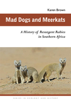
Through the ages, rabies has exemplified the danger of diseases that transfer from wild animals to humans and their domestic stock. In South Africa, rabies has been on the rise since the latter part of the twentieth century despite the availability of postexposure vaccines and regular inoculation campaigns for dogs.
In Mad Dogs and Meerkats: A History of Resurgent Rabies in Southern Africa, Karen Brown links the increase of rabies to the HIV/AIDS epidemic. Her study shows that the most afflicted regions of South Africa have seen a dangerous rise in feral dog populations as people lack the education, means, or will to care for their pets or take them to inoculation centers. Most victims are poor black children. Ineffective disease control, which in part depends on management policies in neighboring states and the diminished medical and veterinary infrastructures in Zimbabwe, has exacerbated the problem.
This highly readable book is the first study of rabies in Africa, tracing its history in South Africa and neighboring states from 1800 to the present and showing how environmental and economic changes brought about by European colonialism and global trade have had long-term effects.
Mad Dogs and Meerkats is recommended for public health policy makers and anyone interested in human-animal relations and how societies and governments have reacted to one of the world’s most feared diseases.
How was frontier expansion rationalized in the Americas during the late nineteenth century? As new states fleshed out expanded national maps, how did they represent their advances? Were there any distinct pan-American patterns? The renowned anthropologist and human rights advocate David Maybury-Lewis saw the Latin American frontiers as relatively unknown physical spaces as well as unexplored academic “territory.” He invited eight specialists to explore public narratives of the expansion of Argentina, Brazil, Chile, and the western regions of Canada and the United States during the late nineteenth century, a time when those who then identified as “Americans” claimed territories in which indigenous peoples, who were now seen as economic and political obstacles, lived. The authors examine the narrative forms that stirred or rationalized expansion, and emphasize their impact on the native residents.
The authors illustrate the variety and the similarities of these nationalist ideas and experiences, which were generally expressed in symbolic and cultural terms rather than on simple materialist or essentialist grounds. The cases also point out that civic nationalism, often seem as inclusive and more benign than ethnic nationalism, can produce similarly destructive human and cultural ends. The essays thus suggest a view of nationalism as a theoretical concept, and of frontier expansion as a historical phenomenon.
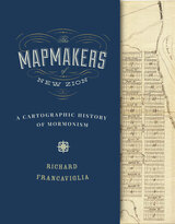
From their earliest days on the American frontier through their growth into a worldwide church, the spatially expansive Mormons made maps to help them create idealized communities, migrate to and colonize large parts of the American West, visualize the stories in their sacred texts, and spread their message internationally through a well-organized missionary system. This book identifies many Mormon mapmakers who played an important but heretofore unsung role in charting the course of Latter-day Saint history. For Mormons, maps had and continue to have both practical and spiritual significance. In addition to using maps to help build their new Zion and to explore the Intermountain West, Latter-day Saint mapmakers used them to depict locations and events described in the Book of Mormon.
Featuring over one hundred historical maps reproduced in full color—many never before published—The Mapmakers of New Zion sheds new light on Mormonism and takes readers on a fascinating journey through maps as both historical documents and touchstones of faith.
Winner of the Southwest Book Design and Production Award from the New Mexico Book Association.
Selected as one of the American Library Association's Best of the Best from University Presses.
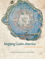
For many, a map is nothing more than a tool used to determine the location or distribution of something—a country, a city, or a natural resource. But maps reveal much more: to really read a map means to examine what it shows and what it doesn’t, and to ask who made it, why, and for whom. The contributors to this new volume ask these sorts of questions about maps of Latin America, and in doing so illuminate the ways cartography has helped to shape this region from the Rio Grande to Patagonia.
In Mapping Latin America,Jordana Dym and Karl Offen bring together scholars from a wide range of disciplines to examine and interpret more than five centuries of Latin American maps.Individual chapters take on maps of every size and scale and from a wide variety of mapmakers—from the hand-drawn maps of Native Americans, to those by famed explorers such as Alexander von Humboldt, to those produced in today’s newspapers and magazines for the general public. The maps collected here, and the interpretations that accompany them, provide an excellent source to help readers better understand how Latin American countries, regions, provinces, and municipalities came to be defined, measured, organized, occupied, settled, disputed, and understood—that is, how they came to have specific meanings to specific people at specific moments in time.
The first book to deal with the broad sweep of mapping activities across Latin America, this lavishly illustrated volume will be required reading for students and scholars of geography and Latin American history, and anyone interested in understanding the significance of maps in human cultures and societies.
In more recent decades, historians have pieced together a story that is not only more likely but more complicated and interesting. Patrick Jung synthesizes the research about Nicolet and his superior Samuel de Champlain, whose diplomatic goals in the region are crucial to understanding this much misunderstood journey across the Great Lakes. Additionally, historical details about Franco-Indian relations and the search for the Northwest Passage provide a framework for understanding Nicolet’s famed mission.
Is Italy il bel paese—the beautiful country—where tourists spend their vacations looking for art, history, and scenery? Or is it a land whose beauty has been cursed by humanity’s greed and nature’s cruelty? The answer is largely a matter of narrative and the narrator’s vision of Italy. The fifteen essays in Nature and History in Modern Italy investigate that nation’s long experience in managing domesxadtixadcated rather than wild natures and offer insight into these conflicting visions. Italians shaped their land in the most literal sense, producing the landscape, sculpting its heritage, embedding memory in nature, and rendering the two different visions inseparxadable. The interplay of Italy’s rich human history and its dramatic natural diversity is a subject with broad appeal to a wide range of readers.
“The New Berlin is a notable contribution to human geography and to the interdisciplinary literature on social memory and place making. Till’s methods and scholarship have provided the conceptual groundwork for the exploration and development of place making, social memory, and spatial haunting through the particular practices and politics of the new Berlin. Her readable style is marked by a narrative economy in which every word and sentence serves the larger purposes of the book. I recommend this book to anyone—student, scholar, or practitioner—who is interested in the social dynamics of memory formation and place making.” —The Professional Geographer
“This book is a well-written ‘first-hand’ account, though it also thoroughly covers academic literature, contemporary news accounts, and archival records.” —German Studies Review
“Karen E. Till's The New Berlin describes the modern metropolis and the ghosts of the past that it has to deal with.” —German World
“Well illustrated and copiously footnoted, this is a cutting-edge study of the power of identity-construction/analysis. Highly recommended.” —CHOICE
Throughout history, human societies have been organized preeminently as territories—politically bounded regions whose borders define the jurisdiction of laws and the movement of peoples. At a time when the technologies of globalization are eroding barriers to communication, transportation, and trade, Once Within Borders explores the fitful evolution of territorial organization as a worldwide practice of human societies. Master historian Charles S. Maier tracks the epochal changes that have defined territories over five centuries and draws attention to ideas and technologies that contribute to territoriality’s remarkable resilience.
Territorial boundaries transform geography into history by providing a framework for organizing political and economic life. But properties of territory—their meanings and applications—have changed considerably across space and time. In the West, modern territoriality developed in tandem with ideas of sovereignty in the seventeenth century. Sovereign rulers took steps to fortify their borders, map and privatize the land, and centralize their sway over the populations and resources within their domain. The arrival of railroads and the telegraph enabled territorial expansion at home and abroad as well as the extension of control over large spaces. By the late nineteenth century, the extent of a nation’s territory had become an index of its power, with overseas colonial possessions augmenting prestige and wealth and redefining territoriality.
Turning to the geopolitical crises of the twentieth century, Maier pays close attention to our present moment, asking in what ways modern nations and economies still live within borders and to what degree our societies have moved toward a post-territiorial world.
The study begins with the French Creole settlement at Old Ste. Genevieve in the middle of the eighteenth century. It describes the movement of the French into the Ozark hills during the rest of that century and continues with that of the American immigrants into Upper Louisiana after 1796, ending with the Americanization of the district after the Louisiana Purchase. Walter Schroeder examines the cultural transition from a French society, operating under a Spanish administration, to an American society in which French, Indians, and Africans formed minorities.
Schroeder used thousands of French- and Spanish-language documents, including the Archives of the Indies in Seville, Spain, as well as documents from Ste. Genevieve and St. Louis to gather his information. He also utilized thousands of land records from the American period, including deeds of land sales and sales from the public domain, and plats from both the Spanish and American periods. In addition, Schroeder performed years of fieldwork and perused aerial photography of the area, interviewing residents and searching for vestiges of the past in the landscape.
As the only study to deal with the cradle of Missouri and the first trans-Mississippi expansion of the Anglo-American frontier, Opening the Ozarks will be invaluable to anyone interested in America’s geographical history, particularly that of Missouri.
Francaviglia looks anew at the geographical-historical context of the driving of the golden spike in May 1869. He gazes outward from the site of the transcontinental railroad's completion—the summit of a remote mountain range that extends south into the Great Salt Lake. The transportation corridor that for the first time linked America's coasts gave this distinctive region significance, but it anchored two centuries of human activity linked to the area's landscape.
Francaviglia brings to that larger story a geographer's perspective on place and society, a railroad enthusiast's knowledge of trains, a cartographic historian's understanding of the knowledge and experience embedded in maps, and a desert lover's appreciation of the striking basin-and-range landscape that borders the Great Salt Lake.
The Partition of Ireland in 1921, which established Northern Ireland and saw it incorporated into the United Kingdom, sparked immediate civil war and a century of unrest. Today, the Partition remains the single most contentious issue in Irish politics, but its origins—how and why the British divided the island—remain obscured by decades of ensuing struggle.
Cutting through the partisan divide, Partition takes readers back to the first days of the twentieth century to uncover the concerns at the heart of the original conflict. Drawing on extensive primary research, Ivan Gibbons reveals how the idea to divide Ireland came about and gained popular support as well as why its implementation proved so controversial and left a century of troubles in its wake.
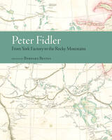
The two journals—“From York Factory to Buckingham House” and “From Buckingham House to the Rocky Mountains”—detail Fidler’s travels over a period of nine months. They include remarks on fur trade history, organization of the inland brigade, three distinct geographical regions, and the daily life of a Plains nation. Belyea’s introduction and ample notes provide insight into the way geographic, specifically cartographic, information was noted in the journals, with additional information on industry trading techniques, traders’ economic decisions, broad changes in regional social and economic conditions, and interactions with indigenous peoples.
Fidler’s journals are an exceptional record of the fur trade’s western expansion and the daily life of a Plains nation at the height of its power and prosperity. With its rich analysis of primary source documents and painstaking reproduction of historical trade routes, Peter Fidler: From York Factory to the Rocky Mountains will be of great value to students and scholars in the fields of fur trade studies, cartography, travel literature, and Canadian history, as well as general readers interested in westward expansion, exploration, commerce, and indigenous-colonial relations.
Incorporating social history and contemporary scholarship in his narrative, Abbott examines current metropolitan character and issues, giving close attention to historical background. He explores the context of opportunities and problems that have helped to shape the rich mosaic that is Portland.
This revised and updated second edition includes greater attention to the Indigenous peoples of the Portland region, Portland’s communities of color, and the challenges of recent years that have thrust Portland into the national spotlight.
A highly readable character study of a city, and enhanced by more than sixty historic and contemporary images, Portland in Three Centuries will appeal to readers interested in Portland, in Oregon, and in Pacific Northwest history.
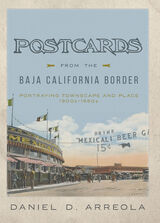
This form of place study calls attention to how we can see a past through a serial view of places, by the nature of repetition, and the photographing of the same place over and over again. Arreola draws our focus to townscapes, or built landscapes, of four border towns—Tijuana, Mexicali, Tecate, and Algodones—during the first half of the twentieth century. With an emphasis on the tourist’s view of these places, this book creates a vivid picture of what life was like for tourists and residents of these towns in the early and mid-twentieth century. Postcards from the Baja California Border is a rich and fascinating experience, one that takes you on a time-travel journey through border town histories and geographies while celebrating the visual intrigue of postcards.
In 1482, the Florentine humanist and statesman Francesco Berlinghieri produced the Geographia, a book of over one hundred folio leaves describing the world in Italian verse, inspired by the ancient Greek geography of Ptolemy. The poem, divided into seven books (one for each day of the week the author “travels” the known world), is interleaved with lavishly engraved maps to accompany readers on this journey.
Sean Roberts demonstrates that the Geographia represents the moment of transition between printing and manuscript culture, while forming a critical base for the rise of modern cartography. Simultaneously, the use of the Geographia as a diplomatic gift from Florence to the Ottoman Empire tells another story. This exchange expands our understanding of Mediterranean politics, European perceptions of the Ottomans, and Ottoman interest in mapping and print. The envoy to the Sultan represented the aspirations of the Florentine state, which chose not to bestow some other highly valued good, such as the city’s renowned textiles, but instead the best example of what Florentine visual, material, and intellectual culture had to offer.
Tales of deforestation and desertification in North Africa have been told from the Roman period to the present. Such stories of environmental decline in the Maghreb are still recounted by experts and are widely accepted without question today. International organizations such as the United Nations frequently invoke these inaccurate stories to justify environmental conservation and development projects in the arid and semiarid lands in North Africa and around the Mediterranean basin. Recent research in arid lands ecology and new paleoecological evidence, however, do not support many claims of deforestation, overgrazing, and desertification in this region.
Diana K. Davis’s pioneering analysis reveals the critical influence of French scientists and administrators who established much of the purported scientific basis of these stories during the colonial period in Algeria, Morocco, and Tunisia, illustrating the key role of environmental narratives in imperial expansion. The processes set in place by the use of this narrative not only systematically disadvantaged the majority of North Africans but also led to profound changes in the landscape, some of which produced the land degradation that continues to plague the Maghreb today.
Resurrecting the Granary of Rome exposes many of the political, economic, and ideological goals of the French colonial project in these arid lands and the resulting definition of desertification that continues to inform global environmental and development projects. The first book on the environmental history of the Maghreb, this volume reframes much conventional thinking about the North African environment. Davis’s book is essential reading for those interested in global environmental history.
The journal kept by Schoolcraft as he traveled ninety days in the rugged terrain of southern Missouri and northern Arkansas was originally published in 1821 and has become an essential record of Ozark territorial society and natural history documenting some of the earliest American settlers in the region, the power and beauty of many lost portions of the White River, the majesty of the open prairies, and the wealth of wildlife once found in the Ozarks.
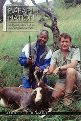
Safari Nation opens new lines of inquiry in the study of national parks in Africa and the rest of the world. The Kruger National Park is South Africa’s most iconic nature reserve, renowned for its rich flora and fauna. According to author Jacob Dlamini, there is another side to the park, a social history neglected by scholars and popular writers alike in which blacks (meaning Africans, Coloureds, and Indians) occupy center stage. Safari Nation details the ways in which black people devoted energies to conservation and to the park over the course of the twentieth century—engagement that transcends the stock (black) figure of the laborer and the poacher.
By exploring the complex and dynamic ways in which blacks of varying class, racial, religious, and social backgrounds related to the Kruger National Park, and with the help of previously unseen archival photographs, Dlamini’s narrative also sheds new light on how and why Africa’s national parks—often derided by scholars as colonial impositions—survived the end of white rule on the continent. Relying on oral histories, photographs, and archival research, Safari Nation engages both with African historiography and with ongoing debates about the “land question,” democracy, and citizenship in South Africa.
The explosion of interest in African environmental history has stimulated research and writing on a wide range of issues facing many African nations.
This collection represents some of the finest studies to date. The general topics include African environmental ideas and practices; colonial science, the state and African responses; and settlers and Africans' culture and nature. The contributors are Emmanuel Kreike, Karen Middleton, Innocent Pikirayi, Terence Ranger, JoAnn McGregor, Helen Tilley, Grace Garswell, John McCracken, Ingrid Yngstrom, David Bunn, Sandra Swart, Robert J. Gordon, and Jane Carruthers.
Histories of ancient Rome have long emphasized the ways in which the empire assimilated the societies it conquered, bringing civilization to the supposed barbarians. Yet interpretations of this “Romanization” of Western Europe tend to erase local identities and traditions from the historical picture, leaving us with an incomplete understanding of the diverse cultures that flourished in the provinces far from Rome.
The Sons of Remus recaptures the experiences, memories, and discourses of the societies that made up the variegated patchwork fabric of the western provinces of the Roman Empire. Focusing on Gaul and Spain, Andrew Johnston explores how the inhabitants of these provinces, though they willingly adopted certain Roman customs and recognized imperial authority, never became exclusively Roman. Their self-representations in literature, inscriptions, and visual art reflect identities rooted in a sense of belonging to indigenous communities. Provincials performed shifting roles for different audiences, rehearsing traditions at home while subverting Roman stereotypes of druids and rustics abroad.
Deriving keen insights from ancient sources—travelers’ records, myths and hero cults, timekeeping systems, genealogies, monuments—Johnston shows how the communities of Gaul and Spain balanced their local identities with their status as Roman subjects, as they preserved a cultural memory of their pre-Roman past and wove their own narratives into Roman mythology. The Romans saw themselves as the heirs of Romulus, the legendary founder of the eternal city; from the other brother, the provincials of the west received a complicated inheritance, which shaped the history of the sons of Remus.
Spain and the Plains introduces and documents Spanish exploration of and migration to the Plains, examines the myths that shaped Spanish exploration and the pragmatic realities of exploration and settlement, and documents racism and misrepresentation that Hispanic groups encountered in the nineteenth and twentieth centuries. Contributors show how early explorers, shaped by the intellectual context of the Renaissance, sought mythical locales: the fountain of youth, the straits of Anian, and the city of Quivira. They describe how exploration shifted to emphasize military and economic gains in the eighteenth and nineteenth centuries. Essays portray the diaspora of Spanish settlers and reconstruct daily life in their settlements on the Plains.
This unique collection paints a clear picture of a crucial but often misrepresented and neglected era in American and Spanish history.
The editors, all authors of previous books, are affiliated with the Center for Great Plains Studies at the University of Nebraska-Lincoln, where Frances W. Kaye is a professor of English, John R. Wunder is a professor of history and journalism, and Ralph H. Vigil is a professor emeritus of history and ethnic studies. Contributors include Félix D. Almaráz Jr., Thomas E. Chávez, Frances W. Kaye, Russell M. Magnaghi, Ralph H. Vigil, Waldo R. Wedel, and John R. Wunder.
Identifying discrete geographical areas in order to better understand a conflict that moves across hundreds of thousands of square miles of land and water, such as the American Civil War and World War II, has been a valuable historical method. During this time of greater study of the war that made America, the authors of Theaters of the American Revolution take this approach for the first time. The result is a stimulating volume that will allow readers to see how the war flowed from region to region from 1775 to 1781, beginning in the Northern colonies and Canada, through the dark months in the Middle colonies, to a shift to the South and culmination at Yorktown. Simultaneously, the war raged up and down the western frontier, with the Patriots working to keep the British and their Indian allies from disrupting the main battle armies to the east. Equally important was the war at sea, where American privateers and a fledgling navy attempted to harass the British; but with the entrance of France to the conflict, the control of the sea took a much more balanced—and important— aspect. With specially commissioned maps and colorful descriptions of eighteenth century American terrain, settlements, and cities, as well as key battles, Theaters of the American Revolution provides an ideal introduction to understanding one of the most important wars in world history in its totality.
Contents
Introduction • James Kirby Martin and David L. Preston
The Northern Theater • James Kirby Martin
The Middle Theater • Edward G. Lengel and Mark Edward Lender
The Southern Theater • Jim Piecuch
The Western Theater • Mark Edward Lender
The Naval Theater • Charles Neimeyer
An interdisciplinary environmental humanities volume that explores human-environment relationships on our permanently polluted planet.
While toxicity and pollution are ever present in modern daily life, politicians, juridical systems, media outlets, scholars, and the public alike show great difficulty in detecting, defining, monitoring, or generally coming to terms with them. This volume’s contributors argue that the source of this difficulty lies in the struggle to make sense of the intersecting temporal and spatial scales working on the human and more-than-human body, while continuing to acknowledge race, class, and gender in terms of global environmental justice and social inequality.
The term toxic timescapes refers to this intricate intersectionality of time, space, and bodies in relation to toxic exposure. As a tool of analysis, it unpacks linear understandings of time and explores how harmful substances permeate temporal and physical space as both event and process. It equips scholars with new ways of creating data and conceptualizing the past, present, and future presence and possible effects of harmful substances and provides a theoretical framework for new environmental narratives. To think in terms of toxic timescapes is to radically shift our understanding of toxicants in the complex web of life.
Toxicity, pollution, and modes of exposure are never static; therefore, dose, timing, velocity, mixture, frequency, and chronology matter as much as the geographic location and societal position of those exposed. Together, these factors create a specific toxic timescape that lies at the heart of each contributor’s narrative. Contributors from the disciplines of history, human geography, science and technology studies, philosophy, and political ecology come together to demonstrate the complex reality of a toxic existence. Their case studies span the globe as they observe the intersection of multiple times and spaces at such diverse locations as former battlefields in Vietnam, aging nuclear-weapon storage facilities in Greenland, waste deposits in southern Italy, chemical facilities along the Gulf of Mexico, and coral-breeding laboratories across the world.
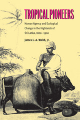
In 1800, the highlands of Sri Lanka had some of the most biologically diverse primary tropical rainforest ecosystems in the world. By 1900, only a few craggy corners and mountain caps had been spared the fire stick. Highland villagers, through the extension of slash-and-burn agriculture, and British managers, through the creation of plantations—first of coffee, then cinchona, and finally tea—had removed virtually the entire primary forest cover.
Tropical Pioneers documents the conversion of a tropical rainforest biome and the collision between what previously had been more discrete ecological zones within South Asia. The ecological impacts were transformational. Author James L. A. Webb, Jr., demonstrates that profound ecological disruption occurred in the central highlands of Sri Lanka during the nineteenth century and suggests that the theme of ecological crisis brought about by the integration of tropical ecological zones during precolonial and colonial periods alike is an important one for historians to investigate elsewhere.
Tropical Pioneers is based on extensive research in the National Archives of Sri Lanka, the National Agricultural Library at Gannaruwa, the Library of the Royal Asiatic Society-Ceylon Branch, the Royal Botanic Gardens at Kew, the Public Record Office of the United Kingdom, and the British Library.
Despite Chicago's location beside the world’s largest source of fresh water, its low elevation at the end of Lake Michigan provided no natural method of carrying away waste. As a result, within a few years of its founding, Chicago began to choke on its own sewage collecting near the shore. The befouled environment, giving rise to outbreaks of sickness and cholera, became so acute that even the ravages and costs of the U.S. Civil War did not distract city leaders from taking action.
Chesbrough's solution was an unprecedented tunnel five feet in diameter lined with brick and dug sixty feet beneath Lake Michigan. Construction began from the shore as well as the tunnel’s terminus in the lake. With workers laboring in shifts and with clay carted away by donkeys, the lake and shore teams met under the lake three years later, just inches out of alignment. When it opened in March 1867, observers, city planners, and grateful citizens hailed the tunnel as the "wonder of America and of the world."
Benjamin Sells narrates in vivid detail the exceptional skill and imagination it took to save this storied city from itself. A wealth of fascinating appendixes round out Sells’s account, which will delight those interested in Chicago history, water resources, and the history of technology and engineering.
From the Renaissance to the Enlightenment, the geopolitical placement of Ukraine drew the attention of some of Europe’s most influential cartographers. Many of these maps, including ones of exceptional rarity, were collected by the Ukrainian scholar and journalist Bohdan Krawciw.
Krawciw traced the physical and aesthetic depiction of Ukraine across its changing borders as a means of self-recognition and as a cultural and political history of the contested nation and its peoples. Of special interest are his maps of Ukraine from the nineteenth and twentieth centuries, at the crossroads of four empires: Habsburg, Ottoman, Russian, and Soviet.
As part of his personal archive, Krawciw’s maps were bequeathed to Harvard University upon his death in 1975. This book serves as both a catalog of his collection and a description of how the maps he collected serve as an invaluable source for Ukraine’s history and a symbol of Ukrainian national identity. The book contains nearly 100 examples from the collection, many in full color, as well as indices listing maps by cartographer and by place name.
Across the world, people are implementing promising new practices—from transforming abandoned public spaces and setting up community co-operatives, to rewilding urban nature and powering up civic energy. Paul Chatterton explores how these grassroots experiments harness the creative power of the collective to transform our city systems, from transportation, energy, and economy, to community, democracy, and nature. Imagining radical alternatives—such as car-free, post-carbon, “bio cities”—this is a toolkit for realizing a better urban future.
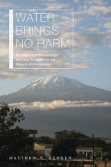
In Water Brings No Harm, Matthew V. Bender explores the history of community water management on Mount Kilimanjaro in Tanzania. Kilimanjaro’s Chagga-speaking peoples have long managed water by employing diverse knowledge: hydrological, technological, social, cultural, and political. Since the 1850s, they have encountered groups from beyond the mountain—colonial officials, missionaries, settlers, the independent Tanzanian state, development agencies, and climate scientists—who have understood water differently. Drawing on the concept of waterscapes—a term that describes how people “see” water, and how physical water resources intersect with their own beliefs, needs, and expectations—Bender argues that water conflicts should be understood as struggles between competing forms of knowledge.
Water Brings No Harm encourages readers to think about the origins and interpretation of knowledge and development in Africa and the global south. It also speaks to the current global water crisis, proposing a new model for approaching sustainable water development worldwide.
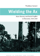
Forests have been at the fault lines of contact between African peasant communities in the Tanzanian coastal hinterland and outsiders for almost two centuries. In recent decades, a global call for biodiversity preservation has been the main challenge to Tanzanians and their forests.
Thaddeus Sunseri uses the lens of forest history to explore some of the most profound transformations in Tanzania from the nineteenth century to the present. He explores anticolonial rebellions, the world wars, the depression, the Cold War, oil shocks, and nationalism through their intersections with and impacts on Tanzania’s coastal forests and woodlands. In Wielding the Ax, forest history becomes a microcosm of the origins, nature, and demise of colonial rule in East Africa and of the first fitful decades of independence.
Wielding the Ax is a story of changing constellations of power over forests, beginning with African chiefs and forest spirits, both known as “ax–wielders,” and ending with international conservation experts who wield scientific knowledge as a means to controlling forest access. The modern international concern over tropical deforestation cannot be understood without an awareness of the long–term history of these forest struggles.
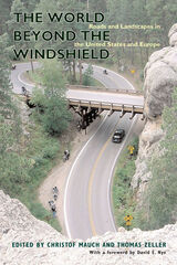
For better or worse, the view through a car’s windshield has redefined how we see the world around us. In some cases, such as the American parkway, the view from the road was the be-all and end-all of the highway; in others, such as the Italian autostrada, the view of a fast, efficient transportation machine celebrating either Fascism or its absence was the goal. These varied environments are neither necessary nor accidental but the outcomes of historical negotiations, and whether we abhor them or take delight in them, they have become part of the fabric of human existence.
The World beyond the Windshield: Roads and Landscapes in the United States and Europe is the first systematic, comparative look at these landscapes. By looking at examples from the United States and Europe, the chapters in this volume explore the relationship between the road and the landscape thatit traverses, cuts through, defines, despoils, and enhances. The authors analyze the Washington Beltway and the Blue Ridge Parkway, as well as iconic roads in Italy, Nazi Germany, East Germany, and Great Britain. This is a story of the transatlantic exchange of ideas about environment and technology and of the national and nationalistic appropriations of such landscaping.
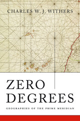
Space and time on earth are regulated by the prime meridian, 0°, which is, by convention, based at the Royal Observatory, Greenwich. But the meridian’s location in southeast London is not a simple legacy of Britain’s imperial past. Before the nineteenth century, more than twenty-five different prime meridians were in use around the world, including Paris, Beijing, Greenwich, Washington, and the location traditional in Europe since Ptolemy, the Canary Islands. Charles Withers explains how the choice of Greenwich to mark 0° longitude solved complex problems of global measurement that had engaged geographers, astronomers, and mariners since ancient times.
Withers guides readers through the navigation and astronomy associated with diverse meridians and explains the problems that these cartographic lines both solved and created. He shows that as science and commerce became more global and as railway and telegraph networks tied the world closer together, the multiplicity of prime meridians led to ever greater confusion in the coordination of time and the geographical division of space. After a series of international scientific meetings, notably the 1884 International Meridian Conference in Washington, DC, Greenwich emerged as the most pragmatic choice for a global prime meridian, though not unanimously or without acrimony. Even after 1884, other prime meridians remained in use for decades.
As Zero Degrees shows, geographies of the prime meridian are a testament to the power of maps, the challenges of accurate measurement on a global scale, and the role of scientific authority in creating the modern world.
READERS
Browse our collection.
PUBLISHERS
See BiblioVault's publisher services.
STUDENT SERVICES
Files for college accessibility offices.
RECENTLY PUBLISHED


UChicago Accessibility Resources
home | accessibility | search | about | contact us
BiblioVault ® 2001 - 2024
The University of Chicago Press