
 A SCHOLARLY BOOK REPOSITORY
Many fundamental studies of the origins of states have built upon landscape data, but an overall study of the Near Eastern landscape itself has never been attempted. Spanning thousands of years of history, the ancient Near East presents a bewildering range of landscapes, the understanding of which can greatly enhance our ability to infer past political and social systems.
Tony Wilkinson now shows that throughout the Holocene humans altered the Near Eastern environment so thoroughly that the land has become a human artifact, albeit one that retains the power to shape human societies. In this trailblazing book—the first to describe and explain the development of the Near Eastern landscape using archaeological data—Wilkinson identifies specific landscape signatures for various regions and periods, from the early stages of complex societies in the fifth to sixth millennium B.C. to the close of the Early Islamic period around the tenth century A.D.
From Bronze Age city-states to colonized steppes, these signature landscapes of irrigation systems, tells, and other features changed through time along with changes in social, economic, political, and environmental conditions. By weaving together the record of the human landscape with evidence of settlement, the environment, and social and economic conditions, Wilkinson provides a holistic view of the ancient Near East that complements archaeological excavations, cuneiform texts, and other conventional sources.
Through this overview, culled from thirty years' research, Wilkinson establishes a new framework for understanding the economic and physical infrastructure of the region. By describing the basic attributes of the ancient cultural landscape and placing their development within the context of a dynamic environment, he breaks new ground in landscape archaeology and offers a new context for understanding the ancient Near East.
Hewsen has divided the maps into five sections, each of which begins with a chronology of important dates and a historical introduction to the period. Specialized maps include Ptolemy's second-century map of Armenia, as well as maps of Roman, Cilician, Ottoman, tsarist, and Soviet Armenia. Other maps show the Persian khanate of Erevan, the Caucasian campaigns of World War I, the Armenian Genocide, the Armenian monuments in Turkey and Transcaucasia, the worldwide diaspora, ground plans of selected cities, and plans of the great monastery of Echmiadzin in 1660, 1890, and 1990. The atlas concludes with maps portraying the Karabagh war and the new Armenian Republic, and an extensive bibliography compiles references to the vast historical, ethnological, and travel literature on the region.
The first comprehensive and authoritative atlas of any of the former Soviet republics, this book does not treat Armenia in isolation, but instead sets it within the context of Caucasia as a whole, providing detailed information on neighboring regions such as Georgia and Azerbaijan. Armenia: A Historical Atlas will be an essential reference and an important teaching tool for generations to come.
Asia Inside Out reveals the dynamic forces that have historically linked regions of the world’s largest continent, stretching from Japan and Korea to the South China Sea, the Indian Ocean, and the Middle East. Connected Places, the second installment in this pioneering three-volume survey, highlights the transregional flows of goods, ideas, and people across natural and political boundaries—sea routes, delta ecologies, and mountain passes, ports and oasis towns, imperial capitals and postmodern cities. It challenges the conventional idea that defines geopolitical regions as land-based, state-centered, and possessing linear histories.
Exploring themes of maritime connections, mobile landscapes, and spatial movements, the authors examine significant sites of linkage and disjuncture from the early modern period to the present. Readers discover how eighteenth-century pirates shaped the interregional networks of Vietnam’s Tonkin Gulf, how Kashmiri merchants provided intelligence of remote Himalayan territories to competing empires, and how for centuries a vibrant trade in horses and elephants fueled the Indian Ocean economy. Other topics investigated include cultural formations in the Pearl River delta, global trade in Chittagong’s transformation, gendered homemaking among mobile Samurai families, border zones in Qing China and contemporary Burma, colonial spaces linking India and Mesopotamia, transnational marriages in Oman’s immigrant populations, new cultural spaces in Korean pop, and the unexpected adoption of the Latin script by ethnically Chinese Muslims in Central Asia.
Connected Places shows the constant fluctuations over many centuries in the making of Asian territories and illustrates the confluence of factors in the historical construction of place and space.
Edited by historian Nancy S. Seasholes, this landmark volume captures all aspects of Boston’s past in a series of fifty-seven stunning full-color spreads. Each section features newly created thematic maps that focus on moments and topics in that history. These maps are accompanied by hundreds of historical and contemporary illustrations and explanatory text from historians and other expert contributors. They illuminate a wide range of topics including Boston’s physical and economic development, changing demography, and social and cultural life. In lavishly produced detail, The Atlas of Boston History offers a vivid, refreshing perspective on the development of this iconic American city.
Contributors
Robert J. Allison, Robert Charles Anderson, John Avault, Joseph Bagley, Charles Bahne, Laurie Baise, J. L. Bell, Rebekah Bryer, Aubrey Butts, Benjamin L. Carp, Amy D. Finstein, Gerald Gamm, Richard Garver, Katherine Grandjean, Michelle Granshaw, James Green, Dean Grodzins, Karl Haglund, Ruth-Ann M. Harris, Arthur Krim, Stephanie Kruel, Kerima M. Lewis, Noam Maggor, Dane A. Morrison, James C. O’Connell, Mark Peterson, Marshall Pontrelli, Gayle Sawtelle, Nancy S. Seasholes, Reed Ueda, Lawrence J. Vale, Jim Vrabel, Sam Bass Warner, Jay Wickersham, and Susan Wilson
This dazzling book takes us on a voyage of discovery around the world at the turn of the last millennium, when for the first time the world was in essence a unity. Islam bridged Eurasia, western Europe, and North Africa. Vikings, with links to Scandinavia and Russia, had just arrived in North America. These and other peoples reached out to create links and put isolated cultures unwittingly in touch. John Man vividly captures these epochal events, and depicts the colorful peoples that defined the world’s mix of stability and change, of isolation and contact. In an immensely learned portrayal, he traces enduring cultural strands that became part of the world as we know it today.
In text, maps, and pictures, most in color, and drawing on the expertise of two dozen consultants, John Man has created a concise compendium of all the major cultures of the lost millennial world of 1000. In some cultures—Europe, Islam, China, and Japan—written records contain a vast range of materials, often revealing sharply focused details of life and personality. Here lie startling contrasts with today’s world, and even foreshadowing of the future that are equally astonishing in their familiarity. For nonliterate cultures—in the United States, Southeast Asia, Polynesia, Africa—this book draws on a wealth of archeological research, some of it made available to nonspecialists for the first time.

Nevertheless, the three-century journey to get to this point had been anything but predictable. The United States’ rise as a regional power was very much conditioned by constantly shifting transcontinental, transpacific, and above all transatlantic factors, all of which influenced North America’s three interactive cultural spheres: the Indigenous, the Hispano, and the Anglo. And while the United States profoundly shaped the history of Canada and Mexico, so, too, did these two transcontinental countries likewise shape the course of U.S. history.
In this ground-breaking work, Kevin Fernlund shows us that any society’s social development is directly related to its own social power and, just as crucially, to the protective extension or destructive intrusion of the social power of other societies.
capitalist transformation, Anne Kelly Knowles traces a community of
Welsh immigrants to Jackson and Gallia counties in southern Ohio. After
reconstructing the gradual process of community-building, Knowles
focuses on the pivotal moment when the immigrants became involved with
the industrialization of their new region as workers and investors in
Welsh-owned charcoal iron companies. Setting the southern Ohio Welsh in
the context of Welsh immigration as a whole from 1795 to 1850, Knowles
explores how these strict Calvinists responded to the moral dilemmas
posed by leaving their native land and experiencing economic success in
the United States.
Knowles draws on a wide variety of sources, including obituaries and
community histories, to reconstruct the personal histories of over 1,700
immigrants. The resulting account will find appreciative readers not
only among historical geographers, but also among American economic
historians and historians of religion.
Renowned geographer John C. Hudson leaves no aspect unexplored in this ambitious and peerless book. Beginning with an overview of metropolitan Chicago, Hudson describes how the city has served as a model to social scientists and examines its unique neighborhoods and communities from the perspectives of Chicagoans themselves. A thorough description of the physical geography of the region introduces a series of studies in historical geography that consider the origins of the city and its early development through to its present state, paying particular attention to race, ethnicity, and suburbanization, as well as commuting patterns, neighborhood change, and patterns of income distribution. Chicago concludes with a comparison of the balanced geography that prevailed in the early twentieth century with the skewed pattern of sectoral imbalances that exists today.
Supplemented with more than one hundred maps that illustrate the evolution of Chicago over time and sixty-four black-and-white and color photographs that capture iconic images of the city’s landscapes and its people, Chicago beautifully synthesizes the city’s social and economic strata with geographical features to provide an authoritative guide to modern Chicagoland.
The dramatic story of Christianity from its origins to the present day, told through more than one hundred stunning color maps.
With over two billion practicing believers today, Christianity has taken root in almost all parts of the globe. Its impact on Europe and the Americas in particular has been fundamental. Through more than one hundred beautiful color maps and illustrations, Christianity traces the history of the religion, beginning with the world of Jesus Christ. From the consolidation of the first Christian empire—Constantine’s Rome—to the early Christian states that thrived in Ireland, Ethiopia, and other regions of the Roman periphery, Christianity quickly proved dynamic and adaptable.
After centuries of dissemination, strife, dogmatic division, and warfare in its European and Near Eastern heartland, Christianity conquered new worlds. In North America, immigrants fleeing persecution and intolerance rejected the established Church, and in time revivalist religions flourished and spread. Missionaries took the Christian message to Latin America, Africa, and Asia, bringing millions of new converts into the fold.
Christianity has served as the inspiration for some of the world’s finest monuments, literature, art, and architecture, while also playing a major role in world politics and history, including conquest, colonization, conflict, and liberation. Despite challenges in the modern world from atheism and secularism, from scandals and internal divisions, Christianity continues to spread its message through new technologies while drawing on a deep well of history and tradition.
With its dignified courthouse set among shade trees and lawns dotted with monuments to prominent citizens and fallen veterans, the courthouse square remains the civic center in a majority of the county seats of Texas. Yet the squares themselves vary in form and layout, reflecting the different town-planning traditions that settlers brought from Europe, Mexico, and the United States. In fact, one way to trace settlement patterns and ethnic dispersion in Texas is by mapping the different types of courthouse squares.
This book offers the first complete inventory of Texas courthouse squares, drawn from extensive archival research and site visits to 139 of the 254 county seats. Robert Veselka classifies every existing plan by type and origin, including patterns and variants not previously identified. He also explores the social and symbolic functions of these plans as he discusses the historical and modern uses of the squares. He draws interesting new conclusions about why the courthouse square remains the hub of commercial and civic activity in the smaller county seats, when it has lost its prominence in others.
From the Bronze Age to the twenty-first century, vying armies have clashed over the territory stretching from the Upper Nile to modern-day Iraq and Iran. Crossroads of War captures five millennia of conflict and conquest in detailed full-color maps, accompanied by incisive, accessible commentary.
The lands of the Middle East were home to a succession of empires—Egyptian, Babylonian, Assyrian, and Persian—that rose and declined with the fortunes of battle. Kings and generals renowned in history bestrode the region: Nebuchadnezzar, David, Alexander the Great, Saladin, Napoleon. The religions of Zoroastrianism, Judaism, Christianity, and Islam were born here and from the beginning became embroiled in conflicts ranging from the Maccabean Revolt to Muhammad’s Arabian conquests to the Christian Crusades. In the twentieth century, the Middle East witnessed the collapse of the Ottoman Empire and played a role in the grim dramas of two world wars, as T. E. Lawrence helped spark the Arab Revolt and General Bernard Montgomery defeated Hitler’s Desert Fox, General Erwin Rommel, at El Alamein.
From the Yom Kippur War and Operation Desert Storm to a Global War on Terror that still looms over the twenty-first century, the Middle East continues to be shaped by the vagaries and vicissitudes of military conflict. Ian Barnes’s Crossroads of War offers valuable insights into the part of the world that first cradled civilization and then imagined its demise in a final clash of armies at Armageddon.
"An extraordinarily wide range of maps is depicted, which makes for good browsing, pondering and close study. . . . This is a very good, highly attractive, and worthwhile book; it will have great impact on the use of old (and new!) maps in teaching. As well, this is a tantalizing survey of mapping the United States and will whet the appetites of students and encourage them to learn more about maps and their origins."—John Warketin, Cartographica

The American West has taken on a rich and evocative array of regional identities since the late nineteenth century. Wilderness wonderland, Hispanic borderland, homesteader’s frontier, cattle kingdom, urban dynamo, Native American homeland. Hell of a Vision explores the evolution of these diverse identities during the twentieth century, revealing how Western regionalism has been defined by generations of people seeking to understand the West’s vast landscapes and varied cultures.
Focusing on the American West from the 1890s up to the present, Dorman provides us with a wide-ranging view of the impact of regionalist ideas in pop culture and diverse fields such as geography, land-use planning, anthropology, journalism, and environmental policy-making.
Going well beyond the realm of literature, Dorman broadens the discussion by examining a unique mix of texts. He looks at major novelists such as Cather, Steinbeck, and Stegner, as well as leading Native American writers. But he also analyzes a variety of nonliterary sources in his book, such as government reports, planning documents, and environmental impact studies.
Hell of a Vision is a compelling journey through the modern history of the American West—a key region in the nation of regions known as the United States.
Identifies town site locations and clarifies entries from the earliest documents and maps of explorers in Alabama
This encyclopedic work is a listing of 398 ancient towns recorded within the present boundaries of the state of Alabama, containing basic information on each village's ethnic affiliation, time period, geographic location, descriptions, and (if any) movements. While publications dating back to 1901 have attempted to compile such a listing, none until now has so exhaustively harvested the 214 historic maps drawn between 1544, when Hernando de Soto's entourage first came through the southeastern territory, and 1846, when Indian removal to the Oklahoma Territory was complete. Wright combines the map data with a keen awareness of both previously published information and archival sources, such as colonial town lists, census information, and travel narratives.
The towns are listed alphabetically, and the text of each entry develops chronologically. While only a few of these towns have been accurately located by archaeologists, this volume provides a wealth of information for the future study of cultural geography, southeastern archaeology, and ethnohistory. It will be an enduring reference source for many years to come.
SAMPLE ENTRY,
ALIBAMA TOWN (Alibama)
The Alibama consisted of several towns—Mucclassa, Tawasa, Tomopa, Koarsati (Knight 1981, 27:48). Pickett ([1851] 1962:81) adds Ecanchati, Pawokti, and Autauga. The Alibama Town can also be added. Many maps show the Alibama as a group, but one map, 1796 Thomas and Andrews, locates the "Alabama Town"on the east bank of the Coosa just below Wetumpka.
Swanton ([1922] 1970a:209) wrote that the Tuskegee at the Alabama forks may have been known as the "Alabama Town"; however, this is unlikely, as Major W. Blue, a removal agent, wrote in July 1835 that Coosada, Alabama Town, and Tuskegee were ready to emigrate and they all lived adjoining each other in Macon County (ASP, Military Affairs 1861,6:731).
On 6 July 1838, some twenty-seven towns, including "Alibama" (NA M234 R225), attended the Creek council held in Indian Territory. Thomas Bibb, brother to Alabama territorial govenor William Wyatt Bibb, and others, including Nashville investors, founded the town of Alabama in 1817 at Ten Mile Bluff in Montgomery County (Moser 1980-94, 4:131). The town soon disappeared into history.
Among the great civilizations of the world, Islam remains an enigma to Western readers. Now, in a beautifully illustrated historical atlas, noted scholar of religion Malise Ruthven recounts the fascinating and important history of the Islamic world.
From the birth of the prophet Muhammed to the independence of post-Soviet Muslim states in Central Asia, this accessible and informative atlas explains the historical evolution of Islamic societies. Short essays cover a wide variety of themes, including the central roles played by sharia (divine law) and fiqh (jurisprudence); philosophy; arts and architecture; the Muslim city; trade, commerce, and manufacturing; marriage and family life; tribal distributions; kinship and dynastic power; ritual and devotional practices; Sufism; modernist and reformist trends; the European domination of the Islamic world; the rise of the modern national state; oil exports and arms imports; and Muslim populations in non-Muslim countries, including the United States.
Lucid and inviting full-color maps chronicle the changing internal and external boundaries of the Islamic world, showing the principal trade routes through which goods, ideas, and customs spread. Ruthven traces the impact of various Islamic dynasties in art and architecture and shows the distribution of sects and religious minorities, the structure of Islamic cities, and the distribution of resources. Among the book's valuable contributions is the incorporation of the often neglected geographical and environmental factors, from the Fertile Crescent to the North African desert, that have helped shape Islamic history.
Rich in narrative and visual detail that illuminates the story of Islamic civilization, this timely atlas is an indispensable resource to anyone interested in world history and religion.
Cradled among the world’s highest mountains—and sheltering one of its most devout religious communities—Tibet is, for many of us, an ultimate destination, a place that touches the heavens, a place only barely in our world, at its very end. In recent decades Western fascination with Tibet has soared, from the rise of Tibetan studies in academia to the rock concerts aimed at supporting its independence to the simple fact that most of us—far from any base camp—know exactly what a sherpa is. And yet any sustained look into Tibet as a place, any attempt to find one’s way around its high plateaus and through its deep history, will yield this surprising fact: we have barely mapped it. With this atlas, Karl E. Ryavec rights that wrong, sweeping aside the image of Tibet as Shangri-La and putting in its place a comprehensive vision of the region as it really is, a civilization in its own right. And the results are absolutely stunning.
The product of twelve years of research and eight more of mapmaking, A Historical Atlas of Tibet documents cultural and religious sites across the Tibetan Plateau and its bordering regions from the Paleolithic and Neolithic times all the way up to today. It ranges through the five main periods in Tibetan history, offering introductory maps of each followed by details of western, central, and eastern regions. It beautifully visualizes the history of Tibetan Buddhism, tracing its spread throughout Asia, with thousands of temples mapped, both within Tibet and across North China and Mongolia, all the way to Beijing. There are maps of major polities and their territorial administrations, as well as of the kingdoms of Guge and Purang in western Tibet, and of Derge and Nangchen in Kham. There are town plans of Lhasa and maps that focus on history and language, on population, natural resources, and contemporary politics.
Extraordinarily comprehensive and absolutely gorgeous, this overdue volume will be a cornerstone in cartography, Asian studies, Buddhist studies, and in the libraries or on the coffee tables of anyone who has ever felt the draw of the landscapes, people, and cultures of the highest place on Earth.
Few reference works are as valuable to both scholars and non-scholars as a historical atlas. Therefore, The Historical Atlas of West Virginia will be an important title for libraries, schools, and every West Virginian who wants to understand how historical forces are mapped onto the state’s terrain. This atlas also shows how the distribution of natural resources intersects with various means of distribution. Frank Riddel’s The Historical Atlas of West Virginia is copiously illustrated with maps, tables, and charts depicting everything from geological deposits and strata that have fed the state’s industries to the settlement patterns of the immigrants who settled in West Virginia. Using federal and state statistics, it also includes revelations from the national census figures since 1790.
Beginning in the sixteenth century, and continuing down to the late nineteenth, Walter Goffart discusses milestones in the origins of historical atlases as well as individual maps illustrating historical events in alternating, paired chapters. He focuses on maps of the medieval period because the development of maps for history hinged particularly on portrayals of this segment of the postclassical, "modern" past. Goffart concludes the book with a detailed catalogue of more than 700 historical maps and atlases produced from 1570 to 1870.
Historical Atlases will immediately take its place as the single most important reference on its subject. Historians of cartography, medievalists, and anyone seriously interested in the role of maps in portraying history will find it invaluable.
In this book Susan Schulten uses maps to explore five centuries of American history, from the voyages of European discovery to the digital age. With stunning visual clarity, A History of America in 100 Maps showcases the power of cartography to illuminate and complicate our understanding of the past.
Gathered primarily from the British Library’s incomparable archives and compiled into nine chronological chapters, these one hundred full-color maps range from the iconic to the unfamiliar. Each is discussed in terms of its specific features as well as its larger historical significance in a way that conveys a fresh perspective on the past. Some of these maps were made by established cartographers, while others were made by unknown individuals such as Cherokee tribal leaders, soldiers on the front, and the first generation of girls to be formally educated. Some were tools of statecraft and diplomacy, and others were instruments of social reform or even advertising and entertainment. But when considered together, they demonstrate the many ways that maps both reflect and influence historical change.
Audacious in scope and charming in execution, this collection of one hundred full-color maps offers an imaginative and visually engaging tour of American history that will show readers a new way of navigating their own worlds.
Landscape has always played a vital role in shaping Japan’s cultural identity. Imaginative Mapping analyzes how intellectuals of the Tokugawa and Meiji eras used specific features and aspects of the landscape to represent their idea of Japan and produce a narrative of Japan as a cultural community. These scholars saw landscapes as repositories of local history and identity, stressing Japan’s differences from the models of China and the West.
By detailing the continuities and ruptures between a sense of shared cultural community that emerged in the seventeenth century and the modern nation state of the late nineteenth century, this study sheds new light on the significance of early modernity, one defined not by temporal order but rather by spatial diffusion of the concept of Japan. More precisely, Nobuko Toyosawa argues that the circulation of guidebooks and other spatial narratives not only promoted further movement but also contributed to the formation of subjectivity by allowing readers to imagine the broader conceptual space of Japan. The recurring claims to the landscape are evidence that it was the medium for the construction of Japan as a unified cultural body.
A new history of Brazil told through the lens of the often-overlooked interior regions.
In colonial Brazil, observers frequently complained that Portuguese settlers appeared content to remain “clinging to the coastline, like crabs.” From their perspective, the vast Brazilian interior seemed like an untapped expanse waiting to be explored and colonized. This divide between a thriving coastal area and a less-developed hinterland has become deeply ingrained in the nation’s collective imagination, perpetuating the notion of the interior as a homogeneous, stagnant periphery awaiting the dynamic influence of coastal Brazil.
The Interior challenges these narratives and reexamines the history of Brazil using an “interior history” perspective. This approach aims to reverse the conventional conceptual and geographical boundaries often employed to study Brazilian history, and, by extension, Latin America as a whole. Through the work of twelve leading scholars, the volume highlights how the people and spaces within the interior have played a pivotal role in shaping national identities, politics, the economy, and culture. The Interior goes beyond the traditional boundaries of borderland and frontier history, expands on the current wave of scholarship on regionalism in Brazil, and, by asking new questions about space and nation, provides a fresh perspective on Brazil’s history.
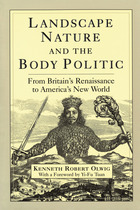
Landscape, Nature, and the Body Politic explores the origins and lasting influences of two contesting but intertwined discourses that persist today when we use the words landscape, country, scenery, nature, national. In the first sense, the land is a physical and bounded body of terrain upon which the nation state is constructed (e.g., the purple mountain majesties above the fruited plain, from sea to shining sea). In the second, the country is constituted through its people and established through time and precedence (e.g., land where our fathers died, land of the Pilgrims’ pride). Kenneth Robert Olwig’s extended exploration of these discourses is a masterful work of scholarship both broad and deep, which opens up new avenues of thinking in the areas of geography, literature, theater, history, political science, law, and environmental studies.
Olwig tracks these ideas though Anglo-American history, starting with seventeenth-century conflicts between the Stuart kings and the English Parliament, and the Stuart dream of uniting Scotland with England and Wales into one nation on the island of Britain. He uses a royal production of a Ben Jonson masque, with stage sets by architect Inigo Jones, as a touchstone for exploring how the notion of "landscape" expands from artful stage scenery to a geopolitical ideal. Olwig pursues these contested concepts of the body politic from Europe to America and to global politics, illuminating a host of topics, from national parks and environmental planning to theories of polity and virulent nationalistic movements.
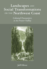
The Fraser Valley has long been a scene of natural resource appropriation—furs and fish, timber and agriculture—with settlement patterns and land claims centering on the use of these materials. Oliver demonstrates how social change and cultural understanding are tied to the way that people use and remake the landscape. Drawing on ethnographic texts, archaeological evidence, cartography, and historical writing, he has created a deep history of the valley that enables us to view how human entanglements with landscape were creative of a variety of contentious issues. By capturing the multiple dynamics that were operating in the past, Oliver shows us not only how landscape transformations were implicated in constructing different perceptions of place but also how such changes influenced peoples’ understanding of history and identity.
This groundbreaking work examines engagement between people and the environment across a variety of themes, from aboriginal appropriation of nature to colonists’ reworking of physical and conceptual geographies, demonstrating the consequences of these interactions as they permeated various social and cultural spheres. It offers a new lens for viewing a region as it provides fresh insight into such topics as landscape change, perceptions of place, and Indigenous-white relations.

Mapping Wonderlands fills part of this gap in existing regional studies by looking at early popular pictorial maps of Arizona. These cartographic representations of the state utilize formal mapmaking conventions to create a place-based state history. They introduce illustrations, unique naming conventions, and written narratives to create carefully visualized landscapes that emphasize the touristic aspects of Arizona.
Analyzing the visual culture of tourism in illuminating detail, this book documents how Arizona came to be identified as an appealing tourism destination. Providing a historically situated analysis, Dori Griffin draws on samples from a comprehensive collection of materials generated to promote tourism during Arizona’s first half-century of statehood. She investigates the relationship between natural and constructed landscapes, visual culture, and narratives of place. Featuring sixty-six examples of these aesthetically appealing maps, the book details how such maps offered tourists and other users a cohesive and storied image of the state. Using historical documentation and rhetorical analysis, this book combines visual design and historical narrative to reveal how early-twentieth-century mapmakers and map users collaborated to imagine Arizona as a tourist’s paradise.
After careful re-reading and analysis of original Old Burmese and other primary sources, the author discovered that four out of the five events considered to be the most important in the history of early Burma, and believed to have been historically accurate, are actually late-nineteenth and twentieth-century inventions of colonial historians caught in their own intellectual and political world.
Only one of these is a genuine indigenous Burmese myth, but it too has been embellished by modern historians.
The author discusses each of these five myths and concludes with an assessment of the current situation in Burma in the context of the new myths springing up today, thereby bringing the thirteenth century into the twentieth.
In this book, cultural geographer Wilbur Zelinsky challenges that nearly universal view and reaches a paradoxical conclusion: that American land and society are becoming more uniform and more diverse at the same time. After recounting the many ways in which modern technologies, an advanced capitalist market system, and a potent central political establishment have standardized the built landscape of the country's vast territory and its burgeoning population over the past two hundred and fifty years, he also considers the vigor of countervailing forces. In a carefully balanced assessment, he documents steady increases in the role of the unpredictable, in the number and variety of arbitrarily located places and activities, and the persistence of basic cultural diversities. Contrary to popular perceptions, place-to-place differences in spoken language, religion, and political behavior have not diminished or disappeared. In fact, Zelinsky shows, novel cultural regions and specialized cities have been emerging even as a latter-day version of regionalism and examples of neo-localism are taking root in many parts of the United States.
The study begins with the French Creole settlement at Old Ste. Genevieve in the middle of the eighteenth century. It describes the movement of the French into the Ozark hills during the rest of that century and continues with that of the American immigrants into Upper Louisiana after 1796, ending with the Americanization of the district after the Louisiana Purchase. Walter Schroeder examines the cultural transition from a French society, operating under a Spanish administration, to an American society in which French, Indians, and Africans formed minorities.
Schroeder used thousands of French- and Spanish-language documents, including the Archives of the Indies in Seville, Spain, as well as documents from Ste. Genevieve and St. Louis to gather his information. He also utilized thousands of land records from the American period, including deeds of land sales and sales from the public domain, and plats from both the Spanish and American periods. In addition, Schroeder performed years of fieldwork and perused aerial photography of the area, interviewing residents and searching for vestiges of the past in the landscape.
As the only study to deal with the cradle of Missouri and the first trans-Mississippi expansion of the Anglo-American frontier, Opening the Ozarks will be invaluable to anyone interested in America’s geographical history, particularly that of Missouri.
China’s modern history has been marked by deep spatial inequalities between regions, between cities, and between rural and urban areas. Contemporary observers and historians alike have attributed these inequalities to distinct stages of China's political economy: the dualistic economy of semicolonialism, rural-urban divisions in the socialist period, and capital concentration in the reform era. In Pivot of China, Mark Baker shows how different states across twentieth-century China shaped these inequalities in similar ways, concentrating resources in urban and core areas at the expense of rural and regional peripheries.
Pivot of China examines this dynamic through the city of Zhengzhou, one of the most dramatic success stories of China’s urbanization: a railroad boomtown of the early twentieth century, a key industrial center and provincial capital of Henan Province in the 1950s, and by the 2020s a “National Central City” of almost ten million people. However, due to the spatial politics of resource concentration, Zhengzhou’s twentieth-century growth as a regional city did not kickstart a wider economic takeoff in its hinterland. Instead, unequal spatial politics generated layers of inequality that China is still grappling with in the twenty-first century.
Producing India mounts a formidable challenge to the entrenched practice of methodological nationalism that has accorded an exaggerated privilege to the nation-state as a dominant unit of historical and political analysis. Manu Goswami locates the origins and contradictions of Indian nationalism in the convergence of the lived experience of colonial space, the expansive logic of capital, and interstate dynamics. Building on and critically extending subaltern and postcolonial perspectives, her study shows how nineteenth-century conceptions of India as a bounded national space and economy bequeathed an enduring tension between a universalistic political economy of nationhood and a nativist project that continues to haunt the present moment.
Elegantly conceived and judiciously argued, Producing India will be invaluable to students of history, political economy, geography, and Asian studies.
Colorado Springs, Colorado, has long profited from Pikes Peak and built an urban infrastructure to sustain that relationship. In Profiting from the Peak, geographer John Harner surveys the events and socioeconomic conditions that formed the city, analyzing the built landscape to offer insight into the origins of its urban forms and spatial layout, focusing particularly on historic downtown architecture and public spaces. He examines the cultural values that have come to define the city, showing how military and other institutions, tourism, political and economic conditions, cultural movements, key individual actors, and administrative policies have created a singular urban personality.
Capital accumulation has been a defining theme of Colorado Springs from its very beginning, with enormous profits generated from regional industrialization, railroads, land sales, water appropriation, and extraction of coal and gold. These conditions and its setting in the Rocky Mountain West formed a libertarian-oriented, limited governance philosophy.
Synthesizing almost thirty years of Dutch archaeological research in central and southern Italy, this book discusses and compares settlement and land use patterns from the late protohistoric period to the late Roman Republic. Considering both social and environmental factors, the authors analyze the long-term progression of indigenous Bronze Age tribal pastoralist societies towards the complexity of urbanized Roman society. Drawing on a decade of collaboration between Dutch and Italian researchers, this exhaustive study will be of great interest to students and scholars of Mediterranean archaeology.
From the first Slavic migrations to the Romanovs’ rise to the Putin era, Russia has endured for centuries as a nation whose sheer size and diversity have challenged its rulers and shaped its identity. Restless Empire illuminates the epic sweep of Russian history in a beautifully illustrated full-color atlas depicting the essential cultural, political, economic, and military developments of Russia’s past.
Like the double-headed eagle that is its state emblem, Russia has always looked abroad to both the East and West, searching for secure trade routes, trustworthy allies, and defensible frontiers. Expansion beyond Muscovy’s forested confines began in the fifteenth century, when Ivan III rejected Mongol rule and moved into the Russian steppe. The waterways linking the Baltic to the Black and Caspian seas were crucial to Russia’s development from the Middle Ages onward. The age-old quest to acquire warm-water ports culminated in the construction of St. Petersburg in the eighteenth century, when imperial Russia began to rival Europe’s Great Powers.
From Ivan the Terrible to Catherine the Great, Lenin and Stalin to Yeltsin and Putin, Russia’s rulers have carved their nation’s destiny into world history, sometimes bending Russia toward despotism or democracy, internationalism or brusque independence. Russia’s titanic conflicts—against the Tatars and Turks, Napoleon, Nazi Germany, and the United States—and its political upheavals from the Time of Troubles to the Soviet Union’s downfall, as well as ongoing strife in Chechnya and Crimea, are presented chronologically in accessible text accompanied by detailed maps and illustrations.
Exploring the commercial aims of the Ming Dynasty, the port city of Quanzhou and its connections with the voyages of the early traveler Zheng He, this book describes the historical background of the era in which the map was used. It also includes an analysis of the skills and techniques involved in Chinese map-making and the significance of the compass bearings, scale, and ratios found on the map, all of which combine to represent a breakthrough in cartographic techniques.
The enthralling story revealed by this extraordinary artifact sheds light on the long history of China’s relationship with the sea and with the wider world.
Thompson examines the history of the land drainage movement and the inevitable environmental changes caused by the intensification of urban and rural land use in the Midwest between sixty and one hundred years ago. He shows how institutions of land drainage were organized and operated and how the nascent drainage engineering and contracting sectors functioned. Focusing on the lower valley, Thompson also deals with drainage as it affects the nation, the Midwest, Chicago, and downstate Illinois.
Thompson is the first to address the array of interrelated physical, economic, and political circumstances caused by the development of competing and incompatible uses for the waters and the floodplain of the Illinois River when large-scale land reclamation and great volumes of water from Lake Michigan and Chicago changed land and water relationships, destroyed a major riverine fishing industry, and severely damaged renowned waterfowl hunting grounds.
The Worldmakers moves beyond histories of globalization to explore how “the world” itself—variously understood as an object of inquiry, a comprehensive category, and a system of order—was self-consciously shaped by human agents. Gathering an international cast of characters, from Dutch cartographers and French philosophers to Portuguese and English poets, Ramachandran describes a history of firsts: the first world atlas, the first global epic, the first modern attempt to develop a systematic natural philosophy—all part of an effort by early modern thinkers to capture “the world” on the page.
READERS
Browse our collection.
PUBLISHERS
See BiblioVault's publisher services.
STUDENT SERVICES
Files for college accessibility offices.
RECENTLY PUBLISHED


UChicago Accessibility Resources
home | accessibility | search | about | contact us
BiblioVault ® 2001 - 2024
The University of Chicago Press