
 A SCHOLARLY BOOK REPOSITORY
Winner, National Association for Chicana and Chicano Studies Book Award, 2019
The Royal Chicano Air Force produced major works of visual art, poetry, prose, music, and performance during the second half of the twentieth century and first decades of the twenty-first. Materializing in Sacramento, California, in 1969 and established between 1970 and 1972, the RCAF helped redefine the meaning of artistic production and artwork to include community engagement projects such as breakfast programs, community art classes, and political and labor activism. The collective’s work has contributed significantly both to Chicano/a civil rights activism and to Chicano/a art history, literature, and culture.
Blending RCAF members’ biographies and accounts of their artistic production with art historical, cultural, and literary scholarship, Flying under the Radar with the Royal Chicano Air Force is the first in-depth study of this vanguard Chicano/a arts collective and activist group. Ella Maria Diaz investigates how the RCAF questioned and countered conventions of Western art, from the canon taught in US institutions to Mexican national art history, while advancing a Chicano/a historical consciousness in the cultural borderlands. In particular, she demonstrates how women significantly contributed to the collective’s output, navigating and challenging the overarching patriarchal cultural norms of the Chicano Movement and their manifestations in the RCAF. Diaz also shows how the RCAF’s verbal and visual architecture—a literal and figurative construction of Chicano/a signs, symbols, and texts—established the groundwork for numerous theoretical interventions made by key scholars in the 1990s and the twenty-first century.
Taking us on a compelling tour of the state-of-the-art science involved in mapping the infinite, Geach offers a first-hand account of both the science itself and how it is done, describing what we currently know as well as that which we still do not. He goes back one hundred years to when scientists first proved the existence of other galaxies, tracking our continued improvement in the ability to collect and interpret the light that stars in faraway galaxies have emitted through space and time. He discusses examples of this rapidly accelerating research, from the initial discovery that the faint “spiral nebulae” were actually separate star systems located far beyond the Milky Way to the latest observations of the nature of galaxies and how they have evolved. He also delves into the theoretical framework and simulations that describe our current “world model” of the universe.
With one hundred superb color illustrations, Galaxy is an illuminating guide to the choreography of the cosmos and how we came to know our place within it that will appeal to any stargazer who has wondered what was beyond their sight.
The Treaty of Guadalupe Hildalgo, which officially ended the U.S.-Mexican War in 1848, cost Mexico half its territory, while the United States gained land that became California, Nevada, Utah, Texas, and parts of Colorado, Arizona, and New Mexico. Because the new United States-Mexico border ran through territory that was still incompletely mapped, the treaty also called for government commissions from both nations to locate and mark the boundary on the ground. This book documents the accomplishments of both the U.S. and the Mexican Boundary Commissions that mapped the boundary between 1849 and 1857, as well as the fifty-four pairs of maps produced by their efforts and the ongoing importance of these historical maps in current boundary administration. Paula Rebert explores how, despite the efforts of both commissions to draw neutral, scientific maps, the actual maps that resulted from their efforts reflected the differing goals and outlooks of the two countries. She also traces how the differences between the U.S. and Mexican maps have had important consequences for the history of the boundary.
"This book should be welcomed by all students of mapping, for it will take them in uncomplicated stages through the complexities of compiling a map. . . . Mr. Greenwood is to be congratulated on an excellent book."—C.J. Angus, Canadian Geographical Journal
"For the baggy and middle-aged who cannot afford skiing in Austria or sailing off Bimini, Greenhood invites his readers to a sort of intellectual excitement which neither skiing nor sailing could equal. . . . Unless you work professionally with maps to the degree that a navigator does, for instance, this book will fascinate and enthrall you."—Monroe Bush, American Forests
"A teacher who wishes to go into the classroom with a storehouse of knowledge and ideas will find this a remarkable book. It is easy to read, and each page contains information which can be fed into the work in progress no matter which area of the world is being studied."—Instructor
"There is much to be praised in this book. It is an excellent history of how India came to be painted red in the nineteenth century. But more importantly, Mapping an Empire sets a new standard for books that examine a fundamental problem in the history of European imperialism."—D. Graham Burnett, Times Literary Supplement
"Mapping an Empire is undoubtedly a major contribution to the rapidly growing literature on science and empire, and a work which deserves to stimulate a great deal of fresh thinking and informed research."—David Arnold, Journal of Imperial and Commonwealth History
"This case study offers broadly applicable insights into the relationship between ideology, technology and politics. . . . Carefully read, this is a tale of irony about wishful thinking and the limits of knowledge."—Publishers Weekly
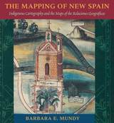
From the sixteenth through the mid-nineteenth centuries, Spain, then Mexico, and finally the United States took ownership of the land from the Gulf Coast of Texas and Mexico to the Pacific Coast of Alta and Baja California—today's American Southwest. Each country faced the challenge of holding on to territory that was poorly known and sparsely settled, and each responded by sending out military mapping expeditions to set boundaries and chart topographical features. All three countries recognized that turning terra incognita into clearly delineated political units was a key step in empire building, as vital to their national interest as the activities of the missionaries, civilian officials, settlers, and adventurers who followed in the footsteps of the soldier-engineers.
With essays by eight leading historians, this book offers the most current and comprehensive overview of the processes by which Spanish, Mexican, and U.S. soldier-engineers mapped the southwestern frontier, as well as the local and even geopolitical consequences of their mapping. Three essays focus on Spanish efforts to map the Gulf and Pacific Coasts, to chart the inland Southwest, and to define and defend its boundaries against English, French, Russian, and American incursions. Subsequent essays investigate the role that mapping played both in Mexico's attempts to maintain control of its northern territory and in the United States' push to expand its political boundary to the Pacific Ocean. The concluding essay draws connections between mapping in the Southwest and the geopolitical history of the Americas and Europe.
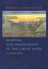
The Great Basin was the last region of continental North America to be explored and mapped, and it remained largely a mystery to Euro-Americans until well into the nineteenth century. In Mapping and Imagination in the Great Basin, geographer-historian Richard Francaviglia shows how the Great Basin gradually emerged from its “cartographic silence” as terra incognita and how this fascinating process both paralleled the development of the sciences of surveying, geology, hydrology, and cartography and reflected the changing geopolitical aspirations of the European colonial powers and the United States. Francaviglia’s interdisciplinary account of the mapping of the Great Basin combines a chronicle of the exploration of the region with a history of the art and science of cartography and of the political, economic, and cultural contexts in which maps are created. It also offers a compelling, wide-ranging discussion that combines a description of the daunting physical realities of the Great Basin with a cogent examination of the ways humans, from early Native Americans to nineteenth-century surveyors to twentieth-century highway and air travelers, have understood, defined, and organized this space, psychologically and through the medium of maps. Mapping and Imagination in the Great Basin continues Francaviglia’s insightful, richly nuanced meditation on the Great Basin landscape that began in Believing in Place.
"Its contribution to its specific field is both significant and original. . . . It is a pure pleasure to read." —Sabine MacCormack, Isis
"Mundy has done a fine job of balancing the artistic interpretation of the maps with the larger historical context within which they were drawn. . . . This is an important work." —John F. Schwaller, Sixteenth Century Journal
"This beautiful book opens a Pandora's box in the most positive sense, for it provokes the reconsideration of several long-held opinions about Spanish colonialism and its effects on Native American culture." —Susan Schroeder, American Historical Review
By the end of World War II, strategists in Washington and London looked ahead to a new era in which the United States shouldered global responsibilities and Britain concentrated its regional interests more narrowly. The two powers also viewed the Muslim world through very different lenses. Mapping the End of Empire reveals how Anglo–American perceptions of geography shaped postcolonial futures from the Middle East to South Asia.
Aiyaz Husain shows that American and British postwar strategy drew on popular notions of geography as well as academic and military knowledge. Once codified in maps and memoranda, these perspectives became foundations of foreign policy. In South Asia, American officials envisioned an independent Pakistan blocking Soviet influence, an objective that outweighed other considerations in the contested Kashmir region. Shoring up Pakistan meshed perfectly with British hopes for a quiescent Indian subcontinent once partition became inevitable. But serious differences with Britain arose over America’s support for the new state of Israel. Viewing the Mediterranean as a European lake of sorts, U.S. officials—even in parts of the State Department—linked Palestine with Europe, deeming it a perfectly logical destination for Jewish refugees. But British strategists feared that the installation of a Jewish state in Palestine could incite Muslim ire from one corner of the Islamic world to the other.
As Husain makes clear, these perspectives also influenced the Dumbarton Oaks Conference and blueprints for the UN Security Council and shaped French and Dutch colonial fortunes in the Levant and the East Indies.
Any landscape has an unseen component: a subjective component of experience, memory, and narrative which people familiar with the place understand to be an integral part of its geography but which outsiders may not suspect the existence of—unless they listen and read carefully. This invisible landscape is make visible though stories, and these stories are the focus of this engrossing book.
Traveling across the invisible landscape in which we imaginatively dwell, Kent Ryden—himself a most careful listener and reader—asks the following questions. What categories of meaning do we read into our surroundings? What forms of expression serve as the most reliable maps to understanding those meanings? Our sense of any place, he argues, consists of a deeply ingrained experiential knowledge of its physical makeup; an awareness of its communal and personal history; a sense of our identity as being inextricably bound up with its events and ways of life; and an emotional reaction, positive or negative, to its meanings and memories.
Ryden demonstrates that both folk and literary narratives about place bear a striking thematic and stylistic resemblance. Accordingly, Mapping the Invisible Landscape examines both kinds of narratives. For his oral materials, Ryden provides an in-depth analysis of narratives collected in the Coeur d'Alene mining district in the Idaho panhandle; for his consideration of written works, he explores the “essay of place,” the personal essay which takes as its subject a particular place and a writer's relationship to that place.
Drawing on methods and materials from geography, folklore, and literature, Mapping the Invisible Landscape offers a broadly interdisciplinary analysis of the way we situate ourselves imaginatively in the landscape, the way we inscribe its surface with stories. Written in an extremely engaging style, this book will lead its readers to an awareness of the vital role that a sense of place plays in the formation of local cultures, to an understanding of the many-layered ways in which place interacts with individual lives, and to renewed appreciation of the places in their own lives and landscapes.
Organized chronologically, Mapping the Middle East addresses the medieval “Realm of Islam;” the sixteenth- to eighteenth-century Ottoman Empire; French and British colonialism through World War I; nationalism in modern Turkey, Iran, and Israel/Palestine; and alternative geographies in the twentieth and twenty-first centuries. Vivid color illustrations throughout allow readers to compare the maps themselves with Antrim’s analysis. Much more than a conventional history of cartography, Mapping the Middle East is an incisive critique of the changing relationship between maps and belonging in a dynamic world region over the past thousand years.
In the nineteenth century, Americans began to use maps in radically new ways. For the first time, medical men mapped diseases to understand and prevent epidemics, natural scientists mapped climate and rainfall to uncover weather patterns, educators mapped the past to foster national loyalty among students, and Northerners mapped slavery to assess the power of the South. After the Civil War, federal agencies embraced statistical and thematic mapping in order to profile the ethnic, racial, economic, moral, and physical attributes of a reunified nation. By the end of the century, Congress had authorized a national archive of maps, an explicit recognition that old maps were not relics to be discarded but unique records of the nation’s past.
All of these experiments involved the realization that maps were not just illustrations of data, but visual tools that were uniquely equipped to convey complex ideas and information. In Mapping the Nation, Susan Schulten charts how maps of epidemic disease, slavery, census statistics, the environment, and the past demonstrated the analytical potential of cartography, and in the process transformed the very meaning of a map.
Today, statistical and thematic maps are so ubiquitous that we take for granted that data will be arranged cartographically. Whether for urban planning, public health, marketing, or political strategy, maps have become everyday tools of social organization, governance, and economics. The world we inhabit—saturated with maps and graphic information—grew out of this sea change in spatial thought and representation in the nineteenth century, when Americans learned to see themselves and their nation in new dimensions.
King considers three stars with popular and controversial personas: Norman Rockwell, Will Smith, and Kim Kardashian. Working in very different contexts and with very different public images, these figures nonetheless share a consistent, if not conspicuous, interest in celebrity as a construct. Offering intertextual readings of their public images across such sites as movie posters, magazines, cinema, and social media—and deploying rhetorical theories of metonymy (a linguistic device linking signifiers by shared associations)—King argues that these stars’ self-reflexive attention to the processes by which celebrity is created and constrained creates opportunities for reframing public discourse about what it means to be famous and what it means to be a person.
This book is here to help teacher candidates not only survive the challenge of the edTPA®, but also thrive. It maps out precisely what steps aspiring secondary education teachers should take to ensure successful completion of the edTPA®. Demystifying the language used in the assessment, it uniquely connects edTPA® requirements with what teacher candidates learn within their teacher preparation programs, showing them how the assessment relates to what they are already doing in their classrooms. The strategies in this book draw on both academic research and practical experience to guide student teachers as they plan for their edTPA® portfolios and for their teaching careers beyond.
In this sequel to Ellie’s Log: Exploring the Forest Where the Great Tree Fell, Ricky Zamora brings his love of map-making and his boundless curiosity to the arid landscapes east of the Cascades Mountains. He arrives during a wild thunderstorm, and watches his family and their neighbors scramble to deal with a wildfire sparked by lightning. Joined by his friend Ellie, he sees how plants, animals, and people adjust to life with wildfires.
While hiking across a natural prairie, climbing up a fire tower, and studying historical photos and maps, Ricky and Ellie learn about the role of fire in shaping the landscape of the semi-arid plateau east of the mountains. They experience the scary days of wildfire in progress, explore a gritty site after a wildfire, and discover how some plants and animals depend on fire to survive.
Color pen-and-ink drawings accompany the text and vividly illustrate plants, animals, and events encountered in this exciting summer adventure. With his friend Ellie, Ricky creates a brightly colored diary of the fire, with maps, timelines, and sketches of what they see in this fire-prone land. Ricky’s notebook about his summer visit to his uncle’s ranch becomes an atlas of fire ecology, weather patterns, and life in the rain shadow.
Upper elementary kids will enjoy the mixture of amazing adventures with actual historical, physical, and ecological data about the region. Woven into the story are the small pleasures of ranch life, intriguing histories of Native Americans and early settlers, and almost unbelievable views of ancient fossils. Ricky and Ellie’s explorations, accompanied by their hand-written notes, introduce readers to a very special landscape and history east of the mountains.
We may think of “globalism” as a recent development but its origins date back to the fifteenth century and beyond, when seafarers pioneered routes across the oceans with the objectives of exploration, trade, and profit.
These voyages only became possible after certain technical innovations—improvements in ship design, compasses, and mapping—enabled navigation across unprecedented distances. The mariners’ embarkation points were the vibrant ports of the West—Venice, Amsterdam, Lisbon—and their destinations the exotic ports of the East—Malacca, Goa, Bombay—where they tracked down the elusive spices, so much in demand by Western palates.
This development of maritime communication brought benefits apart from culinary delights: the spread of ideas on art, literature, and science. But it was not necessarily beneficial for everyone concerned: colonial ambitions were often disastrous for local populations, who were frequently exploited as slave plantation labor.
This wide-ranging account of a fascinating period of global history uses original maps and contemporary artists’ views to tell the story of how each port developed individually while also encouraging us to consider contrasting points of view of the benefits and the damages of the maritime spice trade.
In Terra Incognita, Alfred Hiatt draws on sources both literary and visual to understand the appeal of the antipodes. Examining maps and diagrams, as well as evidence contained in geographical and historical works, poetry, travel narratives, and legal documents, he challenges long-standing characterizations of medieval spatiality as exclusively symbolic and religious. Instead, Hiatt finds, the idea of people on the other side of the Earth provided a potent and malleable symbol for political theorists, satirists, scholars, and poets—as well as for map makers. Terra Incognita is, in the end, the history of a non-place, of lands conjured by the scientific imagination, which nevertheless drove exploration, and which continued to shape the world map, even as they slowly vanished from it.
This work examines the travel account of a German baroque author who journeyed in search of silk from Northern Germany, through Muscovy, to the court of Shah Safi in Isfahan.
Adam Olearius introduced Persian literature, history, and arts to the German-speaking public; his frank appraisal of Persian customs foreshadows the enlightened spirit of the eighteenth century (influencing Montesquieu’s Persian Letters as well as Goethe’s West-Eastern Divan) and prepares the way for German Romanticism’s infatuation with Persian poetry.
Elio Brancaforte focuses on the visual and discursive nexus uniting Olearius’s text with the numerous engravings that supplement the book. The emphasis falls on contextualized readings of Olearius’s decorative frontispieces and his new and improved map of Persia and the Caspian Sea, as expressions of early modern subjectivity.
READERS
Browse our collection.
PUBLISHERS
See BiblioVault's publisher services.
STUDENT SERVICES
Files for college accessibility offices.
RECENTLY PUBLISHED


UChicago Accessibility Resources
home | accessibility | search | about | contact us
BiblioVault ® 2001 - 2024
The University of Chicago Press