
 A SCHOLARLY BOOK REPOSITORY
17 start with C start with C
The Cadastral Map in the Service of the State, illustrated with 126 maps, traces the development and application of rural property mapping in Europe from the Renaissance through the nineteenth century. Beginning with a review of the roots of cadastral mapping in the Roman Empire, the authors concentrate on the use of cadastral maps in the Netherlands, France, England, the Nordic countries, the German lands, the territories of the Austrian Habsburgs, and the European colonies. During the sixteenth century government institutions began to use maps to secure economic and political bases; by the nineteenth century these maps had become tools for aggressive governmental control of land as tax bases, natural resources, and national territories. This work demonstrates how the seemingly neutral science of cartography became a political instrument for national
interests.
Building her exploration around the central figure of Claes Jansz Vischer, an Amsterdam-based publisher closely tied to the Dutch West India Company, Sutton shows how printed maps of Dutch Atlantic territories helped rationalize the Dutch Republic’s global expansion. Maps of land reclamation projects in the Netherlands, as well as the Dutch territories of New Netherland (now New York) and New Holland (Dutch Brazil), reveal how print media were used both to increase investment and to project a common narrative of national unity. Maps of this era showed those boundaries, commodities, and topographical details that publishers and the Dutch West India Company merchants and governing Dutch elite deemed significant to their agenda. In the process, Sutton argues, they perpetuated and promoted modern state capitalism.
G. Malcolm Lewis provides accessible and detailed overviews of the history of native North American maps, mapmaking, and scholarly interest in these topics. Other contributions include a study of colonial Aztec cartography that highlights the connections among maps, space, and history; an account of the importance of native maps as archaeological evidence; and an interpretation of an early-contact-period hide painting of an actual encounter involving whites and two groups of warring natives.
Although few original native maps have survived, contemporary copies and accounts of mapmaking form a rich resource for anyone interested in the history of Native American encounters or the history of cartography and geography.
Maps are stories as much about us as about the landscape. They reveal changing perceptions of the natural world, as well as conflicts over the acquisition of territories. Cartographic Fictions looks at maps in relation to journals, correspondence, advertisements, and novels by authors such as Joseph Conrad and Michael Ondaatje. In her innovative study, Karen Piper follows the history of cartography through three stages: the establishment of the prime meridian, the development of aerial photography, and the emergence of satellite and computer mapping.
Piper follows the cartographer’s impulse to “leave the ground” as the desire to escape the racialized or gendered subject. With the distance that the aerial view provided, maps could then be produced “objectively,” that is, devoid of “problematic” native interference. Piper attempts to bring back the dialogue of the “native informant,” demonstrating how maps have historically constructed or betrayed anxieties about race. The book also attempts to bring back key areas of contact to the map between explorer/native and masculine/feminine definitions of space.
What is “Europe,” and when did it come to be? In the Renaissance, the term “Europe” circulated widely. But as Katharina N. Piechocki argues in this compelling book, the continent itself was only in the making in the fifteenth and sixteenth centuries.
Cartographic Humanism sheds new light on how humanists negotiated and defined Europe’s boundaries at a momentous shift in the continent’s formation: when a new imagining of Europe was driven by the rise of cartography. As Piechocki shows, this tool of geography, philosophy, and philology was used not only to represent but, more importantly, also to shape and promote an image of Europe quite unparalleled in previous centuries. Engaging with poets, historians, and mapmakers, Piechocki resists an easy categorization of the continent, scrutinizing Europe as an unexamined category that demands a much more careful and nuanced investigation than scholars of early modernity have hitherto undertaken. Unprecedented in its geographic scope, Cartographic Humanism is the first book to chart new itineraries across Europe as it brings France, Germany, Italy, Poland, and Portugal into a lively, interdisciplinary dialogue.
But this was not always the case: a thousand years ago, maps were solely a privilege of the ruling elite in Japan. Only in the past four hundred years has Japanese cartography truly taken off, and between the dawn of Japan’s cartographic explosion and today, the nation’s society and landscape have undergone major transformations. At every point, maps have documented those monumental changes. Cartographic Japan offers a rich introduction to the resulting treasure trove, with close analysis of one hundred maps from the late 1500s to the present day, each one treated as a distinctive window onto Japan’s tumultuous history.
Forty-seven distinguished contributors—hailing from Japan, North America, Europe, and Australia—uncover the meanings behind a key selection of these maps, situating them in historical context and explaining how they were made, read, and used at the time. With more than one hundred gorgeous full-color illustrations, Cartographic Japan offers an enlightening tour of Japan’s magnificent cartographic archive.
California, for example, takes earthquakes seriously, with a comprehensive program of seismic mapping, whereas Washington has been comparatively lax about earthquakes in Puget Sound. But as the Northridge earthquake in January 1994 demonstrated all too clearly to Californians, even reliable seismic-hazard maps can deceive anyone who misinterprets "known fault-lines" as the only places vulnerable to earthquakes.
Important as it is to predict and prepare for catastrophic natural hazards, more subtle and persistent phenomena such as pollution and crime also pose serious dangers that we have to cope with on a daily basis. Hazard-zone maps highlight these more insidious hazards and raise awareness about them among planners, local officials, and the public.
With the help of many maps illustrating examples from all corners of the United States, Monmonier demonstrates how hazard mapping reflects not just scientific understanding of hazards but also perceptions of risk and how risk can be reduced. Whether you live on a faultline or a coastline, near a toxic waste dump or an EMF-generating power line, you ignore this book's plain-language advice on geographic hazards and how to avoid them at your own peril.
"No one should buy a home, rent an apartment, or even drink the local water without having read this fascinating cartographic alert on the dangers that lurk in our everyday lives. . . . Who has not asked where it is safe to live? Cartographies of Danger provides the answer."—H. J. de Blij, NBC News
"Even if you're not interested in maps, you're almost certainly interested in hazards. And this book is one of the best places I've seen to learn about them in a highly entertaining and informative fashion."—John Casti, New Scientist
Finding one’s way with a map is a relatively recent phenomenon. In premodern times, maps were used, if at all, mainly for planning journeys in advance, not for guiding travelers on the road. With the exception of navigational sea charts, the use of maps by travelers only became common in the modern era; indeed, in the last two hundred years, maps have become the most ubiquitous and familiar genre of modern cartography.
Examining the historical relationship between travelers, navigation, and maps, Cartographies of Travel and Navigation considers the cartographic response to the new modalities of modern travel brought about by technological and institutional developments in the twentieth century. Highlighting the ways in which the travelers, operators, and planners of modern transportation systems value maps as both navigation tools and as representatives of a radical new mobility, this collection brings the cartography of travel—by road, sea, rail, and air—to the forefront, placing maps at the center of the history of travel and movement.
Richly and colorfully illustrated, Cartographies of Travel and Navigation ably fills the void in historical literature on transportation mapping.
Turning to a previously undiscovered archive of popular maps, Cartophilia reveals Alsace-Lorraine’s lively world of citizen mapmakers that included linguists, ethnographers, schoolteachers, hikers, and priests. Together, this fresh group of mapmakers invented new genres of maps that framed French and German territory in original ways through experimental surveying techniques, orientations, scales, colors, and iconography. In focusing on the power of “bottom-up” maps to transform modern European identities, Cartophilia argues that the history of cartography must expand beyond the study of elite maps and shift its emphasis to the democratization of cartography in the modern world.
Where do you draw the line? In the context of geopolitics, much hinges on the answer to that question. For thousands of years, it has been the work of diplomats to draw the lines in ways that were most advantageous to their leaders, fellow citizens, and sometimes themselves. Carving Up the Globe offers vivid documentation of their handiwork. With hundreds of full-color maps and other images, this atlas illustrates treaties that have determined the political fates of millions. In rich detail, it chronicles everything from ancient Egyptian and Hittite accords to the first Sino-Tibetan peace in 783 CE, the Sykes-Picot Agreement of 1916, and the 2014 Minsk Protocol looming over the war in Ukraine.
But there is more here than shifting territorial frontiers. Throughout history, diplomats have also drawn boundaries around valuable resources and used treaties to empower, liberate, and constrain. Carving Up the Globe encompasses these agreements, too, across land, sea, and air. Missile and nuclear pacts, environmental treaties, chemical weapons conventions, and economic deals are all carefully rendered.
Led by Malise Ruthven, a team of experts provides lively historical commentary, which—together with finely crafted visuals—conjures the ceaseless ambition of princes and politicians. Whether they sought the glory and riches of empire or pursued hegemony, security, stability, and GDP within the modern international system, their efforts culminated in lines on a map—and the enormous real-life consequences those lines represent and enforce.
The dramatic story of Christianity from its origins to the present day, told through more than one hundred stunning color maps.
With over two billion practicing believers today, Christianity has taken root in almost all parts of the globe. Its impact on Europe and the Americas in particular has been fundamental. Through more than one hundred beautiful color maps and illustrations, Christianity traces the history of the religion, beginning with the world of Jesus Christ. From the consolidation of the first Christian empire—Constantine’s Rome—to the early Christian states that thrived in Ireland, Ethiopia, and other regions of the Roman periphery, Christianity quickly proved dynamic and adaptable.
After centuries of dissemination, strife, dogmatic division, and warfare in its European and Near Eastern heartland, Christianity conquered new worlds. In North America, immigrants fleeing persecution and intolerance rejected the established Church, and in time revivalist religions flourished and spread. Missionaries took the Christian message to Latin America, Africa, and Asia, bringing millions of new converts into the fold.
Christianity has served as the inspiration for some of the world’s finest monuments, literature, art, and architecture, while also playing a major role in world politics and history, including conquest, colonization, conflict, and liberation. Despite challenges in the modern world from atheism and secularism, from scandals and internal divisions, Christianity continues to spread its message through new technologies while drawing on a deep well of history and tradition.
Plato’s solution was a map-and-directory combo that used direction and distance from a local business center to give farmers a real address, just like city dwellers. He patented his invention called the “Clock System” and tried to sell it to the Post Office Department. What follows is a tale of persistence and failure as rural farming declined and technology and capitalism overtook John Byron Plato’s chances at geographic immortality.

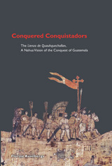
The people of the Nahua community of Quauhquechollan (present-day San Martín Huaquechula), in central Mexico, allied with Cortés during the Spanish-Aztec War and were assigned to the Spanish conquistador Jorge de Alvarado. De Alvarado and his allies, including the Quauhquecholteca and thousands of other indigenous warriors, set off for Guatemala in 1527 to start a campaign against the Maya. The few Quauhquecholteca who lived to tell the story recorded their travels and eventual victory on the huge cloth map, the Lienzo de Quauhquechollan.
Conquered Conquistadors, published in a European edition in 2004, overturned conventional views of the European conquest of indigenous cultures. American historians and anthropologists will relish this new edition and Asselbergs's astute analysis, which includes context, interpretation, and comparison with other pictographic accounts of the "Spanish" conquest. This heavily illustrated edition includes an insert reproduction of the Lienzo de Quauhquechollan.
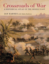
From the Bronze Age to the twenty-first century, vying armies have clashed over the territory stretching from the Upper Nile to modern-day Iraq and Iran. Crossroads of War captures five millennia of conflict and conquest in detailed full-color maps, accompanied by incisive, accessible commentary.
The lands of the Middle East were home to a succession of empires—Egyptian, Babylonian, Assyrian, and Persian—that rose and declined with the fortunes of battle. Kings and generals renowned in history bestrode the region: Nebuchadnezzar, David, Alexander the Great, Saladin, Napoleon. The religions of Zoroastrianism, Judaism, Christianity, and Islam were born here and from the beginning became embroiled in conflicts ranging from the Maccabean Revolt to Muhammad’s Arabian conquests to the Christian Crusades. In the twentieth century, the Middle East witnessed the collapse of the Ottoman Empire and played a role in the grim dramas of two world wars, as T. E. Lawrence helped spark the Arab Revolt and General Bernard Montgomery defeated Hitler’s Desert Fox, General Erwin Rommel, at El Alamein.
From the Yom Kippur War and Operation Desert Storm to a Global War on Terror that still looms over the twenty-first century, the Middle East continues to be shaped by the vagaries and vicissitudes of military conflict. Ian Barnes’s Crossroads of War offers valuable insights into the part of the world that first cradled civilization and then imagined its demise in a final clash of armies at Armageddon.
Over the centuries, maps have served many varied purposes; far from mere guides for reaching a destination, they are unique artistic forms, aides in planning commercial routes, literary devices for illuminating a story. Accuracy—or inaccuracy—of maps has been the make-or-break factor in countless military battles throughout history. They have graced the walls of homes, bringing prestige and elegance to their owners. They track the mountains, oceans, and stars of our existence. Maps help us make sense of our worlds both real and imaginary—they bring order to the seeming chaos of our surroundings.
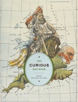
With The Curious Map Book, Ashley Baynton-Williams gathers an amazing, chronologically ordered variety of cartographic gems, mainly from the vast collection of the British Library. He has unearthed a wide array of the whimsical and fantastic, from maps of board games to political ones, maps of the Holy Land to maps of the human soul. In his illuminating introduction, Baynton-Williams also identifies and expounds upon key themes of map production, peculiar styles, and the commerce and collection of unique maps. This incredible volume offers a wealth of gorgeous illustrations for anyone who is cartographically curious.
READERS
Browse our collection.
PUBLISHERS
See BiblioVault's publisher services.
STUDENT SERVICES
Files for college accessibility offices.
RECENTLY PUBLISHED


UChicago Accessibility Resources
home | accessibility | search | about | contact us
BiblioVault ® 2001 - 2024
The University of Chicago Press