4 start with G start with G
One of the first maps of Mars, published by an Italian astronomer in 1877, with its pattern of canals, fueled belief in intelligent life forms on the distant red planet—a hope that continued into the 1960s. Although the Martian canals have long since been dismissed as a famous error in the history of science, K. Maria D. Lane argues that there was nothing accidental about these early interpretations. Indeed, she argues, the construction of Mars as an incomprehensibly complex and engineered world both reflected and challenged dominant geopolitical themes during a time of major cultural, intellectual, political, and economic transition in the Western world.
Geographies of Mars telescopes in on a critical period in the development of the geographical imagination, when European imperialism was at its zenith and American expansionism had begun in earnest. Astronomers working in the new observatories of the American Southwest or in the remote heights of the South American Andes were inspired, Lane finds, by their own physical surroundings and used representations of the Earth’s arid landscapes to establish credibility for their observations of Mars. With this simple shift to the geographer’s point of view, Lane deftly explains some of the most perplexing stances on Mars taken by familiar protagonists such as Percival Lowell, Alfred Russel Wallace, and Lester Frank Ward.
A highly original exploration of geography’s spatial dimensions at the beginning of the twentieth century, Geographies of Mars offers a new view of the mapping of far-off worlds.
Recent digitization of the Gough Map has made it more legible than at any other time since its arrival at the Bodleian Library in 1809. This work utilizes new georectification technology to project a modern map of Britain over the Gough Map, revealing the incredible accuracy of the 700-year-old manuscript. In stunningly detailed reproduction, The Gough Map charts a vast array of cities, routes, and landmarks, including the principal medieval settlements of Bristol, Oxford and Norwich; the Severn, Thames, and Humber rivers; the loop of the Wear at Durham; and routes between towns with distances marked in Roman numerals.
The volume also features a color fold-out print of the Gough map, as well as numerous close-up images of each area. The Gough Map offers an unparalleled opportunity to examine this fascinating example of medieval mapmaking.
Since the publication of the first edition of Grasses: Bromus to Paspalumin 1972, twenty-two additional taxa of grasses have been discovered in Illinois that are properly placed in this volume. In addition, numerous nomenclatural changes have occurred for plants previously discovered, and many distributional records have been added. New keys have been prepared for each genus where additional species from Illinois are known. For new species, full-page illustrations are provided. This second edition updates the status of Illinois grasses. The book features 263 figures from the first edition plus 21 new figures for this edition by Paul W. Nelson.
Genera of grasses included in this work are Aegilops, Agropyron, Agrostis, Aira, Alopecurus, Anthoxanthum, Avena, Beckmannia, Briza, Bromus, Calamagrostis, Cinna, Dactylis, Deschampsia, Elyhordeum, Elymus, Elytrigia, Festuca, Hierochloe, Holcus, Hordeum, Koeleria, Lolium, Milium, Paspalum, Pennisetum, Phalaris, Phleum, Poa, Puccinellia, Sclerochloa, Secale, Sphenopholis, Torreyochloa, Triticum, and Vulpia.
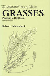
Since the publication of the first edition of Grasses: Panicum to Danthonia in 1973, twenty additional taxa of grasses have been discovered in Illinois that are properly placed in this volume. In addition, numerous nomenclatural changes have occurred for plants already known from the state, and many distributional records have been added. This second edition updates the status of grasses in Illinois. Paul W. Nelson has provided illustrations for all of the additions.
Because the nature of grass structures is generally so different from that of other flowering plants, a special terminology is applied to them. In his introduction, Robert H. Mohlenbrock cites these terms, with descriptions that make the identification of unknown specimens possible. Mohlenbrock’s division of the grass family into subfamilies and tribes is a major departure from the sequence usually found in most floristic works in North America.
Synonyms that have been applied to species in the northeastern United States are given under each species. A description based primarily on Illinois material covers the more important features of the species. The common names—Paflic Grass, Billion Dollar Grass or Japanese Millett, Thread Love Grass, and Goose Grass—are the ones used locally in the state. The habitat designation and dot maps showing county distribution of each grass are provided only for grasses in Illinois, but the overall range for each species is also given.
READERS
Browse our collection.
PUBLISHERS
See BiblioVault's publisher services.
STUDENT SERVICES
Files for college accessibility offices.
UChicago Accessibility Resources
home | accessibility | search | about | contact us
BiblioVault ® 2001 - 2024
The University of Chicago Press


