
 A SCHOLARLY BOOK REPOSITORY
12 start with H start with H
This handbook is an essential guide to the LAMSAS project, laying out its history and describing its scope and methodology. In addition, the handbook reveals biographical information about the informants and social histories of the communities in which they lived, including primary settlement areas of the original colonies. Dialectologists will rely on it for understanding the LAMSAS, and historians will find it valuable for its original historical research.
Since much of the LAMSAS questionnaire concerns rural terms, the data collected from the interviews can pinpoint such language differences as those between areas of plantation and small-farm agriculture. For example, LAMSAS reveals that two waves of settlement through the Appalachians created two distinct speech types. Settlers coming into Georgia and other parts of the Upper South through the Shenandoah Valley and on to the western side of the mountain range had a Pennsylvania-influenced dialect, and were typically small farmers. Those who settled the Deep South in the rich lowlands and plateaus tended to be plantation farmers from Virginia and the Carolinas who retained the vocabulary and speech patterns of coastal areas.
With these revealing findings, the LAMSAS represents a benchmark study of the English language, and this handbook is an indispensable guide to its riches.
Among the great civilizations of the world, Islam remains an enigma to Western readers. Now, in a beautifully illustrated historical atlas, noted scholar of religion Malise Ruthven recounts the fascinating and important history of the Islamic world.
From the birth of the prophet Muhammed to the independence of post-Soviet Muslim states in Central Asia, this accessible and informative atlas explains the historical evolution of Islamic societies. Short essays cover a wide variety of themes, including the central roles played by sharia (divine law) and fiqh (jurisprudence); philosophy; arts and architecture; the Muslim city; trade, commerce, and manufacturing; marriage and family life; tribal distributions; kinship and dynastic power; ritual and devotional practices; Sufism; modernist and reformist trends; the European domination of the Islamic world; the rise of the modern national state; oil exports and arms imports; and Muslim populations in non-Muslim countries, including the United States.
Lucid and inviting full-color maps chronicle the changing internal and external boundaries of the Islamic world, showing the principal trade routes through which goods, ideas, and customs spread. Ruthven traces the impact of various Islamic dynasties in art and architecture and shows the distribution of sects and religious minorities, the structure of Islamic cities, and the distribution of resources. Among the book's valuable contributions is the incorporation of the often neglected geographical and environmental factors, from the Fertile Crescent to the North African desert, that have helped shape Islamic history.
Rich in narrative and visual detail that illuminates the story of Islamic civilization, this timely atlas is an indispensable resource to anyone interested in world history and religion.
Cradled among the world’s highest mountains—and sheltering one of its most devout religious communities—Tibet is, for many of us, an ultimate destination, a place that touches the heavens, a place only barely in our world, at its very end. In recent decades Western fascination with Tibet has soared, from the rise of Tibetan studies in academia to the rock concerts aimed at supporting its independence to the simple fact that most of us—far from any base camp—know exactly what a sherpa is. And yet any sustained look into Tibet as a place, any attempt to find one’s way around its high plateaus and through its deep history, will yield this surprising fact: we have barely mapped it. With this atlas, Karl E. Ryavec rights that wrong, sweeping aside the image of Tibet as Shangri-La and putting in its place a comprehensive vision of the region as it really is, a civilization in its own right. And the results are absolutely stunning.
The product of twelve years of research and eight more of mapmaking, A Historical Atlas of Tibet documents cultural and religious sites across the Tibetan Plateau and its bordering regions from the Paleolithic and Neolithic times all the way up to today. It ranges through the five main periods in Tibetan history, offering introductory maps of each followed by details of western, central, and eastern regions. It beautifully visualizes the history of Tibetan Buddhism, tracing its spread throughout Asia, with thousands of temples mapped, both within Tibet and across North China and Mongolia, all the way to Beijing. There are maps of major polities and their territorial administrations, as well as of the kingdoms of Guge and Purang in western Tibet, and of Derge and Nangchen in Kham. There are town plans of Lhasa and maps that focus on history and language, on population, natural resources, and contemporary politics.
Extraordinarily comprehensive and absolutely gorgeous, this overdue volume will be a cornerstone in cartography, Asian studies, Buddhist studies, and in the libraries or on the coffee tables of anyone who has ever felt the draw of the landscapes, people, and cultures of the highest place on Earth.
Few reference works are as valuable to both scholars and non-scholars as a historical atlas. Therefore, The Historical Atlas of West Virginia will be an important title for libraries, schools, and every West Virginian who wants to understand how historical forces are mapped onto the state’s terrain. This atlas also shows how the distribution of natural resources intersects with various means of distribution. Frank Riddel’s The Historical Atlas of West Virginia is copiously illustrated with maps, tables, and charts depicting everything from geological deposits and strata that have fed the state’s industries to the settlement patterns of the immigrants who settled in West Virginia. Using federal and state statistics, it also includes revelations from the national census figures since 1790.
Beginning in the sixteenth century, and continuing down to the late nineteenth, Walter Goffart discusses milestones in the origins of historical atlases as well as individual maps illustrating historical events in alternating, paired chapters. He focuses on maps of the medieval period because the development of maps for history hinged particularly on portrayals of this segment of the postclassical, "modern" past. Goffart concludes the book with a detailed catalogue of more than 700 historical maps and atlases produced from 1570 to 1870.
Historical Atlases will immediately take its place as the single most important reference on its subject. Historians of cartography, medievalists, and anyone seriously interested in the role of maps in portraying history will find it invaluable.
An exploration of Colombian maps in New Granada.
During the late Spanish colonial period, the Pacific Lowlands, also called the Greater Chocó, was famed for its rich placer deposits. Gold mined here was central to New Granada’s economy yet this Pacific frontier in today’s Colombia was considered the “periphery of the periphery.” Infamous for its fierce, unconquered Indigenous inhabitants and its brutal tropical climate, it was rarely visited by Spanish administrators, engineers, or topographers and seldom appeared in detail on printed maps of the period.
In this lavishly illustrated and meticulously researched volume, Juliet Wiersema uncovers little-known manuscript cartography and makes visible an unexamined corner of the Spanish empire. In concert with thousands of archival documents from Colombia, Spain, and the United States, she reveals how a "periphery" was imagined and projected, largely for political or economic reasons. Along the way, she unearths untold narratives about ephemeral settlements, African adaptation and autonomy, Indigenous strategies of resistance, and tenuous colonialisms on the margins of a beleaguered viceroyalty.
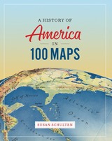
In this book Susan Schulten uses maps to explore five centuries of American history, from the voyages of European discovery to the digital age. With stunning visual clarity, A History of America in 100 Maps showcases the power of cartography to illuminate and complicate our understanding of the past.
Gathered primarily from the British Library’s incomparable archives and compiled into nine chronological chapters, these one hundred full-color maps range from the iconic to the unfamiliar. Each is discussed in terms of its specific features as well as its larger historical significance in a way that conveys a fresh perspective on the past. Some of these maps were made by established cartographers, while others were made by unknown individuals such as Cherokee tribal leaders, soldiers on the front, and the first generation of girls to be formally educated. Some were tools of statecraft and diplomacy, and others were instruments of social reform or even advertising and entertainment. But when considered together, they demonstrate the many ways that maps both reflect and influence historical change.
Audacious in scope and charming in execution, this collection of one hundred full-color maps offers an imaginative and visually engaging tour of American history that will show readers a new way of navigating their own worlds.
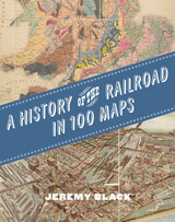
The first international history of railroads and railroad infrastructure told through stunningly reproduced maps.
Since their origins in eighteenth-century England, railroads have spread across the globe, changing everything in their path, from where and how people grew and made things to where and how they lived and moved. Railroads rewrote not only world geography but also the history of maps and mapping. Today, the needs of train companies and their users continue to shape the maps we consume and consult.
Featuring full-color maps primarily from the British Library's distinguished collection—many of them never before published—A History of the Railroad in 100 Maps is the first international history of railroads and railroad infrastructure told through maps. Jeremy Black includes examples from six continents, spanning a variety of uses from railroad planning and operations to guides for passengers, shippers, and tourists.
Arranged chronologically, the maps are accompanied by explanatory text that sheds light on the political, military, and urban development histories associated with the spread of railroads. A final chapter considers railroad maps from games, books, and other cultural artifacts. For anyone interested in the history of railroads or maps, A History of the Railroad in 100 Maps will offer new and unexpected insights into their intertwined global history.
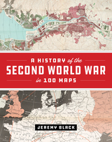
The First World War was marked by an exceptional expansion in the use and production of military cartography. But World War II took things even further, employing maps, charts, reconnaissance, and the systematic recording and processing of geographical and topographical information on an unprecedented scale. As Jeremy Black—one of the world’s leading military and cartographic historians—convincingly shows in this lavish full-color book, it is impossible to understand the events and outcomes of the Second World War without deep reference to mapping at all levels. In World War II, maps themselves became the weapons.
A History of the Second World War in 100 Maps traces how military cartography developed from simply recording and reflecting history to having a decisive impact on events of a global scale. Drawing on one hundred key maps from the unparalleled collections of the British Library and other sources—many of which have never been published in book form before--Jeremy Black takes us from the prewar mapping programs undertaken by both Germany and the United Kingdom in the mid-1930s through the conflict’s end a decade later. Black shows how the development of maps led directly to the planning of the complex and fluid maneuvers that defined the European theater in World War II: for example, aerial reconnaissance photography allowed for the charting of beach gradients and ocean depths in the runup to the D-Day landings, and the subsequent troop movements at Normandy would have been impossible without the help of situation maps and photos. In the course of the conflict, both in Europe and the Pacific, the realities of climate, terrain, and logistics—recorded on maps—overcame the Axis powers. Maps also became propaganda tools as the pages of Time outlined the directions of the campaigns and the Allies dropped maps from their aircraft.
In this thrilling and unique book, Jeremy Black blends his singular cartographic and military expertise into a captivating overview of World War II from the air, sea, and sky, making clear how fundamental maps were to every aspect of this unforgettable global conflict.
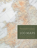
As Bryars and Harper reveal, maps make ideal narrators, and the maps in this book tell the story of the 1900s—which saw two world wars, the Great Depression, the Swinging Sixties, the Cold War, feminism, leisure, and the Internet. Several of the maps have already gained recognition for their historical significance—for example, Harry Beck’s iconic London Underground map—but the majority of maps on these pages have rarely, if ever, been seen in print since they first appeared. There are maps that were printed on handkerchiefs and on the endpapers of books; maps that were used in advertising or propaganda; maps that were strictly official and those that were entirely commercial; maps that were printed by the thousand, and highly specialist maps issued in editions of just a few dozen; maps that were envisaged as permanent keepsakes of major events, and maps that were relevant for a matter of hours or days.
As much a pleasure to view as it is to read, A History of the Twentieth Century in 100 Maps celebrates the visual variety of twentieth century maps and the hilarious, shocking, or poignant narratives of the individuals and institutions caught up in their production and use.
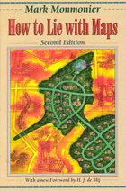
The second edition is updated with the addition of two new chapters, 10 color plates, and a new foreword by renowned geographer H. J. de Blij. One new chapter examines the role of national interest and cultural values in national mapping organizations, including the United States Geological Survey, while the other explores the new breed of multimedia, computer-based maps.
To show how maps distort, Monmonier introduces basic principles of mapmaking, gives entertaining examples of the misuse of maps in situations from zoning disputes to census reports, and covers all the typical kinds of distortions from deliberate oversimplifications to the misleading use of color.
"Professor Monmonier himself knows how to gain our attention; it is not in fact the lies in maps but their truth, if always approximate and incomplete, that he wants us to admire and use, even to draw for ourselves on the facile screen. His is an artful and funny book, which like any good map, packs plenty in little space."—Scientific American
"A useful guide to a subject most people probably take too much for granted. It shows how map makers translate abstract data into eye-catching cartograms, as they are called. It combats cartographic illiteracy. It fights cartophobia. It may even teach you to find your way. For that alone, it seems worthwhile."—Christopher Lehmann-Haupt, The New York Times
". . . witty examination of how and why maps lie. [The book] conveys an important message about how statistics of any kind can be manipulated. But it also communicates much of the challenge, aesthetic appeal, and sheer fun of maps. Even those who hated geography in grammar school might well find a new enthusiasm for the subject after reading Monmonier's lively and surprising book."—Wilson Library Bulletin
"A reading of this book will leave you much better defended against cheap atlases, shoddy journalism, unscrupulous advertisers, predatory special-interest groups, and others who may use or abuse maps at your expense."—John Van Pelt, Christian Science Monitor
"Monmonier meets his goal admirably. . . . [His] book should be put on every map user's 'must read' list. It is informative and readable . . . a big step forward in helping us to understand how maps can mislead their readers."—Jeffrey S. Murray, Canadian Geographic
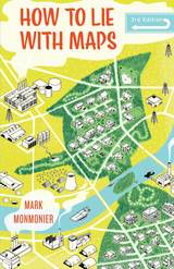
Fully updated for the digital age, this new edition of How to Lie with Maps examines the myriad ways that technology offers new opportunities for cartographic mischief, deception, and propaganda. While retaining the same brevity, range, and humor as its predecessors, this third edition includes significant updates throughout as well as new chapters on image maps, prohibitive cartography, and online maps. It also includes an expanded section of color images and an updated list of sources for further reading.
READERS
Browse our collection.
PUBLISHERS
See BiblioVault's publisher services.
STUDENT SERVICES
Files for college accessibility offices.
RECENTLY PUBLISHED

")
")
")
")


UChicago Accessibility Resources
home | accessibility | search | about | contact us
BiblioVault ® 2001 - 2024
The University of Chicago Press