7 start with S start with S

The Historia Tolteca-Chichimeca was created at a pivotal transitional moment, bridging an era when pictorial manuscripts dominated and one that witnessed the rising hegemony of alphabetic texts. The Historia was composed using both systems, yet, as Dana Leibsohn notes, neither was fully trusted. Leibsohn analyzes the choices made by the patron, don Alonso de Castañeda, and tlacuilos enlisted to create the manuscript. How does one create a history? Which narratives are included, and which are strikingly absent? Which modes of representation are called upon to convey certain types of information? Leibsohn argues how the very practice of history-keeping itself sustains or challenges a current reality.
Central to the Historia Tolteca-Chichimeca is the creation, representation, and understanding of landscape. In the recording of ancestral migrations, don Alonso delineates territory, noting boundaries and their histories, and also reveals relationships with a sacred landscape, detailing how relationships with territory were constantly re-inscribed. In this sense, Script and Glyph is a particularly appropriate volume for Dumbarton Oaks, as it crosses the boundaries of Pre-Columbian and Landscape areas of study. The volume is beautifully illustrated with color images from the manuscript itself.
Unique in several respects, Carex is by far the most numerous genus of plants in Illinois. Because of the vast number of species, the similarity of many of the species, and the relatively small size of the critical reproductive structures, the members of this genus are extremely confusing to identify. This book, with its detailed descriptions, key, and precise illustrations, should aid the interested person in the identification of these plants.
Since more than three-fourths of the species of Carex in Illinois are inhabitants of wetlands, an understanding of the genus is critical for those working in wetlands. Amateur and professional botanists will find the information extremely valuable, as well as environmental and conservation groups, garden clubs, farm bureaus, home extension groups, scout organizations, and school libraries. Persons working in natural areas programs and in rare and endangered species programs and those working on environmental impact assessments and wildlife management projects will also find the information pertinent.
Starting in the late nineteenth century, mining engineers developed a new set of practices, artifacts, and discourses to visualize complex, pitch-dark three-dimensional spaces. These maps and models became necessary tools in creating and controlling those spaces. They made mining more understandable, predictable, and profitable. Nystrom shows that this new visual culture was crucial to specific developments in American mining, such as implementing new safety regulations after the Avondale, Pennsylvania fire of 1869 killed 110 men and boys; understanding complex geology, as in the rich ores of Butte, Montana; and settling high-stakes litigation, such as the Tonopah, Nevada, Jim Butler v. West End lawsuit, which reached the US Supreme Court.
Nystrom demonstrates that these neglected artifacts of the nineteenth and early twentieth centuries have much to teach us today. The development of a visual culture helped create a new professional class of mining engineers and changed how mining was done. Seeing Undergound is the winner of the 2015 Mining History Association’s Clark Spence Award for the best book on mining history.
Exploring the commercial aims of the Ming Dynasty, the port city of Quanzhou and its connections with the voyages of the early traveler Zheng He, this book describes the historical background of the era in which the map was used. It also includes an analysis of the skills and techniques involved in Chinese map-making and the significance of the compass bearings, scale, and ratios found on the map, all of which combine to represent a breakthrough in cartographic techniques.
The enthralling story revealed by this extraordinary artifact sheds light on the long history of China’s relationship with the sea and with the wider world.
An encyclopedia as well as an atlas, this monumental work describes the taxonomy, geographic distribution, and ecology of 339 plants, most of them common and characteristic trees, shrubs, or succulants. Also included is valuable information on natural history and ethnobotanical, commercial, and horticultural uses of these plants. The entry for each species includes a range map, an elevational profile, and a narrative account. The authors also include an extensive bibliography, referring the reader to the latest research and numerous references of historical importance, with a glossary to aid the general reader. Sonoran Desert Plants is a monumental work, unlikely to be superseded in the next generation. As the region continues to attract more people, there will be an increasingly urgent need for basic knowledge of plant species as a guide for creative and sustainable habitation of the area. This book will stand as a landmark resource for many years to come.
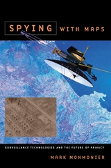
Despite our apprehension about surveillance technology, Spying with Maps is not a jeremiad, crammed with dire warnings about eyes in the sky and invasive tracking. Monmonier's approach encompasses both skepticism and the acknowledgment that geospatial technology brings with it unprecedented benefits to governments, institutions, and individuals, especially in an era of asymmetric warfare and bioterrorism. Monmonier frames his explanations of what this new technology is and how it works with the question of whether locational privacy is a fundamental right. Does the right to be left alone include not letting Big Brother (or a legion of Little Brothers) know where we are or where we've been? What sacrifices must we make for homeland security and open government?
With his usual wit and clarity, Monmonier offers readers an engaging, even-handed introduction to the dark side of the new technology that surrounds us—from traffic cameras and weather satellites to personal GPS devices and wireless communications.
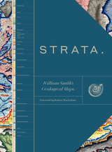
This sumptuous volume begins with an introduction by Douglas Palmer that places Smith’s work in the context of earlier, concurrent, and subsequent ideas regarding the structure and natural processes of the earth, geographical mapping, and biostratigraphical theories. The book is then organized into four parts, each beginning with four sheets from Smith’s hand-colored, 1815 strata map, accompanied by related geological cross-sections and county maps, and followed by fossil illustrations by Smith contemporary James Sowerby, all organized by strata. Essays between each section explore the aims of Smith’s work and its application in the fields of mining, agriculture, cartography and hydrology. Strata concludes with reflections on Smith’s later years as an itinerant geologist and surveyor, plagiarism by a rival, receipt of the first Wollaston Medal in recognition of his achievements, and the influence of his geological mapping and biostratigraphical theories on the sciences—all of which culminated in the establishment of the modern geological timescale.
Featuring a foreword by Robert Macfarlane, Strata is a glorious testament to the lasting geological and illustrative genius of William Smith, a collection as colossal and awe-inspiring as the layers of the Earth themselves.
READERS
Browse our collection.
PUBLISHERS
See BiblioVault's publisher services.
STUDENT SERVICES
Files for college accessibility offices.
UChicago Accessibility Resources
home | accessibility | search | about | contact us
BiblioVault ® 2001 - 2024
The University of Chicago Press


