
 A SCHOLARLY BOOK REPOSITORY
"Clever title, rewarding book. Monmonier . . . offers here a basic course in meteorology, which he presents gracefully by means of a history of weather maps." —Scientific American
"Mark Monmonier is onto a winner with Air Apparent. . . . It is good, accessible science and excellent history. . . . Read it." —Fred Pearce, New Scientist
"[Air Apparent] is a superb first reading for any backyard novice of weather . . . but even the veteran forecaster or researcher will find it engaging and, in some cases, enlightening." —Joe Venuti, Bulletin of the American Meteorological Society
"Monmonier is solid enough in his discussion of geographic and meteorological information to satisfy the experienced weather watcher. But even if this information were not presented in such a lively and engaging manner, it would still hook most any reader who checks the weather map every morning or who sits happily entranced through a full cycle of forecasts on the Weather Channel."—Michael Kennedy, Boston Globe
Written from the perspective of a cartographer rather than a political scientist, Bushmanders and Bullwinkles examines the political tales maps tell when votes and power are at stake. Monmonier shows how redistricting committees carve out favorable election districts for themselves and their allies; how disgruntled politicians use shape to challenge alleged racial gerrymanders; and how geographic information systems can make reapportionment a controversial process with outrageous products. He also explores controversies over the proper roles of natural boundaries, media maps, census enumeration, and ethnic identity. Raising important questions about Supreme Court decisions in regulating redistricting, Monmonier asks if the focus on form rather than function may be little more than a distraction from larger issues like election reform.
Characterized by the same wit and clarity as Monmonier's previous books, Bushmanders and Bullwinkles is essential background for understanding what might prove the most contentious political debate of the new decade.
California, for example, takes earthquakes seriously, with a comprehensive program of seismic mapping, whereas Washington has been comparatively lax about earthquakes in Puget Sound. But as the Northridge earthquake in January 1994 demonstrated all too clearly to Californians, even reliable seismic-hazard maps can deceive anyone who misinterprets "known fault-lines" as the only places vulnerable to earthquakes.
Important as it is to predict and prepare for catastrophic natural hazards, more subtle and persistent phenomena such as pollution and crime also pose serious dangers that we have to cope with on a daily basis. Hazard-zone maps highlight these more insidious hazards and raise awareness about them among planners, local officials, and the public.
With the help of many maps illustrating examples from all corners of the United States, Monmonier demonstrates how hazard mapping reflects not just scientific understanding of hazards but also perceptions of risk and how risk can be reduced. Whether you live on a faultline or a coastline, near a toxic waste dump or an EMF-generating power line, you ignore this book's plain-language advice on geographic hazards and how to avoid them at your own peril.
"No one should buy a home, rent an apartment, or even drink the local water without having read this fascinating cartographic alert on the dangers that lurk in our everyday lives. . . . Who has not asked where it is safe to live? Cartographies of Danger provides the answer."—H. J. de Blij, NBC News
"Even if you're not interested in maps, you're almost certainly interested in hazards. And this book is one of the best places I've seen to learn about them in a highly entertaining and informative fashion."—John Casti, New Scientist
Plato’s solution was a map-and-directory combo that used direction and distance from a local business center to give farmers a real address, just like city dwellers. He patented his invention called the “Clock System” and tried to sell it to the Post Office Department. What follows is a tale of persistence and failure as rural farming declined and technology and capitalism overtook John Byron Plato’s chances at geographic immortality.
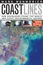
Whether for sailing charts or property maps, Monmonier shows, coastlines challenge mapmakers to capture on paper a highly irregular land-water boundary perturbed by tides and storms and complicated by rocks, wrecks, and shoals. Coast Lines is peppered with captivating anecdotes about the frustrating effort to expunge fictitious islands from nautical charts, the tricky measurement of a coastline’s length, and the contentious notions of beachfront property and public access.
Combing maritime history and the history of technology, Coast Lines charts the historical progression from offshore sketches to satellite images and explores the societal impact of coastal cartography on everything from global warming to homeland security. Returning to the form of his celebrated Air Apparent, Monmonier ably renders the topic of coastal cartography accessible to both general readers and historians of science, technology, and maritime studies. In the post-Katrina era, when the map of entire regions can be redrawn by a single natural event, the issues he raises are more important than ever.
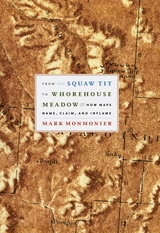
From Squaw Tit to Whorehouse Meadow probes this little-known chapter in American cartographic history by considering the intersecting efforts to computerize mapmaking, standardize geographic names, and respond to public concern over ethnically offensive appellations. Interweaving cartographic history with tales of politics and power, celebrated geographer Mark Monmonier locates his story within the past and present struggles of mapmakers to create an orderly process for naming that avoids confusion, preserves history, and serves different political aims. Anchored by a diverse selection of naming controversies—in the United States, Canada, Cyprus, Israel, Palestine, and Antarctica; on the ocean floor and the surface of the moon; and in other parts of our solar system—From Squaw Tit to Whorehouse Meadow richly reveals the map’s role as a mediated portrait of the cultural landscape. And unlike other books that consider place names, this is the first to reflect on both the real cartographic and political imbroglios they engender.
From Squaw Tit to Whorehouse Meadow is Mark Monmonier at his finest: a learned analysis of a timely and controversial subject rendered accessible—and even entertaining—to the general reader.
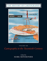
The twentieth century is a pivotal period in map history. The transition from paper to digital formats led to previously unimaginable dynamic and interactive maps. Geographic information systems radically altered cartographic institutions and reduced the skill required to create maps. Satellite positioning and mobile communications revolutionized wayfinding. Mapping evolved as an important tool for coping with complexity, organizing knowledge, and influencing public opinion in all parts of the globe and at all levels of society. Volume 6 covers these changes comprehensively, while thoroughly demonstrating the far-reaching effects of maps on science, technology, and society—and vice versa.
The lavishly produced volume includes more than five hundred articles accompanied by more than a thousand images. Hundreds of expert contributors provide both original research, often based on their own participation in the developments they describe, and interpretations of larger trends in cartography. Designed for use by both scholars and the general public, this definitive volume is a reference work of first resort for all who study and love maps.
The second edition is updated with the addition of two new chapters, 10 color plates, and a new foreword by renowned geographer H. J. de Blij. One new chapter examines the role of national interest and cultural values in national mapping organizations, including the United States Geological Survey, while the other explores the new breed of multimedia, computer-based maps.
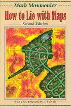
To show how maps distort, Monmonier introduces basic principles of mapmaking, gives entertaining examples of the misuse of maps in situations from zoning disputes to census reports, and covers all the typical kinds of distortions from deliberate oversimplifications to the misleading use of color.
"Professor Monmonier himself knows how to gain our attention; it is not in fact the lies in maps but their truth, if always approximate and incomplete, that he wants us to admire and use, even to draw for ourselves on the facile screen. His is an artful and funny book, which like any good map, packs plenty in little space."—Scientific American
"A useful guide to a subject most people probably take too much for granted. It shows how map makers translate abstract data into eye-catching cartograms, as they are called. It combats cartographic illiteracy. It fights cartophobia. It may even teach you to find your way. For that alone, it seems worthwhile."—Christopher Lehmann-Haupt, The New York Times
". . . witty examination of how and why maps lie. [The book] conveys an important message about how statistics of any kind can be manipulated. But it also communicates much of the challenge, aesthetic appeal, and sheer fun of maps. Even those who hated geography in grammar school might well find a new enthusiasm for the subject after reading Monmonier's lively and surprising book."—Wilson Library Bulletin
"A reading of this book will leave you much better defended against cheap atlases, shoddy journalism, unscrupulous advertisers, predatory special-interest groups, and others who may use or abuse maps at your expense."—John Van Pelt, Christian Science Monitor
"Monmonier meets his goal admirably. . . . [His] book should be put on every map user's 'must read' list. It is informative and readable . . . a big step forward in helping us to understand how maps can mislead their readers."—Jeffrey S. Murray, Canadian Geographic
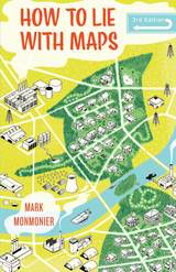
Fully updated for the digital age, this new edition of How to Lie with Maps examines the myriad ways that technology offers new opportunities for cartographic mischief, deception, and propaganda. While retaining the same brevity, range, and humor as its predecessors, this third edition includes significant updates throughout as well as new chapters on image maps, prohibitive cartography, and online maps. It also includes an expanded section of color images and an updated list of sources for further reading.
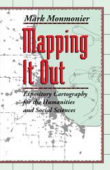
In his acclaimed How to Lie with Maps, Mark Monmonier showed how maps can distort facts. In Mapping it Out: Expository Cartography for the Humanities and Social Sciences, he shows authors and scholars how they can use expository cartography—the visual, two-dimensional organization of information—to heighten the impact of their books and articles.
This concise, practical book is an introduction to the fundamental principles of graphic logic and design, from the basics of scale to the complex mapping of movement or change. Monmonier helps writers and researchers decide when maps are most useful and what formats work best in a wide range of subject areas, from literary criticism to sociology. He demonstrates, for example, various techniques for representing changes and patterns; different typefaces and how they can either clarify or confuse information; and the effectiveness of less traditional map forms, such as visibility base maps, frame-rectangle symbols, and complementary scatterplot designs for conveying complex spatial relationships.
There is also a wealth of practical information on map compilation, cartobibliographies, copyright and permissions, facsimile reproduction, and the evaluation of source materials. Appendixes discuss the benefits and limitations of electronic graphics and pen-and-ink drafting, and how to work with a cartographic illustrator.
Clearly written, and filled with real-world examples, Mapping it Out demystifies mapmaking for anyone writing in the humanities and social sciences.
"A useful guide to a subject most people probably take too much for granted. It shows how map makers translate abstract data into eye-catching cartograms, as they are called. It combats cartographic illiteracy. It fights cartophobia. It may even teach you to find your way."—Christopher Lehmann-Haupt, The New York Times
"A most welcome and thorough investigation of a neglected aspect of both the history of cartography and modern cartographic practice."—Mapline
"A well-written, scholarly treatment of journalistic cartography. . . . It is well researched, thoroughly indexed and referenced . . . amply illustrated."—Judith A. Tyner, Imago Mundi
"There is little doubt that Maps with the News should be part of the training and on the desks of all those concerned with producing maps for mass consumption, and also on the bookshelves of all journalists, graphic artists, historians of cartography, and geographic educators."—W. G. V. Balchin, Geographical Journal
"A definitive work on journalistic cartography."—Virginia Chipperfield, Society of University Cartographers Bulletin
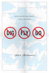
Some maps help us find our way; others restrict where we go and what we do. These maps control behavior, regulating activities from flying to fishing, prohibiting students from one part of town from being schooled on the other, and banishing certain individuals and industries to the periphery. This restrictive cartography has boomed in recent decades as governments seek regulate activities as diverse as hiking, building a residence, opening a store, locating a chemical plant, or painting your house anything but regulation colors. It is this aspect of mapping—its power to prohibit—that celebrated geographer Mark Monmonier tackles in No Dig, No Fly, No Go.
Rooted in ancient Egypt’s need to reestablish property boundaries following the annual retreat of the Nile’s floodwaters, restrictive mapping has been indispensable in settling the American West, claiming slices of Antarctica, protecting fragile ocean fisheries, and keeping sex offenders away from playgrounds. But it has also been used for opprobrium: during one of the darkest moments in American history, cartographic exclusion orders helped send thousands of Japanese Americans to remote detention camps. Tracing the power of prohibitive mapping at multiple levels—from regional to international—and multiple dimensions—from property to cyberspace—Monmonier demonstrates how much boundaries influence our experience—from homeownership and voting to taxation and airline travel. A worthy successor to his critically acclaimed How to Lie with Maps, the book is replete with all of the hallmarks of a Monmonier classic, including the wry observations and witty humor.
In the end, Monmonier looks far beyond the lines on the page to observe that mapped boundaries, however persuasive their appearance, are not always as permanent and impermeable as their cartographic lines might suggest. Written for anyone who votes, owns a home, or aspires to be an informed citizen, No Dig, No Fly. No Go will change the way we look at maps forever.
Because it distorts the proportionate size of countries, the Mercator map was criticized for inflating Europe and North America in a promotion of colonialism. In 1974, German historian Arno Peters proffered his own map, on which countries were ostensibly drawn in true proportion to one another. In the ensuing "map wars" of the 1970s and 1980s, these dueling projections vied for public support—with varying degrees of success.
Widely acclaimed for his accessible, intelligent books on maps and mapping, Monmonier here examines the uses and limitations of one of cartography's most significant innovations. With informed skepticism, he offers insightful interpretations of why well-intentioned clerics and development advocates rallied around the Peters projection, which flagrantly distorted the shape of Third World nations; why journalists covering the controversy ignored alternative world maps and other key issues; and how a few postmodern writers defended the Peters worldview with a self-serving overstatement of the power of maps. Rhumb Lines and Map Wars is vintage Monmonier: historically rich, beautifully written, and fully engaged with the issues of our time.
Despite our apprehension about surveillance technology, Spying with Maps is not a jeremiad, crammed with dire warnings about eyes in the sky and invasive tracking. Monmonier's approach encompasses both skepticism and the acknowledgment that geospatial technology brings with it unprecedented benefits to governments, institutions, and individuals, especially in an era of asymmetric warfare and bioterrorism. Monmonier frames his explanations of what this new technology is and how it works with the question of whether locational privacy is a fundamental right. Does the right to be left alone include not letting Big Brother (or a legion of Little Brothers) know where we are or where we've been? What sacrifices must we make for homeland security and open government?
With his usual wit and clarity, Monmonier offers readers an engaging, even-handed introduction to the dark side of the new technology that surrounds us—from traffic cameras and weather satellites to personal GPS devices and wireless communications.
READERS
Browse our collection.
PUBLISHERS
See BiblioVault's publisher services.
STUDENT SERVICES
Files for college accessibility offices.
RECENTLY PUBLISHED


UChicago Accessibility Resources
home | accessibility | search | about | contact us
BiblioVault ® 2001 - 2024
The University of Chicago Press