
 A SCHOLARLY BOOK REPOSITORY
19 start with C start with C
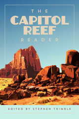
The volume features nearly fifty writers who have anchored their attention and imagination in Utah’s least-known national park. The bedrock elders of Colorado Plateau literature are here (Clarence Dutton, Wallace Stegner, Edward Abbey), as are generations of writers who love this land (including Ellen Meloy, Craig Childs, Charles Bowden, Renny Russell, Ann Zwinger, Gary Ferguson, and Rose Houk). Their pieces are a pleasure to read and each reveals a facet of Capitol Reef’s story, creating a gem of a volume. Editor Stephen Trimble guides and orients with commentary and context.
A visual survey of the park in almost 100 photographs adds another layer to our understanding of this place. Historic photos, pictures from Trimble’s forty-five years of hiking the park, as well as images from master visual artists who have worked in Capitol Reef are included. No other book captures the essence of Capitol Reef like this one.
Part of the National Park Reader series, edited by Lance Newman and David Stanley
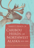
In his final, major publication Ernest S. “Tiger” Burch Jr. reconstructs the distribution of caribou herds in northwest Alaska using data and information from research conducted over the past several decades as well as sources that predate western science by more than one hundred years. Additionally, he explores human and natural factors that contributed to the demise and recovery of caribou and reindeer populations during this time. Burch provides an exhaustive list of published and unpublished literature and interviews that will intrigue laymen and experts alike. The unflinching assessment of the roles that humans and wolves played in the dynamics of caribou and reindeer herds will undoubtedly strike a nerve. Supplemental essays before and after the unfinished work add context about the author, the project of the book, and the importance of both.
Winner, Friends of the Dallas Public Library Award, Texas Institute of Letters, 2001
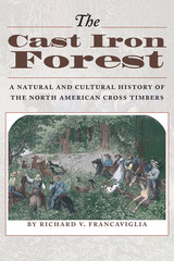
A complex mosaic of post oak and blackjack oak forests interspersed with prairies, the Cross Timbers covers a north-south belt of southern Kansas, eastern Oklahoma, and North Central Texas. Home to Native Americans over several thousand years, the Cross Timbers became a barrier to westward expansion in the nineteenth century, until roads and railroads opened it up to farmers and ranchers, coal miners, and modern city developers, all of whom changed its character in far-reaching ways.
This landmark book fully describes the natural environment of the Cross Timbers and the role that people have played in transforming the region. Richard Francaviglia opens with a natural history that discusses the region's geography and geology, vegetation, and climate. He then traces the interaction of people and the landscape, from the earliest Native American inhabitants and European explorers to the developers and residents of today's ever-expanding cities and suburbs. Many historical and contemporary maps and photographs illustrate the text.
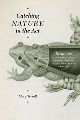
At the center of Terrall’s study is René-Antoine Ferchault de Réaumur (1683–1757)—the definitive authority on natural history in the middle decades of the eighteenth century—and his many correspondents, assistants, and collaborators. Through a close examination of Réaumur’s publications, papers, and letters, Terrall reconstructs the working relationships among these naturalists and shows how observing, collecting, and experimenting fit into their daily lives. Essential reading for historians of science and early modern Europe, Catching Nature in the Act defines and excavates a dynamic field of francophone natural history that has been inadequately mined and understood to date.
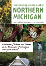
Northern Michigan is undergoing unprecedented changes in land use, climate, resource extraction, and species distributions. For the last hundred years, the University of Michigan Biological Station has monitored these environmental transformations. Stretching 10,000 acres along Burt and Douglas Lakes in the northern Lower Peninsula and 3,200 acres on Sugar Island near Sault Ste. Marie, Michigan, the station has played host to nearly 10,000 students and a steady stream of top scientists in the fields of biology, ecology, geology, archeology, and climatology.
The Changing Environment of Northern Michigan collects essays by some of these scientists, who lead readers on virtual field trips exploring the history of people and science at the station itself, the relations of indigenous people to the land, the geophysical history of the region, characteristics of terrestrial and aquatic ecosystems, key groups of organisms and their relations to local habitats, and perspectives on critical environmental challenges of today and their effects on the region. Accompanying the chapters are color illustrations and photographs that bring the station's pristine setting to life.
Like the station itself, the book provides a solid background for better appreciating the relationships among living and nonliving parts of northern Michigan, for anyone interested in exploring the region's forests, fields, and wetlands; wading or paddling down its rivers; or swimming or floating across its lakes.
Knute J. Nadelhoffer is Director of the University of Michigan Biological Station and Professor of Ecology and Evolutionary Biology at the University of Michigan.
Alan J. Hogg, Jr., teaches science writing at the University of Michigan as a faculty member of the Sweetland Writing Center. His Ph.D. research explored the effects of ozone and nitrogen oxides on University of Michigan Biological Station forests.
Brian A. Hazlett is Professor Emeritus of Zoology at the University of Michigan.
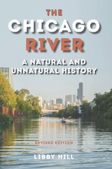
This widely acclaimed volume weaves the perspectives of science, engineering, commerce, politics, economics, and the natural world into a chronicle of the river from its earliest geologic history through its repeated adaptations to the city that grew up around it. While explaining the river’s role in massive public works, such as drainage and straightening, designed to address the infrastructure needs of a growing population, Hill focuses on the synergy between the river and the people of greater Chicago, whether they be the tribal cultures that occupied the land after glacial retreat, the first European inhabitants, or more recent residents.
In the first edition, Hill brought together years of original research and the contributions of dozens of experts to tell the Chicago River’s story up until 2000. This revised edition features discussions of disinfection, Asian carp, green strategies, the evolution of the Chicago Riverwalk, and the river’s rejuvenation. It also explores how earlier solutions to problems challenge today’s engineers, architects, environmentalists, and public policy agencies as they address contemporary issues.
Revealing the river to be a microcosm of the uneasy relationship between nature and civilization, The Chicago River offers the tools and knowledge for the city’s residents to be champions on the river’s behalf.
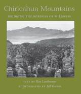
Lamberton shares insights about the geology, habitats, and diversity of wildlife in a place of such isolation that species must either adapt or become extinct. The Chiricahuas are one link in a chain of mountains connecting the Rockies to the Sierra Madre Occidental in Mexico, and some Madrean species reach the northernmost extension of their ranges here: birds like sulphur-bellied flycatchers, mammals like jaguarundis, and trees like the Apache pine. But this is not an untraveled wilderness. We learn why the Chiricahuas are so popular with birders, who flock to these mountains from around the world in the hopes of spotting some of the nearly four hundred avian species found here. We also learn something of the Chiricahua's rich human culture, from Apache warriors to European settlers.
Gracing the text are more than a dozen black-and-white photographs by Jeff Garton that offer views of the Chiricahuas different from those usually found in tourist brochures: landscapes and riparian settings, rock formations and plant studies that give readers a lasting impression of the beauty and tranquility of this wilderness. Together words and images convey an intimate view of one of the Southwest's most exotic locations—stronghold, paradise, and everlasting island in the vast and rolling desert.
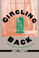
“There was so much space.” These words epitomize ecologist Joe Truett's boyhood memories of the Angelina River valley in East Texas. Years and miles later, back home for the funeral of his grandfather, Truett began a long meditation on the world Corbett Graham had known and he himself had glimpsed, a now-vanished world where wild hogs and countless other animals rustled through the leaves, cows ate pinewoods grass instead of corn, oaks and hickories and longleaf pines were untouched by the corporate ax, and the river flowed freely. Truett's meditation resulted in this clear-sighted portrait of a place over time, its layers revealed by his love and care and curiosity.Truett celebrates his family's heritage and the unspoiled natural world of the Piney Woods without nostalgia. He recreates an older, simpler, more worthy age, but he knows that we have lost touch with it because we wanted to: he laments the loss but understands it. What makes his prose so moving and so redeeming is this precise combination of honesty and sorrow, overlaid by a quiet passion for both the natural and the human worlds.
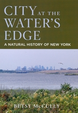
City at the Water's Edge invites readers to do just that. Betsy McCully, a long-time urban dweller, argues that this city of lights is much more than a human-made metropolis. It has a rich natural history that is every bit as fascinating as the glitzy veneer that has been built atop it. Through twenty years of nature exploration, McCully has come to know New York as part of the Lower Hudson Bioregion-a place of salt marshes and estuaries, sand dunes and barrier islands, glacially sculpted ridges and kettle holes, rivers and streams, woodlands and outwash plains. Here she tells the story of New York that began before the first humans settled in the region twelve thousand years ago, and long before immigrants ever arrived at Ellis Island. The timeline that she recounts is one that extends backward half a billion years; it plumbs the depths of Manhattan's geological history and forecasts a possible future of global warming, with rising seas lapping at the base of the Empire State Building.
Counter to popular views that see the city as a marvel of human ingenuity diametrically opposed to nature, this unique account shows how the region has served as an evolving habitat for a diversity of species, including our own. The author chronicles the growth of the city at the expense of the environment, but leaves the reader with a vision of a future city as a human habitat that is brought into balance with nature.
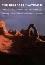
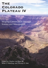
This book focuses on the integration of science and resource management issues in this unique and highly varied environment. Broken into three subsections, this volume addresses conservation biology, biophysical resources, and inventory and monitoring concerns. The chapters range in content, addressing conservation issues—past, present, and future—on the Colorado Plateau, measurement of human impacts on resources, grazing and wildland-urban interfaces, and tools and methods for monitoring habitats and species.
An informative read for people interested in the conservation and natural history of the region, the book will also serve as a valuable reference for those people engaged in the management of cultural and biological resources of the Colorado Plateau, as well as scientists interested in methods and tools for land and resource management throughout the West.
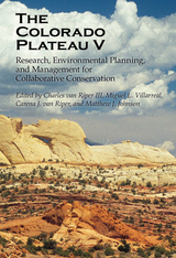
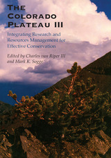
This volume, the fifth from the University of Arizona Press and the tenth overall, focuses on adaptation of resource management and conservation to climate change and water scarcity, protecting biodiversity through restructured energy policies, ensuring wildlife habitat connectivity across barriers, building effective conservation networks, and exploring new opportunities for education and leadership in conservation science.
An informative read for people interested in the conservation and natural history of the region, the book will also serve as a valuable reference for those people engaged in the management of cultural and biological resources of the Colorado Plateau, as well as scientists interested in methods and tools for land and resource management throughout the West.
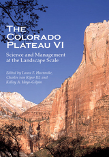
The Colorado Plateau VI’s contributors show how new technologies for monitoring, spatial analysis, restoration, and collaboration improve our understanding, management, and conservation of outcomes at the appropriate landscape scale for the Colorado Plateau. The volume’s chapters fall into five major themes: monitoring as a key tool for addressing management challenges, restoration approaches to improving ecosystem condition and function, collaboration and organizational innovations to achieve conservation and management objectives, landscape-scale approaches to understanding, and managing key species and ecological communities.
Focusing on the integration of science into resource management issues over the Colorado Plateau, this volume includes contributions from dozens of leading scholars of the region. The Colorado Plateau VI proves a valuable resource to all interested in the conservation management, natural history, and cultural biological resources of the Colorado Plateau.
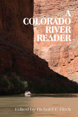
"This canyon world where water yearns toward the ocean is a place so large I can’t take it in. Instead, I am taken in, traveling a near dream as we journey by water, contained by rock walls. In order to see this shorn-away world, I narrow my vision to the small and nearly secret. Never mind the stone’s illusion of permanence or the great strength of water. I look to the most fragile of things here, to the plant world of the canyon. The other river travelers seem taken in by stone, time, and water, and do not see the small things that tempt my attention, the minute fern between stones, the tiny black snails in a pond of water. I am drawn in by the growing life and not by the passing."
- from 'Plant Journey' by Linda Hogan
The mystique of the Colorado River is no less enduring and powerful than is its physical presence in the landscape of the West. Little wonder that narratives about the Colorado still arouse and intrigue readers, or that the river continues to inspire new writing among contemporary authors. What is surprising is that no anthology offering a comprehensive introduction to these works existed - until now.
A Colorado River Reader spans hundreds of years and many cultures and voices to capture an array of responses to this mighty river and tributaries. The collection opens with a Paiute creation myth set in the Grand Canyon and progresses through time, encompassing the Spanish and American exploration narratives of the eighteenth and nineteenth centuries and culminating in the adventure and nature writings of the twentieth.
This is a book that deserves a place next to every armchair and in a pocket of every backpack.
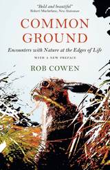
That’s what Rob Cowen discovered after moving to a new home in northern England. After ten years in London he was suddenly adrift, searching for a sense of connection. He found himself drawn to a square-mile patch of waste ground at the edge of town. Scrappy, weed-filled, this heart-shaped tangle of land was the very definition of overlooked—a thoroughly in-between place that capitalism no longer had any use for, leaving nature to take its course. Wandering its meadows, woods, hedges, and fields, Cowen found it was also a magical, mysterious place, haunted and haunting, abandoned but wildly alive—and he fell in fascinated love.
Common Ground is a true account of that place and Cowen’s transformative journey through its layers and lives, but it’s much more too. As the land’s stories intertwine with events in his own life—and he learns he is to become a father for the first time—the divisions between human and nature begin to blur and shift. The place turns out to be a mirror, revealing what we are, what we’re not and how those two things are ultimately inseparable.
This is a book about discovering a new world, a forgotten world on the fringes of our daily lives, and the richness that comes from uncovering the stories and lives—animal and human—contained within. It is an unforgettable piece of nature writing, part of a brilliant tradition that stretches from Gilbert White to Robert Macfarlane and Helen Macdonald.
“I am dreaming of the edge-land again,” Cowen writes. Read Common Ground, and you, too, will be dreaming of the spaces in between, and what—including us—thrives there.
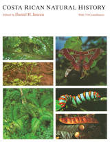
"This is an extraordinary, virtually unique work. . . . The tremendous amount of original, previously unpublished, firsthand information is remarkable."—Peter H. Raven, Director, Missouri Botanical Garden
"An essential resource for anyone interested in tropical biology. . . . It can be used both as an encyclopedia—a source of facts on specific organisms—and as a source of ideas and generalizations about tropical ecology."—Alan P. Smith, Ecology
READERS
Browse our collection.
PUBLISHERS
See BiblioVault's publisher services.
STUDENT SERVICES
Files for college accessibility offices.
RECENTLY PUBLISHED


")


UChicago Accessibility Resources
home | accessibility | search | about | contact us
BiblioVault ® 2001 - 2024
The University of Chicago Press