
 A SCHOLARLY BOOK REPOSITORY
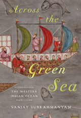
A history of two centuries of interactions among the areas bordering the western Indian Ocean, including India, Iran, and Africa.
Beginning in the mid-fifteenth century, the regions bordering the western Indian Ocean—“the green sea,” as it was known to Arabic speakers—had increasing contact through commerce, including a slave trade, and underwent cultural exchange and transformation. Using a variety of texts and documents in multiple Asian and European languages, Across the Green Sea looks at the history of the ocean from a variety of shifting viewpoints: western India; the Red Sea and Mecca; the Persian Gulf; East Africa; and Kerala.
Sanjay Subrahmanyam sets the scene for this region starting with the withdrawal of China's Ming Dynasty and explores how the western Indian Ocean was transformed by the growth and increasing prominence of the Ottoman Empire and the continued spread of Islam into East Africa. He examines how several cities, including Mecca and the vital Indian port of Surat, grew and changed during these centuries, when various powers interacted until famines and other disturbances upended the region in the seventeenth century. Rather than proposing an artificial model of a dominant center and its dominated peripheries, Across the Green Sea demonstrates the complexity of a truly dynamic and polycentric system through the use of connected histories, a method pioneered by Subrahmanyam himself.
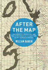
In After the Map, William Rankin argues that although this shift did not render traditional maps obsolete, it did radically change our experience of geographic knowledge, from the God’s-eye view of the map to the embedded subjectivity of GPS. Likewise, older concerns with geographic truth and objectivity have been upstaged by a new emphasis on simplicity, reliability, and convenience. After the Map shows how this change in geographic perspective is ultimately a transformation of the nature of territory, both social and political.
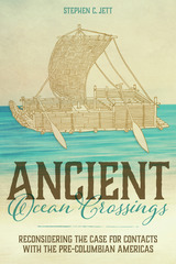
In Ancient Ocean Crossings: Reconsidering the Case for Contacts with the Pre-Columbian Americas, Stephen Jett encourages readers to reevaluate the common belief that there was no significant interchange between the chiefdoms and civilizations of Eurasia and Africa and peoples who occupied the alleged terra incognita beyond the great oceans.
More than a hundred centuries separate the time that Ice Age hunters are conventionally thought to have crossed a land bridge from Asia into North America and the arrival of Columbus in the Bahamas in 1492. Traditional belief has long held that earth’s two hemispheres were essentially cut off from one another as a result of the post-Pleistocene meltwater-fed rising oceans that covered that bridge. The oceans, along with arctic climates and daunting terrestrial distances, formed impermeable barriers to interhemispheric communication. This viewpoint implies that the cultures of the Old World and those of the Americas developed independently.
Drawing on abundant and concrete evidence to support his theory for significant pre-Columbian contacts, Jett suggests that many ancient peoples had both the seafaring capabilities and the motives to cross the oceans and, in fact, did so repeatedly and with great impact. His deep and broad work synthesizes information and ideas from archaeology, geography, linguistics, climatology, oceanography, ethnobotany, genetics, medicine, and the history of navigation and seafaring, making an innovative and persuasive multidisciplinary case for a new understanding of human societies and their diffuse but interconnected development.
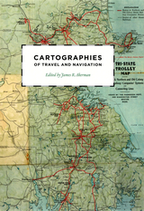
Finding one’s way with a map is a relatively recent phenomenon. In premodern times, maps were used, if at all, mainly for planning journeys in advance, not for guiding travelers on the road. With the exception of navigational sea charts, the use of maps by travelers only became common in the modern era; indeed, in the last two hundred years, maps have become the most ubiquitous and familiar genre of modern cartography.
Examining the historical relationship between travelers, navigation, and maps, Cartographies of Travel and Navigation considers the cartographic response to the new modalities of modern travel brought about by technological and institutional developments in the twentieth century. Highlighting the ways in which the travelers, operators, and planners of modern transportation systems value maps as both navigation tools and as representatives of a radical new mobility, this collection brings the cartography of travel—by road, sea, rail, and air—to the forefront, placing maps at the center of the history of travel and movement.
Richly and colorfully illustrated, Cartographies of Travel and Navigation ably fills the void in historical literature on transportation mapping.
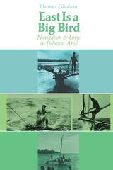
Puluwat Atoll in Micronesia, with a population of only a few hundred proud seafaring people, can fulfill anyone's romantic daydream of the South Seas. Thomas Gladwin has written a beautiful and perceptive book which describes the complex navigational systems of the Puluwat natives, yet has done so principally to provide new insights into the effects of poverty in Western cultures.
The cognitive system which enables the Puluwatans to sail their canoes without instruments over trackless expanses of the Pacific Ocean is sophisticated and complex, yet the Puluwat native would score low on a standardized intelligence test. The author relates this discrepancy between performance and measured abilities to the educational problems of disadvantaged children. He presents his arguments simply and clearly, with sensitive and detailed descriptions and many excellent illustrations. His book will appeal to anthropologists, psychologists, and sailing enthusiasts alike.
Edgar Allan Poe - American Writers 89 was first published in 1970. Minnesota Archive Editions uses digital technology to make long-unavailable books once again accessible, and are published unaltered from the original University of Minnesota Press editions.

A Wired Most Fascinating Book of the Year
“An important book that reminds us that navigation remains one of our most underappreciated arts.”
—Tristan Gooley, author of The Lost Art of Reading Nature’s Signs
“If you want to understand what rats can teach us about better-planned cities, why walking into a different room can help you find your car keys, or how your brain’s grid, border, and speed cells combine to give us a sense of direction, this book has all the answers.”
—The Scotsman
How is it that some of us can walk unfamiliar streets without losing our way, while the rest of us struggle even with a GPS? Navigating in uncharted territory is a remarkable feat if you stop to think about it. In this beguiling mix of science and storytelling, Michael Bond explores how we do it: how our brains make the “cognitive maps” that keep us orientated and how that anchors our sense of wellbeing. Children are instinctive explorers, developing a spatial understanding as they roam. And yet today few of us make use of the wayfinding skills that we inherited from our nomadic ancestors.
Bond tells stories of the lost and found—sailors, orienteering champions, early aviators—and explores why being lost can be such a devastating experience. He considers how our understanding of the world around us affects our psychology and helps us see how our reliance on technology may be changing who we are.
“Bond concludes that, by setting aside our GPS devices, by redesigning parts of our cities and play areas, and sometimes just by letting ourselves get lost, we can indeed revivify our ability to find our way, to the benefit of our inner world no less than the outer one.”
—Science
“A thoughtful argument about how our ability to find our way is integral to our nature.”
—Sunday Times
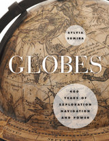
Showcasing the impressive collection of globes held by the British Library, Sumira traces the inception and progression of globes during the period in which they were most widely used—from the late fifteenth century to the late nineteenth century—shedding light on their purpose, function, influence, and manufacture, as well as the cartographers, printers, and instrument makers who created them. She takes readers on a chronological journey around the world to examine a wide variety of globes, from those of the Renaissance that demonstrated a renewed interest in classical thinkers; to those of James Wilson, the first successful commercial globe maker in America; to those mass-produced in Boston and New York beginning in the 1800s. Along the way, Sumira not only details the historical significance of each globe, but also pays special attention to their materials and methods of manufacture and how these evolved over the centuries.
A stunning and accessible guide to one of the great tools of human exploration, Globes will appeal to historians, collectors, and anyone who has ever examined this classroom accessory and wondered when, why, and how they came to be made.
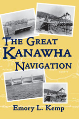
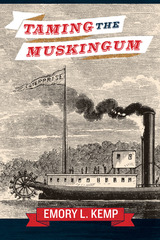
The vision of a central waterway connecting tidewater Virginia with the Ohio River to rival the Erie Canal persisted for decades during the 19th century. The idea was at first fostered by the commonwealth of Virginia and then reincarnated as the Central Water Line, which was endorsed by the federal government. It was a grand vision, and though never implemented, the Great Kanawha Navigation nevertheless became a highly successful regionally controlled waterway that developed the rich resources of the Kanawha Valley. Emory Kemp has compiled a comprehensive history of navigation on the Great Kanawha River, detailing the industrial archaeology of this waterway from the early 19th century, and offering a detailed case study of a major 19th- and early 20th-century civil engineering project that would significantly advance the nation's industrial development.
Using the early unsuccessful attempts to connect the James River and western waters as a background, The Great Kanawha Navigation emphasizes technological innovation and construction of navigational structures on the river. With the river men championing open navigation during favorable stages of the river, and at the same time clamoring for controls to ensure navigation during periods of low flow, the Corps of Engineers responded with the concept of the movable dam to provide a cost-effective means of moving bulk cargo, especially coal, salt, lumber, cement, and chemicals, along nearly 100 miles of the Great Kanawha River. The Great Kanawha Navigation employed a series of ten locks and dams and became a laboratory for the use of movable dams in the United States, using first the French Chanoine shutter wicket dam and then the German Roller Gate dam. The innovative technology of the ten dams, the volume of freight carried and the management of the system by the Corps of Engineers made this one of the most significant public works in the nation. Each of the two systems provided cost-effective and environmentally sound means to tap the rich mineral resources of the Kanawha Valley. By any measure, the Great Kanawha Navigation has been one of the more successful ventures of the Corps of Engineers; Kemp has provided extensive photographs, illustrations, diagrams, and maps to further emphasize the construction of the various hydraulic structures. The result is an interesting and significant blend of biographical, technical, political, geographical, and industrial history that will delight historians of technology and the region.
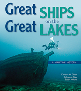
In this highly accessible history of ships and shipping on the Great Lakes, upper elementary readers are taken on a rip-roaring journey through the waterways of the upper Midwest.
Great Ships on the Great Lakes explores the history of the region’s rivers, lakes, and inland seas—and the people and ships who navigated them. Read along as the first peoples paddle tributaries in birch bark canoes. Follow as European voyageurs pilot rivers and lakes to get beaver pelts back to the eastern market. Watch as settlers build towns and eventually cities on the shores of the Great Lakes. Listen to the stories of sailors, lighthouse keepers, and shipping agents whose livelihoods depended on the dangerous waters of Lake Michigan, Superior, Huron, Erie, and Ontario. Give an ear to their stories of unexpected tragedy and miraculous rescue, and heed their tales of risk and reward on the low seas.
Great Ships also tells the story of sea battles and gunships, of the first vessels to travel beyond the Niagara, and of the treacherous storms and cold weather that caused thousands of ships to sink in the Great Lakes. Watch as underwater archaeologists solve the mysteries of Great Lakes shipwrecks today. And learn how the shift from sail to steam forever changed the history of shipping, as schooners made way for steamships and bulk freighters, and sailing became a recreation, not a hazardous way of life.
Designed for the upper elementary classroom with emphasis on Michigan and Wisconsin, Great Ships on the Great Lakes includes a timeline of events, on-page vocabulary, and a list of resources and places to visit. Over 20 maps highlight the region’s maritime history. The accompanying Teacher’s Guide includes 18 classroom activities, arranged by chapter, including lessons on exploring shipwrecks and learning how glaciers moved across the landscape.
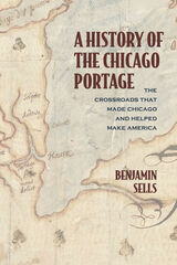
This fascinating account explores the significance of the Chicago Portage, one of the most important—and neglected—sites in early US history. A seven-mile-long strip of marsh connecting the Chicago and Des Plaines Rivers, the portage was inhabited by the earliest indigenous people in the Midwest and served as a major trade route for Native American tribes. A link between the Mississippi River and the Atlantic Ocean, the Chicago Portage was a geopolitically significant resource that the French, British, and US governments jockeyed to control. Later, it became a template for some of the most significant waterways created in the nineteenth and twentieth centuries. The portage gave Chicago its name and spurred the city’s success—and is the reason why the metropolis is located in Illinois, not Wisconsin.
A History of the Chicago Portage: The Crossroads That Made Chicago and Helped Make America is the definitive story of a national landmark.
An important symbolic element in Hawai'ian cartography is the storied place name, which reflects Hawai'ian spatial knowledge of the environment. Many Hawai'ian place names performed in daily rituals were a conscious act of locating genealogical connections, recreating cultural landscapes, and regenerating cultural mores. They constitute a critically important body of Hawai'ian cultural knowledge. When Hawai'ian place names were incorporated into Western cartographic maps they were transformed epistemologically. They went from representing place as a repository of cultural knowledge to representing place as an object on the landscape. Hawai'ian spatial knowledge presentation is interactive, multi-sensual, and multi‐ dimensional.
Kanaka Hawai'i Cartography interweaves methodology with personal narrative and performance presentation in a playbill format. Three of the seven chapters are presented as “Acts” in a play. The remaining four chapters serve as intermissions or interludes together with a prologue and an epilogue for setting the stage and providing closure. To help make the topic more accessible, complex terms have been minimized, making academic theory easier for the educated reader to understand. The book will fill an important gap in Indigenous and Native Studies and will be welcomed by anyone interested in traditional Hawai’ian performance cartography.

"A great read about some great ladies, Pat Majher's Ladies of the Lights pays long overdue homage to an overlooked part of Great Lakes maritime history in which a select group of stalwart women beat the odds to succeed in a field historically reserved for men."
---Terry Pepper, Great Lakes Lighthouse Keepers Association
Michigan once led the country in the number of lighthouses, and they're still a central part of the mystique of the state. What even the region's lighthouse enthusiasts might not know is the rich history of female lighthouse keepers in the area.
Fifty women served the sailing communities on Lakes Huron, Michigan, and Superior, as well as on the Detroit River, for more than 100 years. From Catherine Shook, who raised eight children while maintaining the Pointe Aux Barques light at the entrance to Saginaw Bay; to Eliza Truckey, who assumed responsibility for the lighthouse in Marquette while her husband fought for four years in the Civil War; to Elizabeth Whitney, whose combined service on Beaver Island and in Harbor Springs totaled forty-one years---the stories of Michigan's "ladies of the lights" are inspiring.
This is no technical tome documenting the minutiae of Michigan's lighthouse specifications. Rather, it's a detailed, human portrait of the women who kept those lighthouses running, defying the gender expectations of their time.
Patricia Majher is Editor of Michigan History magazine, published by the Historical Society of Michigan. Prior, she was Assistant Director of the Michigan Women's Historical Center and Hall of Fame in Lansing, Michigan. In addition, she has been writing both advertising and editorial copy for almost thirty years and has been a frequent contributor to Michigan newspapers and magazines.
Long before GPS, Google Earth, and global transit, humans traveled vast distances using only environmental clues and simple instruments. John Huth asks what is lost when modern technology substitutes for our innate capacity to find our way. Encyclopedic in breadth, weaving together astronomy, meteorology, oceanography, and ethnography, The Lost Art of Finding Our Way puts us in the shoes, ships, and sleds of early navigators for whom paying close attention to the environment around them was, quite literally, a matter of life and death.
Haunted by the fate of two young kayakers lost in a fog bank off Nantucket, Huth shows us how to navigate using natural phenomena—the way the Vikings used the sunstone to detect polarization of sunlight, and Arab traders learned to sail into the wind, and Pacific Islanders used underwater lightning and “read” waves to guide their explorations. Huth reminds us that we are all navigators capable of learning techniques ranging from the simplest to the most sophisticated skills of direction-finding. Even today, careful observation of the sun and moon, tides and ocean currents, weather and atmospheric effects can be all we need to find our way.
Lavishly illustrated with nearly 200 specially prepared drawings, Huth’s compelling account of the cultures of navigation will engross readers in a narrative that is part scientific treatise, part personal travelogue, and part vivid re-creation of navigational history. Seeing through the eyes of past voyagers, we bring our own world into sharper view.

Karamanski explores both the navigational and sailing tools of First Nations peoples and the dismissive and foolhardy attitude of early European maritime sailors. He investigates the role played by commercial boats in the Underground Railroad, as well as how the federal development of crucial navigational resources exacerbated sectionalism in the antebellum United States. Ultimately Mastering the Inland Sea shows the undeniable environmental impact of technologies used by the modern commercial maritime industry. This expansive story illuminates the symbiotic relationship between infrastructure investment in the region's interconnected waterways and North America's lasting economic and political development.
Huck and Jim’s little raft is not made of logs, as it is often depicted in illustrations, but of sawn planks, and it was originally part of a much larger raft. Beidler explains why this matters and describes the other rivercraft that appear in the book. He gives what will almost certainly be the last word on the vexed question of whether the lengthy “raft episode,” removed at the publisher’s suggestion from the novel, should be restored to its original place.
Because it distorts the proportionate size of countries, the Mercator map was criticized for inflating Europe and North America in a promotion of colonialism. In 1974, German historian Arno Peters proffered his own map, on which countries were ostensibly drawn in true proportion to one another. In the ensuing "map wars" of the 1970s and 1980s, these dueling projections vied for public support—with varying degrees of success.
Widely acclaimed for his accessible, intelligent books on maps and mapping, Monmonier here examines the uses and limitations of one of cartography's most significant innovations. With informed skepticism, he offers insightful interpretations of why well-intentioned clerics and development advocates rallied around the Peters projection, which flagrantly distorted the shape of Third World nations; why journalists covering the controversy ignored alternative world maps and other key issues; and how a few postmodern writers defended the Peters worldview with a self-serving overstatement of the power of maps. Rhumb Lines and Map Wars is vintage Monmonier: historically rich, beautifully written, and fully engaged with the issues of our time.
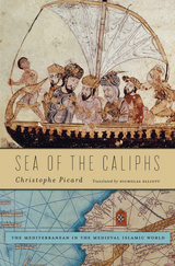
“How could I allow my soldiers to sail on this disloyal and cruel sea?” These words, attributed to the most powerful caliph of medieval Islam, Umar Ibn al-Khattab (634–644), have led to a misunderstanding in the West about the importance of the Mediterranean to early Islam. This body of water, known in Late Antiquity as the Sea of the Romans, was critical to establishing the kingdom of the caliphs and for introducing the new religion to Europe and Africa. Over time, it also became a pathway to commercial and political dominion, indispensable to the prosperity and influence of the Islamic world. Sea of the Caliphs returns Muslim sailors to their place of prominence in the history of the Islamic caliphate.
As early as the seventh century, Muslim sailors competed with Greek and Latin seamen for control of this far-flung route of passage. Christophe Picard recreates these adventures as they were communicated to admiring Muslims by their rulers. After the Arab conquest of southern Europe and North Africa, Muslims began to speak of the Mediterranean in their strategic visions, business practices, and notions of nature and the state. Jurists and ideologues conceived of the sea as a conduit for jihad, even as Muslims’ maritime trade with Latin, Byzantine, and Berber societies increased.
In the thirteenth century, Christian powers took over Mediterranean trade routes, but by that time a Muslim identity that operated both within and in opposition to Europe had been shaped by encounters across the sea of the caliphs.

READERS
Browse our collection.
PUBLISHERS
See BiblioVault's publisher services.
STUDENT SERVICES
Files for college accessibility offices.
RECENTLY PUBLISHED


UChicago Accessibility Resources
home | accessibility | search | about | contact us
BiblioVault ® 2001 - 2024
The University of Chicago Press