2 books about Selden Map

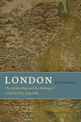
London
The Selden Map and the Making of a Global City, 1549-1689
Robert K. Batchelor
University of Chicago Press, 2013
If one had looked for a potential global city in Europe in the 1540s, the most likely candidate would have been Antwerp, which had emerged as the center of the German and Spanish silver exchange as well as the Portuguese spice and Spanish sugar trades. It almost certainly would not have been London, an unassuming hub of the wool and cloth trade with a population of around 75,000, still trying to recover from the onslaught of the Black Plague. But by 1700 London’s population had reached a staggering 575,000—and it had developed its first global corporations, as well as relationships with non-European societies outside the Mediterranean. What happened in the span of a century and half? And how exactly did London transform itself into a global city?
London’s success, Robert K. Batchelor argues, lies not just with the well-documented rise of Atlantic settlements, markets, and economies. Using his discovery of a network of Chinese merchant shipping routes on John Selden’s map of China as his jumping-off point, Batchelor reveals how London also flourished because of its many encounters, engagements, and exchanges with East Asian trading cities. Translation plays a key role in Batchelor’s study—translation not just of books, manuscripts, and maps, but also of meaning and knowledge across cultures—and Batchelor demonstrates how translation helped London understand and adapt to global economic conditions. Looking outward at London’s global negotiations, Batchelor traces the development of its knowledge networks back to a number of foreign sources and credits particular interactions with England’s eventual political and economic autonomy from church and King.
London offers a much-needed non-Eurocentric history of London, first by bringing to light and then by synthesizing the many external factors and pieces of evidence that contributed to its rise as a global city. It will appeal to students and scholars interested in the cultural politics of translation, the relationship between merchants and sovereigns, and the cultural and historical geography of Britain and Asia.
[more]

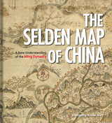
The Selden Map of China
A New Understanding of the Ming Dynasty
Hongping Annie Nie
Bodleian Library Publishing, 2019
Dating from the seventeenth century at the height of the Ming Dynasty, the Selden Map of China reveals a country very different from popular conceptions of the time, looking not inward to the Asian landmass but outward to the sea. Discovered in the stacks of the Bodleian Library, this beautifully decorative map of China is, in fact, a seafaring chart showing Ming Dynasty trade routes. It is the earliest surviving example of Chinese merchant cartography and is evidence that Ming China was outward-looking, capitalistic, and vibrant.
Exploring the commercial aims of the Ming Dynasty, the port city of Quanzhou and its connections with the voyages of the early traveler Zheng He, this book describes the historical background of the era in which the map was used. It also includes an analysis of the skills and techniques involved in Chinese map-making and the significance of the compass bearings, scale, and ratios found on the map, all of which combine to represent a breakthrough in cartographic techniques.
The enthralling story revealed by this extraordinary artifact sheds light on the long history of China’s relationship with the sea and with the wider world.
[more]
READERS
Browse our collection.
PUBLISHERS
See BiblioVault's publisher services.
STUDENT SERVICES
Files for college accessibility offices.
UChicago Accessibility Resources
home | accessibility | search | about | contact us
BiblioVault ® 2001 - 2024
The University of Chicago Press


