
 A SCHOLARLY BOOK REPOSITORY
Ancient Perspectives encompasses a vast arc of space and time—Western Asia to North Africa and Europe from the third millennium BCE to the fifth century CE—to explore mapmaking and worldviews in the ancient civilizations of Mesopotamia, Egypt, Greece, and Rome. In each society, maps served as critical economic, political, and personal tools, but there was little consistency in how and why they were made. Much like today, maps in antiquity meant very different things to different people.
This book begins with a simple question: why do so many Dominicans deny the African components of their DNA, culture, and history?
Field Life examines the practice of science in the field in the Great Plains and Rocky Mountains of the American West between the 1860s and the 1910s, when the railroad was the dominant form of long-distance transportation. Grounded in approaches from environmental history and the history of technology, it emphasizes the material basis of scientific fieldwork, joining together the human labor that produced knowledge with the natural world in which those practices were embedded.
Four distinct modes of field practice, which were shared by different field science disciplines, proliferated during this period—surveys, lay networks, quarries, and stations—and this book explores the dynamics that underpinned each of them. Using two diverse case studies to animate each mode of practice, as well as the making of the field as a place for science, Field Life combines textured analysis of specific examples of field science on the ground with wider discussion of the commonalities in the practices of a diverse array of field sciences, including the earth and physical sciences, the life and agricultural sciences, and the human sciences.
By situating science in its regional environmental context, Field Life analyzes the intersection between the cosmopolitan knowledge of science and the experiential knowledge of people living in the field. Examples of field science in the Plains and Rockies range widely: geological surveys and weather observing networks, quarries to uncover dinosaur fossils and archaeological remains, and branch agricultural experiment stations and mountain biological field stations.
This book is both a resource guide and a review of major issues in gender and agriculture which demonstrates that recognizing the contribution of women to agricultural production is a necessary step in development planning. It presents relevant information and research literature regarding women's roles in agriculture in a consolidated and accessible format, offering insights into how the inclusion or exclusion of appropriate information at the planning stage can have an impact during implementation. It also provides guidelines for locating information on gender-related agricultural issues and incorporating it into development planning, research, and training. The literature reviewed not only calls attention to the work women do in order to improve their access to technology and training but also challenges existing development paradigms. The issues discussed present women's experiences and local knowledge and allude to gender and class inequities that farming women face. Each chapter is intended to help the reader address major gender issues in a specific subject in order to access relevant information and thereby better design and implement appropriate agricultural planning and policies.
By synthesizing twenty years of international research, Gender and Agricultural Development provides an effective tool for development practitioners to use in training programs or surveys in order to ensure the appropriate collection of gender disaggregated data and for educators to integrate gender issues into courses dealing with social aspects of agricultural systems. Its findings are presented in such a way as to allow them to be easily incorporated into innovative planning for more sustainable and equitable agricultural policies.
The Treaty of Guadalupe Hildalgo, which officially ended the U.S.-Mexican War in 1848, cost Mexico half its territory, while the United States gained land that became California, Nevada, Utah, Texas, and parts of Colorado, Arizona, and New Mexico. Because the new United States-Mexico border ran through territory that was still incompletely mapped, the treaty also called for government commissions from both nations to locate and mark the boundary on the ground. This book documents the accomplishments of both the U.S. and the Mexican Boundary Commissions that mapped the boundary between 1849 and 1857, as well as the fifty-four pairs of maps produced by their efforts and the ongoing importance of these historical maps in current boundary administration. Paula Rebert explores how, despite the efforts of both commissions to draw neutral, scientific maps, the actual maps that resulted from their efforts reflected the differing goals and outlooks of the two countries. She also traces how the differences between the U.S. and Mexican maps have had important consequences for the history of the boundary.
After the Treaty of Paris ended the Seven Years’ War in 1763, British America stretched from Hudson Bay to the Florida Keys, from the Atlantic coast to the Mississippi River, and across new islands in the West Indies. To better rule these vast dominions, Britain set out to map its new territories with unprecedented rigor and precision. Max Edelson’s The New Map of Empire pictures the contested geography of the British Atlantic world and offers new explanations of the causes and consequences of Britain’s imperial ambitions in the generation before the American Revolution.
Under orders from King George III to reform the colonies, the Board of Trade dispatched surveyors to map far-flung frontiers, chart coastlines in the Gulf of St. Lawrence, sound Florida’s rivers, parcel tropical islands into plantation tracts, and mark boundaries with indigenous nations across the continental interior. Scaled to military standards of resolution, the maps they produced sought to capture the essential attributes of colonial spaces—their natural capacities for agriculture, navigation, and commerce—and give British officials the knowledge they needed to take command over colonization from across the Atlantic.
Britain’s vision of imperial control threatened to displace colonists as meaningful agents of empire and diminished what they viewed as their greatest historical accomplishment: settling the New World. As London’s mapmakers published these images of order in breathtaking American atlases, Continental and British forces were already engaged in a violent contest over who would control the real spaces they represented.
Accompanying Edelson’s innovative spatial history of British America are online visualizations of more than 250 original maps, plans, and charts.
Ancient human groups in the Eastern Woodlands of North America were long viewed as homogeneous and stable hunter-gatherers, changing little until the late prehistoric period when Mesoamerican influences were thought to have stimulated important economic and social developments. The authors in this volume offer new, contrary evidence to dispute this earlier assumption, and their studies demonstrate the vigor and complexity of prehistoric peoples in the North American Midwest and Midsouth. These peoples gathered at favored places along midcontinental streams to harvest mussels and other wild foods and to inter their dead in the shell mounds that had resulted from their riverside activities. They created a highly successful, pre-maize agricultural system beginning more than 4,000 years ago, established far-flung trade networks, and explored and mined the world's longest cave—the Mammoth Cave System in Kentucky.
Contributors include:
Kenneth C. Carstens, Cheryl Ann Munson, Guy Prentice, Kenneth B. Tankersley, Philip J. DiBlasi, Mary C. Kennedy, Jan Marie Hemberger, Gail E. Wagner, Christine K. Hensley, Valerie A. Haskins, Nicholas P. Herrmann, Mary Lucas Powell, Cheryl Claassen, David H. Dye, and Patty Jo Watson
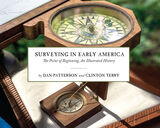
In Surveying Early America: The Point of Beginning, An Illustrated History, award-winning photographer Dan Patterson and American historian Clinton Terry vividly and succinctly unpack the profession of surveying during the eighteenth century. Over 100 full color photographs exclusively shot for the book depict authentic and historically accurate reproductions of techniques and tools through the use of American reenactors from the Department of Geographer, which provide an interpretive look at surveying as a primary means to building the American nation.
Through the lens of Patterson’s camera and Terry’s narrative, readers see what Washington saw as he learned his trade, explored the vast American wilderness, and occasionally laid personal claim to great expanses of land. Readers are visually and intellectually immersed in the historically accurate details of the surveying practices of George Washington, Virginia’s first surveyor and his team.
Step-by-step, readers learn how early America, in particular the east to the Ohio River Valley was initially divided and documented. Terry characterizes both the profession and methods of land measurement and surveying in British colonial North America—techniques that did not substantially change until the invention of GPS technology 200 years later. Along the way Terry details the various tools of the trade early surveyors used.
Photographer Dan Patterson, working with the Department of the Geographer, restages Washington’s actual expeditions during his time with the Geographers to the Army, the technical staff department consisting of American and French soldiers, whose work in the field supported the Continental Army. Patterson brilliantly displays the processes and instruments Washington used 260 years ago.
Together Ohio based photographer and author team up to create a single story, expanding the understanding of primary source material for general readers and those with a passion for early American history.

Archaeology in the Southwest is increasingly directing its attention south of the international border as it becomes clear that a picture of the pre-hispanic Southwest is incomplete without taking the Mexican Northwest into account.
Surveying the Archaeology of Northwest Mexico presents an overview of recent work in Sonora and Chihuahua, comprising a sort of professional tour of the area. The chapters offer fresh insights into the formation of centers such as Paquimé, Cerro de Trincheras, and the Rio Sonora cabaceras. Contributors explore relations between these centers, individual internal organization of the various identifiable polities, and the relation of the whole northwest Mexican region to better-known adjacent ones. The volume underscores that northwest Mexico was not a dependent hinterland but was inhabited by many independent groups throughout prehistory.
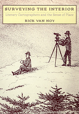
From a cartographer who wrote to a writer who mapped, the literary significance of surveying is revealed in this study of human relationships to the landscape. From the very beginning, American literature was closely intertwined with surveying. In Surveying the Interior, Rick Van Noy explores the ways that four American literary cartographers—Henry David Thoreau, Clarence King, John Wesley Powell, and Wallace Stegner—concerned themselves with what it means to map or survey a place and what it means to write about it. In the process, he helps define the ways by which space enters the human psyche as definable place, as well as the ways by which physical landscape is transmuted into a sense of place as an intimate, personal manifestation of both physical and existential realities.
This study presents “best practices in the integration of arts practice in U.S. research universities . . . , fulfill[ing] the need for a document that articulates models, obstacles, implementation strategies, costs, and impact on students and faculty as well as on research, practice, and teaching in other knowledge areas” (ArtsEngine). Rather than providing a detailed set of instructions, this document maps the landscape of arts integration at 30 partner institutions in the Alliance for the Arts in Research Universities (a2ru) and at 16 other institutions. It highlights aspirational models and presents an overall guide to current practices linking the arts to other learning areas.
READERS
Browse our collection.
PUBLISHERS
See BiblioVault's publisher services.
STUDENT SERVICES
Files for college accessibility offices.
RECENTLY PUBLISHED


 Writing: Donald Murray and the Writing Process Movement, 1963–1987")


UChicago Accessibility Resources
home | accessibility | search | about | contact us
BiblioVault ® 2001 - 2024
The University of Chicago Press