
 A SCHOLARLY BOOK REPOSITORY
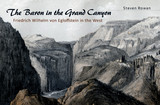
This revealing account concentrates on Egloffstein’s activity in the American mountain West from 1853 to 1858. The early chapters cover his roots as a member of an imperial baronial family in Franconia, his service in the Prussian army, his arrival in the United States in 1846, and his links to his scandalous gothic-novelist cousin, Baron Ludwig von Reizenstein.
Egloffstein’s work as a cartographer in St. Louis in the 1840s led to his participation in John C. Frémont’s final expedition to the West in 1853 and 1854. He left Frémont for Salt Lake City where he joined the Gunnison Expedition under the leadership of Edward Beckwith. During this time, Egloffstein produced his most outstanding panoramas and views of the expedition, which were published in Pacific Railroad Reports.
Egloffstein also served along with Heinrich Balduin Möllhusen as one of the artists and as the chief cartographer of Joseph Christmas Ives’s expedition up the Colorado River. The two large maps produced by Egloffstein for the expedition report are regarded as classics of American art and cartography in the nineteenth century.
While with the Ives expedition, Egloffstein performed his revolutionary experiments in printing photographic images. He developed a procedure for working from photographs of plaster models of terrain, and that led him to invent “heliography,” a method of creating printing plates directly from photographs. He later went on to launch a company to exploit his photographic printing process, which closed after only a few years of operation.
Among the many images in this engaging narrative are photographs of the Egloffstein castle and of Egloffstein in 1865 and in his later years. Also include are illustrations that were published in the PRR, such as “View Showing the Formation of the Cañon of Grand River [today called the Gunnison River] / near the Mouth of Lake Fork with Indications of the Formidable Side Cañons” and Beckwith Map 1: “From the Valley of Green River to the Great Salt Lake.”
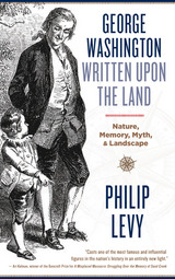
George Washington’s childhood is famously the most elusive part of his life story. For centuries biographers have struggled with a lack of period documentation and an absence of late-in-life reflection in trying to imagine Washington’s formative years.
In George Washington Written upon the Land, Philip Levy explores this most famous of American childhoods through its relationship to the Virginia farm where much of it took place. Using approaches from biography, archaeology, folklore, and studies of landscape and material culture, Levy focuses on how different ideas about Washington’s childhood functioned—what sorts of lessons they sought to teach and how different epochs and writers understood the man and the past itself.
In a suggestive and far-reaching final chapter, Levy argues that Washington was present at the onset of the Anthropocene—the geologic era when human activity began to have a significant impact on world ecosystems. Interpreting Washington’s childhood farm through the lens of “big” history, he encourages scholars to break down boundaries between science and social science and between human and nonhuman.
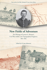
This volume provides the perspective of an individual who was both a topographical engineer—with extensive experience that spanned the country from Arkansas to the Overland Trail—and a common soldier. As a member of the Thirty-Sixth Illinois Infantry, Bennett provided one of the most detailed contemporary accounts of the pivotal Battle of Pea Ridge, March 7–8, 1862. By December 1863, Bennett was promoted to first lieutenant in the newly formed Fourth Arkansas Cavalry (US) and wrote an invaluable first-person account of guerrilla fighting in the Ozark mountains. Readers will delight in Bennett’s witty descriptions of the ankles (and even higher!) of ladies as they gathered their skirts to trek through the mud; his sometimes-cutting words about his fellow hospital patients; and his wry comments on that “exclusively southern institution,” the chigger. New Fields of Adventure will prove useful to scholars of the Ozarks, landscape studies, and the Civil War in the West.
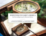
In Surveying Early America: The Point of Beginning, An Illustrated History, award-winning photographer Dan Patterson and American historian Clinton Terry vividly and succinctly unpack the profession of surveying during the eighteenth century. Over 100 full color photographs exclusively shot for the book depict authentic and historically accurate reproductions of techniques and tools through the use of American reenactors from the Department of Geographer, which provide an interpretive look at surveying as a primary means to building the American nation.
Through the lens of Patterson’s camera and Terry’s narrative, readers see what Washington saw as he learned his trade, explored the vast American wilderness, and occasionally laid personal claim to great expanses of land. Readers are visually and intellectually immersed in the historically accurate details of the surveying practices of George Washington, Virginia’s first surveyor and his team.
Step-by-step, readers learn how early America, in particular the east to the Ohio River Valley was initially divided and documented. Terry characterizes both the profession and methods of land measurement and surveying in British colonial North America—techniques that did not substantially change until the invention of GPS technology 200 years later. Along the way Terry details the various tools of the trade early surveyors used.
Photographer Dan Patterson, working with the Department of the Geographer, restages Washington’s actual expeditions during his time with the Geographers to the Army, the technical staff department consisting of American and French soldiers, whose work in the field supported the Continental Army. Patterson brilliantly displays the processes and instruments Washington used 260 years ago.
Together Ohio based photographer and author team up to create a single story, expanding the understanding of primary source material for general readers and those with a passion for early American history.
READERS
Browse our collection.
PUBLISHERS
See BiblioVault's publisher services.
STUDENT SERVICES
Files for college accessibility offices.
RECENTLY PUBLISHED


UChicago Accessibility Resources
home | accessibility | search | about | contact us
BiblioVault ® 2001 - 2024
The University of Chicago Press