
 A SCHOLARLY BOOK REPOSITORY
12 start with H start with H

An artist and painter trained at the School of the Art Institute of Chicago, Samarov began driving a cab in 1993 to make ends meet, and he’s been working as a taxi driver ever since. In Hack: Stories from a Chicago Cab, he recounts tales that will delight, surprise, and sometimes shock the most seasoned urbanite. We follow Samarov through the rhythms of a typical week, as he waits hours at the garage to pick up a shift, ferries comically drunken passengers between bars, delivers prostitutes to their johns, and inadvertently observes drug deals. There are long waits with other cabbies at O’Hare, vivid portraits of street corners and their regular denizens, amorous Cubs fans celebrating after a game at Wrigley Field, and customers who are pleasantly surprised that Samarov is white—and tell him so. Throughout, Samarov’s own drawings—of his fares, of the taxi garage, and of a variety of Chicago street scenes—accompany his stories. In the grand tradition of Nelson Algren, Saul Bellow, Mike Royko, and Studs Terkel, Dmitry Samarov has rendered an entertaining, poignant, and unforgettable vision of Chicago and its people.


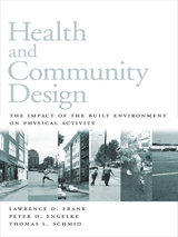
Health and Community Design is a comprehensive examination of how the built environment encourages or discourages physical activity, drawing together insights from a range of research on the relationships between urban form and public health. It provides important information about the factors that influence decisions about physical activity and modes of travel, and about how land use patterns can be changed to help overcome barriers to physical activity. Chapters examine:
• why urban and suburban development should be designed to promote moderate types of physical activity
• the divergent needs and requirements of different groups of people and the role of those needs in setting policy
• how different settings make it easier or more difficult to incorporate walking and bicycling into everyday activities
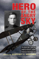
Hero of the Angry Sky draws on the unpublished diaries, correspondence, informal memoir, and other personal documents of the U.S. Navy’s only flying “ace” of World War I to tell his unique story. David S. Ingalls was a prolific writer, and virtually all of his World War I aviation career is covered, from the teenager’s early, informal training in Palm Beach, Florida, to his exhilarating and terrifying missions over the Western Front. This edited collection of Ingalls’s writing details the career of the U.S. Navy’s most successful combat flyer from that conflict.
While Ingalls’s wartime experiences are compelling at a personal level, they also illuminate the larger, but still relatively unexplored, realm of early U.S. naval aviation. Ingalls’s engaging correspondence offers a rare personal view of the evolution of naval aviation during the war, both at home and abroad. There are no published biographies of navy combat flyers from this period, and just a handful of diaries and letters in print, the last appearing more than twenty years ago. Ingalls’s extensive letters and diaries add significantly to historians’ store of available material.
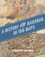
The first international history of railroads and railroad infrastructure told through stunningly reproduced maps.
Since their origins in eighteenth-century England, railroads have spread across the globe, changing everything in their path, from where and how people grew and made things to where and how they lived and moved. Railroads rewrote not only world geography but also the history of maps and mapping. Today, the needs of train companies and their users continue to shape the maps we consume and consult.
Featuring full-color maps primarily from the British Library's distinguished collection—many of them never before published—A History of the Railroad in 100 Maps is the first international history of railroads and railroad infrastructure told through maps. Jeremy Black includes examples from six continents, spanning a variety of uses from railroad planning and operations to guides for passengers, shippers, and tourists.
Arranged chronologically, the maps are accompanied by explanatory text that sheds light on the political, military, and urban development histories associated with the spread of railroads. A final chapter considers railroad maps from games, books, and other cultural artifacts. For anyone interested in the history of railroads or maps, A History of the Railroad in 100 Maps will offer new and unexpected insights into their intertwined global history.

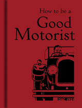
Among the practical and unusual guidelines offered are what precautions one should take when another car approaches and which parts of a car’s engine can be fixed in a pinch with emery paper, copper wire, and insulating tape. Some of the observations, like the cautionary note that, when driving, one ought to “look on all other drivers as fools” are sure to strike a chord with many motorists today. Others, like the suggestion that “a good chauffeur will save his employer a great deal of expense” evoke the style of a glamorous bygone era. The book covers such topics as unscrupulous secondhand car dealers, simple maintenance, women drivers, and “dashboard delights.” (Spoiler: For a well-equipped dashboard, don’t forget the speedometer.) For those planning a longer journey, the book also advises on how to choose the most pleasant picnic site when on the road.
How to be a Good Motorist is the perfect gift for the new driver or anyone who longs for a simpler time before rush-hour traffic reports and roundabouts.
Jarrett Walker believes that transit can be simple, if we focus first on the underlying geometry that all transit technologies share. In Human Transit, Walker supplies the basic tools, the critical questions, and the means to make smarter decisions about designing and implementing transit services.
Human Transit explains the fundamental geometry of transit that shapes successful systems; the process for fitting technology to a particular community; and the local choices that lead to transit-friendly development. Whether you are in the field or simply a concerned citizen, here is an accessible guide to achieving successful public transit that will enrich any community.
The first edition of Human Transit, published in 2011, has become a classic for professionals, advocates, and interested citizens. No other book explains the basic principles of public transit in such lively and accessible prose, all based on a respect for your right to form your own opinion. Walker’s goal is not to make you share his values, but to give you the tools to clarify and advocate for yours.
Walker has updated and expanded the book to deepen its explanations. His ongoing work as a network planning consultant has provided a wealth of new examples, images, and tools. New topics include the problem with specialization; the role of flexible or “demand response” services; how to know when to redesign your network; and responding to tech-industry claims that transit will soon be obsolete. Finally, he has also added a major new section exploring the idea of access to opportunity as a core measure of transit’s success.
Whether you are a professional or a concerned citizen, the revised edition of this accessible guide can help you to achieve successful public transit that will enrich any community.
READERS
Browse our collection.
PUBLISHERS
See BiblioVault's publisher services.
STUDENT SERVICES
Files for college accessibility offices.
RECENTLY PUBLISHED


UChicago Accessibility Resources
home | accessibility | search | about | contact us
BiblioVault ® 2001 - 2024
The University of Chicago Press