
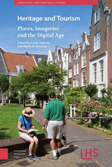
 A SCHOLARLY BOOK REPOSITORY
54 start with H start with H
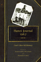
McEldowney first gained the respect of her fellow activists as a student organizer at the University of Michigan. High regard for her intelligence, skill, and hard work with SDS's Economic Recovery Action Program during the years following her graduation in 1964 earned her an invitation to attend an international conference in Czechoslovakia and an offer to continue on to North Vietnam. Though her journal displays only traces of the feminist consciousness that would mark her later political activism, she recorded her observations of North Vietnam clearly aware that she was an outsider—a woman not subject to the military draft, not married to a soldier, and without the heartache of a brother or even a close friend serving in the war.
McEldowney searched for glimpses of everyday life that would help her to better relate to women in Hanoi and the hardships they faced during wartime. As she traveled in North Vietnam, she sought a deeper understanding of the events of her time. Her journal provides readers with a unique lens through which to study those events and gain a new perspective on the Vietnam War era.
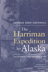
A keen observer of his surroundings, Grinnell provides a unique perspective on northern life in the late nineteenth century. He documented hunting techniques and material culture of the Eskimo of Siberia, as well as the totem poles and architecture of the Tlingit of Southeast. As a pioneer conservationist, Grinnell was one of the first to express concern over the effects of trade and industry on Alaska's peoples and natural resources.
Illustrated with photos and drawings by Harriman Expedition members, including Edward S. Curtis, this volume makes the work of a passionate observer available to a new generation of readers.

Shortly after her sixteenth birthday, Leonin learned from her mother that her father, a Cuban exile, was very much alive and living in Florida. Her attempts to contact him, however, were thwarted until four years later, when she left home in search of her roots.
She meets her father, but trying to discover the truth behind him proves to be a more daunting task. Her journey takes her to Miami, Colombia, and Cuba, and her search for cultural identity leads her to create memories, friendships, and romances. She finds moments of connection and redemption, ending up in Havana not as a cultural tourist but as an illegitimate daughter of Cuba looking for validation. What she discovers is an island bereft of fathers and brimming with paternalism. As she becomes entangled with two different men, she descends further into the Havana of poverty, humiliation, and despair, as well as the ever-inventive city that is as passionate as it is contradictory.
Insightful, imaginative, and often poetic, Havana and Other Missing Fathers is Mia Leonin’s recollection of this journey and her longing to learn more about her origins. In the end, she must learn to accept the answers she discovers as well as the questions that remain.
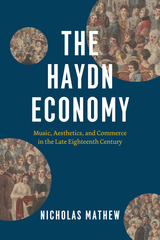
In this far-reaching work of music history and criticism, Nicholas Mathew reimagines the world of Joseph Haydn and his contemporaries, with its catastrophic upheavals and thrilling sense of potential. In the process, Mathew tackles critical questions of particular moment: how we tell the history of the European Enlightenment and Romanticism; the relation of late eighteenth-century culture to incipient capitalism and European colonialism; and how the modern market and modern aesthetic values were—and remain—inextricably entwined.
The Haydn Economy weaves a vibrant material history of Haydn’s career, extending from the sphere of the ancient Esterházy court to his frenetic years as an entrepreneur plying between London and Vienna to his final decade as a venerable musical celebrity, during which he witnessed the transformation of his legacy by a new generation of students and acolytes, Beethoven foremost among them. Ultimately, Mathew asserts, Haydn’s historical trajectory compels us to ask what we might retain from the cultural and political practices of European modernity—whether we can extract and preserve its moral promise from its moral failures. And it demands that we confront the deep histories of capitalism that continue to shape our beliefs about music, sound, and material culture.
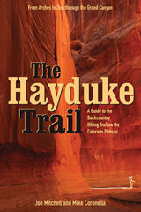
Joe Mitchell and Mike Coronella pioneered Hayduke after concluding that a long trail—such as the Appalachian or Pacific Crest— was possible on the Plateau, thus introducing more people to these unique and threatened public lands. The Hayduke Trail includes detailed maps of the entire route, suggested cache points, and a wealth of description and tips for tackling this intense undertaking.
Hiking the entire route requires at least three months, though like other long trails it can be broken into smaller segments. The guide, featured in the March 2005 issue of National Geographic Adventure Magazine, is designed for experienced desert trekkers seeking a thorough-hiking experience on a well-tested route.
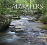
From their primal seepages in the Appalachian highlands or along the broad Chunnenuggee Hills, Alabama’s rivers carve through the rocky uplands and down the Fall Line rapids, then ease across the coastal plain to their eventual confluence with the Gulf of Mexico.
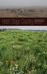
As proud grasslanders know, the prairie is biologically fulfilling, unique, and increasingly rare: biologists from the National Park Service and the Nature Conservancy agree that a healthy prairie remains one of the most ecologically diverse and dynamic ecosystems on this planet—as well as one of the rarest left on earth. This landscape that once inspired rapturous exclamations from travelers headed west on horseback now mostly exists in fragments exiled from each other by cropland, cities, and interstate highways.
Historically, tallgrass prairie stretched from Canada to Texas, from central Kansas to Indiana. Now the last major expanse of tallgrass occurs in the Flint Hills, a verdant landscape extending in a north-south strip across eastern Kansas and into northern Oklahoma’s Osage County. In these essays, Gary Lantz brings the beautiful diversity of the prairie home to all of us.
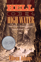
Although John Wesley Powell and party are usually given credit for the first river descent through the Grand Canyon, the ghost of James White has haunted those claims. White was a Colorado prospector, who, almost two years before Powell's journey, washed up on a makeshift raft at Callville, Nevada. His claim to have entered the Colorado above the San Juan River with another man (soon drowned) as they fled from Indians was widely disseminated and believed for a time, but Powell and his successors on the river publically discounted it. Colorado River runners and historians have since debated whether White's passage through Grand Canyon even could have happened.
Hell or High Water is the first full account of White's story and how it became distorted and he disparaged over time. It is also a fascinating detective story, recounting how White's granddaughter, Eilean Adams, over decades and with the assistance of a couple of notable Colorado River historians who believed he could have done what he claimed, gradually uncovered the record of James White's adventure and put together a plausible narrative of how and why he ended up floating helplessly down a turbulent river, entrenched in massive cliffs, with nothing but a driftwood raft to carry him through.
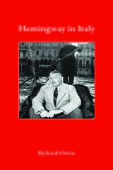
In evocative prose, complemented by a rich selection of historical images, Richard Owen takes us on a tour through Hemingway’s Italy. He describes how Hemingway first visited the country of the Latins during World War I, an experience that set the scene for A Farewell to Arms. Then after World War II, it was in Italy that he found inspiration for Across the River and into the Trees. Again and again, the Italian landscape—from the Venetian lagoon to the Dolomites and beyond—deeply affected one of the greatest writers of the twentieth century. Hemingway in Italy demonstrates that Italy stands alongside Spain as a key influence on Hemingway’s work—and why the Italians themselves hold Hemingway and his writing close to their hearts.
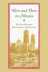
Mary Ashley Townsend was a novelist, newspaper columnist, and poet laureate of New Orleans who made several trips to Mexico with her daughter Cora during the last two decades of the 19th century. She collected her impressions of many aspects of life in that country—flora, fauna, architecture, people at work and play, fashion, society, food—and wrote about them during a time when few women engaged in solo travel, much less the pursuit of travel writing. Her collected work was still in progress when she died in a train accident in 1901, and was never published.
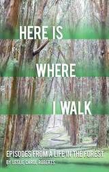
In layered stories of her life and travels, Leslie turns her daily walks into revelations of deeper meaning. From Maryland to Iowa to Tasmania, we follow a fierce and keenly observant walker through places of exquisite beauty and complexity. Her daily walks inspire Leslie to accept the invitation of the beckoning trees where she finds herself colliding with the urban coyote, the peculiar banana slug, and the manzanita. She also notes both ridiculous and poignant aspects of human ecosystems in pursuit of what it means to live a life of creativity and creation from scientist-activists battling to save environments to the tragic realities of ordinary life.
In this finely crafted eco-memoir, each place provides Leslie with exactly the scaffolding needed to survive, with nature serving as the tonic. Here is Where I Walk provides a vivid answer to how we can find our place, not only in nature but within ourselves and the world we walk.
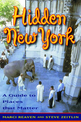
Many of them matter because of the opportunities they provide for socializing, such as the Empire Roller Disco in Brooklyn that attracts a community of skaters and the Cube sculpture on Astor Place, which is a meeting spot for homeless youth. Others matter because they are focal points for communities and the spaces are intertwined with how people share in each others' lives. Still others have been lost, like the house under the roller coaster in Coney Island, made famous by Woody Allen in Annie Hall.
This book is not just about Manhattan, but covers all five boroughs in New York City. It is an invitation to visit, revisit, learn, and enjoy all that you didn't know the city has to offer. It will show you what's there, what used to be there, and why it will be there for years to come. The chapters, illustrated with appealing black-and-white photos, include first-person remembrances and commentaries from New Yorkers themselves. Each entry functions as a small travel essay, evoking how certain destinations are experienced. As a guide to the New York City that is less traveled, this unique book shows that some of the best places to visit are ones that you never even thought existed.
The 32 Places That Matter
Hua Mei Bird Garden
Russian and Turkish Tenth Street Baths
Bohemian Hall and Beer Garden
The Magic Table at the Edison Hotel
The General Society of Mechanics and Tradesman
Webster Hall
The Cube
Stickball Boulevard and the Stadiums of the Street
Thomas Jefferson Park Pool
Empire Roller Skating Center
Chess Havens
Coney Island
The Lemon Ice King of Corona
Coney Island Bialys and Bagels
Sahadi's Specialty and Middle Eastern Foods
Arthur Avenue Market
Union Square Greenmarket
The Village Vanguard
Casa Amadeo Record Shop
Richmond Barthé's Frieze at Kingsborough Houses
Quirky Features of the Landscape
Art in the Subways
Governors Island
Casita Rincón Criollo, Magnolia Tree Earth Center, Liz Christy Bowery-Houston Community Garden
The Flower District
Fishing around New York
Kehila Kedosha Janina Synagogue and Museum
Masjid Al-Taqwa
Ganesha Hindu Temple
Our Lady of Mount Carmel Grotto
The Memorials of the Battery
Strawberry Fields
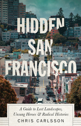
Hidden San Francisco is a guidebook like no other. It’s a radical, alternative guidebook and history of San Francisco, complete with maps detailing walking and bike routes around the city.
San Francisco is an iconic and symbolic city. But only when you look beyond the picture-postcards of the Golden Gate Bridge and the quaint cable cars do you realize that the city's most interesting stories are not the Summer of Love, the Beats or even the latest gold rush in Silicon Valley.
Carlsson delves into the Bay Area's long prehistory, examining the region's geography and the lives of its inhabitants before the 1849 Gold Rush changed everything, setting in motion the clash between capital and labor that shaped the modern city. Structured around the four major themes of ecology, labor, transit and dissent, Chris Carlsson’s book peels back the layers of San Francisco's history to reveal a storied past: behind old walls and gleaming glass facades lurk former industries, secret music and poetry venues, forgotten terrorist bombings, and much more.
From the perspective of the students and secretaries, hippies and beatniks, longshoremen and waitresses, Hidden San Francisco uncovers dozens of overlooked, forgotten and buried histories that pulse through the streets and hills even today, inviting the reader to see themselves in the middle of the ongoing, everyday process of making history together.
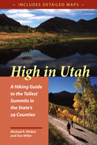
High in Utah is quite consciously a book for peak baggers, complete with a checklist and elevations. Summits range from Kings Peak, Utah’s highest at 13,528’ to the unnamed peak in Rich County, a mere 9,255’. In addition to the county high points, this book also has four “classic” climbs: Mt. Olympus in Salt Lake County; Mt. Timpanogos above Provo; Notch Peak in the House Range west of Delta; and Wellsville Cone, Cache Valley’s western landmark.
Since finding a place to start can often be the most frustrating part of a hike, emphasis is placed on directions to each trailhead. There is a road map for each hike, as well as a trail map showing contours. The routes in this guide are not always the easiest or most practical, but they may be the most appealing and are often the most commonly used (lessening human impact on other potential routes). Difficulty levels range from 'extreme'—long, steep routes that may require some route finding—to 'too easy'—reachable by car. Two sets of hiking times are provided to accommodate variations in hiking speed, and there are also sections on flora and fauna, mountain weather, low-impact hiking and camping, equipment, and altitude sickness.
"Alaska is our biggest, buggiest, boggiest state. Texas remains our largest unfrozen state. But mountainous Utah, if ironed out flat, would take up more space on a map than either."
—Edward Abbey, 1927–1989
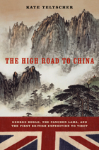
Bogle was able to gain an audience with the Panchen Lama, and in him he found much more than a business partner; the Incarnate Lama was a friendly man who loved to discuss politics, science, art, and culture. Bogle gradually became less of a tourist and less of a colonist, growing comfortable and happy the longer he spent in Tibet even as his mission to open China failed. All the while, he kept a detailed journal—his prose by turn playful, self-deprecating, grandiose, and shrewd—and this revelatory document gives readers an exhilarating front seat to the beginnings of international relationships that exert their effects even now.
Teltscher’s portrayal of Bogle’s unique diplomatic relationship with the holy man is an admission that history is made by people—and people have emotions, flaws, and feelings that enrich and affect history.
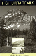
High Uinta Wilderness—three emotion-charged words that describe a very precious place. The highest mountains, the unique alpine ecosystem, and the largest designated Wilderness in Utah are all found here.
This is a complete rewriting of the original High Uinta Trails, first published in 1974. Access road and land management information has been expanded, new areas and routes have been added, and trail conditions have been completely updated.
The descriptions of the trails, lakes, ridges, and summits are an indispensable resource for selecting a destination and planning a trip but there are still plenty of undocumented places in the Uintas to explore.
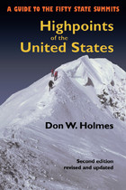
The highpoints of the fifty states range from Alaska’s 20,320 foot high Mount McKinley to 345 feet at Lakewood Park in Florida. Some highpoints, such as Mount Mitchell in North Carolina and New Hampshire’s Mount Washington can be reached by automobile on a sightseeing drive. Others such as Colorado’s Mount Elbert or Mount Marcy in New York are accessible as wilderness day hikes. Still others, such as Mount Rainier in Washington or Gannett Peak in Wyoming, are strenuous and risky mountaineering challenges that should be attempted only by experienced climbers. Whatever your level of skill and interest, Highpoints of the United States offers a diverse range of experiences.
Arranged alphabetically by state, each listing has a map, photographs, and information on trailhead, main and alternative routes, elevation gain, and conditions. Historical and natural history notes are also included, as are suggestions for specific guidebooks to a region or climb. Appendices include a list of highpoints by region, by elevation, and a personal log for the unashamed "peak-bagger."
Whether you’re an armchair hiker or a seasoned climber, interested only in your state’s highest point or all fifty, this book will be an invaluable companion and reference.
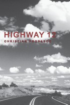
Highway 12 is undoubtedly one of not only America's but the world's most scenic highways. From its intersection on the west with Highway 89 south of Panguitch, Utah, it runs up through Red Canyon onto the Paunsagunt Plateau and across Bryce Canyon National Park. It then drops into the Paria River Valley, passes through several tiny villages, crosses some extraordinary (for anywhere but this region) badlands, and descends the Escalante River into Potato Valley. While a driver may justifiably feel she has seen some scenery by that point, the highway is just getting started, for in the next stretch, it crosses a labyrinth of multicolored sandstone humps and corridors, climaxed by a narrow hogback with steep slickrock drops to each side, all within Grand Staircase-Escalante National Monument. Reaching the oasis of Boulder within this desert of rock, the road then climbs across the flank of the Aquarius Plateau, providing spectacular vistas and terminating at the gateway to Capitol Reef National Park. Along the way side roads and trails access the vast wilderness of the Paria and Escalante Rivers and the high plateaus they drain. Congress acknowledged the unequaled splendor of Highway 12 by designating it one of a handful of All-American Roads.
To travel with Christian Probasco this road and its spurs, which lead deep into some of the wildest, most broken-up and stunning landscapes anywhere, can put a unique twist on an already singular experience. He knows the region as well as anyone and brings an original, edgy, youthful view to it. His opinions and his language may challenge you. His approaches to and perspectives on the land may sometimes surprise you. His understanding of the area's history and its people will likely teach you a thing or two.
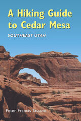
A Hiking Guide to Cedar Mesa describes sixty-three routes, ranging from quarter-mile walks to fifteen-mile day hikes, loops, and multi-day backpack trips. There is essential information on permits, weather, gear, road, trailhead access, geology, human history in the region, and leave-no-trace camping.
Care is given to name only those well-known archaeological sites that are visible or immediately accessible from roads. Throughout, the author emphasizes proper visitation protocol for fragile archaeological sites. He states, "I have been touched by this landscape and would prefer to keep its teachings and secrets to myself, but I cannot. The experience of the desert should be available to everyone with the motivation to encounter it."
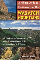
Northern Utah’s Wasatch Mountains are popular destinations for outdoor enthusiasts in every season. These mountains rise spectacularly from the relatively flat valley floor to thirteen peaks over 11,000 feet in elevation. An additional nineteen peaks rise more than 10,000 feet in elevation. Although many hiking guides exist for the Wasatch Mountains, there has been no guide book that focuses on the geologic features visible from the trails—until now.
Written by a recognized authority on the geology of the Wasatch Mountains, this guide is meant to enrich the experience of outdoor enthusiasts who want to understand the geological history and development of the Wasatch range. The first section of the book introduces the major geological time periods—the record of mountain building events from oldest to youngest, the effects of glaciation, and the development of the present topography. It then follows with a descriptive trail guide for each major trail system, including Mill Creek and Neffs Canyons, Mount Olympus, Little and Big Cottonwood Canyons, and Bells Canyon. Trail length, elevation gain, relative difficulty, and major geological features are outlined for each trail. Now you can hike these trails with the answers to all your geologic questions right at your fingertips.
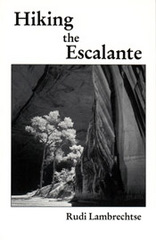
An invaluable resource to anyone traversing the Escalante, this comprehensive guide details 43 hikes.
Publisher's Note: Realizing there are virtually no marked trails in the Escalante country (mostly canyons that wander and have many intersections, challenging anyone to write explicit description), this book includes directions to the trailhead, how to follow a particular route with choices of side canyons along the way, and occasional alternate endings. Some of the hikes may be appropriate for beginners. Some only the most experienced should attempt.

breathtaking and rugged national parks. The second edition of this compellingly readable
and useful book is completely updated, giving outdoor enthusiasts the most current
information they need to explore this world-renowned wilderness.
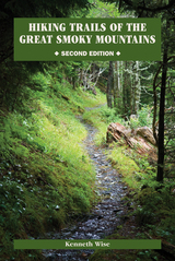
Included here are facts on more than 125 official trails recognized by the Park Service.
Each one has its own setting, purpose, style, and theme, and author Kenneth Wise
describes them in rich and vivid detail. For every route, he includes a set of driving directions
to the trailhead, major points of interest, a schedule of distances to each one, a
comprehensive outline of the trail’s course, specifics about where it begins and ends, references
to the U.S. Geological Survey’s quadrangle maps, and, when available, historical
anecdotes relating to the trail. His colorful descriptions of the area’s awe-inspiring beauty
are sure to captivate even armchair travelers.
Organized by sections that roughly correspond to the seventeen major watersheds
in the Smokies, Wise starts in Tennessee and moves south into North Carolina, with
two major trails—the Lakeshore and the Appalachian—that traverse several watersheds
treated independently. Further enhancing the utility of this volume is the inclusion of the
Great Smoky Mountains’ official trail map as well as an informative introduction filled
with details about the geology, climate, vegetation, wildlife, human history, and environmental
concerns of the region.
A seasoned outdoorsman with more than thirty years of experience in the area and
codirector of the Great Smoky Mountains Regional Project at the University of Tennessee,
Knoxville, Wise brings an exceptional depth of knowledge to this guide. Both experienced
hikers and novices will find this newly revised edition an invaluable resource for trekking in
the splendor of the Smokies.
Belloc captures the essence of each place he visits--whether on the gloomy English fens, or the sunny Provence and Languedoc regions of France, or navigating the North Sea in a leaky boat. Praised for his blend of wit and philosophy, Belloc also weaves together fantasy and fact, producing portraits that take on mythic proportions.
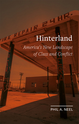
Urgent and unsparing, this book opens our eyes to America’s new heart of darkness. Driven by an ever-expanding socioeconomic crisis, America’s class structure is recomposing itself in new geographies of race, poverty, and production. The center has fallen. Riots ricochet from city to city led by no one in particular. Anarchists smash financial centers as a resurgent far right builds power in the countryside. Drawing on his direct experience of recent popular unrest, from the Occupy movement to the wave of riots and blockades that began in Ferguson, Missouri, Phil A. Neel provides a close-up view of this landscape in all its grim but captivating detail. Inaugurating the new Field Notes series, published in association with the Brooklyn Rail, Neel’s book tells the intimate story of a life lived within America’s hinterland.
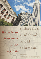
Ever look at a modern skyscraper or a vacant lot and wonder what was there before? Or maybe you have passed an old house and been curious about who lived there long ago. This richly illustrated new book celebrates Columbus, Ohio’s, two-hundred-year history and supplies intriguing stories about the city’s buildings and celebrated citizens, stopping at individual addresses, street corners, parks, and riverbanks where history was made. As Columbus celebrates its bicentennial in 2012, a guide to local history is very relevant.
Like Columbus itself, the city’s history is underrated. Some events are of national importance; no one would deny that Abraham Lincoln’s funeral procession down High Street was a historical highlight. But the authors have also included a wealth of social and entertainment history from Columbus’s colorful history as state capital and destination for musicians, artists, and sports teams.
The book is divided into seventeen chapters, each representing a section of the city, including Statehouse Square, German Village, and Franklinton, the city’s original settlement in 1797. Each chapter opens with an entertaining story that precedes the site listings. Sites are clearly numbered on maps in each section to make it easy for readers to visit the places that pique their interest. Many rare and historic photos are reproduced along with stunning contemporary images that offer insight into the ways Columbus has changed over the years.
A Historical Guidebook to Old Columbus invites Columbus’s families to rediscover their city with a treasure trove of stories from its past and suggests to visitors and new residents many interesting places that they might not otherwise find. This new book is certain to amuse and inform for years to come.
Hawaiian culture as it met foreign traders and settlers is the context for Sahlins's structuralist methodology of historical interpretation
Filled with profound reflections and snapshots from the past, Karen Chase’s History is Embarrassing weaves together threads from one single life—a girl suffering from polio, a poet, a Jewish woman, a writer, and a painter. Like Chase, the characters who populate these essays are outsiders—undercover cops, a gay couple in 1500s India, bear poachers, psychiatric patients, and even a president—each a meaningful part of history. Divided into three parts—histories, pleasures, and horrors—History is Embarrassing is an assortment of thought-provoking essays that are sure to resonate with many readers.
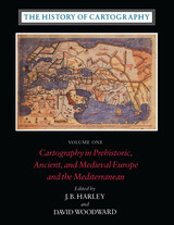
Volume One addresses the prehistorical and historical mapping traditions of premodern Europe and the Mediterranean world. A substantial introductory essay surveys the historiography and theoretical development of the history of cartography and situates the work of the multi-volume series within this scholarly tradition. Cartographic themes include an emphasis on the spatial-cognitive abilities of Europe's prehistoric peoples and their transmission of cartographic concepts through media such as rock art; the emphasis on mensuration, land surveys, and architectural plans in the cartography of Ancient Egypt and the Near East; the emergence of both theoretical and practical cartographic knowledge in the Greco-Roman world; and the parallel existence of diverse mapping traditions (mappaemundi, portolan charts, local and regional cartography) in the Medieval period.
Throughout the volume, a commitment to include cosmographical and celestial maps underscores the inclusive definition of "map" and sets the tone for the breadth of scholarship found in later volumes of the series.
"[The six-volume set] is certain to be the standard reference for all subsequent scholarship. The editors . . . have assembled and analyzed a vast collection of knowledge. . . . If the first volume is an indication, the complete set will be comprehensive and judicious." —John Noble Wilford, New York Times Book Review
"As well as enlarging the mind and lifting the spirits through the sheer magnitude of its endeavor, the collection delights the senses. The illustrations are exquisite: browsing fingers will instinctively alight on the sheaf of maps reproduced on stock slightly thicker than that of the text. The maps are so beguiling in the tantalizing glimpses they offer of other, seemingly incomprehensible, worlds, that the sight of them will stir the connoisseur in even the most-guarded scholar." —Ronald Rees, Geographical Review
"The corpus it brings to light, along with the extensive references, bibliography, and exhaustive appendices containing valuable comments about many of the pieces discussed, together make this book an important resource for the scholar."—Robert Provin, Professional Geographer
"This volume is a landmark of new research and will certainly contribute to further discoveries, translations, interpretations, inventories, more precise dating and the construction of stemmata." —Christian Jacob, Cartographica
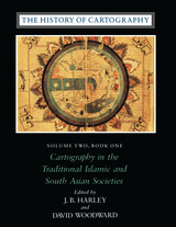
"In seeking to characterize the cartography of premodern Islamic and south Asian societies, the editors offer the image of an archipelago of cartographically conscious islands in a silent sea. The research potential which they have revealed is clearly vast and underappreciated, with many islands still to be discovered or enlarged. This important book, does more, therefore, than plug a huge gap in cartographic historiography. It provides the foundation for crosscultural cartographic research in two major world regions."-Jeffrey Stone, Ecumene
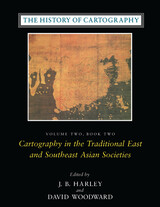
Volume 2, book 2, considers the cartographic traditions of China, Korea, Japan, Vietnam, Tibet, Burma, Thailand, Laos, Malaysia, Indonesia, Brunei, and the Philippines, presenting significant new research and interpretation of archaeological, literary, and graphic sources. Richly illustrated with forty color plates and over five hundred black and white illustrations, the book includes a number of rare and elaborate maps, many previously unpublished.
"The maps in this book provide an evocative picture of how indigenous peoples view and represent their worlds. They illuminate not only questions of material culture but also the cognitive systems and social motivations that underpin them" (from the introduction).
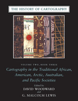
Although they are often rendered in forms unfamiliar to Western eyes, maps have existed in most cultures. In this latest book of the acclaimed History of Cartography, contributors from a broad variety of disciplines collaborate to describe and address the significance of traditional cartographies. Whether painted on rock walls in South Africa, chanted in a Melanesian ritual, or fashioned from palm fronds and shells in the Marshall Islands, all indigenous maps share a crucial role in representing and codifying the spatial knowledge of their various cultures. Some also serve as repositories of a group's sacred or historical traditions, while others are exquisite art objects.
The indigenous maps discussed in this book offer a rich resource for disciplines such as anthropology, archaeology, art history, ethnology, geography, history, psychology, and sociology. Copious illustrations and carefully researched bibliographies enhance the scholarly value of this definitive reference.
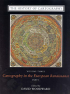
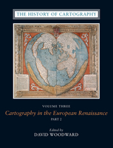
Cartography in the European Renaissance treats the period from 1450 to 1650, long considered the most important in the history of European mapping. This period witnessed a flowering in the production of maps comparable to that in the fields of literature and fine arts. Scientific advances, appropriations of classical mapping techniques, burgeoning trade routes—all such massive changes drove an explosion in the making and using of maps. While this volume presents detailed histories of mapping in such well-documented regions as Italy and Spain, it also breaks significant new ground by treating Renaissance Europe in its most expansive geographical sense, giving careful attention to often-neglected regions like Scandinavia, East-Central Europe, and Russia, and by providing innovative interpretive essays on the technological, scientific, cultural, and social aspects of cartography.
Lavishly illustrated with more than a thousand maps, many in color, the two volumes of Cartography in the European Renaissance will be the unsurpassable standard in its field, both defining it and propelling it forward.
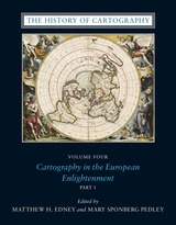
The social and intellectual changes that swept Enlightenment Europe also transformed many of its mapmaking practices. A new emphasis on geometric principles gave rise to improved tools for measuring and mapping the world, even as large-scale cartographic projects became possible under the aegis of powerful states. Yet older mapping practices persisted: Enlightenment cartography encompassed a wide variety of processes for making, circulating, and using maps of different types. The volume’s more than four hundred encyclopedic articles explore the era’s mapping, covering topics both detailed—such as geodetic surveying, thematic mapping, and map collecting—and broad, such as women and cartography, cartography and the economy, and the art and design of maps. Copious bibliographical references and nearly one thousand full-color illustrations complement the detailed entries.
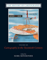
The twentieth century is a pivotal period in map history. The transition from paper to digital formats led to previously unimaginable dynamic and interactive maps. Geographic information systems radically altered cartographic institutions and reduced the skill required to create maps. Satellite positioning and mobile communications revolutionized wayfinding. Mapping evolved as an important tool for coping with complexity, organizing knowledge, and influencing public opinion in all parts of the globe and at all levels of society. Volume 6 covers these changes comprehensively, while thoroughly demonstrating the far-reaching effects of maps on science, technology, and society—and vice versa.
The lavishly produced volume includes more than five hundred articles accompanied by more than a thousand images. Hundreds of expert contributors provide both original research, often based on their own participation in the developments they describe, and interpretations of larger trends in cartography. Designed for use by both scholars and the general public, this definitive volume is a reference work of first resort for all who study and love maps.
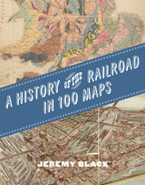
The first international history of railroads and railroad infrastructure told through stunningly reproduced maps.
Since their origins in eighteenth-century England, railroads have spread across the globe, changing everything in their path, from where and how people grew and made things to where and how they lived and moved. Railroads rewrote not only world geography but also the history of maps and mapping. Today, the needs of train companies and their users continue to shape the maps we consume and consult.
Featuring full-color maps primarily from the British Library's distinguished collection—many of them never before published—A History of the Railroad in 100 Maps is the first international history of railroads and railroad infrastructure told through maps. Jeremy Black includes examples from six continents, spanning a variety of uses from railroad planning and operations to guides for passengers, shippers, and tourists.
Arranged chronologically, the maps are accompanied by explanatory text that sheds light on the political, military, and urban development histories associated with the spread of railroads. A final chapter considers railroad maps from games, books, and other cultural artifacts. For anyone interested in the history of railroads or maps, A History of the Railroad in 100 Maps will offer new and unexpected insights into their intertwined global history.

A History of the Silk Road not only offers the reader a chronological outline of the region’s development, but also provides an invaluable introduction to its languages, literature, and arts. It takes a comprehensive and illuminating look at the rich history of this dynamic and little known region, and provides an easy-to-use reference source. Jonathan Clements pays particular attention to the fascinating historical sites which feature on any visitor’s itinerary and also gives special emphasis to the writings and reactions of travelers through the centuries.
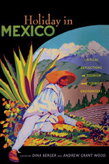
Essays feature research on prototourist American soldiers of the mid-nineteenth century, archaeologists who excavated Teotihuacán, business owners who marketed Carnival in Veracruz during the 1920s, American tourists in Mexico City who promoted goodwill during the Second World War, American retirees who settled San Miguel de Allende, restaurateurs who created an “authentic” cuisine of Central Mexico, indigenous market vendors of Oaxaca who shaped the local tourist identity, Mayan service workers who migrated to work in Cancun hotels, and local officials who vied to develop the next “it” spot in Tijuana and Cabo San Lucas. Including insightful studies on food, labor, art, diplomacy, business, and politics, this collection illuminates the many processes and individuals that constitute the tourism industry. Holiday in Mexico shows tourism to be a complicated set of interactions and outcomes that reveal much about the nature of economic, social, cultural, and environmental change in Greater Mexico over the past two centuries.
Contributors. Dina Berger, Andrea Boardman, Christina Bueno, M. Bianet Castellanos, Mary K. Coffey, Lisa Pinley Covert, Barbara Kastelein, Jeffrey Pilcher, Andrew Sackett, Alex Saragoza, Eric M. Schantz, Andrew Grant Wood
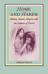
In her look at England, Grewal draws on nineteenth-century aesthetics, landscape art, and debates about women’s suffrage and working-class education to show how all social classes, not only the privileged, were educated and influenced by imperialist travel narratives. By examining diverse forms of Indian travel to the West and its colonies and focusing on forms of modernity offered by colonial notions of travel, she explores how Indian men and women adopted and appropriated aspects of European travel discourse, particularly the set of oppositions between self and other, East and West, home and abroad.
Rather than being simply comparative, Home and Harem is a transnational cultural study of the interaction of ideas between two cultures. Addressing theoretical and methodological developments across a wide range of fields, this highly interdisciplinary work will interest scholars in the fields of postcolonial and cultural studies, feminist studies, English literature, South Asian studies, and comparative literature.
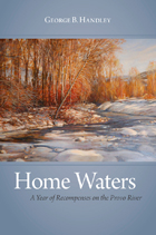
People who flyfish know that a favorite river bend, a secluded spot in moving waters, can feel like home—a place you know intimately and intuitively. In prose that reads like the flowing current of a river, scholar and essayist George Handley blends nature writing, local history, theology, environmental history, and personal memoir in his new book Home Waters: A Year of Recompenses on the Provo River.
Handley’s meditations on the local Provo River watershed present the argument that a sense of place requires more than a strong sense of history and belonging, it requires awareness and commitment. Handley traces a history of settlement along the Provo that has profoundly transformed the landscape and yet neglected its Native American and environmental legacies. As a descendent of one of the first pioneers to irrigate the area, and as a witness to the loss of orchards, open space, and an eroded environmental ethic, Handley weaves his own personal and family history into the landscape to argue for sustainable belonging. In avoiding the exclusionist and environmentally harmful attitudes that come with the territorial claims to a homeland, the flyfishing term, “home waters,” is offered as an alternative, a kind of belonging that is informed by deference to others, to the mysteries of deep time, and to a fragile dependence on water. While it has sometimes been mistakenly assumed that the Mormon faith is inimical to good environmental stewardship, Handley explores the faith’s openness to science, its recognition of the holiness of the creation, and its call for an ethical engagement with nature. A metaphysical approach to the physical world is offered as an antidote to the suicidal impulses of modern society and our persistent ambivalence about the facts of our biology and earthly condition. Home Waters contributes a perspective from within the Mormon religious experience to the tradition of such Western writers as Wallace Stegner, Terry Tempest Williams, Steven Trimble, and Amy Irvine.
Winner of the Mormon Letters Award for Memoir.
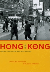
In 1997 the United Kingdom returned control of Hong Kong to China, ending the city’s status as one of the last remnants of the British Empire and initiating a new phase for it as both a modern city and a hub for global migrations. Hong Kong is a tour of the city’s postcolonial urban landscape, innovatively told through fieldwork and photography.
Caroline Knowles and Douglas Harper’s point of entry into Hong Kong is the unusual position of the British expatriates who chose to remain in the city after the transition. Now a relatively insignificant presence, British migrants in Hong Kong have become intimately connected with another small minority group there: immigrants from Southeast Asia. The lives, journeys, and stories of these two groups bring to life a place where the past continues to resonate for all its residents, even as the city hurtles forward into a future marked by transience and transition. By skillfully blending ethnographic and visual approaches, Hong Kong offers a fascinating guide to a city that is at once unique in its recent history and exemplary of our globalized present.
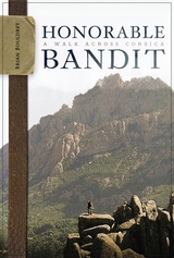
Brian Bouldrey traveled to the island of Corsica, with its wine-dark Mediterranean waters, powdered-sugar beach sand, sumptuous cuisine, and fine wine. And then he walked away from all of them.
Bouldrey strapped on a backpack and walked across Napoleon's native land with the same spirit many choose to dance or drink: to celebrate, to mourn, to think, to avoid thinking, to recall, to ignore, to escape, and to arrive.
This wonderfully textured account of a two-week ramble along a famous Corsican hiking trail with his German friend Petra (she was good at the downhills while he was better at the uphills) offers readers a journal that is a launching point for reflection: thoughts on cultural differences, friendship, physical challenge, personal challenge, and getting very, very lost. Part travelogue, part memoir, and part lampoon, this book offers readers an impressionistic view of a little talked about yet stunningly beautiful landscape.

With Housekeeping by Design, David Brody introduces us to those people—the housekeepers whose labor keeps the rooms clean and the guests happy. Through unprecedented access to staff at several hotels, Brody shows us just how much work goes on behind the scenes—and how much management goes out of its way to make sure that labor stays hidden. We see the incredible amount of hard physical work that is involved in cleaning and preparing a room, how spaces, furniture, and other objects are designed to facilitate a smooth flow of hidden labor, and, crucially, how that design could be improved for workers and management alike if front-line staff were involved in the design process. After reading this fascinating exposé of the ways hotels work—or don’t for housekeepers—one thing is certain: checking in will never be the same again.
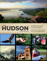
This volume gives a detailed account of the Hudson River’s history, including the geological forces that created it, the various peoples who have lived on its banks, and the great works of art it has inspired. It also showcases the many species making a home on this waterway, including the Atlantic sturgeon, the bald eagle, the invasive zebra mussel, and the herons of New York Harbor. Combining both scientific and historical perspectives, this book demonstrates why the Hudson and its valley have been so central to the environmental movement.
As it charts the progress made towards restoring the river ecosystem and the effects of emerging threats like climate change, The Hudson identifies concrete ways that readers can help. To that end, royalties from the sale of this book will go to the non-profit environmental advocacy group Hudson River Sloop Clearwater, Inc.
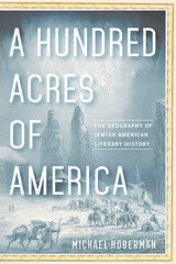
Jewish writers have long had a sense of place in the United States, and interpretations of American geography have appeared in Jewish American literature from the colonial era forward. But troublingly, scholarship on Jewish American literary history often limits itself to an immigrant model, situating the Jewish American literary canon firmly and inescapably among the immigrant authors and early environments of the early twentieth century. In A Hundred Acres of America, Michael Hoberman combines literary history and geography to restore Jewish American writers to their roles as critical members of the American literary landscape from the 1850s to the present, and to argue that Jewish history, American literary history, and the inhabitation of American geography are, and always have been, contiguous entities.
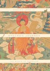
With Hyecho’s Journey, eminent scholar of Buddhism Donald S. Lopez Jr. re-creates Hyecho’s trek. Using the surviving fragments of Hyecho’s travel memoir, along with numerous other textual and visual sources, Lopez imagines the thriving Buddhist world the monk explored. Along the way, Lopez introduces key elements of Buddhism, including its basic doctrines, monastic institutions, works of art, and the many stories that have inspired Buddhist pilgrimage. Through the eyes of one remarkable Korean monk, we discover a vibrant tradition flourishing across a vast stretch of Asia. Hyecho’s Journey is simultaneously a rediscovery of a forgotten pilgrim, an accessible primer on Buddhist history and doctrine, and a gripping, beautifully illustrated account of travel in a world long lost.
READERS
Browse our collection.
PUBLISHERS
See BiblioVault's publisher services.
STUDENT SERVICES
Files for college accessibility offices.
RECENTLY PUBLISHED


UChicago Accessibility Resources
home | accessibility | search | about | contact us
BiblioVault ® 2001 - 2024
The University of Chicago Press