
 A SCHOLARLY BOOK REPOSITORY
Results by Title
8 books about Woodward, David
8 books about Woodward, David
Art and Cartography
Six Historical Essays
Edited by David Woodward
University of Chicago Press, 1987
The contributors—Svetlana Alpers, Samuel Y. Edgerton, Jr., Ulla Ehrensvard, Juergen Schulz, James A. Welu, and David Woodward—examine the historical links between art and cartography from varied perspectives.
[more]
Catalogue of Watermarks in Italian Printed Maps, ca. 1540-1600
David Woodward
University of Chicago Press, 1996
This catalogue presents over three-hundred photographic images of watermarks found in Italian printed maps of the sixteenth century. Such watermarks are essential tools in identifying paper moulds and are part of the evidence that bibliographers use in dating the paper on which maps and other documents were printed. The images reproduced in the catalogue have been selected from some 1200 beta-radiographs of watermarks gathered from Italian printed maps issued mostly in composite atlases printed in Venice and Rome between 1540 and 1600. These beta-radiographs reveal minute variations that are almost invisible to the eye. A special feature of the book is a visual index of miniature black-and-white line tracings of the watermarks.
Fifteen years in the making, this catalogue will be an essential reference for bibliographers and archivists dealing with rare books and maps of the period, for map collectors, map librarians, and scholars and librarians working with early printed items and manuscripts.
Fifteen years in the making, this catalogue will be an essential reference for bibliographers and archivists dealing with rare books and maps of the period, for map collectors, map librarians, and scholars and librarians working with early printed items and manuscripts.
[more]
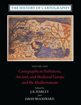
The History of Cartography, Volume 1
Cartography in Prehistoric, Ancient, and Medieval Europe and the Mediterranean
Edited by J. B. Harley and David Woodward
University of Chicago Press, 1987
By developing the broadest and most inclusive definition of the term "map" ever adopted in the history of cartography, this inaugural volume of the History of Cartography series has helped redefine the way maps are studied and understood by scholars in a number of disciplines.
Volume One addresses the prehistorical and historical mapping traditions of premodern Europe and the Mediterranean world. A substantial introductory essay surveys the historiography and theoretical development of the history of cartography and situates the work of the multi-volume series within this scholarly tradition. Cartographic themes include an emphasis on the spatial-cognitive abilities of Europe's prehistoric peoples and their transmission of cartographic concepts through media such as rock art; the emphasis on mensuration, land surveys, and architectural plans in the cartography of Ancient Egypt and the Near East; the emergence of both theoretical and practical cartographic knowledge in the Greco-Roman world; and the parallel existence of diverse mapping traditions (mappaemundi, portolan charts, local and regional cartography) in the Medieval period.
Throughout the volume, a commitment to include cosmographical and celestial maps underscores the inclusive definition of "map" and sets the tone for the breadth of scholarship found in later volumes of the series.
[more]
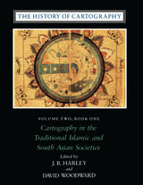
The History of Cartography, Volume 2, Book 1
Cartography in the Traditional Islamic and South Asian Societies
Edited by J. B. Harley and David Woodward
University of Chicago Press, 1992
The first book of volume 2 of the monumental History of Cartography focuses on mapping in non-Western cultures, an area of study traditionally overlooked by Western scholars. Extensive original research makes this the foremost source for defining, describing, and analyzing this vast and unexplored theater of cartographic history. Book 1 offers a critical synthesis of maps, mapmaking, and mapmakers in the Islamic world and South Asia.
"[The six-volume set] is certain to be the standard reference for all subsequent scholarship. The editors . . . have assembled and analyzed a vast collection of knowledge. . . . If the first volume is an indication, the complete set will be comprehensive and judicious." —John Noble Wilford, New York Times Book Review
"As well as enlarging the mind and lifting the spirits through the sheer magnitude of its endeavor, the collection delights the senses. The illustrations are exquisite: browsing fingers will instinctively alight on the sheaf of maps reproduced on stock slightly thicker than that of the text. The maps are so beguiling in the tantalizing glimpses they offer of other, seemingly incomprehensible, worlds, that the sight of them will stir the connoisseur in even the most-guarded scholar." —Ronald Rees, Geographical Review
"The corpus it brings to light, along with the extensive references, bibliography, and exhaustive appendices containing valuable comments about many of the pieces discussed, together make this book an important resource for the scholar."—Robert Provin, Professional Geographer
"This volume is a landmark of new research and will certainly contribute to further discoveries, translations, interpretations, inventories, more precise dating and the construction of stemmata." —Christian Jacob, Cartographica
"In seeking to characterize the cartography of premodern Islamic and south Asian societies, the editors offer the image of an archipelago of cartographically conscious islands in a silent sea. The research potential which they have revealed is clearly vast and underappreciated, with many islands still to be discovered or enlarged. This important book, does more, therefore, than plug a huge gap in cartographic historiography. It provides the foundation for crosscultural cartographic research in two major world regions."-Jeffrey Stone, Ecumene
[more]
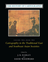
The History of Cartography, Volume 2, Book 2
Cartography in the Traditional East and Southeast Asian Societies
Edited by J. B. Harley and David Woodward
University of Chicago Press, 1994
The monumental History of Cartography is an unprecedented survey of the development of cartography both as a science and an art. This essential reference presents the enormous value of maps to societies worldwide and explores the many ways they have been used to depict the earth, sky, and cosmos from ancient times to the present.
Volume 2, book 2, considers the cartographic traditions of China, Korea, Japan, Vietnam, Tibet, Burma, Thailand, Laos, Malaysia, Indonesia, Brunei, and the Philippines, presenting significant new research and interpretation of archaeological, literary, and graphic sources. Richly illustrated with forty color plates and over five hundred black and white illustrations, the book includes a number of rare and elaborate maps, many previously unpublished.
Volume 2, book 2, considers the cartographic traditions of China, Korea, Japan, Vietnam, Tibet, Burma, Thailand, Laos, Malaysia, Indonesia, Brunei, and the Philippines, presenting significant new research and interpretation of archaeological, literary, and graphic sources. Richly illustrated with forty color plates and over five hundred black and white illustrations, the book includes a number of rare and elaborate maps, many previously unpublished.
[more]
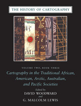
The History of Cartography, Volume 2, Book 3
Cartography in the Traditional African, American, Arctic, Australian, and Pacific Societies
Edited by David Woodward and G. Malcolm Lewis
University of Chicago Press, 1998
"Certain to be the standard reference for all subsequent scholarship."—John Noble Wilford, New York Times Book Review, on the History of Cartography series
"The maps in this book provide an evocative picture of how indigenous peoples view and represent their worlds. They illuminate not only questions of material culture but also the cognitive systems and social motivations that underpin them" (from the introduction).
Although they are often rendered in forms unfamiliar to Western eyes, maps have existed in most cultures. In this latest book of the acclaimed History of Cartography, contributors from a broad variety of disciplines collaborate to describe and address the significance of traditional cartographies. Whether painted on rock walls in South Africa, chanted in a Melanesian ritual, or fashioned from palm fronds and shells in the Marshall Islands, all indigenous maps share a crucial role in representing and codifying the spatial knowledge of their various cultures. Some also serve as repositories of a group's sacred or historical traditions, while others are exquisite art objects.
The indigenous maps discussed in this book offer a rich resource for disciplines such as anthropology, archaeology, art history, ethnology, geography, history, psychology, and sociology. Copious illustrations and carefully researched bibliographies enhance the scholarly value of this definitive reference.
[more]
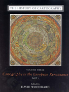
The History of Cartography, Volume 3 (Replacement Volume)
Cartography in the European Renaissance, Part 1
Edited by David Woodward
University of Chicago Press, 2007
When the University of Chicago Press launched the landmark History of Cartography series nearly thirty years ago, founding editors J.B. Harley and David Woodward hoped to create a new basis for map history. They did not, however, anticipate the larger renaissance in map studies that the series would inspire. But as the renown of the series and the comprehensiveness and acuity of the present volume demonstrate, the history of cartography has proven to be unexpectedly fertile ground.
Cartography in the European Renaissance treats the period from 1450 to 1650, long considered the most important in the history of European mapping. This period witnessed a flowering in the production of maps comparable to that in the fields of literature and fine arts. Scientific advances, appropriations of classical mapping techniques, burgeoning trade routes—all such massive changes drove an explosion in the making and using of maps. While this volume presents detailed histories of mapping in such well-documented regions as Italy and Spain, it also breaks significant new ground by treating Renaissance Europe in its most expansive geographical sense, giving careful attention to often-neglected regions like Scandinavia, East-Central Europe, and Russia, and by providing innovative interpretive essays on the technological, scientific, cultural, and social aspects of cartography.
Lavishly illustrated with more than a thousand maps, many in color, the two volumes of Cartography in the European Renaissance will be the unsurpassable standard in its field, both defining it and propelling it forward.
[more]
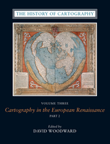
The History of Cartography, Volume 3 (Replacement Volume)
Cartography in the European Renaissance, Part 2
Edited by David Woodward
University of Chicago Press, 2007
When the University of Chicago Press launched the landmark History of Cartography series nearly thirty years ago, founding editors J.B. Harley and David Woodward hoped to create a new basis for map history. They did not, however, anticipate the larger renaissance in map studies that the series would inspire. But as the renown of the series and the comprehensiveness and acuity of the present volume demonstrate, the history of cartography has proven to be unexpectedly fertile ground.
Cartography in the European Renaissance treats the period from 1450 to 1650, long considered the most important in the history of European mapping. This period witnessed a flowering in the production of maps comparable to that in the fields of literature and fine arts. Scientific advances, appropriations of classical mapping techniques, burgeoning trade routes—all such massive changes drove an explosion in the making and using of maps. While this volume presents detailed histories of mapping in such well-documented regions as Italy and Spain, it also breaks significant new ground by treating Renaissance Europe in its most expansive geographical sense, giving careful attention to often-neglected regions like Scandinavia, East-Central Europe, and Russia, and by providing innovative interpretive essays on the technological, scientific, cultural, and social aspects of cartography.
Lavishly illustrated with more than a thousand maps, many in color, the two volumes of Cartography in the European Renaissance will be the unsurpassable standard in its field, both defining it and propelling it forward.
Cartography in the European Renaissance treats the period from 1450 to 1650, long considered the most important in the history of European mapping. This period witnessed a flowering in the production of maps comparable to that in the fields of literature and fine arts. Scientific advances, appropriations of classical mapping techniques, burgeoning trade routes—all such massive changes drove an explosion in the making and using of maps. While this volume presents detailed histories of mapping in such well-documented regions as Italy and Spain, it also breaks significant new ground by treating Renaissance Europe in its most expansive geographical sense, giving careful attention to often-neglected regions like Scandinavia, East-Central Europe, and Russia, and by providing innovative interpretive essays on the technological, scientific, cultural, and social aspects of cartography.
Lavishly illustrated with more than a thousand maps, many in color, the two volumes of Cartography in the European Renaissance will be the unsurpassable standard in its field, both defining it and propelling it forward.
[more]
READERS
Browse our collection.
PUBLISHERS
See BiblioVault's publisher services.
STUDENT SERVICES
Files for college accessibility offices.
RECENTLY PUBLISHED


 the Feminine: Bande Dessinée and Women")


UChicago Accessibility Resources
home | accessibility | search | about | contact us
BiblioVault ® 2001 - 2024
The University of Chicago Press