Results by title
152 books match the query 'Cartography' and 4 start with e
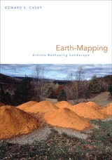
Earth-Mapping
Artists Reshaping LandscapeEdward S. Casey
University of Minnesota Press, 2005
Dutch world maps of the sixteenth and seventeenth centuries, with their decorative pictures and elaborate typography, stand in sharp contrast to the wholly practical maps of today, which emphasize precise detail and consistent scale. Art, since the Impressionist period, has seemingly moved in the opposite direction, toward a less realistic interpretation of the world around us. Edward S. Casey demonstrates that the disciplines of mapping and painting, long thought to have diverged, are again intersecting. Earth-Mapping describes the ways in which artists of the last half century have incorporated ingenious mapping techniques into their art works. Beginning with a reassessment of the pioneering earth art of Robert Smithson in the 1960s and 1970s, Casey follows Smithson's legacy in the works of Sandy Gellis, Margot McLean, and Michelle Stuart. He also explores the visions of the earth found in the abstract paintings of Richard Diebenkorn, Jasper Johns, Willem de Kooning, Eve Ingalls, and Dan Rice. Focusing on forms of mapping that depart radically from conventional cartography - particularly "mapping with/in," being with or in a place, and "mapping out," communicating that experience of connection with others - Casey shows how earth art and abstract painting respectively reshape our landscape and our view of it, drawing us in from our bird's-eye view of the grid of highways and roads. In these works, we come to see the earth as it is sensed, remembered, and reshaped by artists as they explore the effect of the landscape on humans and the human effect on the landscape, and as they demand a response to the changing world around us.
[more]
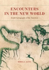
Encounters in the New World
Jesuit Cartography of the AmericasMirela Altic
University of Chicago Press, 2022
Analyzing more than 150 historical maps, this book traces the Jesuits’ significant contributions to mapping and mapmaking from their arrival in the New World.
In 1540, in the wake of the tumult brought on by the Protestant Reformation, Saint Ignatius of Loyola founded the Society of Jesus, also known as the Jesuits. The Society’s goal was to revitalize the faith of Catholics and to evangelize to non-Catholics through charity, education, and missionary work. By the end of the century, Jesuit missionaries were sent all over the world, including to South America. In addition to performing missionary and humanitarian work, Jesuits also served as cartographers and explorers under the auspices of the Spanish, Portuguese, and French crowns as they ventured into remote areas to find and evangelize to native populations.
In Encounters in the New World, Mirela Altic analyzes more than 150 of their maps, most of which have never previously been published. She traces the Jesuit contribution to mapping and mapmaking from their arrival in the New World into the post-suppression period, placing it in the context of their worldwide undertakings in the fields of science and art. Altic’s analysis also shows the incorporation of indigenous knowledge into the Jesuit maps, effectively making them an expression of cross-cultural communication—even as they were tools of colonial expansion. This ambiguity, she reveals, reflects the complex relationship between missions, knowledge, and empire. Far more than just a physical survey of unknown space, Jesuit mapping of the New World was in fact the most important link to enable an exchange of ideas and cultural concepts between the Old World and the New.
[more]
Envisioning the City
Six Studies in Urban CartographyEdited by David Buisseret
University of Chicago Press, 1998
Churchman or merchant, soldier or sanitary engineer, everyone who lives in a city sees it differently. Envisioning the City explores how these points of urban view have been expressed in city plans. Ranging from vertical plans to bird's-eye views, profiles, and three-dimensional models, these diverse maps all show cities "the way people want to see them."
Whether a Chinese vertical city plan from the first millennium B.C. or a bird's-eye view appended to a fifteenth-century edition of Ptolemy's Geography, the type of plan chosen and its focus reflected the aspects of a city that the map's creators wished to highlight. For instance, maps of seventeenth-century cities emphasized impregnable fortifications as a deterrent to potential attackers. And Daniel Burnham's famous 1909 Plan of Chicago used a distinct representational style to "sell" his version of the new Chicago.
Although city plans are among the oldest maps known, few books have been devoted to them. Historians of cartography and geography, architects, and urban planners will all enjoy this profusely illustrated volume.
[more]
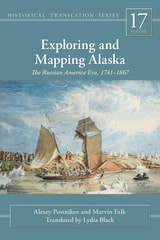
Exploring and Mapping Alaska
The Russian America Era, 1741-1867Alexey Postnikov and Marvin Falk
University of Alaska Press, 2015
Russia first encountered Alaska in 1741 as part of the most ambitious and expensive expedition of the entire eighteenth century. For centuries since, cartographers have struggled to define and develop the enormous region comprising northeastern Asia, the North Pacific, and Alaska. The forces of nature and the follies of human error conspired to make the area incredibly difficult to map.
Exploring and Mapping Alaska focuses on this foundational period in Arctic cartography. Russia spurred a golden era of cartographic exploration, while shrouding their efforts in a veil of secrecy. They drew both on old systems developed by early fur traders and new methodologies created in Europe. With Great Britain, France, and Spain following close behind, their expeditions led to an astounding increase in the world’s knowledge of North America.
Through engrossing descriptions of the explorations and expert navigators, aided by informative illustrations, readers can clearly trace the evolution of the maps of the era, watching as a once-mysterious region came into sharper focus. The result of years of cross-continental research, Exploring and Mapping Alaska is a fascinating study of the trials and triumphs of one of the last great eras of historic mapmaking.
[more]