Results by title
111 books match the query 'Historical geography' and 4 start with f
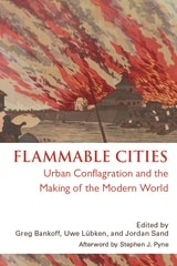
Flammable Cities
Urban Conflagration and the Making of the Modern WorldGreg Bankoff
University of Wisconsin Press, 2012
In most cities today, fire has been reduced to a sporadic and isolated threat. But throughout history the constant risk of fire has left a deep and lasting imprint on almost every dimension of urban society. This volume, the first truly global study of urban conflagration, shows how fire has shaped cities throughout the modern world, from Europe to the imperial colonies, major trade entrepôts, and non-European capitals, right up to such present-day megacities as Lagos and Jakarta. Urban fire may hinder commerce or even spur it; it may break down or reinforce barriers of race, class, and ethnicity; it may serve as a pretext for state violence or provide an opportunity for displays of state benevolence. As this volume demonstrates, the many and varied attempts to master, marginalize, or manipulate fire can turn a natural and human hazard into a highly useful social and political tool.
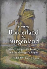
From Borderland to Burgenland
Science, Geopolitics, Identity, and the Making of a RegionFerenc Jankó
Central European University Press, 2024
The area that constitutes the Austrian federal province of Burgenland belonged to the Hungarian part of the Habsburg empire until the end of World War I. This book helps us realize that geographical knowledge does not come ready-made. Instead, it is created by knowledge makers: geographers, historians, statisticians etc. This knowledge-making helped to legitimatize the area transferred between Austria and Hungary, shape the Burgenland identity, and depict its geopolitical role in the rise of national socialism. This book is about how those studying Burgenland, the creators of its geographical knowledge, saw and represented the province. It explores how they grasped the geographical characteristics of the region through their own perspective, influenced by their own professional positions, individual careers, motivations, and by the broader historical and social medium.
The way the area between the provinces of Lower Austria and Styria came about as Burgenland is enthralling, as is how the people there experienced this change of sovereignty and how everyday social and economic relationships were transformed. Tracing the geographical discourses in the interwar period and beyond, the book argues that Burgenland became a successful geographical project, and departs from thoughts of subdivision, unviability, and backwardness, concentrating instead on fertility, unity, and modernization.
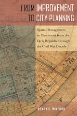
From Improvement to City Planning
Spatial Management in Cincinnati from the Early Republic through the Civil War DecadeHenry C. Binford
Temple University Press, 2021
From Improvement to City Planning emphasizes the ways people in nineteenth-century America managed urban growth. Historian Henry Binford shows how efforts to improve space were entwined with the evolution of urban governance (i.e., regulation)—and also influenced by a small group of advantaged families.
Binford looks specifically at Cincinnati, Ohio, then the largest and most important interior city west of the Appalachian Mountains. He shows that it was not just industrialization, but also beliefs about morality, race, health, poverty, and “slum” environments, that demanded an improvement of urban space. As such, movements for public parks and large-scale sanitary engineering in the 1840s and ’50s initiated the beginning of modern city planning. However, there were limitations and consequences to these efforts..
Many Americans believed that remaking city environments could also remake citizens. From Improvement to City Planning examines how the experiences of city living in the early republic prompted city dwellers to think about and shape urban space.

From Sea Charts to Satellite Images
Interpreting North American History through MapsEdited by David Buisseret
University of Chicago Press, 1990
"An extraordinarily wide range of maps is depicted, which makes for good browsing, pondering and close study. . . . This is a very good, highly attractive, and worthwhile book; it will have great impact on the use of old (and new!) maps in teaching. As well, this is a tantalizing survey of mapping the United States and will whet the appetites of students and encourage them to learn more about maps and their origins."—John Warketin, Cartographica