Results by title
341 books match the query 'Geography' and 9 start with h
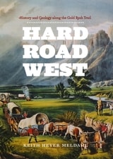
Hard Road West
History and Geology along the Gold Rush TrailKeith Heyer Meldahl
University of Chicago Press, 2007
In 1848 news of the discovery of gold in California triggered an enormous wave of emigration toward the Pacific. Lured by the promise of riches, thousands of settlers left behind the forests, rain, and fertile soil of the eastern United States in favor of the rough-hewn lands of the American West. The dramatic terrain they struggled to cross is so familiar to us now that it is hard to imagine how frightening—even godforsaken—its sheer rock faces and barren deserts seemed to our forebears.
Hard Road West brings their perspective vividly to life, weaving together the epic overland journey of the covered wagon trains and the compelling story of the landscape they encountered. Taking readers along the 2,000-mile California Trail, Keith Meldahl uses the diaries and letters of the settlers themselves—as well as the countless hours he has spent following the trail—to reveal how the geology and geography of the West directly affected our nation’s westward expansion. He guides us through a corrugated landscape of sawtooth mountains, following the meager streams that served as lifelines through an arid land, all the way to California itself, where colliding tectonic plates created breathtaking scenery and planted the gold that lured travelers west in the first place.
“Alternates seamlessly between vivid accounts of the 19th-century journey and lucid explanations of the geological events that shaped the landscape traveled. . . . The reader comes away with both an appreciation for the arduous cross-continental wagon journey and an understanding of the events that created such a vast and difficult landscape.”—Library Journal
“Alternates seamlessly between vivid accounts of the 19th-century journey and lucid explanations of the geological events that shaped the landscape traveled. . . . The reader comes away with both an appreciation for the arduous cross-continental wagon journey and an understanding of the events that created such a vast and difficult landscape.”—Library Journal
“[Meldahl] draws on his professional knowledge to explain the geology of the West, showing how centuries of geological activity had a direct effect on the routes taken by the travelers. . . . Meldahl provides a novel account of the largest overland migration since the Crusades.”—Science News
[more]
Haste
The Slow Politics of Climate UrgencyEdited by Håvard Haarstad, Jakob Grandin, Kristin Kjærås, and Eleanor Johnson
University College London, 2023
A powerful argument for not approaching climate change in a hurry, but with a slow politics of urgency.
It’s understandable that we tend to present climate change as something urgently requiring action. Every day we fail to act, the potential for catastrophe grows. But is that framing itself a problem? When we hurry, we make more mistakes. We overlook things. We get tunnel vision.
In Haste, a group of distinguished contributors makes the case for a slow politics of urgency. Rather than rushing and speeding up, he argues, the sustainable future is better served by our challenging of the dominant framings through which we understand time and change in society. While recognizing the need for certain types of urgency in climate politics, Haste directs attention to the different and alternative temporalities at play in climate and sustainability politics. Divided into short and accessible chapters, written by both established and emerging scholars from different disciplines, Haste tackles a major problem in contemporary climate change research and offers creative perspectives on pathways out of the climate emergency.
[more]
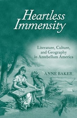
Heartless Immensity
Literature, Culture, and Geography in Antebellum AmericaAnne Baker
University of Michigan Press, 2010
As the size of the United States more than doubled during the first half of the nineteenth century, a powerful current of anxiety ran alongside the well-documented optimism about national expansion. Heartless Immensity tells the story of how Americans made sense of their country’s constantly fluctuating borders and its annexation of vast new territories. Anne Baker looks at a variety of sources, including letters, speeches, newspaper editorials, schoolbooks, as well as visual and literary works of art. These cultural artifacts suggest that the country’s anxiety was fueled primarily by two concerns: fears about the size of the nation as a threat to democracy, and about the incorporation of nonwhite, non-Protestant regions. These fears had a consistent and influential presence until after the Civil War, functioning as vital catalysts for the explosion of literary creativity known as the “American Renaissance,” including the work of Melville, Thoreau, and Fuller, among others.
Building on extensive archival research as well as insights from cultural geographers and theorists of nationhood, Heartless Immensity demonstrates that national expansion had a far more complicated, multifaceted impact on antebellum American culture than has previously been recognized. Baker shows that Americans developed a variety of linguistic strategies for imagining the form of the United States and its position in relation to other geopolitical entities. Comparisons
to European empires, biblical allusions, body politic metaphors, and metaphors derived from science all reflected—and often attempted to assuage—fears that the nation was becoming either monstrously large or else misshapen in ways that threatened cherished beliefs and national self-images.
Heartless Immensity argues that, in order to understand the nation’s shift from republic to empire and to understand American culture in a global context, it is first necessary to pay close attention to the processes by which the physical entity known as the United States came into being. This impressively thorough study will make a valuable contribution to the fields of American studies and literary studies.
Anne Baker is Assistant Professor of English at North Carolina State University.
[more]
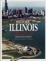
Historic Illinois from the Air
David Buisseret
University of Chicago Press, 1990
"A distinctive and skillful effort to bring facets of Illinois history to a popular as well as an academic audience."—John Hoffman, Illinois Historical Survey, University of Illinois Library
[more]
Historical Atlases
The First Three Hundred Years, 1570-1870Walter Goffart
University of Chicago Press, 2003
Today we can walk into any well-stocked bookstore or library and find an array of historical atlases. The first thorough review of the source material, Historical Atlases traces how these collections of "maps for history"—maps whose sole purpose was to illustrate some historical moment or scene—came into being.
Beginning in the sixteenth century, and continuing down to the late nineteenth, Walter Goffart discusses milestones in the origins of historical atlases as well as individual maps illustrating historical events in alternating, paired chapters. He focuses on maps of the medieval period because the development of maps for history hinged particularly on portrayals of this segment of the postclassical, "modern" past. Goffart concludes the book with a detailed catalogue of more than 700 historical maps and atlases produced from 1570 to 1870.
Historical Atlases will immediately take its place as the single most important reference on its subject. Historians of cartography, medievalists, and anyone seriously interested in the role of maps in portraying history will find it invaluable.
[more]
Hitler's Geographies
The Spatialities of the Third ReichEdited by Paolo Giaccaria and Claudio Minca
University of Chicago Press, 2016
Lebensraum: the entitlement of “legitimate” Germans to living space. Entfernung: the expulsion of “undesirables” to create empty space for German resettlement. During his thirteen years leading Germany, Hitler developed and made use of a number of powerful geostrategical concepts such as these in order to justify his imperialist expansion, exploitation, and genocide. As his twisted manifestation of spatial theory grew in Nazi ideology, it created a new and violent relationship between people and space in Germany and beyond.
With Hitler’s Geographies, editors Paolo Giaccaria and Claudio Minca examine the variety of ways in which spatial theory evolved and was translated into real-world action under the Third Reich. They have gathered an outstanding collection by leading scholars, presenting key concepts and figures as well exploring the undeniable link between biopolitical power and spatial expansion and exclusion.
With Hitler’s Geographies, editors Paolo Giaccaria and Claudio Minca examine the variety of ways in which spatial theory evolved and was translated into real-world action under the Third Reich. They have gathered an outstanding collection by leading scholars, presenting key concepts and figures as well exploring the undeniable link between biopolitical power and spatial expansion and exclusion.
[more]
How Green Became Good
Urbanized Nature and the Making of Cities and CitizensHillary Angelo
University of Chicago Press, 2021
As projects like Manhattan’s High Line, Chicago’s 606, China’s eco-cities, and Ethiopia’s tree-planting efforts show, cities around the world are devoting serious resources to urban greening. Formerly neglected urban spaces and new high-end developments draw huge crowds thanks to the considerable efforts of city governments. But why are greening projects so widely taken up, and what good do they do? In How Green Became Good, Hillary Angelo uncovers the origins and meanings of the enduring appeal of urban green space, showing that city planners have long thought that creating green spaces would lead to social improvement. Turning to Germany’s Ruhr Valley (a region that, despite its ample open space, was “greened” with the addition of official parks and gardens), Angelo shows that greening is as much a social process as a physical one. She examines three moments in the Ruhr Valley's urban history that inspired the creation of new green spaces: industrialization in the late nineteenth century, postwar democratic ideals of the 1960s, and industrial decline and economic renewal in the early 1990s. Across these distinct historical moments, Angelo shows that the impulse to bring nature into urban life has persistently arisen as a response to a host of social changes, and reveals an enduring conviction that green space will transform us into ideal inhabitants of ideal cities. Ultimately, however, she finds that the creation of urban green space is more about how we imagine social life than about the good it imparts.
[more]
How to Lie with Maps
Mark Monmonier
University of Chicago Press, 1996
Originally published to wide acclaim, this lively, cleverly illustrated essay on the use and abuse of maps teaches us how to evaluate maps critically and promotes a healthy skepticism about these easy-to-manipulate models of reality. Monmonier shows that, despite their immense value, maps lie. In fact, they must.
The second edition is updated with the addition of two new chapters, 10 color plates, and a new foreword by renowned geographer H. J. de Blij. One new chapter examines the role of national interest and cultural values in national mapping organizations, including the United States Geological Survey, while the other explores the new breed of multimedia, computer-based maps.
To show how maps distort, Monmonier introduces basic principles of mapmaking, gives entertaining examples of the misuse of maps in situations from zoning disputes to census reports, and covers all the typical kinds of distortions from deliberate oversimplifications to the misleading use of color.
"Professor Monmonier himself knows how to gain our attention; it is not in fact the lies in maps but their truth, if always approximate and incomplete, that he wants us to admire and use, even to draw for ourselves on the facile screen. His is an artful and funny book, which like any good map, packs plenty in little space."—Scientific American
"A useful guide to a subject most people probably take too much for granted. It shows how map makers translate abstract data into eye-catching cartograms, as they are called. It combats cartographic illiteracy. It fights cartophobia. It may even teach you to find your way. For that alone, it seems worthwhile."—Christopher Lehmann-Haupt, The New York Times
". . . witty examination of how and why maps lie. [The book] conveys an important message about how statistics of any kind can be manipulated. But it also communicates much of the challenge, aesthetic appeal, and sheer fun of maps. Even those who hated geography in grammar school might well find a new enthusiasm for the subject after reading Monmonier's lively and surprising book."—Wilson Library Bulletin
"A reading of this book will leave you much better defended against cheap atlases, shoddy journalism, unscrupulous advertisers, predatory special-interest groups, and others who may use or abuse maps at your expense."—John Van Pelt, Christian Science Monitor
"Monmonier meets his goal admirably. . . . [His] book should be put on every map user's 'must read' list. It is informative and readable . . . a big step forward in helping us to understand how maps can mislead their readers."—Jeffrey S. Murray, Canadian Geographic
[more]
How to Lie with Maps, Third Edition
Mark Monmonier
University of Chicago Press, 2018
An instant classic when first published in 1991, How to Lie with Maps revealed how the choices mapmakers make—consciously or unconsciously—mean that every map inevitably presents only one of many possible stories about the places it depicts. The principles Mark Monmonier outlined back then remain true today, despite significant technological changes in the making and use of maps. The introduction and spread of digital maps and mapping software, however, have added new wrinkles to the ever-evolving landscape of modern mapmaking.
Fully updated for the digital age, this new edition of How to Lie with Maps examines the myriad ways that technology offers new opportunities for cartographic mischief, deception, and propaganda. While retaining the same brevity, range, and humor as its predecessors, this third edition includes significant updates throughout as well as new chapters on image maps, prohibitive cartography, and online maps. It also includes an expanded section of color images and an updated list of sources for further reading.
Fully updated for the digital age, this new edition of How to Lie with Maps examines the myriad ways that technology offers new opportunities for cartographic mischief, deception, and propaganda. While retaining the same brevity, range, and humor as its predecessors, this third edition includes significant updates throughout as well as new chapters on image maps, prohibitive cartography, and online maps. It also includes an expanded section of color images and an updated list of sources for further reading.
[more]