Results by title
228 books match the query 'Guidebooks' and 14 start with h

Happy Tails Across New Jersey
Things to See and Do with Your Dog in the Garden StateGoodspeed, Diane
Rutgers University Press, 2006
In this first-of-its-kind guidebook, Diane Goodspeed brings the encouraging news to pet lovers that their furry friends are welcome to many of New Jersey's beaches, trails, parks, swim holes, and even stores. Whether you are hiking in the Kittatinny Mountains, going for a run on the beach, or playing fetch along the Delaware River, you and your dog can explore New Jersey together. From transportation and equipment to basic obedience and fitness conditioning, this guide contains all the information you need to get your dog out the door for exciting adventures in every season.
Organized by county for easy reference, you will find information about county, state, and national parks that will welcome your canine companion. The book also functions as a convenient handbook for shops, covering everything from high-end pet stores and large chains to independently run dog bakeries. Goodspeed identifies training facilities, the most reputable and well-established dog trainers, as well as shelters, rescue centers, and every dog park across the state. Whether you are a long-time dog owner, or new to the canine scene, you will be surprised by how many dog-friendly events, including walk-a-thons, fairs, canine sporting competitions, town festivals, dog parades, and fundraising events for rescue groups occur annually throughout New Jersey.
Finally, with your leash in one hand and this indispensable and all-inclusive guide in the other, you can enjoy the exciting recreational opportunities available in the Garden State with your favorite four-legged friend.
Hidden New York
A Guide to Places That MatterReaven, Marci
Rutgers University Press, 2006
Many of them matter because of the opportunities they provide for socializing, such as the Empire Roller Disco in Brooklyn that attracts a community of skaters and the Cube sculpture on Astor Place, which is a meeting spot for homeless youth. Others matter because they are focal points for communities and the spaces are intertwined with how people share in each others' lives. Still others have been lost, like the house under the roller coaster in Coney Island, made famous by Woody Allen in Annie Hall.
This book is not just about Manhattan, but covers all five boroughs in New York City. It is an invitation to visit, revisit, learn, and enjoy all that you didn't know the city has to offer. It will show you what's there, what used to be there, and why it will be there for years to come. The chapters, illustrated with appealing black-and-white photos, include first-person remembrances and commentaries from New Yorkers themselves. Each entry functions as a small travel essay, evoking how certain destinations are experienced. As a guide to the New York City that is less traveled, this unique book shows that some of the best places to visit are ones that you never even thought existed.
The 32 Places That Matter
Hua Mei Bird Garden
Russian and Turkish Tenth Street Baths
Bohemian Hall and Beer Garden
The Magic Table at the Edison Hotel
The General Society of Mechanics and Tradesman
Webster Hall
The Cube
Stickball Boulevard and the Stadiums of the Street
Thomas Jefferson Park Pool
Empire Roller Skating Center
Chess Havens
Coney Island
The Lemon Ice King of Corona
Coney Island Bialys and Bagels
Sahadi's Specialty and Middle Eastern Foods
Arthur Avenue Market
Union Square Greenmarket
The Village Vanguard
Casa Amadeo Record Shop
Richmond Barthé's Frieze at Kingsborough Houses
Quirky Features of the Landscape
Art in the Subways
Governors Island
Casita Rincón Criollo, Magnolia Tree Earth Center, Liz Christy Bowery-Houston Community Garden
The Flower District
Fishing around New York
Kehila Kedosha Janina Synagogue and Museum
Masjid Al-Taqwa
Ganesha Hindu Temple
Our Lady of Mount Carmel Grotto
The Memorials of the Battery
Strawberry Fields
High in Utah
Michael Weibel
University of Utah Press, 1999
High in Utah is quite consciously a book for peak baggers, complete with a checklist and elevations. Summits range from Kings Peak, Utah’s highest at 13,528’ to the unnamed peak in Rich County, a mere 9,255’. In addition to the county high points, this book also has four “classic” climbs: Mt. Olympus in Salt Lake County; Mt. Timpanogos above Provo; Notch Peak in the House Range west of Delta; and Wellsville Cone, Cache Valley’s western landmark.
Since finding a place to start can often be the most frustrating part of a hike, emphasis is placed on directions to each trailhead. There is a road map for each hike, as well as a trail map showing contours. The routes in this guide are not always the easiest or most practical, but they may be the most appealing and are often the most commonly used (lessening human impact on other potential routes). Difficulty levels range from 'extreme'—long, steep routes that may require some route finding—to 'too easy'—reachable by car. Two sets of hiking times are provided to accommodate variations in hiking speed, and there are also sections on flora and fauna, mountain weather, low-impact hiking and camping, equipment, and altitude sickness.
"Alaska is our biggest, buggiest, boggiest state. Texas remains our largest unfrozen state. But mountainous Utah, if ironed out flat, would take up more space on a map than either."
—Edward Abbey, 1927–1989

Highpoints of the United States
A Guide to the Fifty State SummitsDon Holmes
University of Utah Press, 2000
The highpoints of the fifty states range from Alaska’s 20,320 foot high Mount McKinley to 345 feet at Lakewood Park in Florida. Some highpoints, such as Mount Mitchell in North Carolina and New Hampshire’s Mount Washington can be reached by automobile on a sightseeing drive. Others such as Colorado’s Mount Elbert or Mount Marcy in New York are accessible as wilderness day hikes. Still others, such as Mount Rainier in Washington or Gannett Peak in Wyoming, are strenuous and risky mountaineering challenges that should be attempted only by experienced climbers. Whatever your level of skill and interest, Highpoints of the United States offers a diverse range of experiences.
Arranged alphabetically by state, each listing has a map, photographs, and information on trailhead, main and alternative routes, elevation gain, and conditions. Historical and natural history notes are also included, as are suggestions for specific guidebooks to a region or climb. Appendices include a list of highpoints by region, by elevation, and a personal log for the unashamed "peak-bagger."
Whether you’re an armchair hiker or a seasoned climber, interested only in your state’s highest point or all fifty, this book will be an invaluable companion and reference.

Highpoints of the United States
A Guide to the Fifty State SummitsDon W. Holmes
University of Utah Press, 2023
The highpoints of the fifty states range from Alaska’s 20,310-foot-high Mount McKinley to 345 feet at Lakewood Park in Florida. Some highpoints, such as Mount Mitchell in North Carolina and New Hampshire’s Mount Washington, can be reached by car on a sightseeing drive. Others, including Colorado’s Mount Elbert or Mount Marcy in New York, are accessible as wilderness day hikes. Still others, such as Mount Rainier in Washington or Gannett Peak in Wyoming, are strenuous and risky mountaineering challenges that should be attempted only by experienced climbers. Whatever your level of skill and interest, these varied highpoints offer a diverse range of experiences.
The third edition of this classic guide updates route descriptions and maps, changes to private property ownership and public lands requirements, lists of guides and outfitters, and essential online resources. As with the two popular previous editions, Highpoints of the United States is arranged alphabetically by state, each site description accompanied with a map, photographs, information on trailhead, main and alternative routes, elevation gain, conditions, historical and natural history notes, and lists of potential guides or outfitters. Appendices include a list of highpoints by region and by elevation, useful resources, and a personal log for the unashamed “peak-bagger.”
Whether you’re an armchair hiker or a seasoned climber, interested only in your state’s highest point or all fifty, this book will be an invaluable companion and reference.
Highway 12
Christian Probasco
Utah State University Press, 2005
Highway 12 is undoubtedly one of not only America's but the world's most scenic highways. From its intersection on the west with Highway 89 south of Panguitch, Utah, it runs up through Red Canyon onto the Paunsagunt Plateau and across Bryce Canyon National Park. It then drops into the Paria River Valley, passes through several tiny villages, crosses some extraordinary (for anywhere but this region) badlands, and descends the Escalante River into Potato Valley. While a driver may justifiably feel she has seen some scenery by that point, the highway is just getting started, for in the next stretch, it crosses a labyrinth of multicolored sandstone humps and corridors, climaxed by a narrow hogback with steep slickrock drops to each side, all within Grand Staircase-Escalante National Monument. Reaching the oasis of Boulder within this desert of rock, the road then climbs across the flank of the Aquarius Plateau, providing spectacular vistas and terminating at the gateway to Capitol Reef National Park. Along the way side roads and trails access the vast wilderness of the Paria and Escalante Rivers and the high plateaus they drain. Congress acknowledged the unequaled splendor of Highway 12 by designating it one of a handful of All-American Roads.
To travel with Christian Probasco this road and its spurs, which lead deep into some of the wildest, most broken-up and stunning landscapes anywhere, can put a unique twist on an already singular experience. He knows the region as well as anyone and brings an original, edgy, youthful view to it. His opinions and his language may challenge you. His approaches to and perspectives on the land may sometimes surprise you. His understanding of the area's history and its people will likely teach you a thing or two.
Hiking Circuits in Rocky Mountain National Park
Jack P. Hailman
University Press of Colorado, 2003
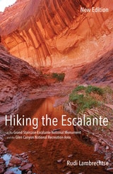
Hiking the Escalante
In the Grand Staircase-Escalante National Monument and the Glen Canyon National Recreation Area, New EditionRudi Lambrechtse
University of Utah Press, 2015
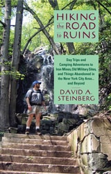
Hiking the Road to Ruins
Day Trips and Camping Adventures to Iron Mines, Old Military Sites, and Things Abandoned in the New York City Area ... and BeyondSteinberg, David A
Rutgers University Press, 2007
Each chapter contains detailed directions, a hand-drawn map, suggestions for the optimal time and season to visit, and GPS coordinates to specific sites. Bringing fifteen years of experience as a leader of hikes, Steinberg leaves no part of the trip unplanned. He even suggests ideal conditions for the outing. An overcast day, for instance, sets up the haunted atmosphere appropriate for visiting a water tower in Mountainside, New Jersey, that has links to a murder-suicide in the 1970s.
For less experienced hikers, the guide also includes a chapter on equipment and safety, detailed instructions on how to program a hand-held Global Positioning System receiver, and a glossary of terms.
Both a practical guide and a creative chronicle, this book is bound to please hikers and history buffs alike.
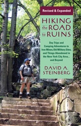
Hiking the Road to Ruins
Daytrips and Camping Adventures to Iron Mines, Old Military Sites, and Things Abandoned in the New York City Area...and BeyondSteinberg, David A
Rutgers University Press, 2015
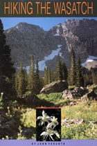
Hiking the Wasatch
A Hiking and Natural History Guide to the Central WasatchJohn Veranth
University of Utah Press, 2014
Trail descriptions range from nearly level walks requiring less than an hour to ascents that challenge experienced mountaineers. To assist in selecting an appropriate trail, hikes are listed according to best season, time required, objective, and desired level of difficulty. The easy trails have the most detailed descriptions to aid beginners, while expert trails have sparse descriptions to preserve the adventure. Maps, photos, and line drawings are included and detailed driving directions to the trailheads are consolidated to save repetition. The area’s geology, flora and fauna, and human history are also discussed to further appreciation of this mountain environment.
Since the first publication of Hiking the Wasatch, there have been numerous changes to these trails, especially along the foothill-urban interface. This revised third edition contains full updates based on the author’s field checking, comments from members of the Wasatch Mountain Club, and information from land-management agencies. Hiking the Wasatch is an essential resource for exploring these mountain trails.
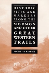
Historic Sites and Markers along the Mormon and Other Great Western Trails
Stanley B. Kimball
University of Illinois Press, 1988
is an indispensable guide for travelers who wish to retrace the various frontier
routes taken by the Mormons and other pioneers in their treks westward. Traversing
fifteen states from New York to California, Stanley Kimball presents some of
America's most famous trails--the Mormon, the Oregon-California, the Santa Fe,
the Overland, and many others--and describes important points of interest, including
forts, trail centers, and museums.
"An important contribution
to the history of the West and perhaps the most comprehensive mile-by-mile guide
to trail markers and historical sites ever prepared."
-- Brigham D. Madsen, author of The Shoshoni Frontier and the Bear
River Massacre
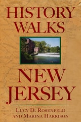
History Walks in New Jersey
Rosenfeld, Lucy D
Rutgers University Press, 2006
Whether you are an amateur historian, a weekend walker, or a teacher planning a class trip, this book will be an essential resource for ideas and information. Walks include the Kingston Loop, a long canal where George Washington, pen in hand, composed his post-Revolutionary War speech, "Farewell Orders to the Armies of the United States." Also included is a mountain walk that traces Native American Leni-Lenape history and one that wends its way into an old Moravian village in the town of Hope. A pirate cove, stops on the Underground Railroad, a Civil War cemetery, and the sites of duels, mines, canals, architectural innovations, estates and resorts, centuries-old agricultural and fishing settlements, and the Hindenburg crash are all here.
Each walk includes directions, information on tours, a brief history, and suggestions for additional places to visit in the area. Whether a New Jersey native or a visitor to the Garden State, readers will enjoy going beyond the highways and suburban towns to learn about history while discovering the state's natural beauty.

House Stories
The Meanings of Home in a New England TownBeth Luey
University of Massachusetts Press, 2017
Historic houses adorned with plaques populate New England like nowhere else in the country. These plaques note the construction year and original owner of the house, but they tell nothing about the rich lives of the people who lived there. In House Stories, Beth Luey takes readers on a virtual walking tour of several historic houses in Fairhaven, Massachusetts, a small New England coastal town, inviting us in to learn each house's secrets.
Through letters and diaries, church and business records, newspaper accounts, legal documents, and the recollections of neighbors who knew them, Luey introduces the diverse cast of historical characters who lived in these houses at various times from 1800 to the 2000s, including a Japanese castaway and his rescuer, a self-made millionaire, a seagoing adventurer, a religious pioneer, and an entrepreneurial immigrant. All of the houses are still standing and all but a lighthouse are still called home. In House Stories, Luey asks readers to join her as she considers the multiple meanings of “home” for these people and their families.