Results by title
54 books match the query 'Hiking' and 10 start with h
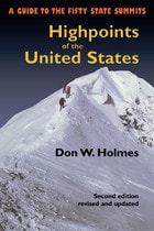
Highpoints of the United States
A Guide to the Fifty State SummitsDon Holmes
University of Utah Press, 2000
The highpoints of the fifty states range from Alaska’s 20,320 foot high Mount McKinley to 345 feet at Lakewood Park in Florida. Some highpoints, such as Mount Mitchell in North Carolina and New Hampshire’s Mount Washington can be reached by automobile on a sightseeing drive. Others such as Colorado’s Mount Elbert or Mount Marcy in New York are accessible as wilderness day hikes. Still others, such as Mount Rainier in Washington or Gannett Peak in Wyoming, are strenuous and risky mountaineering challenges that should be attempted only by experienced climbers. Whatever your level of skill and interest, Highpoints of the United States offers a diverse range of experiences.
Arranged alphabetically by state, each listing has a map, photographs, and information on trailhead, main and alternative routes, elevation gain, and conditions. Historical and natural history notes are also included, as are suggestions for specific guidebooks to a region or climb. Appendices include a list of highpoints by region, by elevation, and a personal log for the unashamed "peak-bagger."
Whether you’re an armchair hiker or a seasoned climber, interested only in your state’s highest point or all fifty, this book will be an invaluable companion and reference.

Highpoints of the United States
A Guide to the Fifty State SummitsDon W. Holmes
University of Utah Press, 2023
The highpoints of the fifty states range from Alaska’s 20,310-foot-high Mount McKinley to 345 feet at Lakewood Park in Florida. Some highpoints, such as Mount Mitchell in North Carolina and New Hampshire’s Mount Washington, can be reached by car on a sightseeing drive. Others, including Colorado’s Mount Elbert or Mount Marcy in New York, are accessible as wilderness day hikes. Still others, such as Mount Rainier in Washington or Gannett Peak in Wyoming, are strenuous and risky mountaineering challenges that should be attempted only by experienced climbers. Whatever your level of skill and interest, these varied highpoints offer a diverse range of experiences.
The third edition of this classic guide updates route descriptions and maps, changes to private property ownership and public lands requirements, lists of guides and outfitters, and essential online resources. As with the two popular previous editions, Highpoints of the United States is arranged alphabetically by state, each site description accompanied with a map, photographs, information on trailhead, main and alternative routes, elevation gain, conditions, historical and natural history notes, and lists of potential guides or outfitters. Appendices include a list of highpoints by region and by elevation, useful resources, and a personal log for the unashamed “peak-bagger.”
Whether you’re an armchair hiker or a seasoned climber, interested only in your state’s highest point or all fifty, this book will be an invaluable companion and reference.

Hikes Around Philadelphia
Boyd Newman
Temple University Press, 1997
These are only five of the forty hiking trails described in Hikes Around Philadelphia. All are within an hour and a half's drive of the city. Ranging from 1.0 to 12.6 miles in length, they will take you through dense forests or wide-open meadows, past early farmsteads or a ringing boulder field from the last ice age. You can break your hike with a visit to a restored home or leave civilization behind on an isolated mountain ridge. Some of the trails are gravel or paved, or are canal towpaths, and are quite suitable for young children, older adults, or wheelchair hikers. Others are longer and more challenging, including rugged sections of the Appalachian Trail and the Horseshoe Trail.
For each hike Boyd Newman and Linda Newman provide a detailed write-up, a trail map showing the hike route on a USGS survey map, and directions to the trailhead. They also include information on distance, elevation, probable time, surface, interesting features, facililities, disability access, whether hunting is allowed in the vicinity, and availability to public transportation. This format allows you to browse through the book and easily locate the particular hike that appeals to you today.
In a concise introduction, the authors not only explain how to get the most out of the book but also give some hints on hiking safety and appropriate clothing and equipment.
This handy reference offers:
*a detailed write-up of each hike
*easy-to-read trail maps
*directions to the trail heads
*information that are accessible by public transportation
*details about handicap accessibility
*lots of other pointers that make planned or last-minute hikes fun and easy for everyone
Hiking Circuits in Rocky Mountain National Park
Jack P. Hailman
University Press of Colorado, 2003
Hiking The Escalante
Rudi Lambrechts
University of Utah Press, 1999
An invaluable resource to anyone traversing the Escalante, this comprehensive guide details 43 hikes.
Publisher's Note: Realizing there are virtually no marked trails in the Escalante country (mostly canyons that wander and have many intersections, challenging anyone to write explicit description), this book includes directions to the trailhead, how to follow a particular route with choices of side canyons along the way, and occasional alternate endings. Some of the hikes may be appropriate for beginners. Some only the most experienced should attempt.
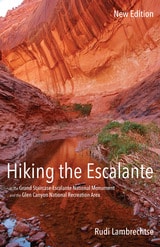
Hiking the Escalante
In the Grand Staircase-Escalante National Monument and the Glen Canyon National Recreation Area, New EditionRudi Lambrechtse
University of Utah Press, 2015
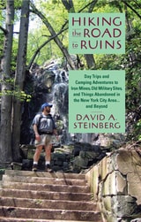
Hiking the Road to Ruins
Day Trips and Camping Adventures to Iron Mines, Old Military Sites, and Things Abandoned in the New York City Area ... and BeyondSteinberg, David A
Rutgers University Press, 2007
Each chapter contains detailed directions, a hand-drawn map, suggestions for the optimal time and season to visit, and GPS coordinates to specific sites. Bringing fifteen years of experience as a leader of hikes, Steinberg leaves no part of the trip unplanned. He even suggests ideal conditions for the outing. An overcast day, for instance, sets up the haunted atmosphere appropriate for visiting a water tower in Mountainside, New Jersey, that has links to a murder-suicide in the 1970s.
For less experienced hikers, the guide also includes a chapter on equipment and safety, detailed instructions on how to program a hand-held Global Positioning System receiver, and a glossary of terms.
Both a practical guide and a creative chronicle, this book is bound to please hikers and history buffs alike.
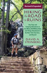
Hiking the Road to Ruins
Daytrips and Camping Adventures to Iron Mines, Old Military Sites, and Things Abandoned in the New York City Area...and BeyondSteinberg, David A
Rutgers University Press, 2015
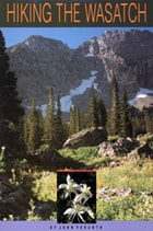
Hiking the Wasatch
A Hiking and Natural History Guide to the Central WasatchJohn Veranth
University of Utah Press, 2014
Trail descriptions range from nearly level walks requiring less than an hour to ascents that challenge experienced mountaineers. To assist in selecting an appropriate trail, hikes are listed according to best season, time required, objective, and desired level of difficulty. The easy trails have the most detailed descriptions to aid beginners, while expert trails have sparse descriptions to preserve the adventure. Maps, photos, and line drawings are included and detailed driving directions to the trailheads are consolidated to save repetition. The area’s geology, flora and fauna, and human history are also discussed to further appreciation of this mountain environment.
Since the first publication of Hiking the Wasatch, there have been numerous changes to these trails, especially along the foothill-urban interface. This revised third edition contains full updates based on the author’s field checking, comments from members of the Wasatch Mountain Club, and information from land-management agencies. Hiking the Wasatch is an essential resource for exploring these mountain trails.
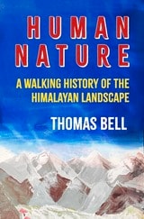
Human Nature
A Walking History of the Himalayan LandscapeThomas Bell
Haus Publishing, 2025
Combining travelogue, folklore, literature, art, and anthropology, this work explores the human and natural geography of the Himalayas and offers a nuanced portrait of life over the centuries in one of the world’s most enigmatic regions.
In Human Nature, Thomas Bell embarks on four walks through the Himalayas, each in a different season, to explore the interplay between the land and the people who call it home. Bell’s decades in Nepal give him an unusual perspective that bridges the gap between insider and outsider. The stories he recounts touch on themes from religion to ecology and political economy, and span from prehistory to the present day. He also deftly examines the impact of British imperialism and the growing external pressures on the environment. Accompanied by Bell’s striking photographs and maps, Human Nature is a magnificently written account that spans big ideas and real lives. Erudite, intimate, and evocative, this is essential reading for anyone seeking to understand the relationship between communities and their environments.