Results by title
122 books match the query 'Maps' and 5 start with h

Handbook of the Linguistic Atlas of the Middle and South Atlantic States
William A. Kretzschmar Jr., Virginia G. McDavid, Theodore K. Lerud, and Ellen Johnson
University of Chicago Press, 1993
This handbook is an essential guide to the LAMSAS project, laying out its history and describing its scope and methodology. In addition, the handbook reveals biographical information about the informants and social histories of the communities in which they lived, including primary settlement areas of the original colonies. Dialectologists will rely on it for understanding the LAMSAS, and historians will find it valuable for its original historical research.
Since much of the LAMSAS questionnaire concerns rural terms, the data collected from the interviews can pinpoint such language differences as those between areas of plantation and small-farm agriculture. For example, LAMSAS reveals that two waves of settlement through the Appalachians created two distinct speech types. Settlers coming into Georgia and other parts of the Upper South through the Shenandoah Valley and on to the western side of the mountain range had a Pennsylvania-influenced dialect, and were typically small farmers. Those who settled the Deep South in the rich lowlands and plateaus tended to be plantation farmers from Virginia and the Carolinas who retained the vocabulary and speech patterns of coastal areas.
With these revealing findings, the LAMSAS represents a benchmark study of the English language, and this handbook is an indispensable guide to its riches.
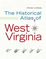
Historical Atlas of West Virginia
FRANK S. RIDDEL
West Virginia University Press, 2008
Few reference works are as valuable to both scholars and non-scholars as a historical atlas. Therefore, The Historical Atlas of West Virginia will be an important title for libraries, schools, and every West Virginian who wants to understand how historical forces are mapped onto the state’s terrain. This atlas also shows how the distribution of natural resources intersects with various means of distribution. Frank Riddel’s The Historical Atlas of West Virginia is copiously illustrated with maps, tables, and charts depicting everything from geological deposits and strata that have fed the state’s industries to the settlement patterns of the immigrants who settled in West Virginia. Using federal and state statistics, it also includes revelations from the national census figures since 1790.
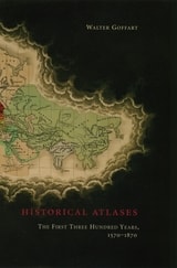
Historical Atlases
The First Three Hundred Years, 1570-1870Walter Goffart
University of Chicago Press, 2003
Beginning in the sixteenth century, and continuing down to the late nineteenth, Walter Goffart discusses milestones in the origins of historical atlases as well as individual maps illustrating historical events in alternating, paired chapters. He focuses on maps of the medieval period because the development of maps for history hinged particularly on portrayals of this segment of the postclassical, "modern" past. Goffart concludes the book with a detailed catalogue of more than 700 historical maps and atlases produced from 1570 to 1870.
Historical Atlases will immediately take its place as the single most important reference on its subject. Historians of cartography, medievalists, and anyone seriously interested in the role of maps in portraying history will find it invaluable.
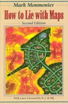
How to Lie with Maps
Mark Monmonier
University of Chicago Press, 1996
The second edition is updated with the addition of two new chapters, 10 color plates, and a new foreword by renowned geographer H. J. de Blij. One new chapter examines the role of national interest and cultural values in national mapping organizations, including the United States Geological Survey, while the other explores the new breed of multimedia, computer-based maps.
To show how maps distort, Monmonier introduces basic principles of mapmaking, gives entertaining examples of the misuse of maps in situations from zoning disputes to census reports, and covers all the typical kinds of distortions from deliberate oversimplifications to the misleading use of color.
"Professor Monmonier himself knows how to gain our attention; it is not in fact the lies in maps but their truth, if always approximate and incomplete, that he wants us to admire and use, even to draw for ourselves on the facile screen. His is an artful and funny book, which like any good map, packs plenty in little space."—Scientific American
"A useful guide to a subject most people probably take too much for granted. It shows how map makers translate abstract data into eye-catching cartograms, as they are called. It combats cartographic illiteracy. It fights cartophobia. It may even teach you to find your way. For that alone, it seems worthwhile."—Christopher Lehmann-Haupt, The New York Times
". . . witty examination of how and why maps lie. [The book] conveys an important message about how statistics of any kind can be manipulated. But it also communicates much of the challenge, aesthetic appeal, and sheer fun of maps. Even those who hated geography in grammar school might well find a new enthusiasm for the subject after reading Monmonier's lively and surprising book."—Wilson Library Bulletin
"A reading of this book will leave you much better defended against cheap atlases, shoddy journalism, unscrupulous advertisers, predatory special-interest groups, and others who may use or abuse maps at your expense."—John Van Pelt, Christian Science Monitor
"Monmonier meets his goal admirably. . . . [His] book should be put on every map user's 'must read' list. It is informative and readable . . . a big step forward in helping us to understand how maps can mislead their readers."—Jeffrey S. Murray, Canadian Geographic
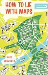
How to Lie with Maps, Third Edition
Mark Monmonier
University of Chicago Press, 2018
Fully updated for the digital age, this new edition of How to Lie with Maps examines the myriad ways that technology offers new opportunities for cartographic mischief, deception, and propaganda. While retaining the same brevity, range, and humor as its predecessors, this third edition includes significant updates throughout as well as new chapters on image maps, prohibitive cartography, and online maps. It also includes an expanded section of color images and an updated list of sources for further reading.