152 books match the query 'Cartography' and 4 start with i
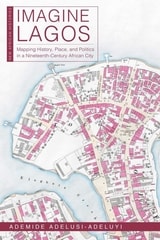
cover of Imagine Lagos: Mapping History, Place, and Politics in a Nineteenth-Century African City

Imagine Lagos

Mapping History, Place, and Politics in a Nineteenth-Century African City

Ademide Adelusi-Adeluyi

Ohio University Press, 2024
Written from a digital humanities perspective, this book combines historical sources, maps, and a walking cartography to create new perspectives on the nineteenth-century history of Lagos, West Africa’s most populous city. What traces do people leave in the places where they live, and even where they die? This book addresses the spatial history of nineteenth-century Lagos, rebuilding its past as a series of encounters: between men and women, between past and present, between enslaved and free, between living and dead, and finally between land and lagoon. In Imagine Lagos, Ademide Adelusi-Adeluyi argues that the invention, destruction, and reinvention of spatial markers in Lagos—the streets, markets, roads, squares, palaces, and lagoons where these encounters occurred—was crucial to negotiations over identity, power, and freedom. Research for this book combines oral and archival sources from three countries with the experience of three summers of walking the streets of Lagos. Contrary to historical interpretations that render the physical city as a blank, featureless space in desperate need of constant repair, this book offers a variety of visual and textual narratives to push readers to imagine the old city. Throughout Imagine Lagos, historical maps join other texts—including colonial correspondence and reports, missionary letters, oríkì (Yoruba praise poetry), and newspaper articles—to create a complex collage of urban life in Lagos. Streets emerge as sites of historical memories, and Adelusi-Adeluyi’s maps of the mid-nineteenth-century city reveal and catalog layers of change. A focus on the city as a whole—as both a physical and social landscape—brings us closer than ever to understanding the lives of Lagosians between 1845 and 1872. In old Lagos, the streets keep their histories. The story maps and full-resolution maps for this book are available at https://newmapsoldlagos.com.
[more]
cover of In Space We Read Time: On the History of Civilization and Geopolitics

In Space We Read Time

On the History of Civilization and Geopolitics

Karl Schlögel

Bard Graduate Center, 2016

History is usually thought of as a tale of time, a string of events flowing in a particular chronological order. But as Karl Schlögel shows in this groundbreaking book, the where of history is just as important as the when. Schlögel relishes space the way a writer relishes a good story: on a quest for a type of history that takes full account of place, he explores everything from landscapes to cities, maps to railway timetables. Do you know the origin of the name “Everest”? What can the layout of towns tell us about the American Dream? In Space We Read Time reveals this and much, much more.

Here is both a model for thinking about history within physical space and a stimulating history of thought about space, as Schlögel reads historical periods and events within the context of their geographical location. Discussions range from the history of geography in France to what a town directory from 1930s Berlin can say about professional trades that have since disappeared. He takes a special interest in maps, which can serve many purposes—one poignant example being the German Jewish community’s 1938 atlas of emigration, which showed the few remaining possibilities for escape. Other topics include Thomas Jefferson’s map of the United States; the British survey of India; and the multiple cartographers with Woodrow Wilson at the Paris Peace Conference, where the aim was to redraw Europe’s boundaries on the basis of ethnicity. Moving deftly from the Austro-Hungarian Empire to 9/11 and from Vermeer’s paintings to the fall of the Berlin Wall, this intriguing book presents history from a completely new perspective.
 
[more]
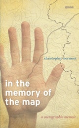
cover of In the Memory of the Map: A Cartographic Memoir

In the Memory of the Map

A Cartographic Memoir

Christopher Norment

University of Iowa Press, 2012

Throughout his life, maps have been a source of imagination and wonder for Christopher Norment. Mesmerized by them since the age of eight or nine, he found himself courted and seduced by maps, which served functional and allegorical roles in showing him worlds that he might come to know and helping him understand worlds that he had already explored.

Maps may have been the stuff of his dreams, but they sometimes drew him away from places where he should have remained firmly rooted. In the Memory of the Map explores the complex relationship among maps, memory, and experience—what might be called a “cartographical psychology” or “cartographical history.” Interweaving a personal narrative structured around a variety of maps, with stories about maps as told by scholars, poets, and fiction writers, this book provides a dazzlingly rich personal and intellectual account of what many of us take for granted.

A dialog between desire and the maps of his life, an exploration of the pleasures, utilitarian purposes, benefits, and character of maps, this rich and powerful personal narrative is the matrix in which Norment embeds an exploration of how maps function in all our lives. Page by page, readers will confront the aesthetics, mystery, function, power, and shortcomings of maps, causing them to reconsider the role that maps play in their lives.
[more]
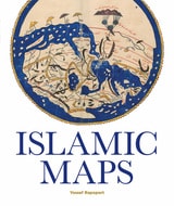
cover of Islamic Maps

Islamic Maps

Yossef Rapoport

Bodleian Library Publishing, 2019

Spanning the Islamic world, from ninth-century Baghdad to nineteenth-century Iran, this book tells the story of Islamic cartography and the key Muslim map-makers who shaped the art over the centuries. Muslim geographers like al-Khwārazmī and al-Idrīsī developed distinctive styles, often based on geometrical patterns and calligraphy, and their maps covered all the known world, from the sources of the Nile to the European lands of the north and the Wall of Gog and Magog in the east. These map-makers combined novel cartographical techniques with art, science, and geographical knowledge to produce maps that could be both aesthetically stunning and mathematically sophisticated.

Islamic Maps examines Islamic visual interpretations of the world in their historical context through the map-makers themselves. What was the purpose of their maps, what choices did they make, and what arguments about the world were they trying to convey? Lavishly illustrated with stunning manuscripts, beautiful instruments, and Qibla charts, this book shows how maps constructed by Muslim map-makers capture the many dimensions of Islamic civilization across the centuries.
 
[more]