Results by title
152 books match the query 'Cartography' and 3 start with n
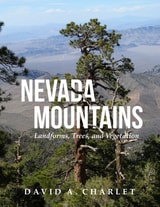
Nevada Mountains
Landforms, Trees, and VegetationDavid Alan Charlet
University of Utah Press, 2020
Divided into three parts, the book presents a simple system recognizing the primary landscape features of Nevada. Part I describes the methods used to define the boundaries of the ranges and divides the state into meaningful landforms. Part II describes the ecological life zones and their vegetation types. Part III describes the individual mountain ranges. Each mountain range entry contains a descriptive narrative and a data summary that includes the county or counties in which the range occurs, whether the author has visited and collected plants there, the highest point, the base elevation, a brief discussion of the geology, any historic settlements or post offices located in the range, the distribution of life zones, and a list of all conifers and flowering trees.
The result of over thirty years of exploration and study throughout the state, this is a long-overdue compendium of Nevada’s mountains and associated flora. This book is a required reference for anyone venturing out into the Nevada wilds.
New Lines
Critical GIS and the Trouble of the MapMatthew W. Wilson
University of Minnesota Press, 2017
New Lines takes the pulse of a society increasingly drawn to the power of the digital map, examining the conceptual and technical developments of the field of geographic information science as this work is refracted through a pervasive digital culture. Matthew W. Wilson draws together archival research on the birth of the digital map with a reconsideration of the critical turn in mapping and cartographic thought.
Seeking to bridge a foundational divide within the discipline of geography—between cultural and human geographers and practitioners of Geographic Information Systems (GIS)—Wilson suggests that GIS practitioners may operate within a critical vacuum and may not fully contend with their placement within broader networks, the politics of mapping, the rise of the digital humanities, the activist possibilities of appropriating GIS technologies, and more.
Employing the concept of the drawn and traced line, Wilson treads the theoretical terrain of Deleuze, Guattari, and Gunnar Olsson while grounding their thoughts with the hybrid impulse of the more-than-human thought of Donna Haraway. What results is a series of interventions—fractures in the lines directing everyday life—that provide the reader with an opportunity to consider the renewed urgency of forceful geographic representation. These five fractures are criticality, digitality, movement, attention, and quantification. New Lines examines their traces to find their potential and their necessity in the face of our frenetic digital life.
No Dig, No Fly, No Go
How Maps Restrict and ControlMark Monmonier
University of Chicago Press, 2010
Some maps help us find our way; others restrict where we go and what we do. These maps control behavior, regulating activities from flying to fishing, prohibiting students from one part of town from being schooled on the other, and banishing certain individuals and industries to the periphery. This restrictive cartography has boomed in recent decades as governments seek regulate activities as diverse as hiking, building a residence, opening a store, locating a chemical plant, or painting your house anything but regulation colors. It is this aspect of mapping—its power to prohibit—that celebrated geographer Mark Monmonier tackles in No Dig, No Fly, No Go.
Rooted in ancient Egypt’s need to reestablish property boundaries following the annual retreat of the Nile’s floodwaters, restrictive mapping has been indispensable in settling the American West, claiming slices of Antarctica, protecting fragile ocean fisheries, and keeping sex offenders away from playgrounds. But it has also been used for opprobrium: during one of the darkest moments in American history, cartographic exclusion orders helped send thousands of Japanese Americans to remote detention camps. Tracing the power of prohibitive mapping at multiple levels—from regional to international—and multiple dimensions—from property to cyberspace—Monmonier demonstrates how much boundaries influence our experience—from homeownership and voting to taxation and airline travel. A worthy successor to his critically acclaimed How to Lie with Maps, the book is replete with all of the hallmarks of a Monmonier classic, including the wry observations and witty humor.
In the end, Monmonier looks far beyond the lines on the page to observe that mapped boundaries, however persuasive their appearance, are not always as permanent and impermeable as their cartographic lines might suggest. Written for anyone who votes, owns a home, or aspires to be an informed citizen, No Dig, No Fly. No Go will change the way we look at maps forever.