Results by title
122 books match the query 'Maps' and 5 start with s

Sedges
CarexRobert H. Mohlenbrock. Illustrated by Paul Nelson
Southern Illinois University Press, 1999
Sedges: Carex is the fourteenth volume of the Illustrated Flora of Illinois series and the sixth and last volume devoted to monocots, or plants that have a single seed-leaf, or cotyledon, upon germination. For each of the 159 species of Carex in Illinois, there is a full illustration showing the habit of the plant and close-ups of various vegetative and reproductive structures that are crucial for the identification of the individual species. There is also a complete description of each species as well as a discussion of the nomenclature and habitats. Range maps show the county distribution of each species in Illinois. A detailed key is provided for identification of the species.
Unique in several respects, Carex is by far the most numerous genus of plants in Illinois. Because of the vast number of species, the similarity of many of the species, and the relatively small size of the critical reproductive structures, the members of this genus are extremely confusing to identify. This book, with its detailed descriptions, key, and precise illustrations, should aid the interested person in the identification of these plants.
Since more than three-fourths of the species of Carex in Illinois are inhabitants of wetlands, an understanding of the genus is critical for those working in wetlands. Amateur and professional botanists will find the information extremely valuable, as well as environmental and conservation groups, garden clubs, farm bureaus, home extension groups, scout organizations, and school libraries. Persons working in natural areas programs and in rare and endangered species programs and those working on environmental impact assessments and wildlife management projects will also find the information pertinent.
[more]
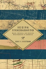
Seeing Underground
Maps, Models, and Mining Engineering in AmericaEric C. Nystrom
University of Nevada Press, 2014
Digging mineral wealth from the ground dates to prehistoric times, and Europeans pursued mining in the Americas from the earliest colonial days. Prior to the Civil War, little mining was deep enough to require maps. However, the major finds of the mid-nineteenth century, such as the Comstock Lode, were vastly larger than any before in America. In Seeing Underground, Nystrom argues that, as industrial mining came of age in the United States, the development of maps and models gave power to a new visual culture and allowed mining engineers to advance their profession, gaining authority over mining operations from the miners themselves.
Starting in the late nineteenth century, mining engineers developed a new set of practices, artifacts, and discourses to visualize complex, pitch-dark three-dimensional spaces. These maps and models became necessary tools in creating and controlling those spaces. They made mining more understandable, predictable, and profitable. Nystrom shows that this new visual culture was crucial to specific developments in American mining, such as implementing new safety regulations after the Avondale, Pennsylvania fire of 1869 killed 110 men and boys; understanding complex geology, as in the rich ores of Butte, Montana; and settling high-stakes litigation, such as the Tonopah, Nevada, Jim Butler v. West End lawsuit, which reached the US Supreme Court.
Nystrom demonstrates that these neglected artifacts of the nineteenth and early twentieth centuries have much to teach us today. The development of a visual culture helped create a new professional class of mining engineers and changed how mining was done. Seeing Undergound is the winner of the 2015 Mining History Association’s Clark Spence Award for the best book on mining history.
[more]
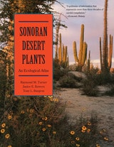
Sonoran Desert Plants
An Ecological AtlasRaymond M. Turner, Janice E. Bowers, and Tony L. Burgess
University of Arizona Press, 1995
The Sonoran Desert, a fragile ecosystem, is under ever-increasing pressure from a burgeoning human population. This ecological atlas of the region's plants, a greatly enlarged and full revised version of the original 1972 atlas, will be an invaluable resource for plant ecologists, botanists, geographers, and other scientists, and for all with a serious interest in living with and protecting a unique natural southwestern heritage.
An encyclopedia as well as an atlas, this monumental work describes the taxonomy, geographic distribution, and ecology of 339 plants, most of them common and characteristic trees, shrubs, or succulants. Also included is valuable information on natural history and ethnobotanical, commercial, and horticultural uses of these plants. The entry for each species includes a range map, an elevational profile, and a narrative account. The authors also include an extensive bibliography, referring the reader to the latest research and numerous references of historical importance, with a glossary to aid the general reader. Sonoran Desert Plants is a monumental work, unlikely to be superseded in the next generation. As the region continues to attract more people, there will be an increasingly urgent need for basic knowledge of plant species as a guide for creative and sustainable habitation of the area. This book will stand as a landmark resource for many years to come.
An encyclopedia as well as an atlas, this monumental work describes the taxonomy, geographic distribution, and ecology of 339 plants, most of them common and characteristic trees, shrubs, or succulants. Also included is valuable information on natural history and ethnobotanical, commercial, and horticultural uses of these plants. The entry for each species includes a range map, an elevational profile, and a narrative account. The authors also include an extensive bibliography, referring the reader to the latest research and numerous references of historical importance, with a glossary to aid the general reader. Sonoran Desert Plants is a monumental work, unlikely to be superseded in the next generation. As the region continues to attract more people, there will be an increasingly urgent need for basic knowledge of plant species as a guide for creative and sustainable habitation of the area. This book will stand as a landmark resource for many years to come.
[more]
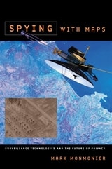
Spying with Maps
Surveillance Technologies and the Future of PrivacyMark Monmonier
University of Chicago Press, 2002
Maps, as we know, help us find our way around. But they're also powerful tools for someone hoping to find you. Widely available in electronic and paper formats, maps offer revealing insights into our movements and activities, even our likes and dislikes. In Spying with Maps, the "mapmatician" Mark Monmonier looks at the increased use of geographic data, satellite imagery, and location tracking across a wide range of fields such as military intelligence, law enforcement, market research, and traffic engineering. Could these diverse forms of geographic monitoring, he asks, lead to grave consequences for society? To assess this very real threat, he explains how geospatial technology works, what it can reveal, who uses it, and to what effect.
Despite our apprehension about surveillance technology, Spying with Maps is not a jeremiad, crammed with dire warnings about eyes in the sky and invasive tracking. Monmonier's approach encompasses both skepticism and the acknowledgment that geospatial technology brings with it unprecedented benefits to governments, institutions, and individuals, especially in an era of asymmetric warfare and bioterrorism. Monmonier frames his explanations of what this new technology is and how it works with the question of whether locational privacy is a fundamental right. Does the right to be left alone include not letting Big Brother (or a legion of Little Brothers) know where we are or where we've been? What sacrifices must we make for homeland security and open government?
With his usual wit and clarity, Monmonier offers readers an engaging, even-handed introduction to the dark side of the new technology that surrounds us—from traffic cameras and weather satellites to personal GPS devices and wireless communications.
[more]
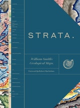
Strata
William Smith’s Geological MapsEdited by the Oxford University Museum of Natural History
University of Chicago Press, 2020
Lavishly illustrated with full-color geological maps, tables of strata, geological cross-sections, photographs, and fossil illustrations from the archives of the Oxford University Museum of Natural History, the Geological Society, the London Natural History Museum, and others, Strata provides the first complete presentation of the revolutionary work of nineteenth-century geologist William Smith, the so-called father of English geology. It illustrates the story of his career, from apprentice to surveyor for hire and fossil collector, from his 1799 geological map of Bath and table of strata to his groundbreaking 1815 geological strata map, and from his imprisonment for debt to his detailed stratigraphical county maps.
This sumptuous volume begins with an introduction by Douglas Palmer that places Smith’s work in the context of earlier, concurrent, and subsequent ideas regarding the structure and natural processes of the earth, geographical mapping, and biostratigraphical theories. The book is then organized into four parts, each beginning with four sheets from Smith’s hand-colored, 1815 strata map, accompanied by related geological cross-sections and county maps, and followed by fossil illustrations by Smith contemporary James Sowerby, all organized by strata. Essays between each section explore the aims of Smith’s work and its application in the fields of mining, agriculture, cartography and hydrology. Strata concludes with reflections on Smith’s later years as an itinerant geologist and surveyor, plagiarism by a rival, receipt of the first Wollaston Medal in recognition of his achievements, and the influence of his geological mapping and biostratigraphical theories on the sciences—all of which culminated in the establishment of the modern geological timescale.
Featuring a foreword by Robert Macfarlane, Strata is a glorious testament to the lasting geological and illustrative genius of William Smith, a collection as colossal and awe-inspiring as the layers of the Earth themselves.
[more]