Results by title
341 books match the query 'Geography' and 66 start with t
The Political Mapping of Cyberspace
Jeremy W. Crampton
University of Chicago Press, 2003
Using concepts and methods derived from the work of Michel Foucault, Crampton outlines a new mapping of cyberspace to help define the role of space in virtual worlds and to provide constructive ways in which humans can exist in another spatial dimension. He delineates the critical role maps play in constructing the medium as an object of knowledge and demonstrates that by processes of mapping we come to understand cyberspace. Maps, he argues, shape political thinking about cyberspace, and he deploys in-depth case studies of crime mapping, security maintenance, and geo-surveillance to show how we map ourselves onto cyberspace, inexorably, and indelibly.
Offering a powerful reinterpretation of technology and contemporary life, this innovative book will be an essential touchstone for the study of cartography and cyberspace in the twenty-first century.
The Political Origins of Inequality
Why a More Equal World Is Better for Us AllSimon Reid-Henry
University of Chicago Press, 2015
The problem of inequality, Reid-Henry argues, is a problem that manifests between places as well as over time. This is one reason why it cannot be resolved by the usual arguments of left versus right, bound as they are to the national scale alone. Most of all, however, it is why the level of inequality that confronts us today is indicative of a more general crisis in political thought. Modern political discourse has no place for public reason or the common good. Equality is yesterday’s dream. Yet the fact that we now accept such a world—a world that values security over freedom, special treatment over universal opportunity, and efficiency over fairness—is ultimately because we have stopped even trying in recent decades to build the political architecture the world actually requires.
Our politics has fallen out of step with the world, then, and at the every moment it is needed more than ever. Yet it is within our power to address this. Doing so involves identifying and then meeting our political responsibilities to others, not just offering them the selective charity of the rich. It means looking beyond issues of economics and outside our national borders. But above all it demands of us that we reinvent the language of equality for a modern, global world: and then institute this. The world is not falling apart. Different worlds, we all can see, are colliding together. It is our capacity to act in concert that is falling apart. It is this that needs restoring most of all.
The Politics of Scale
A History of Rangeland ScienceNathan F. Sayre
University of Chicago Press, 2017
During the late 1880s and early 1890s, a variety of forces—from the Homestead Act of 1862 to the extermination of bison, foreign investment, and lack of government regulation—promoted free-for-all access to and development of the western range, with disastrous environmental consequences. To address the crisis, government agencies turned to scientists, but as Nathan F. Sayre shows, range science grew in a politically fraught landscape. Neither the scientists nor the public agencies could escape the influences of bureaucrats and ranchers who demanded results, and the ideas that became scientific orthodoxy—from fire suppression and predator control to fencing and carrying capacities—contained flaws and blind spots that plague public debates about rangelands to this day. Looking at the global history of rangeland science through the Cold War and beyond, The Politics of Scale identifies the sources of past conflicts and mistakes and helps us to see a more promising path forward, one in which rangeland science is guided less by capital and the state and more by communities working in collaboration with scientists.

The Regional Dynamics of Language Differentiation in Belgium
A Study in Cultural-Political GeographyAlexander B. Murphy
University of Chicago Press, 1988
The Sinai
A Physical GeographyBy Ned Greenwood
University of Texas Press, 1997
One of the world's oldest crossroads, the Sinai joins the great continental land masses of Africa and Eurasia. Its physical geography of rugged mountain peaks, desert plains, and sea coasts was formed by the collision of the two continental plates, while the human tides that have swept across the region over millennia have left an intricate web of cultures and ethnicities.
In this book, Ned Greenwood offers a complete, up-to-date physical geography of Sinai. After an introductory chapter that situates Sinai within world history and geography, he focuses in detail on the following areas: plate tectonics and geology, geomorphology and drainage, weather and climate, soils, and biogeography.
In the concluding chapter, Greenwood considers the human geography of Sinai, including the pressures currently posed by population growth, political extremism, and environmental constrictions on development. He offers a fully rounded picture of the physical environment of Sinai that will be vital reading for everyone concerned about the future of this strategic yet fragile land.

The Sound of Feathers
Attentive Living in a World Beyond OurselvesKathryn Gillespie
Duke University Press, 2026
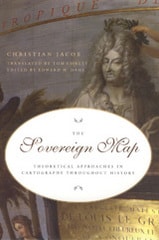
The Sovereign Map
Theoretical Approaches in Cartography throughout HistoryChristian Jacob
University of Chicago Press, 2006
Beginning with a historical overview of maps and their creation—from those traced in the dirt by primitive hands to the monumental Dutch atlases and ornate maps on Italian palace walls—Jacob goes on to consider the visual components of cartography: the decorative periphery, geometric grid, topographical lines, dots, details of iconographic figures, and many other aspects. Considering text on maps—titles, toponyms, legends, and keys—Jacob proposes that writing can both clarify and interfere with a map's visual presentation. Finally Jacob examines the role of the viewer in decoding a map's meaning and the role of society in defining the power of maps as authoritative depictions of space.
Innovative in its philosophical motivation and its interdisciplinary approach to looking at and writing about maps, The Sovereign Map is eagerly awaited by scholars from many different fields.
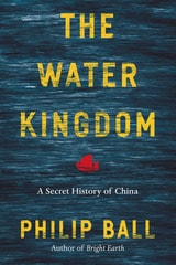
The Water Kingdom
A Secret History of ChinaPhilip Ball
University of Chicago Press, 2017
Water, Ball shows, is a key that unlocks much of Chinese culture. In The Water Kingdom, he takes us on a grand journey through China’s past and present, showing how the complexity and energy of the country and its history repeatedly come back to the challenges, opportunities, and inspiration provided by the waterways. Drawing on stories from travelers and explorers, poets and painters, bureaucrats and activists, all of whom have been influenced by an environment shaped and permeated by water, Ball explores how the ubiquitous relationship of the Chinese people to water has made it an enduring metaphor for philosophical thought and artistic expression. From the Han emperors to Mao, the ability to manage the waters ― to provide irrigation and defend against floods ― was a barometer of political legitimacy, often resulting in engineering works on a gigantic scale. It is a struggle that continues today, as the strain of economic growth on water resources may be the greatest threat to China’s future.
The Water Kingdom offers an unusual and fascinating history, uncovering just how much of China’s art, politics, and outlook have been defined by the links between humanity and nature.

The Work in the World
Geographical Practice and the Written WordMichael R. Curry
University of Minnesota Press, 1996
The Work in the World was first published in 1996. Minnesota Archive Editions uses digital technology to make long-unavailable books once again accessible, and are published unaltered from the original University of Minnesota Press editions.
The writing or reading or buying or selling or judging of a written work is always at the same time the act of making a place-or making places. The author creates a special sort of place for his ideas; the reader, for her engagement with the author; the bookseller, for the notion of books as property to be categorized and sold; and so on. In this book, Michael R. Curry develops a geography of this process, a theory of the nature of space and places in written work.
The Work in the World focuses on a paradox at the heart of this project: Although the written work is inextricably bound up in the construction of the places in which it is written, read, published, circulated, and cited, it nonetheless denies the importance of places. As the product of modern modes of knowledge, technology, and intellectual property, written work seems to say instead that only the encompassing universal space of ideas, objects, and commodities matters.
Distinctive for the way it views theories in geography and science as fundamentally embedded in written works, The Work in the World argues eloquently that the philosophical questions raised by theories can only be addressed within the broader context of the work.
Michael R. Curry is associate professor of geography at the University of California, Los Angeles.
The Yuma Reclamation Project
Irrigation, Indian Allotment, and Settlement Along the Lower Colorado RiverRobert Sauder
University of Nevada Press, 2009
In the arid American West, settlement was generally contingent on the availability of water to irrigate crops and maintain livestock and human residents. Early irrigation projects were usually the cooperative efforts of pioneer farmers, but by the early twentieth century they largely reflected federal intentions to create new farms out of the western public domain. The Yuma Reclamation Project, authorized in 1904, was one of the earliest federal irrigation projects initiated in the western United States and the first authorized on the Colorado River. Its story exemplifies the range of difficulties associated with settling the nation’s final frontier—the remaining irrigable lands in the arid West, including Indian lands—and illuminates some of the current issues and conflicts concerning the Colorado River. Author Robert Sauder’s detailed, meticulously researched examination of the Yuma Project illustrates the complex multiplicity of problems and challenges associated with the federal government’s attempt to facilitate homesteading in the arid West. He examines the history of settlement along the lower Colorado River from earliest times, including the farming of the local Quechan people and the impact of Spanish colonization, and he reviews the engineering problems that had to be resolved before an industrial irrigation scheme could be accomplished. The study also sheds light on myriad unanticipated environmental, economic, and social challenges that the government had to confront in bringing arid lands under irrigation, including the impact on the Native American population of the region.The Yuma Reclamation Project is an original and significant contribution to our understanding of federal reclamation endeavors in the West. It provides new and fascinating information about the history of the Yuma Valley and, as a case study of irrigation policy, it offers compelling insights into the history and consequences of water manipulation in the arid West.
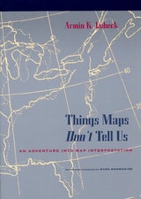
Things Maps Don't Tell Us
An Adventure into Map InterpretationArmin K. Lobeck
University of Chicago Press, 1993
A master cartographer and teacher, Armin Lobeck provides a clear, accessible guide to discerning the geological history of an area through an understanding of the lines of rivers, mountains, and coasts found on maps. He presents commonplace physical features that map users normally take for granted as a collection of cartographic detective stories. After pointing out patterns that call for solutions, Lobeck assembles clues and leads his readers through thoughtful, carefully crafted explanations, to show how to grasp the history of the earth through the art of map reading.
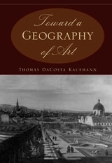
Toward a Geography of Art
Thomas DaCosta Kaufmann
University of Chicago Press, 2004
Toward a Geography of Art presents a historical overview of these complexities, debates contemporary concerns, and completes its exploration with a diverse collection of case studies. Employing the author's expertise in a variety of fields, the book delves into critical issues such as transculturation of indigenous traditions, mestizaje, the artistic metropolis, artistic diffusion, transfer, circulation, subversion, and center and periphery. What results is a foundational study that establishes the geography of art as a subject and forces us to reconsider assumptions about the place of art that underlie the longstanding narratives of art history.
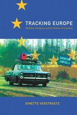
Tracking Europe
Mobility, Diaspora, and the Politics of LocationGinette Verstraete
Duke University Press, 2009
In demystifying the old and new Europe across a multiplicity of texts, images, media, and cultural practices in various times and locations, Verstraete lays bare a territorial persistence in the European imaginary, one which has been differently tied up with the politics of inclusion and exclusion. Tracking Europe moves from policy papers, cultural tourism, and migration to philosophies of cosmopolitanism, nineteenth-century travel guides, electronic surveillance at the border, virtual pilgrimages to Spain, and artistic interventions in the Balkan region. It is a sustained attempt to situate current developments in Europe within a complex matrix of tourism, migration, and border control, as well as history, poststructuralist theory, and critical media and art projects.
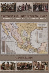
Traveling from New Spain to Mexico
Mapping Practices of Nineteenth-Century MexicoMagali M. Carrera
Duke University Press, 2011
From the sixteenth century until the early nineteenth, Europeans had envisioned New Spain (colonial Mexico) in texts, maps, and other images. In the first decades of the 1800s, ideas about Mexican, rather than Spanish, national character and identity began to cohere in written and illustrated narratives produced by foreign travelers. During the nineteenth century, technologies and processes of visual reproduction expanded to include lithography, daguerreotype, and photography. New methods of display—such as albums, museums, exhibitions, and world fairs—signaled new ideas about spectatorship. García Cubas participated in this emerging visual culture as he reconfigured geographic and cultural imagery culled from previous mapping practices and travel writing. In works such as the Atlas geográfico (1858) and the Atlas pintoresco é historico (1885), he presented independent Mexico to Mexican citizens and the world.
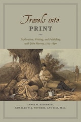
Travels into Print
Exploration, Writing, and Publishing with John Murray, 1773-1859Innes M. Keighren, Charles W. J. Withers, and Bill Bell
University of Chicago Press, 2015
Drawing on detailed examination of the John Murray Archive of manuscripts, images, and the firm’s correspondence with its many authors—a list that included such illustrious explorers and scientists as Charles Darwin and Charles Lyell, and literary giants like Jane Austen, Lord Byron, and Sir Walter Scott—Travels into Print considers how journeys of exploration became published accounts and how travelers sought to demonstrate the faithfulness of their written testimony and to secure their personal credibility. This fascinating study in historical geography and book history takes modern readers on a journey into the nature of exploration, the production of authority in published travel narratives, and the creation of geographical authorship—a journey bound together by the unifying force of a world-leading publisher.

Two Vermonts
Geography and Identity, 1865-1910Paul Searls
University of New Hampshire Press, 2006
Two Vermonts establishes a little-known fact about Vermont: that the state's fascination with tourism as a savior for a suffering economy is more than a century old, and that this interest in tourism has always been dogged by controversy. Through this lens, the book is poised to take its place as the standard work on Vermont in the Gilded Age and the Progressive Era. Searls examines the origins of Vermont's contemporary identity and some reasons why that identity ("Who is a Vermonter?") is to this day so hotly contested.
Searls divides nineteenth-century Vermonters into conceptually “uphill,” or rural/parochial, and “downhill,” or urban/cosmopolitan, elements. These two groups, he says, negotiated modernity in distinct and contrary ways. The dissonance between their opposing tactical approaches to progress and change belied the pastoral ideal that contemporary urban Americans had come to associate with the romantic notion of “Vermont.” Downhill Vermonters, espousing a vision of a mutually reinforcing relationship between tradition and progress, unilaterally endeavored to foster the pastoral ideal as a means of stimulating economic development. The hostile uphill resistance to this strategy engendered intense social conflict over issues including education, religion, and prohibition in the late nineteenth and early twentieth centuries. The story of Vermont's vigorous nineteenth-century quest for a unified identity bears witness to the stirring and convoluted forging of today's “Vermont.”
Searls's engaging exploration of this period of Vermont's history advances our understanding of the political, economic, and cultural transformation of all of rural America as industrial capitalism and modernity revolutionized the United States between 1865 and 1910. By the late Progressive Era, Vermont's reputation was rooted in the national yearning to keep society civil, personal, and meaningful in a world growing more informal, bureaucratic, and difficult to navigate. The fundamental ideological differences among Vermont communities are indicative of how elusive and frustrating efforts to balance progress and tradition were in the context of effectively negotiating capitalist transformation in contemporary America.