Results by title
577 books match the query 'Earth Sciences' and 113 start with t
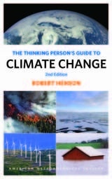
The Thinking Person's Guide to Climate Change
Second EditionRobert Henson
American Meteorological Society, 2019
Using global research and written with nonscientists in mind, the Guide breaks down the issues into straightforward categories: “Symptoms” covers signs such as melting ice and extreme weather, while “Science” lays out what we know and how we figured it out. “Debates” tackles the controversy and politics, while “Solutions” and “Actions” discuss what we can do as individuals and communities to create the best possible future. Full-color illustrations offer explanations of everything from how the greenhouse effect traps heat to which activities in everyday life emit the most carbon. Special-feature boxes zoom in on locations across the globe already experiencing the effects of a shifting climate.
The new edition of The Thinking Person's Guide to Climate Change has been thoroughly updated, including content on new global record highs, new research across the spectrum, and the Paris Agreement to cut greenhouse gases. This reference provides the most comprehensive, yet accessible, overview of where climate science stands today, acknowledging controversies but standing strong in its stance that the climate is changing—and something needs to be done.
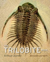
The Trilobite Book
A Visual JourneyRiccardo Levi-Setti
University of Chicago Press, 2014
Featuring specimens from Bohemia to Newfoundland, California to the Tucson Gem and Mineral Show, and Wales to the Anti-Atlas Mountains of Morocco, Levi-Setti’s magnificent book reanimates these “butterflies of the seas” in 235 astonishing full-color photographs. All original, Levi-Setti’s images serve as the jumping-off point for tales of his global quests in search of these highly sought-after fossils; for discussions of their mineralogical origins, as revealed by their color; and for unraveling the role of the now-extinct trilobites in our planetary history.
Sure to enthrall paleontologists with its scientific insights and amateur enthusiasts with its beautiful and informative images, The Trilobite Book combines the best of science, technology, aesthetics, and personal adventure. It will inspire new collectors for eras to come.

The Water Kingdom
A Secret History of ChinaPhilip Ball
University of Chicago Press, 2017
Water, Ball shows, is a key that unlocks much of Chinese culture. In The Water Kingdom, he takes us on a grand journey through China’s past and present, showing how the complexity and energy of the country and its history repeatedly come back to the challenges, opportunities, and inspiration provided by the waterways. Drawing on stories from travelers and explorers, poets and painters, bureaucrats and activists, all of whom have been influenced by an environment shaped and permeated by water, Ball explores how the ubiquitous relationship of the Chinese people to water has made it an enduring metaphor for philosophical thought and artistic expression. From the Han emperors to Mao, the ability to manage the waters ― to provide irrigation and defend against floods ― was a barometer of political legitimacy, often resulting in engineering works on a gigantic scale. It is a struggle that continues today, as the strain of economic growth on water resources may be the greatest threat to China’s future.
The Water Kingdom offers an unusual and fascinating history, uncovering just how much of China’s art, politics, and outlook have been defined by the links between humanity and nature.
The Yuma Reclamation Project
Irrigation, Indian Allotment, and Settlement Along the Lower Colorado RiverRobert Sauder
University of Nevada Press, 2009
In the arid American West, settlement was generally contingent on the availability of water to irrigate crops and maintain livestock and human residents. Early irrigation projects were usually the cooperative efforts of pioneer farmers, but by the early twentieth century they largely reflected federal intentions to create new farms out of the western public domain. The Yuma Reclamation Project, authorized in 1904, was one of the earliest federal irrigation projects initiated in the western United States and the first authorized on the Colorado River. Its story exemplifies the range of difficulties associated with settling the nation’s final frontier—the remaining irrigable lands in the arid West, including Indian lands—and illuminates some of the current issues and conflicts concerning the Colorado River. Author Robert Sauder’s detailed, meticulously researched examination of the Yuma Project illustrates the complex multiplicity of problems and challenges associated with the federal government’s attempt to facilitate homesteading in the arid West. He examines the history of settlement along the lower Colorado River from earliest times, including the farming of the local Quechan people and the impact of Spanish colonization, and he reviews the engineering problems that had to be resolved before an industrial irrigation scheme could be accomplished. The study also sheds light on myriad unanticipated environmental, economic, and social challenges that the government had to confront in bringing arid lands under irrigation, including the impact on the Native American population of the region.The Yuma Reclamation Project is an original and significant contribution to our understanding of federal reclamation endeavors in the West. It provides new and fascinating information about the history of the Yuma Valley and, as a case study of irrigation policy, it offers compelling insights into the history and consequences of water manipulation in the arid West.
Things Maps Don't Tell Us
An Adventure into Map InterpretationArmin K. Lobeck
University of Chicago Press, 1993
A master cartographer and teacher, Armin Lobeck provides a clear, accessible guide to discerning the geological history of an area through an understanding of the lines of rivers, mountains, and coasts found on maps. He presents commonplace physical features that map users normally take for granted as a collection of cartographic detective stories. After pointing out patterns that call for solutions, Lobeck assembles clues and leads his readers through thoughtful, carefully crafted explanations, to show how to grasp the history of the earth through the art of map reading.
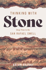
Thinking with Stone
Deep Time in the San Rafael SwellBrian Rajski
University of Utah Press, 2026
An intellectual journey through 250 million years of stone
In the San Rafael Swell, geologic forces have tilted and exposed the strata so that over 250 million years of geologic history can be observed simply by traveling across the rocky landscape, with its dramatic variety of colors and forms. Largely neglected by visitors to the state’s national parks and monuments and overlooked by many nature writers of the Colorado Plateau, the exceptional “Swell” offers a unique opportunity to think about people’s connections to the layers of earth beneath our feet.
Thinking with Stone takes readers on an intellectual journey across the Swell, moving from the youngest rocks at its edges to the oldest near its center and guiding readers through the features and histories of each geological layer. Drawing on personal experience and scientific research, Brian Rajski explores how creatively engaging with geology by using rocks as the foundation for thinking can generate new ideas about art, ethics, and the environment. Ultimately, the book reimagines the relationships between history and deep time, humanity and geology, and the individual and the stories told by stone.
Time's River
Archaeological Syntheses from the Lower Mississippi ValleyEdited by Janet Rafferty and Evan Peacock
University of Alabama Press, 2008
An archaeologically rich region, in advance of impending disturbance
This volume stands as a key general resource for archaeologists working in the region extending from Louisiana through Mississippi north to Missouri and Kentucky, and it represents an opportunity to influence for decades a large part of the archaeological work to take place in the Southeast.
The book responds to a need for a comprehensive archaeological overview of the Lower Mississippi Valley that forms a portion of an interstate corridor spanning nine states that will run from southern Michigan to the Texas-Mexico border. The culturally sensitive Mississippi Delta is one of the richest archaeological areas in North America, and it is crucial that research designs be comprehensive, coordinated, and meet current preservation and future research needs. The authors are well-respected researchers from both within and outside the region with expertise in the full range of topics that comprise American archaeology. They examine matters of method and theory, the application of materials science, geophysics, and other high-tech tools in archaeology that provide for optimum data-recovery.
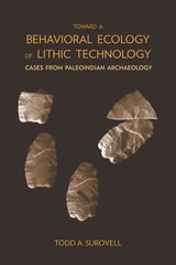
Toward a Behavioral Ecology of Lithic Technology
Cases from Paleoindian ArchaeologyTodd A. Surovell
University of Arizona Press, 2009
Because the fundamental processes of making, using, and discarding stone tools are, at root, exercises in problem solving, Todd Surovell asks what conditions favor certain technological solutions. Whether asking if a biface should be made thick or thin or if a flake should be saved or discarded, Surovell seeks answers that extend beyond a case-by-case analysis. One avenue for addressing these questions theoretically is formal mathematical modeling.
Here Surovell constructs a series of models designed to link environmental variability to human decision making as it pertains to lithic technology. To test the models, Surovell uses data from the analysis of more than 40,000 artifacts from five Rocky Mountain and Northern Plains Folsom and Goshen complex archaeological sites dating to the Younger Dryas stadial (ca. 12,600-11,500 years BP). The primary result is the production of powerful new analytical tools useful to the interpretation of archaeological assemblages.
Surovell's goal is to promote modeling and explore the general issues governing technological decisions. In this light, his models can be applied to any context in which stone tools are made and used.
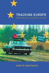
Tracking Europe
Mobility, Diaspora, and the Politics of LocationGinette Verstraete
Duke University Press, 2009
In demystifying the old and new Europe across a multiplicity of texts, images, media, and cultural practices in various times and locations, Verstraete lays bare a territorial persistence in the European imaginary, one which has been differently tied up with the politics of inclusion and exclusion. Tracking Europe moves from policy papers, cultural tourism, and migration to philosophies of cosmopolitanism, nineteenth-century travel guides, electronic surveillance at the border, virtual pilgrimages to Spain, and artistic interventions in the Balkan region. It is a sustained attempt to situate current developments in Europe within a complex matrix of tourism, migration, and border control, as well as history, poststructuralist theory, and critical media and art projects.
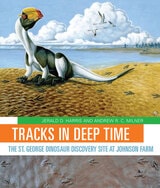
Tracks in Deep Time
The St. George Dinosaur Discovery Site at Johnson FarmJerald D. Harris and Andrew R. Milner
University of Utah Press, 2015
Tracks in Deep Time presents, for the first time, an engaging, thoroughly readable account of the history, geology, and paleontology of this important site. Two hundred million years ago, Lake Dixie covered the site. Within its waters and along its shores, a diverse ecosystem of dinosaurs, early crocodylians, fishes, plants, and other organisms thrived, leaving behind thousands of footprints and other fossils preserved in layers of rock. Unusual fossils found here include the world’s largest collection of tracks left by swimming dinosaurs and one of only six traces known to have been made by a sitting, meat-eating dinosaur. With approachable text and lavish, full-color photographs and illustrations, Jerald Harris and Andrew Milner describe how geologists and paleontologists have painstakingly reconstructed a vivid “snapshot” of life from the Early Jurassic epoch.
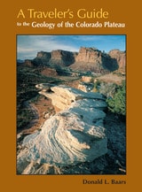
Travelers Guide
To The Geology Of Colorado PlateauDonald L Baars
University of Utah Press, 2002
Driving across I-70 in southern Utah one can’t help but wonder about the magnificent upturned rocks of the San Rafael Reef. With A Travelers Guide to the Geology of the Colorado Plateau in hand, you’ll soon discover that you were driving through Page and Navajo Sandstone formations, sharply folded into a monocline along one of the "Basin and Range" fault lines. Nearing Flagstaff, Arizona, on Highway 89, you will learn that Mt. Humphry of the San Francisco Peaks, a Navajo Sacred Mountain, was once an active volcano. Keep reading and you’ll find many things worth a slight detour.
A Traveler's Guide to the Geology of the Colorado Plateau will enrich and enliven all of your trips through the varied landscapes of the Colorado Plateau as you learn about the geological forces that have shaped its natural features. The mile-by-mile road logs will take you from Vernal, Utah, in the north to the southernmost reaches of the Plateau in Sedona, Arizona; from the red rocks of Cedar Breaks National Monument near Cedar City, Utah, to the edges of the soaring peaks of the San Juan Mountains near Durango, Colorado. The most comprehensive geological guide to the Colorado Plateau
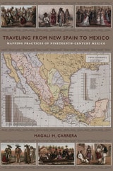
Traveling from New Spain to Mexico
Mapping Practices of Nineteenth-Century MexicoMagali M. Carrera
Duke University Press, 2011
From the sixteenth century until the early nineteenth, Europeans had envisioned New Spain (colonial Mexico) in texts, maps, and other images. In the first decades of the 1800s, ideas about Mexican, rather than Spanish, national character and identity began to cohere in written and illustrated narratives produced by foreign travelers. During the nineteenth century, technologies and processes of visual reproduction expanded to include lithography, daguerreotype, and photography. New methods of display—such as albums, museums, exhibitions, and world fairs—signaled new ideas about spectatorship. García Cubas participated in this emerging visual culture as he reconfigured geographic and cultural imagery culled from previous mapping practices and travel writing. In works such as the Atlas geográfico (1858) and the Atlas pintoresco é historico (1885), he presented independent Mexico to Mexican citizens and the world.
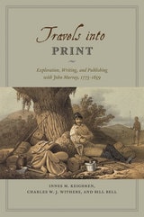
Travels into Print
Exploration, Writing, and Publishing with John Murray, 1773-1859Innes M. Keighren, Charles W. J. Withers, and Bill Bell
University of Chicago Press, 2015
Drawing on detailed examination of the John Murray Archive of manuscripts, images, and the firm’s correspondence with its many authors—a list that included such illustrious explorers and scientists as Charles Darwin and Charles Lyell, and literary giants like Jane Austen, Lord Byron, and Sir Walter Scott—Travels into Print considers how journeys of exploration became published accounts and how travelers sought to demonstrate the faithfulness of their written testimony and to secure their personal credibility. This fascinating study in historical geography and book history takes modern readers on a journey into the nature of exploration, the production of authority in published travel narratives, and the creation of geographical authorship—a journey bound together by the unifying force of a world-leading publisher.