Results by title
5 books match the query '100 Maps'
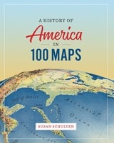
A History of America in 100 Maps
Susan Schulten
University of Chicago Press, 2018
In this book Susan Schulten uses maps to explore five centuries of American history, from the voyages of European discovery to the digital age. With stunning visual clarity, A History of America in 100 Maps showcases the power of cartography to illuminate and complicate our understanding of the past.
Gathered primarily from the British Library’s incomparable archives and compiled into nine chronological chapters, these one hundred full-color maps range from the iconic to the unfamiliar. Each is discussed in terms of its specific features as well as its larger historical significance in a way that conveys a fresh perspective on the past. Some of these maps were made by established cartographers, while others were made by unknown individuals such as Cherokee tribal leaders, soldiers on the front, and the first generation of girls to be formally educated. Some were tools of statecraft and diplomacy, and others were instruments of social reform or even advertising and entertainment. But when considered together, they demonstrate the many ways that maps both reflect and influence historical change.
Audacious in scope and charming in execution, this collection of one hundred full-color maps offers an imaginative and visually engaging tour of American history that will show readers a new way of navigating their own worlds.
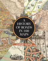
A History of Roads in 100 Maps
Jeremy Black
University of Chicago Press, 2026
A beautifully illustrated, first-of-its-kind chronicle of road maps through the ages.
Road maps are the most common form of map that most of us regularly interact with while we all seek to find our way from here to there. Today, the digital maps on our devices are just the latest in a series of cartographic innovations designed to make transportation of people and goods easier and more predictable. Whether traveling on foot, in a vehicle, or by animal, people have long created and relied on roads, and efforts to map these overland routes predate the invention of the printing press. Yet the vast majority of road maps have been produced only within the last five hundred years—and even more specifically within the last century.
Historian Jeremy Black is the first to chart the tale of road maps, beginning with the "Peutinger Map," which illustrated the roads famously connecting the Roman Empire. From the time of antiquity, Black guides the reader through the centuries all the way to the modern age, when the invention of the automobile spurred the creation of roads and road maps like nothing before. Over the course of this journey, Black illuminates the integral role maps played in the development of government infrastructures through time and across all the inhabited continents. And, arriving in the present day, Black shows how technology may soon make the paper road map obsolete even as it builds on the conventions of the preceding centuries.
Featuring a series of full-color maps from the British Library's collection and beyond, A History of Roads in 100 Maps is an eye-opening visual story of how modern civilizations traversed, constructed, and connected their worlds.
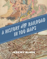
A History of the Railroad in 100 Maps
Jeremy Black
University of Chicago Press, 2024
The first international history of railroads and railroad infrastructure told through stunningly reproduced maps.
Since their origins in eighteenth-century England, railroads have spread across the globe, changing everything in their path, from where and how people grew and made things to where and how they lived and moved. Railroads rewrote not only world geography but also the history of maps and mapping. Today, the needs of train companies and their users continue to shape the maps we consume and consult.
Featuring full-color maps primarily from the British Library's distinguished collection—many of them never before published—A History of the Railroad in 100 Maps is the first international history of railroads and railroad infrastructure told through maps. Jeremy Black includes examples from six continents, spanning a variety of uses from railroad planning and operations to guides for passengers, shippers, and tourists.
Arranged chronologically, the maps are accompanied by explanatory text that sheds light on the political, military, and urban development histories associated with the spread of railroads. A final chapter considers railroad maps from games, books, and other cultural artifacts. For anyone interested in the history of railroads or maps, A History of the Railroad in 100 Maps will offer new and unexpected insights into their intertwined global history.
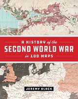
A History of the Second World War in 100 Maps
Jeremy Black
University of Chicago Press, 2020
The First World War was marked by an exceptional expansion in the use and production of military cartography. But World War II took things even further, employing maps, charts, reconnaissance, and the systematic recording and processing of geographical and topographical information on an unprecedented scale. As Jeremy Black—one of the world’s leading military and cartographic historians—convincingly shows in this lavish full-color book, it is impossible to understand the events and outcomes of the Second World War without deep reference to mapping at all levels. In World War II, maps themselves became the weapons.
A History of the Second World War in 100 Maps traces how military cartography developed from simply recording and reflecting history to having a decisive impact on events of a global scale. Drawing on one hundred key maps from the unparalleled collections of the British Library and other sources—many of which have never been published in book form before--Jeremy Black takes us from the prewar mapping programs undertaken by both Germany and the United Kingdom in the mid-1930s through the conflict’s end a decade later. Black shows how the development of maps led directly to the planning of the complex and fluid maneuvers that defined the European theater in World War II: for example, aerial reconnaissance photography allowed for the charting of beach gradients and ocean depths in the runup to the D-Day landings, and the subsequent troop movements at Normandy would have been impossible without the help of situation maps and photos. In the course of the conflict, both in Europe and the Pacific, the realities of climate, terrain, and logistics—recorded on maps—overcame the Axis powers. Maps also became propaganda tools as the pages of Time outlined the directions of the campaigns and the Allies dropped maps from their aircraft.
In this thrilling and unique book, Jeremy Black blends his singular cartographic and military expertise into a captivating overview of World War II from the air, sea, and sky, making clear how fundamental maps were to every aspect of this unforgettable global conflict.
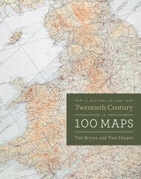
A History of the Twentieth Century in 100 Maps
Tim Bryars and Tom Harper
University of Chicago Press, 2014
As Bryars and Harper reveal, maps make ideal narrators, and the maps in this book tell the story of the 1900s—which saw two world wars, the Great Depression, the Swinging Sixties, the Cold War, feminism, leisure, and the Internet. Several of the maps have already gained recognition for their historical significance—for example, Harry Beck’s iconic London Underground map—but the majority of maps on these pages have rarely, if ever, been seen in print since they first appeared. There are maps that were printed on handkerchiefs and on the endpapers of books; maps that were used in advertising or propaganda; maps that were strictly official and those that were entirely commercial; maps that were printed by the thousand, and highly specialist maps issued in editions of just a few dozen; maps that were envisaged as permanent keepsakes of major events, and maps that were relevant for a matter of hours or days.
As much a pleasure to view as it is to read, A History of the Twentieth Century in 100 Maps celebrates the visual variety of twentieth century maps and the hilarious, shocking, or poignant narratives of the individuals and institutions caught up in their production and use.