Results by title
5 books match the query 'Extinct cities'
Archaeology Of Settlement Abandonment of Middle America
Takeshi Inomata
University of Utah Press, 2003
Mesoamerican archaeologists have long been interested in the collapse of political systems or civilizations but have been slow to undertake detailed abandonment analyses of specific settlements. The Archaeology of Settlement Abandonment in Middle America explores some of the old questions in Middle American archaeology in light of the newer theoretical approach provided by abandonment studies. Unlike much of the abandonment work previously done in the American Southwest, a number of contributions to this volume examine relatively large population centers.
Among the original contributions in this collection is the discovery that deposits resulting from termination rituals are more common than previously thought. Several chapters point out that structures and places can continue to serve ritual functions even after abandonment. Another finding is that the causes of abandonment—warfare, economic marginalization, or natural cataclysm—are likely to have varied effects on different social groups, which in turn sheds light on occupational histories in specific sites preceding major abandonments.
Center Places and Cherokee Towns
Archaeological Perspectives on Native American Architecture and Landscape in the Southern AppalachiansChristopher B. Rodning
University of Alabama Press, 2015
In Center Places and Cherokee Towns, Christopher B. Rodning opens a panoramic vista onto protohistoric Cherokee culture. He posits that Cherokee households and towns were anchored within their cultural and natural landscapes by built features that acted as “center places.”
Rodning investigates the period from just before the first Spanish contact with sixteenth-century Native American chiefdoms in La Florida through the development of formal trade relations between Native American societies and English and French colonial provinces in the American South during the late 1600s and 1700s. Rodning focuses particularly on the Coweeta Creek archaeological site in the upper Little Tennessee Valley in southwestern North Carolina and describes the ways in which elements of the built environment were manifestations of Cherokee senses of place.
Drawing on archaeological data, delving into primary documentary sources dating from the eighteenth century, and considering Cherokee myths and legends remembered and recorded during the nineteenth century, Rodning shows how the arrangement of public structures and household dwellings in Cherokee towns both shaped and were shaped by Cherokee culture. Center places at different scales served as points of attachment between Cherokee individuals and their communities as well as between their present and past. Rodning explores the ways in which Cherokee architecture and the built environment were sources of cultural stability in the aftermath of European contact, and how the course of European contact altered the landscape of Cherokee towns in the long run.
In this multi-faceted consideration of archaeology, ethnohistory, and recorded oral tradition, Rodning adeptly demonstrates the distinct ways that Cherokee identity was constructed through architecture and other material forms. Center Places and Cherokee Towns will have a broad appeal to students and scholars of southeastern archaeology, anthropology, Native American studies, prehistoric and protohistoric Cherokee culture, landscape archaeology, and ethnohistory.
Kandik Map
Linda Johnson
University of Alaska Press, 2009
Treadwell Gold
An Alaska Saga of Riches and RuinSheila Kelly
University of Alaska Press, 2010
A century ago, Treadwell, Alaska, was a featured stop on steamship cruises, a rich, up-to-date town that was the most prominent and proud in all Alaska. Its wealth, however, was founded on the remarkably productive gold mines on Douglas Island, and when those caved in and flooded in the early decades of the twentieth century, Treadwell sank into relative obscurity.
Treadwell Gold presents first-person accounts from the sons and daughters of the miners, machinists, hoist operators, and superintendents who together dug and blasted the gold that made Treadwell rich. Alongside these stories are vintage photos that capture both the industrial vigor of the mines and the daily lives that made up Treadwell society. The book will fascinate anyone interested in Alaskan history or the romance of gold mining’s past.
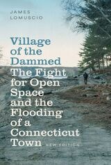
Village of the Dammed
The Fight for Open Space and the Flooding of a Connecticut TownJames Lomuscio
Brandeis University Press, 2025
In the early 1940s, the Bridgeport Hydraulic Company flooded Connecticut’s Saugatuck River Valley to create a reservoir that would meet the region’s growing population. Under twelve billion gallons of water lay Valley Forge, once a thriving iron and steel manufacturing town, which was seized by eminent domain to create the reservoir and dam. In Village of the Dammed, journalist James Lomuscio tells the story of the rise and fall of Valley Forge, drawing on Civil War-era photographs of the town and other sources to show what the town was like, document the futile battle to save it, and reveal the flooding’s life-altering repercussions. He also recounts a grassroots movement to prevent the development of nearby Trout Brook Valley in the 1990s, a heated fight with a different outcome. As the population of the American northeast continues to swell and spread, placing new demands on existing resources, communities are frequently confronted with forces and choices not unlike those faced by Valley Forge and Trout Brook Valley. Village of the Dammed reminds us to be ever vigilant in the protection of our irreplaceable environmental heritage.